Beaubery
| Beaubery | |
|---|---|
| Commune | |
 | |
 Beaubery Location within Bourgogne-Franche-Comté region  Beaubery | |
| Coordinates: 46°24′14″N 4°23′56″E / 46.4039°N 4.3989°ECoordinates: 46°24′14″N 4°23′56″E / 46.4039°N 4.3989°E | |
| Country | France |
| Region | Bourgogne-Franche-Comté |
| Department | Saône-et-Loire |
| Arrondissement | Charolles |
| Canton | Charolles |
| Intercommunality | Val de Joux |
| Government | |
| • Mayor (2014–2020) | Gérard Duchet |
| Area1 | 22.98 km2 (8.87 sq mi) |
| Population (2013)2 | 371 |
| • Density | 16/km2 (42/sq mi) |
| Time zone | UTC+1 (CET) |
| • Summer (DST) | UTC+2 (CEST) |
| INSEE/Postal code | 71025 /71220 |
| Elevation |
312–555 m (1,024–1,821 ft) (avg. 510 m or 1,670 ft) |
|
1 French Land Register data, which excludes lakes, ponds, glaciers > 1 km2 (0.386 sq mi or 247 acres) and river estuaries. 2 Population without double counting: residents of multiple communes (e.g., students and military personnel) only counted once. | |
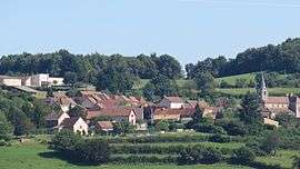
Beaubery is a commune in the Saône-et-Loire department in the region of Bourgogne-Franche-Comté in eastern France.
Population
| Historical population | ||
|---|---|---|
| Year | Pop. | ±% |
| 1793 | 1,201 | — |
| 1806 | 1,064 | −11.4% |
| 1821 | 961 | −9.7% |
| 1831 | 1,012 | +5.3% |
| 1841 | 1,087 | +7.4% |
| 1851 | 1,140 | +4.9% |
| 1861 | 1,173 | +2.9% |
| 1872 | 1,122 | −4.3% |
| 1881 | 1,104 | −1.6% |
| 1891 | 1,124 | +1.8% |
| 1901 | 1,049 | −6.7% |
| 1911 | 912 | −13.1% |
| 1921 | 827 | −9.3% |
| 1931 | 813 | −1.7% |
| 1946 | 707 | −13.0% |
| 1954 | 639 | −9.6% |
| 1962 | 592 | −7.4% |
| 1968 | 509 | −14.0% |
| 1975 | 445 | −12.6% |
| 1982 | 419 | −5.8% |
| 1990 | 392 | −6.4% |
| 1999 | 357 | −8.9% |
| 2008 | 357 | +0.0% |
| 2013 | 371 | +3.9% |
See also
References
| Wikimedia Commons has media related to Beaubery. |
This article is issued from
Wikipedia.
The text is licensed under Creative Commons - Attribution - Sharealike.
Additional terms may apply for the media files.