Authumes
| Authumes | |
|---|---|
| Commune | |
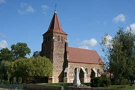 The church in Authumes | |
 Authumes Location within Bourgogne-Franche-Comté region  Authumes | |
| Coordinates: 46°53′25″N 5°18′11″E / 46.8903°N 5.3031°ECoordinates: 46°53′25″N 5°18′11″E / 46.8903°N 5.3031°E | |
| Country | France |
| Region | Bourgogne-Franche-Comté |
| Department | Saône-et-Loire |
| Arrondissement | Louhans |
| Canton | Pierre-de-Bresse |
| Intercommunality | CC Canton Pierre-de-Bresse |
| Government | |
| • Mayor (2014-2020) | Joël Martin |
| Area1 | 12.88 km2 (4.97 sq mi) |
| Population (2015)2 | 255 |
| • Density | 20/km2 (51/sq mi) |
| Time zone | UTC+1 (CET) |
| • Summer (DST) | UTC+2 (CEST) |
| INSEE/Postal code | 71013 /71270 |
| Elevation |
180–213 m (591–699 ft) (avg. 211 m or 692 ft) |
|
1 French Land Register data, which excludes lakes, ponds, glaciers > 1 km2 (0.386 sq mi or 247 acres) and river estuaries. 2 Population without double counting: residents of multiple communes (e.g., students and military personnel) only counted once. | |
Authumes is a commune in the Saône-et-Loire department in Bourgogne in eastern France.
Population
| Historical population | ||
|---|---|---|
| Year | Pop. | ±% |
| 1791 | 440 | — |
| 1806 | 472 | +7.3% |
| 1821 | 551 | +16.7% |
| 1831 | 659 | +19.6% |
| 1841 | 667 | +1.2% |
| 1851 | 630 | −5.5% |
| 1861 | 637 | +1.1% |
| 1872 | 666 | +4.6% |
| 1881 | 599 | −10.1% |
| 1891 | 550 | −8.2% |
| 1901 | 302 | −45.1% |
| 1911 | 432 | +43.0% |
| 1921 | 418 | −3.2% |
| 1931 | 412 | −1.4% |
| 1946 | 352 | −14.6% |
| 1954 | 330 | −6.2% |
| 1962 | 306 | −7.3% |
| 1968 | 304 | −0.7% |
| 1975 | 250 | −17.8% |
| 1982 | 209 | −16.4% |
| 1990 | 199 | −4.8% |
| 1999 | 215 | +8.0% |
| 2006 | 214 | −0.5% |
| 2012 | 264 | +23.4% |
| 2015 | 255 | −3.4% |
See also
References
| Wikimedia Commons has media related to Authumes. |
This article is issued from
Wikipedia.
The text is licensed under Creative Commons - Attribution - Sharealike.
Additional terms may apply for the media files.