Morey
| Morey | |
|---|---|
| Commune | |
 | |
 Morey Location within Bourgogne-Franche-Comté region  Morey | |
| Coordinates: 46°48′04″N 4°36′09″E / 46.8011°N 4.6025°ECoordinates: 46°48′04″N 4°36′09″E / 46.8011°N 4.6025°E | |
| Country | France |
| Region | Bourgogne-Franche-Comté |
| Department | Saône-et-Loire |
| Arrondissement | Autun |
| Canton | Chagny |
| Intercommunality | CU Creusot Montceau |
| Government | |
| • Mayor (2008–2014) | Kader Atteye |
| Area1 | 13.32 km2 (5.14 sq mi) |
| Population (2006)2 | 186 |
| • Density | 14/km2 (36/sq mi) |
| Time zone | UTC+1 (CET) |
| • Summer (DST) | UTC+2 (CEST) |
| INSEE/Postal code | 71321 /71510 |
| Elevation |
242–438 m (794–1,437 ft) (avg. 400 m or 1,300 ft) |
|
1 French Land Register data, which excludes lakes, ponds, glaciers > 1 km2 (0.386 sq mi or 247 acres) and river estuaries. 2 Population without double counting: residents of multiple communes (e.g., students and military personnel) only counted once. | |
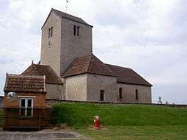
Morey is a commune in the Saône-et-Loire department in the region of Bourgogne in eastern France.
Geography
Morey is located in the hills surrounding the Dheune river and the Canal Du Centre. In addition to the main village, several hamlets are also parts of Morey:
- Fangey-le-bas
- Fangey-le-haut
- Baugey
- Nuit
The village is surrounded by the communes of Châtel-Moron, Essertenne, Villeneuve-en-Montagne, Saint-Bérain-sur-Dheune, Saint-Julien-sur-Dheune.
History
Anciently named "Moreyurn", the village was a dependency of the baron of Couches.
See also
References
| Wikimedia Commons has media related to Morey. |
This article is issued from
Wikipedia.
The text is licensed under Creative Commons - Attribution - Sharealike.
Additional terms may apply for the media files.