Baron, Saône-et-Loire
| Baron | |
|---|---|
| Commune | |
 | |
 Baron Location within Bourgogne-Franche-Comté region  Baron | |
| Coordinates: 46°29′37″N 4°16′46″E / 46.4936°N 4.2794°ECoordinates: 46°29′37″N 4°16′46″E / 46.4936°N 4.2794°E | |
| Country | France |
| Region | Bourgogne-Franche-Comté |
| Department | Saône-et-Loire |
| Arrondissement | Charolles |
| Canton | Charolles |
| Intercommunality | Canton of Charolles |
| Government | |
| • Mayor (2001–2008) | Noël Pallot |
| Area1 | 13.29 km2 (5.13 sq mi) |
| Population (2013)2 | 288 |
| • Density | 22/km2 (56/sq mi) |
| Time zone | UTC+1 (CET) |
| • Summer (DST) | UTC+2 (CEST) |
| INSEE/Postal code | 71021 /71120 |
| Elevation |
282–446 m (925–1,463 ft) (avg. 400 m or 1,300 ft) |
|
1 French Land Register data, which excludes lakes, ponds, glaciers > 1 km2 (0.386 sq mi or 247 acres) and river estuaries. 2 Population without double counting: residents of multiple communes (e.g., students and military personnel) only counted once. | |
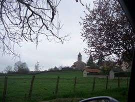
Baron is a commune in the Saône-et-Loire department in the region of Bourgogne-Franche-Comté in eastern France.
Population
| Historical population | ||
|---|---|---|
| Year | Pop. | ±% |
| 1793 | 528 | — |
| 1806 | 614 | +16.3% |
| 1821 | 660 | +7.5% |
| 1831 | 731 | +10.8% |
| 1841 | 630 | −13.8% |
| 1851 | 613 | −2.7% |
| 1861 | 622 | +1.5% |
| 1872 | 581 | −6.6% |
| 1881 | 572 | −1.5% |
| 1891 | 571 | −0.2% |
| 1901 | 515 | −9.8% |
| 1911 | 482 | −6.4% |
| 1921 | 389 | −19.3% |
| 1931 | 354 | −9.0% |
| 1946 | 265 | −25.1% |
| 1954 | 241 | −9.1% |
| 1962 | 207 | −14.1% |
| 1968 | 185 | −10.6% |
| 1975 | 148 | −20.0% |
| 1982 | 153 | +3.4% |
| 1990 | 184 | +20.3% |
| 1999 | 217 | +17.9% |
| 2008 | 276 | +27.2% |
| 2013 | 288 | +4.3% |
See also
References
| Wikimedia Commons has media related to Baron (Saône-et-Loire). |
This article is issued from
Wikipedia.
The text is licensed under Creative Commons - Attribution - Sharealike.
Additional terms may apply for the media files.