Montceau-les-Mines
| Montceau-les-Mines | |
|---|---|
| Commune | |
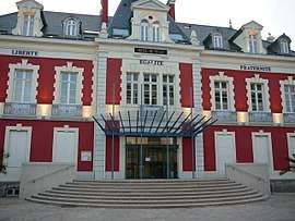 Town hall | |
 Montceau-les-Mines Location within Bourgogne-Franche-Comté region  Montceau-les-Mines | |
| Coordinates: 46°40′04″N 4°22′11″E / 46.6678°N 4.3697°ECoordinates: 46°40′04″N 4°22′11″E / 46.6678°N 4.3697°E | |
| Country | France |
| Region | Bourgogne-Franche-Comté |
| Department | Saône-et-Loire |
| Arrondissement | Autun |
| Canton | Montceau-les-Mines |
| Intercommunality | CU Creusot Montceau |
| Government | |
| • Mayor (1995–2008) | Didier Mathus |
| Area1 | 16.62 km2 (6.42 sq mi) |
| Population (2006)2 | 20,033 |
| • Density | 1,200/km2 (3,100/sq mi) |
| Time zone | UTC+1 (CET) |
| • Summer (DST) | UTC+2 (CEST) |
| INSEE/Postal code | 71306 /71300 |
| Elevation |
274–326 m (899–1,070 ft) (avg. 287 m or 942 ft) |
|
1 French Land Register data, which excludes lakes, ponds, glaciers > 1 km2 (0.386 sq mi or 247 acres) and river estuaries. 2 Population without double counting: residents of multiple communes (e.g., students and military personnel) only counted once. | |
Montceau-les-Mines is a commune in the Saône-et-Loire department in the region of Bourgogne in eastern France.
It is the second-largest commune of the metropolitan Communauté urbaine Creusot Montceau, which lies southwest of the city of Dijon.
History
Montceau-les-Mines is a former mining city. Coal was discovered in the area in the 16th Century. A hamlet called "Le Montceau" developed from this discovery.
"Le Montceau" began to grow after the building of the Canal du Centre, built between 1783 and 1791. A business entity, "Compagnie des mines", started to extract coals in 1833.
The commune was officially established June 24, 1856. as Montceau-les-Mines, a community of 1300 inhabitants, drawn from a territory formed from the villages of Blanzy, Saint-Vallier, Saint-Berain-sous-Sanvignes, and Sanvignes-les-Mines.
A graveyard and a church were built by the principal coal company, a sign of paternalism of mining industry.
Intense social movements took place at the end of the 19th century and there at the beginning of the 20th century.
Coal made the city prosperous until 1918. During the War, the production reached 2,786,000 tons. There were about 30,000 inhabitants. After the war, the production started to decrease and stopped in 1992. Economic hardship followed the closing of the mines. By 2017 the population has fallen to about 18,000, unemployment is 21% and many shops of the city have closed.[1]
Geography/geology
The Bourbince flows northward through the commune and crosses the town. Exceptional preservation of Late Carboniferous fossil biota characterizes a Lagerstätte at Montceau-les-Mines.[2][3][4]
See also
International relations
Twin towns and Sister cities
Montceau-les-Mines is twinned with:
References
- ↑ Nossiter, Adam (December 27, 2017). "Chef Gives Up a Star, Reflecting Hardship of 'the Other France'". NYTimes. Retrieved December 27, 2017.
- ↑ See, for example Racheboeuf, Patrick R.; et al. (2009). "New malacostracan custacea from the Carboniferous (Stephanian) lagerst?tte of Montceau-les-Mines, France". Journal of Paleontology. 83: 624–629. doi:10.1666/08-171r.1. ; the site is discussed by Vincent Perrier and Sylvain Charbonnierby in "The Montceau-les-Mines lagerstätte (Late Carboniferous, France)", Comptes Rendus Palevol, 13.5:353-367.
- ↑ Garwood, Russell J.; Dunlop, Jason A.; Giribet, Gonzalo; Sutton, Mark D. (2011). "Anatomically modern Carboniferous harvestmen demonstrate early cladogenesis and stasis in Opiliones". Nature Communications. 2: 444. doi:10.1038/ncomms1458. PMID 21863011. Retrieved June 8, 2015.
- ↑ Garwood, Russell J.; Sharma, Prashant P.; Dunlop, Jason A.; Giribet, Gonzalo (2014). "A Paleozoic Stem Group to Mite Harvestmen Revealed through Integration of Phylogenetics and Development". Current Biology. 24 (9): 1017–1023. doi:10.1016/j.cub.2014.03.039. PMID 24726154. Retrieved April 17, 2014.
External links
| Wikimedia Commons has media related to Montceau-les-Mines. |
| Authority control |
|---|