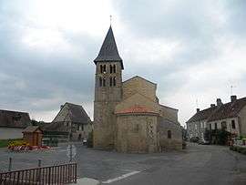
Rigny-sur-Arroux
| Rigny-sur-Arroux | |
|---|---|
| Commune | |
 | |
 Rigny-sur-Arroux Location within Bourgogne-Franche-Comté region  Rigny-sur-Arroux | |
| Coordinates: 46°32′00″N 4°01′43″E / 46.5333°N 4.0286°ECoordinates: 46°32′00″N 4°01′43″E / 46.5333°N 4.0286°E | |
| Country | France |
| Region | Bourgogne-Franche-Comté |
| Department | Saône-et-Loire |
| Arrondissement | Charolles |
| Canton | Gueugnon |
| Intercommunality | Pays de Gueugnon |
| Government | |
| • Mayor | Claude Balestrieri |
| Area1 | 48.17 km2 (18.60 sq mi) |
| Population (2006)2 | 625 |
| • Density | 13/km2 (34/sq mi) |
| Time zone | UTC+1 (CET) |
| • Summer (DST) | UTC+2 (CEST) |
| INSEE/Postal code | 71370 /71160 |
| Elevation |
227–347 m (745–1,138 ft) (avg. 240 m or 790 ft) |
|
1 French Land Register data, which excludes lakes, ponds, glaciers > 1 km2 (0.386 sq mi or 247 acres) and river estuaries. 2 Population without double counting: residents of multiple communes (e.g., students and military personnel) only counted once. | |
Rigny-sur-Arroux is a commune in the Saône-et-Loire department in the region of Bourgogne in eastern France.
See also
References
| Wikimedia Commons has media related to Rigny-sur-Arroux. |
This article is issued from
Wikipedia.
The text is licensed under Creative Commons - Attribution - Sharealike.
Additional terms may apply for the media files.