Bear River Mountains
| Bear River Mountains | |
|---|---|
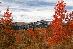 Autumn aspens in the Bear River Range | |
| Highest point | |
| Peak |
Naomi Peak (Cache County, Utah & Mount Naomi Wilderness) |
| Elevation | 9,979 ft (3,042 m) |
| Coordinates | 41°54′41.04″N 111°40′28.92″W / 41.9114000°N 111.6747000°W |
| Dimensions | |
| Area | 1,615 sq mi (4,180 km2) [1] |
| Naming | |
| Etymology | Bear River |
| Geography | |
| Country | United States |
| States | Utah and Idaho |
| Range coordinates | 42°8′N 111°37′W / 42.133°N 111.617°WCoordinates: 42°8′N 111°37′W / 42.133°N 111.617°W |
| Parent range | Wasatch Range |
| Borders on |
Cache Valley (west) Bear Lake & Monte Cristo Range (east) |
The Bear River Mountains, or Bear River Range, is located in northeastern Utah and southeastern Idaho, forming the eastern boundary of the Cache Valley. One of the mountains' sinks (Peter Sinks) recorded the lowest temperature in Utah on February 1, 1985, at −69 °F (−56 °C),[2] which is also the second-lowest temperature ever recorded in the contiguous United States. U.S. Highway 89 via Logan Canyon provides the only major route through the mountains, and the canyon is the location of Logan River, the Beaver Mountain ski resort, and Tony Grove Lake.
References
- ↑ "Bear River Mountains". Peakbagger.com.
- ↑ NCDC: January 2002 City/State Extremes

Wasatch Mountains, Utah, May 2008
External links

This article is issued from
Wikipedia.
The text is licensed under Creative Commons - Attribution - Sharealike.
Additional terms may apply for the media files.