As-Safira
- For SIPRI, see Stockholm International Peace Research Institute.
| As-Safira السفيرة Sfireh, Sipri[1] | |
|---|---|
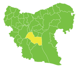
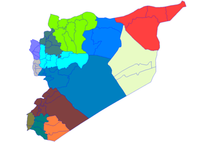
 As-Safira Location in Syria | |
| Coordinates: 36°04′N 37°22′E / 36.067°N 37.367°E | |
| Country |
|
| Governorate | Aleppo |
| District | Al-Safira |
| Subdistrict | Al-Safira |
| Elevation | 348 m (1,142 ft) |
| Population (2007 est.) | |
| • Total | 106,382 |
| Time zone | UTC+2 (EET) |
| • Summer (DST) | +3 |
As-Safira (Arabic: السفيرة / ALA-LC: as-Safīrah; Aleppo dialect: Sfīre) is a Syrian city administratively belonging to the Aleppo Governorate. It is the administrative center for the as-Safira District. As Safīrah has an altitude of 348 meters (1,142 ft), and a population of 106,382 as of 2007, making it the 11th largest city per geographical entity in Syria.
Name
Medieval geographer Yaqut al-Hamawi spells the name Asfīrah[2] (أسفيرة), not as-Safira (السفيرة), which indicates that the definite article in the modern spelling is a result of hypercorrection.
As-Safira was known in pre-Islamic times as Sipri.[1] Historians[3] have suggested that the name Sipri may have come from the Akkadian word siparru meaning "bronze", which might indicate that copper was mined and bronze was worked there.
History
Since ancient times the city has been the distribution point for salt gathered from the nearby Sabkhat al-Jabbul.
More recently, the town became of the major centers of the Syrian defense industry, housing a number of factories that manufacture ammunition.[4]
Archeological findings
The Sfire I Treaty which may contain 8th century BCE evidence of a deity called "Most High."
Climate
| Climate data for As Safira | |||||||||||||
|---|---|---|---|---|---|---|---|---|---|---|---|---|---|
| Month | Jan | Feb | Mar | Apr | May | Jun | Jul | Aug | Sep | Oct | Nov | Dec | Year |
| Average high °C (°F) | 10.8 (51.4) |
13.3 (55.9) |
17.7 (63.9) |
23.1 (73.6) |
29.6 (85.3) |
34.7 (94.5) |
37.0 (98.6) |
37.4 (99.3) |
33.7 (92.7) |
28.2 (82.8) |
20.0 (68) |
12.9 (55.2) |
24.9 (76.8) |
| Average low °C (°F) | 1.8 (35.2) |
2.6 (36.7) |
5.2 (41.4) |
8.9 (48) |
13.6 (56.5) |
17.9 (64.2) |
20.5 (68.9) |
20.7 (69.3) |
16.9 (62.4) |
12.1 (53.8) |
6.6 (43.9) |
3.5 (38.3) |
10.9 (51.5) |
| Average precipitation mm (inches) | 59 (2.32) |
48 (1.89) |
32 (1.26) |
36 (1.42) |
17 (0.67) |
2 (0.08) |
0 (0) |
0 (0) |
1 (0.04) |
16 (0.63) |
19 (0.75) |
59 (2.32) |
289 (11.38) |
| Average snowy days | 0.9 | 0.1 | 0 | 0 | 0 | 0 | 0 | 0 | 0 | 0 | 0 | 0.2 | 1.2 |
| Source: Climate-data.org. | |||||||||||||
Notes
- 1 2 Ball, Warwick (2006) "The desert edges" Syria: A Historical And Architectural Guide Interlink Publishing Group, Northampton, Massachusetts, page 157, ISBN 1-56656-665-7
- ↑ le Strange, 1890, p. 400
- ↑ Notably Dossin and Lewy, see Sasson, Jack M. (1966) "A Sketch of North Syrian Economic Relations in the Middle Bronze Age" Journal of the Economic and Social History of the Orient 9(3): pp. 161–181, page 169, note 2
- ↑ Cooper, Tom. "Syria's Rebels: Turkey Won, and Lost, the Race to Al Bab". War Is Boring. Retrieved 6 March 2017.
Bibliography
- le Strange, Guy (1890). Palestine Under the Moslems: A Description of Syria and the Holy Land from A.D. 650 to 1500. Committee of the Palestine Exploration Fund.
External links
- Traditional dwellings in as-Safira "Traditional Architecture in Syria: a Mediterranean Dwelling", European Commission Meda-euromed Heritage, page 14, left-hand photo, and page 16, top right-hand photos.
Coordinates: 36°04′40″N 37°22′24″E / 36.07778°N 37.37333°E
Capital: Aleppo | ||||||||||||||||||||
|  | |||||||||||||||||||
|
| ||||||||||||||||||||
| ||||||||||||||||||||
| ||||||||||||||||||||
| ||||||||||||||||||||
| ||||||||||||||||||||
| ||||||||||||||||||||
| ||||||||||||||||||||
| ||||||||||||||||||||