Cities, towns and villages
|
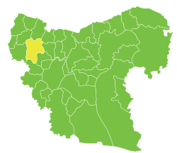
Cities, towns and villages of Afrin Subdistrict
| PCode | Name | Population |
|---|
| C1366 | Afrin | 36,562 |
| C1376 | Basouta | 2,389 |
| C1367 | Inab | 2,309 |
| C1387 | Karzahayel | 1,548 |
| C1378 | Ghazawyah | 1,413 |
| C1375 | Barad | 1,229 |
| C1377 | Burj Abdullah | 1,224 |
| C1353 | Ibbin | 1,142 |
| C1384 | Maaratah | 1,134 |
| C1365 | al-Khadraa | 1,131 |
| C1352 | Iskan | 1,116 |
| C1356 | Shwarghat al-Joz | 1,095 |
| C1361 | Oqayba | 1,040 |
| C1358 | Ziyarah | 1,009 |
| C1374 | Basufan | 901 |
| C1386 | Maryamin | 810 |
| C1362 | al-Hawa | 743 |
| C1389 | Kafr Zeed | 727 |
| C1359 | Sheikh al-Deer | 714 |
| C1363 | Tharifa | 706 |
| C1382 | Kimar | 660 |
| C1379 | Zahrat al-Hiyat | 654 |
| C1373 | Baai | 626 |
| C1354 | Burj Hayder | 616 |
| C1380 | Kabashin | 583 |
| C1371 | Basselhaya | 512 |
| C1383 | Fafrtin | 507 |
| C1360 | Jalbul | 461 |
| C1357 | Shwarghat al-Arz | 383 |
| C1369 | al-Basselya | 311 |
| C1385 | Kafr Sheel | 271 |
| C1370 | Ain Dara | 248 |
| C1390 | Kfeer | 213 |
| N/A | Tell Tawil | 211 |
| C1355 | Tellef | 200 |
| C1381 | Kawkabeh | 173 |
| C1351 | Babblit | 164 |
| C1368 | al-Nyrah | 122 |
| N/A | al-Kabira | 109 |
| C1388 | Kafr Batra | 63 |
| C1372 | Betita | 54 |
| N/A | Tell Ghazi | 51 |
| N/A | al-Jamila | 28 |
| C1364 | Khaldiyah | 26 |
References
|
|---|
|
|
|---|
| Jabal Samaan Subdistrict |
- Aleppo
- Abtin
- Assan
- Ayn al-Kabira
- Azzan
- Duwayr al-Zaytun
- Haddadin
- Hilan
- Hreibel
- Kafr Saghir
- Khan Tuman
- Maghayer Khan Tuman
- Maratat al-Muslimiyah
- al-Muslimiyah
- al-Muslimiyah al-Shamaliyah
- Qarras
- Rasm Assan
- Saqlaya
- Siefat
- Tell Shair Samaan
- Tell Shughayb
- al-Dhahabiyah
- al-Wadihi
|
|---|
| Tell al-Daman Subdistrict |
- Tell al-Daman
- Abu Rweil
- Ameriyeh
- Arjel
- Atshana Sharqiya
- Atshana Gharbiya
- Ballas
- Ballas al-Jadida
- Batranah
- Burda
- Buwaida Saghira
- Deir Saliba
- Hmeidi
- Hober
- Jubb Aleis
- Kafr Obeid
- al-Mintar
- Mreiqes
- Oweinat Kabira
- Rasm al-Mofakker
- Tabara al-Khusheir
- Um al-Karamel
|
|---|
| Haritan Subdistrict | |
|---|
| Darat Izza Subdistrict |
- Darat Izza
- Bshantara
- Basrtun
- Bishqatin
- Kafrantin
- al-Hoteh
- Hur
- Injarah
- Qabtan al-Jabal
- al-Sakhriyah
- Taqad
|
|---|
| al-Hadher Subdistrict | |
|---|
| al-Zirbah Subdistrict |
- al-Zirbah
- Abad
- Arada
- Banes
- Barnah
- Barqum
- Bawabiyah
- Humayrah
- Huweir al-Eiss
- Jazraya
- Jubb Kas
- Kassibeh
- Othmaniya Kabira
- Rasm al-Eiss
- Talafeh
- Tell Allush
- Tell Hidyah
- Zitan
- Ziyara Samaan
|
|---|
| Zammar Subdistrict | |
|---|
|
| |
|
|
|---|
| Afrin Subdistrict | |
|---|
| Bulbul Subdistrict |
- Bulbul
- Burj Haider
- Darmashkanli
- Deir Ballut
- Fafertin
- Jalbul
- Kimar
- Karzahayel
|
|---|
| Jandairis Subdistrict | |
|---|
| Maabatli Subdistrict | |
|---|
| Rajo Subdistrict | |
|---|
| Sharran Subdistrict | |
|---|
| Shaykh al-Hadid Subdistrict | |
|---|
|
|
|
|
|
|
|---|
| Dayr Hafir Subdistrict | |
|---|
| Kuweires Sharqi Subdistrict | |
|---|
| Rasm Harmil al-Imam Subdistrict | |
|---|
|
|
|
|
|
|---|
| As-Safira Subdistrict | |
|---|
| Banan Subdistrict | |
|---|
| al-Hajib Subdistrict | |
|---|
| Khanasir Subdistrict | |
|---|
| Tell Aran Subdistrict | |
|---|
|
|