Muhambal
| Muhambal محمبل Mhambal, Mahambel | |
|---|---|
| Town | |
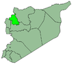
 Muhambal Location in Syria | |
| Coordinates: 35°47′2″N 36°28′10″E / 35.78389°N 36.46944°E | |
| Country |
|
| Governorate | Idlib |
| District | Ariha |
| Subdistrict | Muhambal |
| Population (2004) | |
| • Total | 4,970 |
| Time zone | UTC+2 (EET) |
| • Summer (DST) | UTC+3 (EEST) |
Muhambal (Arabic: محمبل, also spelled Mhambal or Mahambel) is a town in northwestern Syria, administratively part of the Ariha District of the Idlib Governorate. According to the Syria Central Bureau of Statistics, Muhambal had a population of 4,970 in the 2004 census. It is the administrative center of the Muhambal Subdistrict, which contained 21 localities with a collective population of 27,089 in 2004.[1] Nearby localities include Jisr al-Shughur, Bishlamun and Bizit to the west, Juzif to the south, al-Rami to the east, and Ayn Shib to the north.
References
- ↑ General Census of Population and Housing 2004 Archived 2013-02-06 at the Wayback Machine.. Syria Central Bureau of Statistics (CBS). Idlib Governorate. (in Arabic)
This article is issued from
Wikipedia.
The text is licensed under Creative Commons - Attribution - Sharealike.
Additional terms may apply for the media files.