Al-Jarniyah
| Al-Jarniyah الجرنية | |
|---|---|
| Town | |
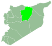
 Al-Jarniyah Location in Syria | |
| Coordinates: 36°09′34″N 38°14′13″E / 36.159560°N 38.236989°ECoordinates: 36°09′34″N 38°14′13″E / 36.159560°N 38.236989°E | |
| Country |
|
| Governorate | Raqqa Governorate |
| District | Al-Thawrah District |
| Subdistrict | Al-Jarniyah Subdistrict |
| Elevation[1] | 371 m (1,217 ft) |
| Population (2004 census)[2] | |
| • Total | 2,686 |
| Time zone | UTC+2 (EET) |
| • Summer (DST) | UTC+3 (EEST) |
Al-Jarniyah (Arabic: الجرنية), also written Jurneyyeh, is a town in Raqqa Governorate, Syria. It is the administrative centre of Al-Jarniyah subdistrict in Al-Thawrah District.[3] The population of the town at the 2004 census was 2686.[2]
The town and much of the subdistrict are currently controlled by the Syrian Democratic Forces, following 2 years of ISIL control since 2014.[4]
Syrian Civil War
The ISIL control of the town was ended in December 2016, when SDF forces cut off and cleared a large part of the Al-Jarniyah Subdistrict.[5][6]
See also
References
- ↑ "Al Jarnīyah, Raqqa, Syria". CountryBox.info. Retrieved 20 December 2016.
- 1 2 "Syrian census 2004". HumanitarianResponse.
Pcode 'C5965'
- ↑ "Map of Al Jarniyah – GeoLocated Syria". GeoLocated. Retrieved 20 December 2016.
- ↑ "ISIS - ISIL map". Liveuamap. Retrieved 20 December 2016.
- ↑ "Syrian Democratic Forces reach Euphrates, besiege ISIS-held area". al-Masdar News. 19 December 2016. Retrieved 4 January 2017.
- ↑ "Kurdish YPG Forces Liberate 54 Villages From ISIS In Province Of Raqqa". SouthFront. 20 December 2016. Retrieved 5 January 2017.
External links
|  | |||||
|
| ||||||
This article is issued from
Wikipedia.
The text is licensed under Creative Commons - Attribution - Sharealike.
Additional terms may apply for the media files.