Shathah
| Shathah شطحة | |
|---|---|
| Town | |
|
Shathah al-Tahta شطحة التحتا | |
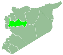
 Shathah Location in Syria | |
| Coordinates: 35°30′11″N 36°14′38″E / 35.503°N 36.244°ECoordinates: 35°30′11″N 36°14′38″E / 35.503°N 36.244°E | |
| Country |
|
| Governorate | Hama |
| District | Al-Suqaylabiyah |
| Subdistrict | Shathah |
| Population (2004)[1] | |
| • Total | 8,076 |
| Time zone | UTC+2 (EET) |
| • Summer (DST) | +3 |
Shathah (Arabic: شطحة التحتا, šaṭḥat at-taḥta) is a town in northwestern Syria, administratively part of the Hama Governorate, located northwest of Hama. Nearby localities include Slinfah to the northwest, Nabl al-Khatib and Farikah to the north, al-Huwash to the northeast, Huwayjat al-Sallah to the southeast, Inab to the south and Ayn al-Tineh to the west.[2]
According to the Syria Central Bureau of Statistics (CBS), Shathah had a population of 8,076 in the 2004 census. It is the administrative center and largest town of Shathah Subdistrict, which consisted of 12 localities with a collective population of 25,273 in 2004.[1] Its inhabitants are predominantly Alawites.
References
- 1 2 General Census of Population and Housing 2004. Syria Central Bureau of Statistics (CBS). Hama Governorate. (in Arabic)
- ↑ Shathat al Tahta. Mapcarta.
This article is issued from
Wikipedia.
The text is licensed under Creative Commons - Attribution - Sharealike.
Additional terms may apply for the media files.