Al-Darbasiyah
| Al-Darbasiyah الدرباسية Dirbêsiyê | |
|---|---|
| Town | |
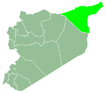
 Al-Darbasiyah Location in Syria | |
| Coordinates: 37°4′22″N 40°39′7″E / 37.07278°N 40.65194°ECoordinates: 37°4′22″N 40°39′7″E / 37.07278°N 40.65194°E | |
| Country | Syria |
| Governorate | Al-Hasakah Governorate |
| District | Ras al-Ayn District |
| Nahiyah | Al-Darbasiyah Subdistrict |
| Elevation | 300 m (1,000 ft) |
| Population (2004 census)[1] | |
| • Total | 8,551 |
| Time zone | UTC+2 (EET) |
| • Summer (DST) | +3 |
| Area code(s) | 52 |
Al-Darbasiyah (Arabic: الدرباسية, Kurdish: Dirbêsiyê, Classical Syriac: ܕܪܒܐܣܝܐ) is a Syrian town on the Syrian-Turkish border opposite the Turkish town of Senyurt. Administratively it is part of the Al-Hasakah Governorate. According to the Syria Central Bureau of Statistics (CBS), al-Darbasiyah had a population of 8,551 in the 2004 census. It is the administrative center of a nahiyah ("subdistrict") consisting of 113 localities with a combined population of 55,614 in 2004.[1] The majority of the inhabitants of the town are Kurds with a large Arab and a smaller Assyrian minority.[2]
It is connected by road to Tell Beydar in the south.
On 22 July 2012, YPG forces took control over the town, after the security and political units withdrew from it, following an ultimatum issued by the Kurds. The town has been under Kurdish control since then.[3][4]
References
- 1 2 General Census of Population and Housing 2004. Syria Central Bureau of Statistics (CBS). Al-Hasakah Governorate. (in Arabic)
- ↑ http://www.lekolin.org/haber-3961--JI-SEDI-61-NISTECIHEN-KANTONA-CIZIRE-KURDIN.html
- ↑ "Kurdish Syria: From cultural to armed revolution". 28 July 2012. Egypt Independent.
- ↑ "Armed Kurds Surround Syrian Security Forces in Qamishli". Rudaw.net. Retrieved 2013-08-29.