Ghabaghib
| Ghabaghib غباغب | |
|---|---|
| Town | |
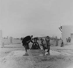 Water well, Ghabaghib, 1965 | |
 Ghabaghib | |
| Coordinates: 33°11′2″N 36°13′35″E / 33.18389°N 36.22639°E | |
| Grid position | 264/287 PAL |
| Country |
|
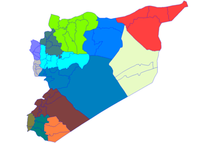
| Governorate | Daraa Governorate |
| District | Al-Sanamayn District |
| Nahiyah | Ghabaghib |
| Elevation | 710 m (2,329 ft) |
| Population (2004 census)[1] | |
| • Total | 11,802 |
| Time zone | UTC+2 (EET) |
| • Summer (DST) | UTC+3 (EEST) |
Ghabaghib (Arabic: غباغب Ğabāğib; also spelled Ghabagheb) is a town in southern Syria, administratively part of the Daraa Governorate, located north of Daraa. Nearby localities include Muthabin to the southeast, al-Sanamayn to the south, Deir al-Bukht, Deir al-Adas to the east, Khan Dannun to the north and al-Qin to the northwest.
According to the Syria Central Bureau of Statistics (CBS), Ghabaghib had a population of 11,802 in the 2004 census.[1] The town is also the administrative center of the Ghabaghib nahiyah which consists of thirteen villages with a combined population of 45,793.[1]
History
On 16 January 1192 news reached Jerusalem that Alam al-Din Sulayman, an emir ("commander") of Ayyubid general Saladin, had died in Ghabaghib on his way to Aleppo.[2] Later, in the early 13th-century, the town was visited by Syrian geographer Yaqut al-Hamawi who noted that it was "a village in the nearer districts of Hauran, 6 leagues from Damascus."[3]
In 1596 Gabagib appeared in the Ottoman tax registers being part of the nahiya of Bani Kilab in the Qada of Hauran. It had an entirely Muslim population consisting of 6 households and 5 bachelors. Taxes were paid on wheat, barley, summer crops, goats and/or beehives.[4]
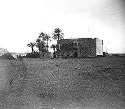
In the mid-19th-century, Ghabaghib was a small village with structures built of black basalt stone.[5] The town, situated along the Hajj caravan route between Damascus and Mecca, served as an intermediate rest stop between Khan Dannun and al-Sanamayn.[6] A tower was built in the town on the orders of Ottoman Sultan, Selim I.[6] Ghabaghib later became a station on the Damascus–Daraa line of the Hejaz Railway.[7] During the Syria–Lebanon Campaign in World War II, Ghabaghib served as the headquarters for the Free French Forces in southern Syria. The town was nicknamed "Rhubarb" by British soldiers who found the name too difficult to pronounce.[8]
In 1906 the traveler William Ewing noted that "At Ghabaghib ... great cisterns and scattered ruins tell of an important place in times past."[9]
References
- 1 2 3 General Census of Population and Housing 2004. Syria Central Bureau of Statistics (CBS). Daraa Governorate. (in Arabic)
- ↑ Ibn al-Athir, 2007, p. 395
- ↑ le Strange, 1890, p. 441.
- ↑ Hütteroth and Abdulfattah, 1977, p. 210
- ↑ Beke, 1862, p. 87
- 1 2 Newbold, 1846, p. 337
- ↑ Masterman, 1897, p. 200.
- ↑ Smith, 2009, p. 228.
- ↑ Ewing, 1907, p. 5.
Bibliography
- Beke, Charles T. (1862). "Notes on an Excursion to Harrān, in Padan-Aram, and Thence over Mount Gilead and the Jordan, to Shechem". Journal of the Royal Geographical Society of London. Wiley-Blackwell. 32: 76–100. doi:10.2307/1798402.
- Ewing, William (1907). Arab and Druze at home. T. C. & E. C. Jack.
- Hütteroth, Wolf-Dieter; Abdulfattah, Kamal (1977). Historical Geography of Palestine, Transjordan and Southern Syria in the Late 16th Century. Erlanger Geographische Arbeiten, Sonderband 5. Erlangen, Germany: Vorstand der Fränkischen Geographischen Gesellschaft. ISBN 3-920405-41-2.
- Ibn al-Athīr, ʻIzz al-Dīn (2007). Donald Sidney Richards, ed. The Chronicle of Ibn Al-Athīr for the Crusading Period from Al-Kāmil Fīʼl-taʼrīkh: The years 541–589. Ashgate Publishing, Ltd. ISBN 9780754640783.
- Masterman, E. W. G. (1897). "The Damascus Railways". Quarterly statement - Palestine Exploration Fund. 29: 198–200.
- Newbold, Captain (1846). "On the Site of Ashtaroth". Journal of the Royal Geographical Society of London. Wiley-Blackwell. 16: 331–338. doi:10.2307/1798240.
- Smith, Colin (2009). England's last war against France: fighting Vichy 1940-1942. Weidenfeld & Nicolson.
- Strange, le, Guy (1890). Palestine Under the Moslems: A Description of Syria and the Holy Land from A.D. 650 to 1500. Committee of the Palestine Exploration Fund.
External links
- Map of town, Google Maps
- Sanameine-map; 19L
Capital: Daraa | |||||||||||||||||||||
| |||||||||||||||||||||
| |||||||||||||||||||||
| |||||||||||||||||||||
Ottoman hajj routes | |||||||
|---|---|---|---|---|---|---|---|
| |||||||