al-Bab District
| al-Bab District منطقة الباب | |
|---|---|
| District | |
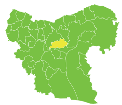
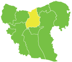 Location of al-Bab District within Aleppo Governorate | |
 al-Bab District Location in Syria | |
| Coordinates (al-Bab): 36°22′21″N 37°31′04″E / 36.3725°N 37.5178°E | |
| Country |
|
| Governorate | Aleppo |
| Seat | al-Bab |
| Subdistricts | 4 nawāḥī |
| Area | |
| • Total | 1,480.19 km2 (571.50 sq mi) |
| Population (2004)[1] | 201,589 |
| Geocode | SY0202 |
al-Bab District (Arabic: منطقة الباب, translit. manṭiqat al-Bāb) is a district of Aleppo Governorate in northern Syria. Administrative centre is the city of al-Bab.
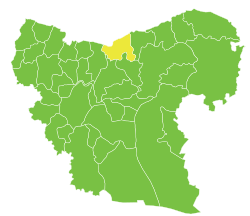
The administrative center of al-Rai Subdistrict shown above is the city of al-Rai.
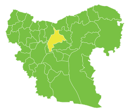
The administrative center of al-Bab Subdistrict shown above is the city of al-Bab.
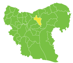
The administrative center of Arima Subdistrict shown above is the city of Arima.
The administrative center of Tadef Subdistrict shown above is the city of Tadef.
The district was split in 2009, when three southern subdistricts were separated to form the new Dayr Hafir District.[2] At the 2004 census, the remaining subdistricts had a total population of 201,589.[1]
Subdistricts
The district of al-Bab is divided into four subdistricts or nawāḥī (population as of 2004[1]):
| Code | Name | Area | Population | Seat |
|---|---|---|---|---|
| SY020200 | al-Bab Subdistrict | 489.28 km² | 112,219 | al-Bab |
| SY020201 | Tadef Subdistrict | 321.24 km² | 41,951 | Tadef |
| SY020202 | al-Rai Subdistrict | 352.30 km² | 15,378 | al-Rai |
| SY020203 | Arima Subdistrict | 317.38 km² | 32,041 | Arima |
References
- 1 2 3 "General Census of Population and Housing 2004" (PDF) (in Arabic). Syrian Central Bureau of Statistics. Archived from the original (PDF) on 8 December 2015. Retrieved 15 October 2015. Also available in English: "2004 Census Data". UN OCHA. Retrieved 15 October 2015.
- ↑ "إحداث منطقتي دير حافر والأتارب سيساهم في النهضة التنموية بالمحافظة". Al-Jamahir (in Arabic). Aleppo. 25 February 2009. Retrieved 24 January 2016.
Capital: Aleppo | ||||||||||||||||||||
|  | |||||||||||||||||||
|
| ||||||||||||||||||||
| ||||||||||||||||||||
| ||||||||||||||||||||
| ||||||||||||||||||||
| ||||||||||||||||||||
| ||||||||||||||||||||
| ||||||||||||||||||||
| ||||||||||||||||||||
This article is issued from
Wikipedia.
The text is licensed under Creative Commons - Attribution - Sharealike.
Additional terms may apply for the media files.