List of historic places in Saskatchewan
This article is a list of historic places in the province of Saskatchewan entered on the Canadian Register of Historic Places, whether they are federal, provincial, or municipal.
List of historic places
| Name | Address | Coordinates | IDF | IDP | IDM | Image | |
|---|---|---|---|---|---|---|---|
| Abbey Fire Hall | 322 Cathedral Avenue, Abbey, SK | 50°44′05″N 108°45′25″W / 50.7348°N 108.757°W | 6152 |  | |||
| Abernethy and District Memorial Hall | Main Street, Abernethy, SK | 50°44′43″N 103°25′05″W / 50.7453°N 103.418°W | 5516 | | |||
| Barn | , Abernethy, SK | 50°43′13″N 103°25′30″W / 50.7202°N 103.425°W | 3341 |  More images | |||
| Christ Anglican Church | , Abernethy, SK | 50°44′51″N 103°25′12″W / 50.7474°N 103.42°W | 1981 | | |||
| Motherwell Homestead National Historic Site of Canada | Highway 22, Abernethy, SK | 50°43′13″N 103°25′30″W / 50.7202°N 103.425°W | 1209 | 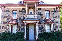 More images | |||
| Stone House Classified Federal Heritage Building | , Abernethy, SK | 50°43′13″N 103°25′30″W / 50.7202°N 103.425°W | 3342 | | |||
| Wood/Gibson Residence | Main Street, Alameda, SK | 49°15′57″N 102°16′48″W / 49.2659°N 102.28°W | 4079 | | |||
| Paroisse St. Jacques D’Albertville | , Albertville, SK | 53°30′35″N 105°33′50″W / 53.5098°N 105.564°W | 11486 | | |||
| The Alsask School | , Alsask, SK | 51°22′33″N 109°59′31″W / 51.3757°N 109.992°W | 3783 | | |||
| Arcola Court House on Souris Avenue | 619 Souris Avenue, Arcola, SK | 49°38′14″N 102°29′02″W / 49.6373°N 102.484°W | 7504 | | |||
| Arcola Town Hall | 21 Main Street, Arcola, SK | 49°38′05″N 102°29′31″W / 49.6348°N 102.492°W | 1309 | | |||
| Land Titles Office | 301 Main Street, Arcola, SK | 49°38′11″N 102°29′31″W / 49.6363°N 102.492°W | 1303 | | |||
| Law Office Building | 114 Main Street, Arcola, SK | 49°39′06″N 103°21′54″W / 49.6518°N 103.365°W | 1308 | | |||
| Pharmacy Building | 107 Main Street, Arcola, SK | 49°38′02″N 102°29′31″W / 49.6339°N 102.492°W | 1304 | | |||
| Assiniboia Court House | 700 Centre Street, Assiniboia, SK | 49°37′42″N 105°59′35″W / 49.6283°N 105.993°W | 3100 | | |||
| Kristiania Lutheran Church | , Atwater, SK | 50°46′42″N 102°13′34″W / 50.7783°N 102.226°W | 6611 | | |||
| CNR Station House and Grounds | 219 Railway Avenue, Avonlea, SK | 50°00′49″N 105°03′38″W / 50.0136°N 105.0605°W | 2573 | | |||
| Balgonie United Church | 137 Lewis Street, Balgonie, SK | 50°29′26″N 104°15′58″W / 50.4905°N 104.266°W | 1983 | | |||
| Batoche National Historic Site of Canada | PO Box 999, Batoche, SK | 52°45′14″N 106°06′58″W / 52.7539°N 106.116°W | 14598 | 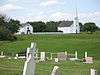 More images | |||
| Former Jean Caron Sr. House | , Batoche, SK | 52°45′14″N 106°07′01″W / 52.754°N 106.117°W | 4684 |  | |||
| St. Antoine de Padoue Church | Batoche National Historic Site of Canada, Batoche, SK | 52°45′08″N 106°07′03″W / 52.7523°N 106.1174°W | 15526 | | |||
| St. Antoine de Padoue Rectory | Batoche National Historic Site of Canada, Batoche, SK | 52°45′14″N 106°07′01″W / 52.754°N 106.117°W | 4762 | | |||
| Jax Theatre | 141 First Avenue West, Bengough, SK | 51°11′43″N 105°08′02″W / 51.1954°N 105.134°W | 6626 | | |||
| Gillis Blakley Bethune and District Heritage Museum | 519 East Street, Bethune, SK | 50°42′44″N 105°12′18″W / 50.7121°N 105.205°W | 5824 | | |||
| Train/Caboose Lot | Railway Ave, Bienfait, SK | 49°08′40″N 102°48′29″W / 49.1445°N 102.808°W | 2569 | | |||
| Biggar Railway Station (Grand Trunk Pacific) National Historic Site of Canada | , Biggar, SK | 52°04′00″N 108°00′00″W / 52.0667°N 108°W | 13347 4579 |
| |||
| CN Station Building | 329 Railway Avenue, Blaine Lake, SK | 52°49′56″N 106°52′59″W / 52.8323°N 106.8830°W | 3003 | | |||
| Doukhobor Prayer Home | 318 Main Street, Blaine Lake, SK | 52°49′46″N 106°52′48″W / 52.8295°N 106.88°W | 16285 | | |||
| St. Andrew's Roman Catholic Church | 102 2nd Avenue E, Blaine Lake, SK | 52°35′41″N 109°16′52″W / 52.5948°N 109.281°W | 11692 | | |||
| Borden Hotel / Model-T Bar & Grill | 301 Railway Avenue, Borden, SK | 52°24′14″N 107°14′29″W / 52.4040°N 107.2414°W | 20225 | | |||
| Turtle Lake School | 202 Main Street, Borden, SK | 52°24′18″N 107°14′24″W / 52.4049°N 107.24°W | 9244 | | |||
| Peachey House | 305 Railway Avenue, Briercrest, SK | 50°10′03″N 105°15′58″W / 50.1674°N 105.266°W | 13867 | | |||
| Former Canadian Pacific Railway Station | Front St. (at 6th Ave. (Highway 605)), Broadview, SK | 50°22′44″N 102°34′44″W / 50.379°N 102.579°W | 4563 | 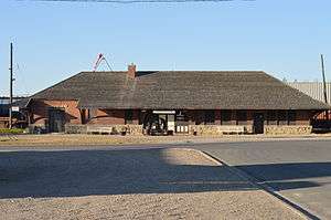 More images | |||
| Old Fire Hall and Jail | 525 Main Street, Bruno, SK | 52°15′52″N 105°31′23″W / 52.2644°N 105.523°W | 9258 | | |||
| Ukrainian Greek Orthodox Church of St. John the Baptist | 607 1st Avenue West, Buchanan, SK | 51°42′19″N 102°45′27″W / 51.7053°N 102.7576°W | 16372 | | |||
| The Anglican Church Property | 312-1st Street South, Cabri, SK | 50°37′02″N 108°27′36″W / 50.6172°N 108.46°W | 2372 | | |||
| Holy Trinity Ukrainian Greek Orthodox Church | 710 Main Street, Canora, SK | 51°37′53″N 102°26′17″W / 51.6315°N 102.438°W | 5813 | | |||
| The Nicholas Lewchuk Property | 316 Barschel Avenue, Canora, SK | 51°37′50″N 102°25′34″W / 51.6306°N 102.426°W | 6466 | | |||
| Holy Trinity Anglican Church | Pacific Avenue, Carievale, SK | 49°10′31″N 101°37′37″W / 49.1753°N 101.627°W | 2499 | | |||
| Rabeau Building | 616 Railway Avenue, Carnduff, SK | 49°10′29″N 101°47′31″W / 49.1748°N 101.792°W | 1532 | | |||
| Old Masonic Lodge | 272 Main Street, Central Butte, SK | 50°47′40″N 106°30′22″W / 50.7944°N 106.506°W | 11918 | | |||
| Bank of Toronto Building | 414 4th Street, Chaplin, SK | 50°27′46″N 106°39′25″W / 50.4628°N 106.657°W | 5557 | | |||
| Conquest United Church | 229 Bounty Street, Conquest, SK | 51°31′45″N 107°14′38″W / 51.5293°N 107.244°W | 1523 | | |||
| Craik Town Hall | Corner of First Avenue & 3rd Street, Craik, SK | 51°02′51″N 105°49′16″W / 51.0475°N 105.821°W | 5819 | | |||
| Prairie Pioneer Museum | 541 Parks Road, Craik, SK | 51°03′06″N 105°49′08″W / 51.0518°N 105.819°W | 5825 | | |||
| Cudworth Museum (former CN station) | 1st Avenue, Cudworth, SK | 52°29′23″N 105°43′50″W / 52.4897°N 105.7306°W | 9252 | | |||
| Cumberland House Provincial Park | , Cumberland House, SK | 53°57′34″N 102°15′54″W / 53.9595°N 102.265°W | 1139 | 3111 | | ||
| St. Lucy's Anglican Church | Gladstone Street, Dilke, SK | 50°52′01″N 105°15′11″W / 50.8669°N 105.253°W | 5820 | | |||
| All Saints Anglican Church | 7th Street E at 1st Ave S, Duck Lake, SK | 52°48′49″N 106°14′07″W / 52.8135°N 106.2352°W | 4060 | | |||
| Almighty Voice Jailhouse | 5 Anderson Avenue, Duck Lake, SK | 52°48′59″N 106°13′05″W / 52.8164°N 106.218°W | 1538 | | |||
| Battle of Duck Lake National Historic Site of Canada | , Duck Lake, SK | 52°49′00″N 106°13′59″W / 52.8167°N 106.233°W | 12916 | | |||
| Victoria School | Victoria Avenue & 3rd Street, Duck Lake, SK | 52°48′50″N 106°13′44″W / 52.814°N 106.229°W | 3315 | | |||
| 39 / Recreational Hall | Dundurn Military Camp, Dundurn, SK | 51°50′51″N 106°33′43″W / 51.8475°N 106.562°W | 13543 | | |||
| Dundurn United Church | 300 2nd Street, Dundurn, SK | 51°48′40″N 106°30′22″W / 51.811°N 106.506°W | 5565 | | |||
| Old Bank Building | 400 2nd Street, Dundurn, SK | 51°48′38″N 106°30′18″W / 51.8106°N 106.5049°W | 5566 | | |||
| Old Brick School | Third Avenue, Dundurn, SK | 51°48′39″N 106°30′36″W / 51.8108°N 106.51°W | 5567 | | |||
| Dysart School | 209 Wark Street, Dysart, SK | 50°56′46″N 104°02′10″W / 50.946°N 104.036°W | 7061 | | |||
| Royal Bank Building | 109 Main Street, Dysart, SK | 50°56′39″N 104°02′16″W / 50.9443°N 104.0377°W | 7063 | | |||
| St. George Romanian Orthodox Church | 201 Mckendre Street, Dysart, SK | 50°56′45″N 104°02′20″W / 50.9457°N 104.039°W | 7070 | | |||
| Old Town Office | 102 Maple Avenue S, Eastend, SK | 49°30′43″N 108°49′08″W / 49.512°N 108.819°W | 1957 | | |||
| Stegner Residence | 126 Tamarack Avenue, Eastend, SK | 49°31′01″N 108°49′34″W / 49.5169°N 108.826°W | 1543 | | |||
| Eatonia Heritage Park | 100 Railway Avenue, Eatonia, SK | 51°13′16″N 109°23′33″W / 51.2212°N 109.3924°W | 4476 | | |||
| Canadian National Railways Station | Railway Avenue, Edam, SK | 53°11′18″N 108°46′07″W / 53.1882°N 108.7687°W | 9259 | | |||
| Edam Café | 937 East Railway Avenue, Edam, SK | 53°11′21″N 108°46′01″W / 53.1891°N 108.767°W | 9250 | 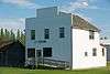 More images | |||
| Elfros Union Church | Elfros Street, Elfros, SK | 51°44′31″N 103°51′58″W / 51.7419°N 103.866°W | 4965 | | |||
| Elrose Brick School | 12 Fourth Avenue East, Elrose, SK | 51°11′59″N 108°01′48″W / 51.1996°N 108.03°W | 7845 | | |||
| Ernest Lindner Studio on Fairy Island | , Emma Lake, SK | 53°37′31″N 105°56′35″W / 53.6254°N 105.943°W | 10429 | | |||
| St. James Anglican Church | 1st Street S, Endeavour, SK | 52°09′30″N 102°39′24″W / 52.1583°N 102.6567°W | 16375 | | |||
| Ernfold School | , Ernfold, SK | 50°26′57″N 106°53′28″W / 50.4492°N 106.891°W | 5555 | | |||
| Esterhazy Flour Mill | 517 Smith-Dorrien Street, Esterhazy, SK | 50°32′27″N 101°50′31″W / 50.5407°N 101.842°W | 14963 | 10427 | 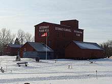 More images | ||
| Estevan Court House | 1016 Fourth Street, Estevan, SK | 49°08′21″N 102°59′31″W / 49.1393°N 102.992°W | 4087 | | |||
| Wood End North West Mounted Police Post | 118 4th Street, Estevan, SK | 49°07′54″N 102°58′23″W / 49.1318°N 102.973°W | 2681 | | |||
| Evans House | 946 2nd Street South East, Eston, SK | 51°08′44″N 108°44′53″W / 51.1456°N 108.748°W | 11914 | | |||
| Battle of Tourond's Coulee / Fish Creek National Historic Site of Canada | , Fish Creek, SK | 52°31′47″N 106°08′17″W / 52.5296°N 106.138°W | 14085 |  | |||
| Fleming Grain Elevator | South Railway Street, Fleming, SK | 50°04′38″N 101°30′43″W / 50.0772°N 101.512°W | 10432 | | |||
| Fleming Lake of the Woods Grain Elevator National Historic Site of Canada | , Fleming, SK | 50°04′31″N 101°30′43″W / 50.0753°N 101.512°W | 12141 | | |||
| Fleming Memorial Cemetery | , Fleming, SK | 50°04′49″N 101°29′42″W / 50.0803°N 101.495°W | 7001 | | |||
| Foam Lake Museum | 133 Bray Avenue West, Foam Lake, SK | 51°38′34″N 103°32′06″W / 51.6429°N 103.535°W | 4972 | | |||
| St. John the Evangelist Anglican Church | 320 Main Street, Foam Lake, SK | 51°38′30″N 103°32′01″W / 51.6418°N 103.5337°W | 4971 | | |||
| Fort Qu'Appelle National Historic Site of Canada | 198 Bay Avenue North, Fort Qu'Appelle, SK | 50°46′17″N 103°47′52″W / 50.7713°N 103.7979°W | 18988 | | |||
| Grand Trunk Pacific Railway Station | Highway 10, Fort Qu'Appelle, SK | 50°45′44″N 103°47′38″W / 50.7622°N 103.794°W | 4884 | 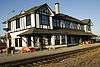 More images | |||
| Hospital, Indian Services | Broad Street, Fort Qu'Appelle, SK | 50°45′57″N 103°47′17″W / 50.7657°N 103.788°W | 4695 | | |||
| Echo Valley Conference Centre (Fort San) | , Fort San, SK | 50°47′45″N 103°48′43″W / 50.7959°N 103.812°W | 13889 | | |||
| Public School | , Fox Valley, SK | 50°28′00″N 109°28′59″W / 50.4666°N 109.483°W | 4147 | | |||
| Frenchman Butte National Historic Site of Canada | , Frenchman Butte, SK | 53°37′38″N 109°34′34″W / 53.6273°N 109.576°W | 14509 | | |||
| Christ Church | 205 Bruce Street, Gainsborough, SK | 49°10′32″N 101°26′56″W / 49.1756°N 101.449°W | 1296 |  | |||
| Girvin Pump House | , Girvin, SK | 51°03′01″N 105°49′08″W / 51.0502°N 105.819°W | 4215 | | |||
| Glenside United Church | NW corner of Main Street and Saskatchewan Avenue, Glenside, SK | 51°27′06″N 106°48′11″W / 51.4517°N 106.803°W | 3780 | | |||
| Goodsoil Historical Museum Site | Main Street, Goodsoil, SK | 54°24′09″N 109°13′41″W / 54.4024°N 109.228°W | 6999 | | |||
| Bishop's Residence | 112 1st Avenue W, Gravelbourg, SK | 49°52′21″N 106°33′29″W / 49.8724°N 106.558°W | 1541 | | |||
| Canadian National Railway Station Building | 701 Main Street N, Gravelbourg, SK | 49°52′43″N 106°33′27″W / 49.8786°N 106.5574°W | 8531 | | |||
| College Mathieu Pavillion | 1st Avenue East at Magnan Street, Gravelbourg, SK | 49°52′20″N 106°32′53″W / 49.8722°N 106.548°W | 8402 | | |||
| Court House | 209 Main Street, Gravelbourg, SK | 49°52′27″N 106°33′26″W / 49.8743°N 106.5573°W | 7510 | | |||
| Elementary School | 240 1st Ave, Gravelbourg, SK | 49°52′18″N 106°33′36″W / 49.8718°N 106.56°W | 7052 | | |||
| Gaiety Theatre | 412 Main Street, Gravelbourg, SK | 49°52′35″N 106°33′25″W / 49.8763°N 106.557°W | 7058 |  More images | |||
| Gravelbourg Post Office | 402 Main Street, Gravelbourg, SK | 49°52′33″N 106°33′25″W / 49.8758°N 106.557°W | 8530 | 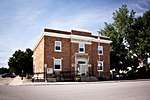 More images | |||
| La Cathédrale | 116 1st Avenue W, Gravelbourg, SK | 49°52′22″N 106°33′25″W / 49.8727°N 106.557°W | 11188 | 2011 |  More images | ||
| Adare House | 711 Wolseley Avenue, Grenfell, SK | 50°24′39″N 102°55′44″W / 50.4109°N 102.929°W | 4961 | | |||
| Windsor Block | 1103 Front Avenue, Grenfell, SK | 50°24′47″N 102°55′51″W / 50.4130°N 102.9308°W | 4960 | | |||
| I.O.O.F. Lodge | 3372 Rutland Avenue, Gull Lake, SK | 50°05′41″N 108°28′59″W / 50.0948°N 108.483°W | 2374 | | |||
| St. Andrew's United Church | Halifax St, Halbrite, SK | 49°29′17″N 103°33′22″W / 49.4881°N 103.556°W | 3390 | | |||
| Harris United Church | 204 2nd Avenue N, Harris, SK | 51°44′02″N 107°34′48″W / 51.734°N 107.58°W | 4823 | | |||
| Old Harris CNR Water Tower | 208 Railway Avenue N, Harris, SK | 51°44′06″N 107°34′59″W / 51.7349°N 107.583°W | 1990 | | |||
| Royal Bank of Canada | 116 Main Street, Harris, SK | 51°44′03″N 107°34′59″W / 51.7342°N 107.5830°W | 4821 | | |||
| St. Brigitte Roman Catholic Church | 215 Main Street, Harris, SK | 51°44′00″N 107°34′55″W / 51.7334°N 107.582°W | 4822 | | |||
| The Rural Municipality of Harris #316 Office | Main Street, Harris, SK | 51°44′03″N 107°34′59″W / 51.7343°N 107.583°W | 4820 | | |||
| Canadian Imperial Bank of Commerce | Gladstone Street near Chester Avenue, Hawarden, SK | 51°24′49″N 106°36′06″W / 51.4136°N 106.6018°W | 16243 | | |||
| Christ Anglican Church | William Street between Chester and Railway Avenues, Hawarden, SK | 51°24′53″N 106°36′04″W / 51.4147°N 106.6010°W | 16244 | | |||
| Hazenmore Community Church | , Hazenmore, SK | 49°41′12″N 107°08′06″W / 49.6868°N 107.135°W | 2244 | | |||
| St. James Anglican Church | Phair Avenue, Hazenmore, SK | 49°41′12″N 107°08′07″W / 49.6867°N 107.1353°W | 2215 | | |||
| Hepburn School | Main Street & Second Street E, Hepburn, SK | 52°31′31″N 106°43′26″W / 52.5252°N 106.724°W | 11531 | | |||
| Station Grounds of the Canadian Northern Railway Company | , Hepburn, SK | 52°31′32″N 106°43′55″W / 52.5256°N 106.732°W | 11532 | | |||
| Hall Residence | 431 Dennis Street, Herbert, SK | 50°25′48″N 107°13′19″W / 50.4299°N 107.2220°W | 5777 | | |||
| Klassen Museum | 801 Herbert Avenue, Herbert, SK | 50°25′35″N 107°13′26″W / 50.4264°N 107.224°W | 6143 | | |||
| St. Patrick's Roman Catholic Church | 507 Shaw Street, Herbert, SK | 50°25′51″N 107°13′08″W / 50.4307°N 107.219°W | 6142 | | |||
| Stone Church on Whyte Street | Whyte Street, Heward, SK | 49°44′12″N 103°09′00″W / 49.7368°N 103.15°W | 1953 | | |||
| Hudson Bay School | 508 & 510 Churchill Street, Hudson Bay, SK | 52°51′22″N 102°23′24″W / 52.8562°N 102.39°W | 3788 | | |||
| Canadian National Railways (Canadian Northern Railway) Station | 5th Avenue (at 9th St.), Humboldt, SK | 52°11′53″N 105°07′26″W / 52.198°N 105.124°W | 4560 | | |||
| Humboldt Post Office National Historic Site of Canada | , Humboldt, SK | 52°11′46″N 105°07′23″W / 52.196°N 105.123°W | 11807 | 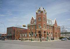 More images | |||
| Post Office | 602 Main Street, Humboldt, SK | 52°11′56″N 105°07′19″W / 52.1989°N 105.122°W | 2880 | | |||
| Provincial Court House | 805 8th Avenue, Humboldt, SK | 52°12′08″N 105°07′23″W / 52.2022°N 105.123°W | 2871 | | |||
| Water Tower | 407 3rd Avenue, Humboldt, SK | 52°11′44″N 105°07′01″W / 52.1955°N 105.117°W | 2787 | | |||
| Cattle Barn Building 14 | , Indian Head, SK | 50°31′59″N 103°39′22″W / 50.5331°N 103.656°W | 18717 | | |||
| Mainline Ford Building | 427 Grand Avenue, Indian Head, SK | 50°31′58″N 103°40′08″W / 50.5328°N 103.669°W | 1286 | | |||
| Stable Building No. 15 | Indian Head Research Station, Indian Head, SK | 50°31′59″N 103°39′15″W / 50.5330°N 103.6542°W | 18719 | | |||
| Red Brick Schoolhouse | 306 - 1st Street S.W., Ituna, SK | 51°10′04″N 103°29′49″W / 51.1678°N 103.497°W | 6451 | | |||
| Capital Theatre at 566 First Street | 566 1st Street, Kamsack, SK | 51°33′44″N 101°54′22″W / 51.5621°N 101.906°W | 4782 | | |||
| Former Power Building | , Kamsack, SK | 51°34′12″N 101°55′16″W / 51.5699°N 101.921°W | 4794 | | |||
| Former Water Tower | Queen Elizabeth Blvd, Kamsack, SK | 51°33′54″N 101°53′24″W / 51.5649°N 101.89°W | 3406 | | |||
| Royal Canadian Legion - Kamsack Branch No. 24 | 324 2nd Street, Kamsack, SK | 51°33′42″N 101°53′53″W / 51.5618°N 101.898°W | 5814 | | |||
| All Saints Anglican Church | Pelletier Park, Katepwa Beach, SK | 50°40′09″N 103°36′04″W / 50.6693°N 103.601°W | 1644 | | |||
| Goddard's Dry Goods | 427 2nd Avenue, Kelliher, SK | 51°15′49″N 103°44′13″W / 51.2636°N 103.737°W | 4973 | | |||
| Heritage Place | 99 Prouse Street, Kelvington, SK | 52°09′41″N 103°31′44″W / 52.1614°N 103.529°W | 8405 | | |||
| Kerrobert Court House | 433 Manitoba Avenue, Kerrobert, SK | 51°55′06″N 109°08′17″W / 51.9182°N 109.138°W | 3587 | 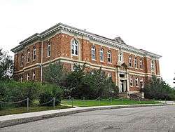 More images | |||
| The Kerrobert Library | 102 Bosworth Street, Kerrobert, SK | 51°55′08″N 109°08′06″W / 51.9190°N 109.1349°W | 4131 | | |||
| Kerrobert Water Tower | , Kerrobert, SK | 51°55′04″N 109°08′35″W / 51.9179°N 109.143°W | 4084 |  More images | |||
| Old Post Office | 218 Main Street, Kinistino, SK | 52°57′06″N 105°01′47″W / 52.9517°N 105.0296°W | 10813 | | |||
| Canadian Northern Railway Station | 524 Railway Street, Kipling, SK | 50°06′15″N 102°38′10″W / 50.1043°N 102.6361°W | 3787 | | |||
| Kipling and District Historical Museum | 201 4th Street, Kipling, SK | 50°06′10″N 102°38′02″W / 50.1027°N 102.634°W | 4889 | | |||
| R.M. of Kingsley No. 124 Office | 613 Main Street, Kipling, SK | 50°06′10″N 102°38′02″W / 50.1027°N 102.634°W | 2756 | | |||
| St. Radagonde Roman Catholic Church | 5 4th Avenue W, Lafleche, SK | 49°42′17″N 106°34′26″W / 49.7048°N 106.574°W | 6458 | | |||
| Larson Mausoleum | , Lang, SK | 49°55′01″N 104°21′43″W / 49.9169°N 104.362°W | 1313 | | |||
| Lanigan CPR Station | 75 Railway Avenue, Lanigan, SK | 51°50′43″N 105°02′06″W / 51.8454°N 105.035°W | 8693 | | |||
| Bramshott Spirits | 7 Main Street, Leask, SK | 53°01′18″N 106°44′28″W / 53.0218°N 106.741°W | 13869 | | |||
| Sacred Heart Parish, Rectory and The Stations of the Cross | , Lebret, SK | 50°45′18″N 103°42′25″W / 50.7549°N 103.707°W | 6393 | 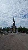 | |||
| Kellross Heritage Museum | 2nd Avenue, Leross, SK | 51°17′14″N 103°51′50″W / 51.2873°N 103.864°W | 7501 | | |||
| Leross Heritage Park | 3rd Avenue, Leross, SK | 51°17′20″N 103°51′54″W / 51.2889°N 103.865°W | 7499 | | |||
| Brinkworth Residence | 1108 Erin Avenue, Lipton, SK | 50°53′59″N 103°51′00″W / 50.8998°N 103.85°W | 7060 | | |||
| R.M. of Lipton No. 217 Office Building and Site | 226 Main Street, Lipton, SK | 50°54′01″N 103°51′04″W / 50.9004°N 103.851°W | 16280 | | |||
| The Old Post Office | 5001 50th Street, Lloydminster, SK | 53°17′02″N 110°00′18″W / 53.2838°N 110.005°W | 3779 |  More images | |||
| Bielby Residence | , Loon Lake, SK | 54°09′01″N 108°55′19″W / 54.1502°N 108.922°W | 1964 | | |||
| Steele Narrows National Historic Site of Canada | Highway 699, Loon Lake, SK | 54°02′21″N 109°19′03″W / 54.0392°N 109.3175°W | 18953 | | |||
| Lucky Lake Museum | , Lucky Lake, SK | 50°59′06″N 107°08′02″W / 50.9851°N 107.134°W | 16250 | | |||
| 165 Elgin Crescent | 165 Elgin Crescent, Lumsden, SK | 50°38′43″N 104°51′43″W / 50.6453°N 104.862°W | 13866 | | |||
| John Nugent Studio | , Lumsden, SK | 50°39′12″N 104°52′12″W / 50.6534°N 104.87°W | 5859 | | |||
| Lumsden & District Heritage Museum Property | 30 Qu'Appelle Drive West, Lumsden, SK | 50°38′39″N 104°52′01″W / 50.6441°N 104.867°W | 16226 | | |||
| Lumsden Plaza | 215 James Street North, Lumsden, SK | 50°38′48″N 104°52′05″W / 50.6467°N 104.868°W | 1527 | | |||
| Luseland Theatre | 403 Grand Avenue, Luseland, SK | 52°04′54″N 109°23′38″W / 52.0817°N 109.394°W | 4779 |  More images | |||
| Macrorie School | , Macrorie, SK | 51°19′38″N 107°05′06″W / 51.3272°N 107.085°W | 3778 | | |||
| CNR Station | 600 2nd Street East, Maidstone, SK | 53°05′06″N 109°17′26″W / 53.0849°N 109.2906°W | 11696 | | |||
| Manor Museum in Manor | Newcombe Street, Manor, SK | 49°36′24″N 102°05′13″W / 49.6066°N 102.087°W | 3108 | | |||
| Cypress Hills Massacre National Historic Site of Canada | , Maple Creek, SK | 49°33′02″N 109°53′20″W / 49.5505°N 109.889°W | 9307 |  More images | |||
| Orr Law Office | 114 Jasper Street, Maple Creek, SK | 49°54′32″N 109°28′43″W / 49.9089°N 109.4786°W | 9045 | | |||
| St. Mary's Anglican Church | 302 Jasper Street, Maple Creek, SK | 49°54′24″N 109°28′44″W / 49.9066°N 109.479°W | 6621 | | |||
| St. Joseph's Roman Catholic Church | 2nd Avenue, Marcelin, SK | 52°55′39″N 106°47′38″W / 52.9274°N 106.794°W | 10416 | | |||
| 120 1st Street East | 120 1st Street East, Meadow Lake, SK | 54°07′55″N 108°25′54″W / 54.1319°N 108.4317°W | 8024 | | |||
| Anderson's Home | 810 Broadway Avenue South, Melfort, SK | 52°51′02″N 104°36′47″W / 52.8505°N 104.613°W | 11923 | | |||
| McKendry House | 412 MacLeod Avenue W, Melfort, SK | 52°51′48″N 104°37′05″W / 52.8634°N 104.618°W | 10711 | | |||
| Court House | 409 Main Street, Melfort, SK | 52°51′46″N 104°36′33″W / 52.8627°N 104.6092°W | 7508 | | |||
| Power House | 401 Melfort Street, Melfort, SK | 52°51′23″N 104°37′18″W / 52.8564°N 104.6216°W | 11924 | | |||
| Sask Tel Building at 103 MacLeod East | 103 McLeod Avenue East, Melfort, SK | 52°51′40″N 104°36′32″W / 52.861°N 104.609°W | 7511 | | |||
| Water Tower | 111 Broadway North, Melfort, SK | 52°51′42″N 104°36′58″W / 52.8618°N 104.6160°W | 3785 | | |||
| All Saints' Anglican Church | 602 Main Street, Melville, SK | 50°55′52″N 102°48′14″W / 50.9312°N 102.804°W | 3184 | | |||
| Canadian National Railways Station | Main Street (at First Ave.W.(Highway 15)), Melville, SK | 50°55′35″N 102°48′26″W / 50.9264°N 102.8073°W | 4561 | | |||
| Cornerstone Place | 101 3rd Avenue W, Melville, SK | 50°55′43″N 102°48′22″W / 50.9287°N 102.806°W | 1413 | | |||
| First Union Church | 148 5th Avenue E, Melville, SK | 50°55′48″N 102°48′10″W / 50.9299°N 102.8029°W | 3185 | | |||
| Intercession of St. Mary Ukrainian Greek Orthodox Church | 398 Prince Edward Street, Melville, SK | 50°55′41″N 102°47′46″W / 50.9281°N 102.796°W | 1577 | | |||
| Luther Academy | 920 9th Avenue W, Melville, SK | 50°56′21″N 102°49′12″W / 50.9392°N 102.82°W | 1410 | | |||
| Melville City Hall | 420 Main Street, Melville, SK | 50°55′47″N 102°48′18″W / 50.9298°N 102.805°W | 3096 | 3183 | | ||
| Melville Railway Museum | Melville Regional Park, Melville, SK | 50°55′48″N 102°48′11″W / 50.9299°N 102.803°W | 3949 | | |||
| St. Paul's Lutheran Church | 238 3rd Avenue E, Melville, SK | 50°39′09″N 102°04′44″W / 50.6524°N 102.079°W | 3186 | | |||
| Ukrainian Greek Catholic Church of St. George | 708 3rd Avenue E, Melville, SK | 50°55′34″N 102°47′35″W / 50.9261°N 102.793°W | 1412 | | |||
| Municipal Office at Meota | 1st Street Street E, Meota, SK | 53°02′28″N 108°27′07″W / 53.041°N 108.452°W | 5756 | | |||
| Commissioners Residence | , Merryflat, SK | 49°33′52″N 109°53′20″W / 49.5645°N 109.889°W | 4322 | | |||
| Fort Walsh National Historic Site of Canada | PO Box 278, Merryflat, SK | 49°33′52″N 109°53′20″W / 49.5645°N 109.889°W | 6666 |  More images | |||
| Milden Community Museum | , Milden, SK | 51°29′16″N 107°31′23″W / 51.4878°N 107.523°W | 7858 | | |||
| Saint Aloysius Roman Catholic Church | 303 Main Street, Milestone, SK | 49°59′42″N 104°30′50″W / 49.995°N 104.514°W | 9228 | | |||
| Doctor Chestnut's Home | 1001 Mark Avenue, Moosomin, SK | 50°08′31″N 101°40′08″W / 50.142°N 101.669°W | 1965 | | |||
| McCurdy (Truman-Heinz) Building | 702 Windover Avenue, Moosomin, SK | 50°08′42″N 101°40′16″W / 50.145°N 101.671°W | 4977 | | |||
| McNaughton Building | 608 Carleton Street, Moosomin, SK | 50°08′41″N 101°39′50″W / 50.1448°N 101.664°W | 1515 | | |||
| Moosomin Communiplex and Bradley Park | Wright Road East, Moosomin, SK | 50°08′14″N 101°40′19″W / 50.1372°N 101.672°W | 1643 | | |||
| The A.A. Hall | 708 Birtle Street, Moosomin, SK | 50°08′42″N 101°40′08″W / 50.145°N 101.669°W | 1571 | | |||
| Old Morse School | 410 McKenzie Street, Morse, SK | 50°25′05″N 107°02′35″W / 50.4181°N 107.043°W | 6459 | | |||
| Fire Hall | 11 - 2nd Avenue West, Mortlach, SK | 50°27′11″N 106°03′59″W / 50.4530°N 106.0664°W | 13864 | | |||
| Ambroz Blacksmith Shop and Residence | 115 Third Street, Mossbank, SK | 49°56′29″N 105°57′50″W / 49.9413°N 105.964°W | 2873 | | |||
| Mossbank & District Museum Inc., the Schoolhouse, the Blacksmith Shop, & Ambroz House | 115 3rd Street W, Mossbank, SK | 49°56′29″N 105°57′50″W / 49.9413°N 105.964°W | 13865 | | |||
| Old Mossbank Fire Hall | 112 Third Street West CN, Mossbank, SK | 49°56′22″N 105°57′50″W / 49.9394°N 105.964°W | 6153 | | |||
| Muenster Hotel | 401 Railway Street, Muenster, SK | 52°11′24″N 104°59′49″W / 52.1899°N 104.997°W | 9248 | | |||
| Pioneer School | 200 Third Avenue, Naicam, SK | 52°25′03″N 104°29′49″W / 52.4174°N 104.497°W | 8676 | | |||
| Bank of Commerce | 201 Main Street, Nokomis, SK | 51°30′30″N 105°00′32″W / 51.5082°N 105.0089°W | 7507 | | |||
| Canadian National Railways Station | 75 Railway Avenue, North Battleford, SK | 52°46′19″N 108°17′55″W / 52.7719°N 108.2985°W | 4582 | | |||
| North Battleford Public Library | 1091 100th Street, North Battleford, SK | 52°46′24″N 108°17′57″W / 52.7732°N 108.2992°W | 1991 | | |||
| Hickson - Maribelli Lakes Pictographs Protected Area | , Northern Saskatchewan Administration District, SK | 56°15′50″N 104°26′35″W / 56.264°N 104.443°W | 16228 | | |||
| B. A. Garage | 123 Main Street, Ogema, SK | 49°34′30″N 104°54′54″W / 49.5751°N 104.915°W | 2678 | | |||
| Fire Hall | 111 Main Street, Ogema, SK | 49°34′28″N 104°54′54″W / 49.5745°N 104.915°W | 1292 | | |||
| Canadian Pacific Railway Station | 100 Railway Ave, Outlook, SK | 51°29′22″N 107°03′15″W / 51.4894°N 107.0541°W | 6398 | | |||
| Greer Block | 233 Main Street, Oxbow, SK | 49°13′45″N 102°10′26″W / 49.2292°N 102.174°W | 1335 | | |||
| Paddockwood Community Hall | First Street North, Paddockwood, SK | 53°30′35″N 105°33′50″W / 53.5098°N 105.564°W | 11322 | | |||
| Parkside Public School and Grounds | , Parkside, SK | 53°09′51″N 106°32′10″W / 53.1641°N 106.536°W | 11698 | | |||
| Saskatchewan Wheat Pool Elevator | Railway Right of Way, Parkside, SK | 53°09′59″N 106°32′12″W / 53.1665°N 106.5366°W | 10418 | | |||
| Fort Livingstone National Historic Site of Canada | , Pelly, SK | 51°54′18″N 101°59′06″W / 51.905°N 101.985°W | 11599 | | |||
| Fort Pelly National Historic Site of Canada | , Pelly, SK | 51°46′36″N 101°59′56″W / 51.7767°N 101.999°W | 11745 | | |||
| Fort Pelly-Livingstone Museum | First Avenue South, Pelly, SK | 51°51′19″N 101°55′41″W / 51.8552°N 101.928°W | 5817 | | |||
| St. Alban's Anglican Church | 302 1st Avenue South, Pelly, SK | 51°51′21″N 101°55′37″W / 51.8559°N 101.927°W | 4834 | | |||
| Synod of the Diocese of Qu'Appelle | 225 Ontario Street, Pense, SK | 50°24′58″N 104°59′02″W / 50.416°N 104.984°W | 5507 | | |||
| Roman Catholic Church in the Village of Plenty | 5th Street, Plenty, SK | 51°46′58″N 108°38′35″W / 51.7828°N 108.643°W | 4132 | | |||
| Notre Dame d’Auvergne Parish Church | 317 2nd Street West, Ponteix, SK | 49°44′49″N 107°29′35″W / 49.747°N 107.493°W | 8399 | | |||
| Notre Dame d’Auvergne Parish Hall | 232 2nd Street West, Ponteix, SK | 49°44′45″N 107°29′35″W / 49.7459°N 107.493°W | 8398 | | |||
| Log Cabin, Rural School & St. David's Church | Windsor Avenue & Elm Street, Porcupine Plain, SK | 52°35′59″N 103°15′40″W / 52.5996°N 103.261°W | 7425 | | |||
| Battle of Cut Knife Hill National Historic Site of Canada | North of Cut Knife, Poundmaker Reserve, SK | 52°50′20″N 108°57′44″W / 52.8390°N 108.9622°W | 18923 | | |||
| St. John the Evangelist Ukrainian Catholic Church | 30 1st Avenue, Prud'homme, SK | 52°20′19″N 105°53′38″W / 52.3386°N 105.894°W | 9243 | | |||
| Sts. Donatien and Rogatien Roman Catholic Church | , Prud'homme, SK | 52°20′23″N 105°53′24″W / 52.3397°N 105.89°W | 9241 | | |||
| Dr. Ernest Luthi Residence | 112 1st Avenue, Punnichy, SK | 51°22′32″N 104°17′49″W / 51.3756°N 104.297°W | 7500 | | |||
| Brite Spot | 28 Qu'Appelle Street, Qu'Appelle, SK | 50°33′00″N 103°52′59″W / 50.55°N 103.883°W | 9260 | | |||
| Knox Presbyterian Church | 106 Walsh Street, Qu'Appelle, SK | 50°32′36″N 103°52′47″W / 50.5433°N 103.8796°W | 4964 | | |||
| Mountjoy Residence | 35 Walsh Street, Qu'Appelle, SK | 50°32′19″N 103°52′44″W / 50.5387°N 103.879°W | 4885 | | |||
| Qu'Appelle Royal Bank Building | Qu'Appelle Street, Qu'Appelle, SK | 50°32′26″N 103°52′41″W / 50.5406°N 103.878°W | 1333 | | |||
| Qu'Appelle Town Hall | 25 9th Avenue, Qu'Appelle, SK | 50°32′30″N 103°52′34″W / 50.5417°N 103.876°W | 13542 | | |||
| St. Peter's Anglican Church | 37 Walsh Street, Qu'Appelle, SK | 50°32′19″N 103°52′44″W / 50.5386°N 103.879°W | 4895 | | |||
| St. Michael's Anglican Church | 28 Main Street, Quill Lake, SK | 52°04′22″N 104°15′22″W / 52.0728°N 104.256°W | 9257 | | |||
| Canadian National Railway Station | Railway Avenue, Rabbit Lake, SK | 53°08′27″N 107°46′03″W / 53.1409°N 107.7674°W | 8020 | | |||
| Rose Gill Hospital | 1st Street W & 2nd Avenue, Rabbit Lake, SK | 53°08′37″N 107°46′05″W / 53.1435°N 107.768°W | 8022 | | |||
| Canadian Imperial Bank of Commerce | 133 Main Street, Radville, SK | 49°27′40″N 104°17′47″W / 49.4612°N 104.2963°W | 4853 | | |||
| Canadian Northern Railway Station | Railway Avenue, Radville, SK | 49°27′42″N 104°17′43″W / 49.4617°N 104.2952°W | 4129 | | |||
| Radville Senior Citizen's Club | 614 Healy Avenue, Radville, SK | 49°27′41″N 104°17′49″W / 49.4615°N 104.297°W | 5580 | | |||
| Ukrainian Greek Orthodox Church of St. Michael's Parish | SK 754, Rama, SK | 51°45′16″N 102°59′56″W / 51.7544°N 102.9989°W | 19575 | | |||
| Raymore Pioneer Museum | 700 Block 1st Avenue, Raymore, SK | 51°20′36″N 104°01′48″W / 51.3433°N 104.03°W | 7426 | | |||
| Future Museum Site | 7, 8, 9 Brewer Bay, Regina Beach, SK | 50°47′12″N 104°58′05″W / 50.7868°N 104.968°W | 3784 | | |||
| Stable, Building 6 | , Reno, SK | 49°33′52″N 109°53′20″W / 49.5645°N 109.889°W | 4323 | | |||
| St. Rapheal's Roman Catholic Church | , Richard, SK | 52°41′41″N 107°42′22″W / 52.6948°N 107.706°W | 16370 | | |||
| Ridgedale United Church | Corner of First St. West and First Ave., Ridgedale, SK | 53°03′22″N 104°09′18″W / 53.0561°N 104.155°W | 4902 | | |||
| Fort Espérance National Historic Site of Canada | , Rocanville, SK | 50°29′36″N 101°35′56″W / 50.4933°N 101.599°W | 11713 | 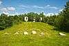 More images | |||
| Rocanville and District Museum Site | 220 Qu'Appelle Avenue, Rocanville, SK | 50°23′09″N 101°42′18″W / 50.3857°N 101.705°W | 6620 | | |||
| Rocanville Farmers Building | 620 Railway Avenue, Rocanville, SK | 50°22′56″N 101°42′00″W / 50.3821°N 101.7°W | 1563 | | |||
| Symons Metalworkers Company Limited | 602 Railway Avenue, Rocanville, SK | 50°22′57″N 101°42′07″W / 50.3825°N 101.702°W | 3590 | | |||
| C.P. Rail Station House | SK-18, at the end of 1st Street North, Rockglen, SK | 49°10′44″N 105°57′01″W / 49.1790°N 105.9504°W | 9124 | | |||
| Lions Community Hall | , Rosthern, SK | 52°39′42″N 106°19′55″W / 52.6617°N 106.332°W | 5020 | | |||
| National Hotel | 802 Railway Avenue, Rosthern, SK | 52°39′41″N 106°19′57″W / 52.6613°N 106.3325°W | 5021 | | |||
| Rosthern Canadian National Railway Station | 701 Railway Avenue, Rosthern, SK | 52°39′44″N 106°19′55″W / 52.6623°N 106.332°W | 5676 | | |||
| Rosthern Mennonite Heritage Museum | 7010 5th Street, Rosthern, SK | 52°39′57″N 106°20′38″W / 52.6658°N 106.344°W | 1576 | | |||
| Rosthern Post Office | 1018 7th Street, Rosthern, SK | 52°39′44″N 106°20′05″W / 52.6621°N 106.3346°W | 11533 | | |||
| Saint Paul's Evangelical Church | 808 1st Avenue, Rosthern, SK | 52°39′43″N 106°20′06″W / 52.662°N 106.335°W | 5019 | | |||
| Seager Wheeler's Maple Grove Farm National Historic Site of Canada | , Rosthern, SK | 52°40′24″N 106°13′05″W / 52.6734°N 106.218°W | 12136 | | |||
| St. Augustine's Anglican Church | 2004 9th Street, Rosthern, SK | 52°39′39″N 106°20′10″W / 52.6607°N 106.336°W | 5018 | | |||
| Town Office and Library | 702 Railway Avenue, Rosthern, SK | 52°39′44″N 106°19′55″W / 52.6623°N 106.332°W | 5017 | | |||
| Grain Elevator 22 | , Scott, SK | 52°21′44″N 108°50′38″W / 52.3623°N 108.844°W | 9823 | | |||
| 1923 portion of Sedley School | 519 Prairie Avenue, Sedley, SK | 50°05′57″N 104°00′25″W / 50.0992°N 104.007°W | 11920 | | |||
| Grand Hotel | 37 & 41 Third Avenue E, Shaunavon, SK | 49°38′55″N 108°24′29″W / 49.6485°N 108.408°W | 1387 | | |||
| Shaunavon Courthouse at 401 Third Street West | 401 3rd Street West, Shaunavon, SK | 49°38′48″N 108°24′47″W / 49.6466°N 108.413°W | 7505 | | |||
| Shaunavon Hotel | 189 Centre Street, Shaunavon, SK | 49°38′41″N 108°24′25″W / 49.6447°N 108.407°W | 1589 | | |||
| Canadian National Railway Station | Carl Erickson Avenue, Shell Lake, SK | 53°18′18″N 107°03′55″W / 53.3051°N 107.0652°W | 8021 | | |||
| Hazel Ridge School | , Shellbrook, SK | 53°09′42″N 106°21′43″W / 53.1617°N 106.362°W | 6891 | | |||
| Shellbrook C.N. Railway Station | CNR Right of Way, Main Street South, Shellbrook, SK | 53°23′41″N 105°32′35″W / 53.3947°N 105.543°W | 11535 | | |||
| Rural Municipality Office | , Simpson, SK | 51°26′56″N 105°26′38″W / 51.4488°N 105.444°W | 4867 | | |||
| Southey's First Original Classroom School | , Southey, SK | 50°56′24″N 104°29′31″W / 50.9399°N 104.492°W | 1988 | | |||
| Reynold Rapp Residence | First Street South, Spalding, SK | 52°19′47″N 104°29′46″W / 52.3296°N 104.496°W | 8675 | | |||
| Spalding United Church | 404 4th Avenue, Spalding, SK | 52°19′50″N 104°30′04″W / 52.3305°N 104.501°W | 8404 | | |||
| St. Brieux Museum | 300 Barbier Drive, St. Brieux, SK | 52°38′18″N 104°53′24″W / 52.6383°N 104.89°W | 10149 | | |||
| Assumption of the Blessed Virgin Mary Church | Main Street and Second Avenue, St. Walburg, SK | 53°37′51″N 109°12′07″W / 53.6309°N 109.202°W | 9218 | | |||
| C.N. Station at Railway Avenue | Railway Avenue at 1st Street East, St. Walburg, SK | 53°38′11″N 109°12′08″W / 53.6364°N 109.2022°W | 9256 | | |||
| Holy Trinity Anglican Church, Stanley Mission | , Stanley Mission, SK | 55°25′04″N 104°33′04″W / 55.4179°N 104.551°W | 2917 | 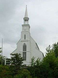 | |||
| Holy Trinity Church National Historic Site of Canada | , Stanley Mission, SK | 55°25′04″N 104°33′00″W / 55.4179°N 104.55°W | 12545 | More images | |||
| Golden Age Club Buildings | 126 4th Street, Star City, SK | 52°51′51″N 104°19′55″W / 52.8642°N 104.332°W | 4891 | | |||
| Town Office | 100 4th Street, Star City, SK | 52°51′53″N 104°19′58″W / 52.8647°N 104.3328°W | 1660 | | |||
| Stenen United Church | 1st Avenue, Stenen, SK | 51°53′56″N 102°22′37″W / 51.8988°N 102.377°W | 4791 | | |||
| 315 Main Street | 315 Main Street, Stoughton, SK | 49°40′48″N 103°01′34″W / 49.6799°N 103.026°W | 1310 | | |||
| Old Municipal Office | , Strasbourg, SK | 51°00′22″N 104°56′28″W / 51.006°N 104.941°W | 6150 | | |||
| Old School (Teacherage) | 501 Railway Avenue, Strasbourg, SK | 51°04′14″N 104°57′04″W / 51.0705°N 104.951°W | 16279 | | |||
| Strasbourg and District Museum | 501 Railway Avenue, Strasbourg, SK | 51°04′24″N 104°57′10″W / 51.0732°N 104.9529°W | 6151 | | |||
| Strongfield Cenotaph | Corner of Broadway Street and Saskatchewan Avenue, Strongfield, SK | 51°19′55″N 106°35′49″W / 51.3319°N 106.597°W | 16258 | | |||
| Sturgis Station House Museum | Corner of Broadway Street and Saskatchewan Avenue, Sturgis, SK | 51°56′04″N 102°32′13″W / 51.9345°N 102.5369°W | 4078 | | |||
| Battleford Trail Wheel Rut Area | , Swift Current, SK | 50°17′45″N 107°48′25″W / 50.2957°N 107.807°W | 4979 | | |||
| C.P.R Dam | , Swift Current, SK | 50°16′44″N 107°47′17″W / 50.2788°N 107.788°W | 5558 | | |||
| Canadian Pacific Railway Station | Railway Station Street East, Swift Current, SK | 50°16′55″N 107°47′59″W / 50.2819°N 107.7996°W | 4525 | | |||
| Central School | 121 Dufferin Street W, Swift Current, SK | 50°17′28″N 107°48′07″W / 50.2911°N 107.802°W | 1551 | | |||
| Court House | 121 Lorne Street W, Swift Current, SK | 50°17′23″N 107°48′07″W / 50.2898°N 107.802°W | 5801 | | |||
| First United Church | 233 3rd Avenue NE, Swift Current, SK | 50°17′08″N 107°47′46″W / 50.2855°N 107.796°W | 1659 | | |||
| Former Lyric Theatre | 227 Central Avenue North, Swift Current, SK | 49°44′45″N 107°29′35″W / 49.7458°N 107.493°W | 8367 | | |||
| Gray Burial Site National Historic Site of Canada | On a farm northwest of Swift Current, Swift Current, SK | 50°20′32″N 107°52′45″W / 50.3421°N 107.8792°W | 19641 | | |||
| Main Building No. 75 | 1 Airport Road, Swift Current, SK | 50°16′51″N 107°45′42″W / 50.2808°N 107.7618°W | 19641 | | |||
| Powley House | 233 Lorne Street E, Swift Current, SK | 50°17′31″N 107°47′49″W / 50.292°N 107.797°W | 1550 | | |||
| Swift Current Mennonite Heritage Village | Agricultural and Exhibition Association Grounds, Swift Current, SK | 50°16′44″N 107°46′37″W / 50.2789°N 107.777°W | 5576 | | |||
| Canadian Pacific Railway Station | 6 Christopher Street N, Theodore, SK | 51°25′30″N 102°55′21″W / 51.4251°N 102.9225°W | 2663 | | |||
| Elim Evangelical Lutheran Church | 121 Henry Street, Theodore, SK | 51°25′30″N 102°55′08″W / 51.4251°N 102.919°W | 4777 | | |||
| Tugaske School | , Tugaske, SK | 50°52′16″N 106°17′28″W / 50.8712°N 106.291°W | 11915 | | |||
| Old CIBC Building | 219 Main Street, Turtleford, SK | 53°23′20″N 108°57′50″W / 53.3890°N 108.9638°W | 1531 | | |||
| Unity Heritage Museum | 900 First Street East, Unity, SK | 52°26′58″N 109°08′49″W / 52.4494°N 109.147°W | 7848 | | |||
| The old Val Marie Elevator | , Val Marie, SK | 49°14′37″N 107°43′41″W / 49.2435°N 107.728°W | 4150 |  More images | |||
| The Red Brick School | 100 Centre Street, Val Marie, SK | 49°14′43″N 107°43′55″W / 49.2452°N 107.732°W | 4149 | | |||
| Doukhobors at Veregin National Historic Site of Canada | , Veregin, SK | 51°35′00″N 102°04′59″W / 51.5833°N 102.083°W | 12783 | | |||
| Veregin Doukhobor Prayer Home | , Veregin, SK | 51°34′56″N 102°05′02″W / 51.5821°N 102.084°W | 3102 | 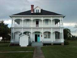 More images | |||
| Vibank Convent | 101 2nd Avenue, Vibank, SK | 50°20′05″N 103°56′49″W / 50.3346°N 103.947°W | 1780 | | |||
| Old Bank of Commerce | Main Street & Buffer Avenue, Vonda, SK | 52°19′20″N 106°05′43″W / 52.3221°N 106.0952°W | 9246 | | |||
| Vonda Rink | 403 Buffer Avenue, Vonda, SK | 52°19′21″N 106°05′35″W / 52.3225°N 106.093°W | 9237 | | |||
| Wadena Glass & Mye Signs | 93 Main Street N, Wadena, SK | 51°56′44″N 103°48′07″W / 51.9455°N 103.802°W | 10749 | | |||
| Wadena Town Office | 102 Main Street, Wadena, SK | 51°56′45″N 103°48′04″W / 51.9459°N 103.801°W | 10754 | | |||
| Wakaw Elementary School | 316 Main Street, Wakaw, SK | 52°38′58″N 105°44′38″W / 52.6495°N 105.744°W | 10150 | | |||
| Former Canadian Northern Railway Station | 4002 Central Avenue, Waldheim, SK | 52°37′15″N 106°39′21″W / 52.6208°N 106.6559°W | 10791 | | |||
| Cenotaph Site | Main Street, Waldron, SK | 50°51′07″N 102°30′50″W / 50.8519°N 102.514°W | 7850 | | |||
| Christ Anglican Church | 319 4th Avenue N, Wapella, SK | 50°15′48″N 101°58′09″W / 50.2633°N 101.9692°W | 2131 | | |||
| Commercial Hotel | 329 South Railway Street, Wapella, SK | 50°15′40″N 101°58′13″W / 50.2611°N 101.9704°W | 16251 | | |||
| Old Town Hall | 529 South Railway Street, Wapella, SK | 50°15′43″N 101°58′25″W / 50.2620°N 101.9735°W | 16256 | | |||
| Warman Senior Drop-In Centre | 422 Peters Street, Warman, SK | 52°19′11″N 106°34′59″W / 52.3198°N 106.583°W | 10748 | | |||
| Christ Anglican Church | 119 First Street E., Waseca, SK | 53°05′59″N 109°28′14″W / 53.0998°N 109.4705°W | 16214 | | |||
| Anahareo's Cabin, Building 35 | Ajawaan Lake, Waskesiu, SK | 53°54′51″N 106°04′26″W / 53.9143°N 106.074°W | 4497 | | |||
| Assembly Hall | Lakeview Drive (I-7, B-1), Waskesiu, SK | 53°55′13″N 106°05′28″W / 53.9202°N 106.091°W | 4472 |  | |||
| Community Hall | , Waskesiu, SK | 55°05′04″N 105°21′07″W / 55.0844°N 105.352°W | 4269 | | |||
| Golf Clubhouse Building 15 | Prospect Point, Waskesiu, SK | 53°54′51″N 106°04′26″W / 53.9143°N 106.074°W | 4474 | 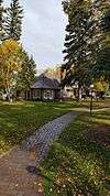 | |||
| Grey Owl's Cabin | Twp. 59, Range 4, Waskesiu, SK | 53°54′51″N 106°04′26″W / 53.9143°N 106.074°W | 4496 | | |||
| Nature Centre | Lakeview Drive, Waskesiu, SK | 53°54′51″N 106°04′26″W / 53.9143°N 106.074°W | 4473 | 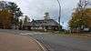 | |||
| Superintendent's Garage, Building 22 | Prospect Drive, Waskesiu, SK | 53°54′51″N 106°04′26″W / 53.9143°N 106.074°W | 4291 | | |||
| Superintendent's Residence, Building 22 | Prospect Drive, Waskesiu, SK | 53°54′51″N 106°04′26″W / 53.9143°N 106.074°W | 4287 | | |||
| W. L. Mackenzie King Cottage, Building 23 | Prospect Drive, Waskesiu, SK | 53°54′51″N 106°04′26″W / 53.9143°N 106.074°W | 4293 | | |||
| Warden's Headquarters / Visitor Information, Building 1 | Waskesiu Drive, Waskesiu, SK | 53°54′51″N 106°04′26″W / 53.9143°N 106.074°W | 4495 | | |||
| South Gate Registration, Building 3 | Highway 263 and 240, Waskesiu Lake, SK | 53°54′51″N 106°04′26″W / 53.9143°N 106.074°W | 4285 | | |||
| All Saints Anglican Church | 310 Main Street, Watrous, SK | 51°40′27″N 105°28′01″W / 51.6741°N 105.4670°W | 16223 | | |||
| Canadian Bank of Commerce National Historic Site of Canada | 201 Main Street, Watson, SK | 52°07′46″N 104°31′25″W / 52.1294°N 104.5237°W | 7564 | 7506 | | ||
| Royal Bank of Canada Building | 104 Main Street, Wawota, SK | 49°54′18″N 102°01′30″W / 49.9049°N 102.025°W | 3396 | | |||
| Wawota's Original Firehall | Main Street, Wawota, SK | 49°54′17″N 102°01′30″W / 49.9048°N 102.025°W | 3397 | | |||
| Weekes Public School at Weekes | , Weekes, SK | 52°34′12″N 102°52′19″W / 52.5699°N 102.872°W | 6616 | | |||
| Harper's Store | , Welwyn, SK | 50°19′33″N 101°30′58″W / 50.3259°N 101.516°W | 1562 | | |||
| Memorial Hall | 304 Main Street, Welwyn, SK | 50°19′28″N 101°31′03″W / 50.3245°N 101.5174°W | 16254 | | |||
| Trinity United Church | McDonald Street and Welwyn Avenue, Welwyn, SK | 50°19′30″N 101°31′08″W / 50.3251°N 101.5190°W | 4776 | | |||
| Knox Presbyterian Church | 136 2nd Street, Weyburn, SK | 49°39′48″N 103°51′17″W / 49.6633°N 103.8547°W | 9201 | | |||
| Moffet Residence | 614 4th Street SE, Weyburn, SK | 49°39′20″N 103°51′04″W / 49.6556°N 103.851°W | 2702 | | |||
| Old City Hall | 106 3rd Street, Weyburn, SK | 49°39′48″N 103°51′12″W / 49.6632°N 103.8533°W | 19247 | | |||
| Powell Residence | 815 4th Street SE, Weyburn, SK | 49°39′04″N 103°51′07″W / 49.6512°N 103.852°W | 1591 | | |||
| Signal Hill Arts Centre | 424 10th Avenue S, Weyburn, SK | 49°38′58″N 103°51′04″W / 49.6494°N 103.851°W | 16257 | | |||
| Soo Line Historical Museum | #39 Highway SE, Weyburn, SK | 49°39′31″N 103°51′04″W / 49.6586°N 103.851°W | 1592 | | |||
| T.C. Douglas Calvary Centre | 10th Avenue S, Weyburn, SK | 49°39′01″N 103°51′40″W / 49.6502°N 103.861°W | 2370 | | |||
| Weyburn Court House | 301 Prairie Avenue NE, Weyburn, SK | 49°39′59″N 103°51′07″W / 49.6664°N 103.852°W | 3101 | | |||
| Weyburn Security Bank | 76 - 3rd Street, Weyburn, SK | 49°39′42″N 103°51′14″W / 49.6616°N 103.854°W | 4070 | | |||
| Knox Presbyterian Church | 611 Railway Street North, Whitewood, SK | 50°19′57″N 102°16′01″W / 50.3325°N 102.267°W | 2666 | | |||
| Masonic Hall | 503 Third Avenue, Whitewood, SK | 50°19′50″N 102°16′07″W / 50.3305°N 102.2685°W | 2128 | | |||
| Old Bank of Montreal | 707 Lalonde Street, Whitewood, SK | 50°19′48″N 102°16′01″W / 50.3299°N 102.267°W | 9306 | | |||
| R.M. of Willowdale No. 153 Municipal Office | 711 Lalonde Street, Whitewood, SK | 50°19′47″N 102°16′01″W / 50.3298°N 102.267°W | 2500 | 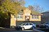 More images | |||
| Rex Theatre | 714 Lalonde Street, Whitewood, SK | 50°19′47″N 102°16′01″W / 50.3298°N 102.267°W | 9230 | | |||
| Ramsey Building | 208 1st Street E, Wilkie, SK | 52°24′39″N 108°33′04″W / 52.4109°N 108.551°W | 11691 | | |||
| Wilkie and District Museum | 212 1st Street E, Wilkie, SK | 52°24′35″N 108°42′05″W / 52.4097°N 108.7015°W | 19576 | | |||
| Catholic Rectory | 5 Ave C, Willow Bunch, SK | 49°23′25″N 105°38′10″W / 49.3904°N 105.636°W | 3781 | | |||
| The Convent | , Willow Bunch, SK | 49°23′23″N 105°38′06″W / 49.3896°N 105.635°W | 3782 | | |||
| Windthorst School (1926 portion) | 326 Moltke Avenue, Windthorst, SK | 50°06′38″N 102°50′02″W / 50.1105°N 102.834°W | 1802 | | |||
| Banbury Residence | 104 Front Street, Wolseley, SK | 50°25′33″N 103°16′48″W / 50.4258°N 103.28°W | 1570 | | |||
| Magee House | 104 Richmond Street, Wolseley, SK | 50°25′26″N 103°16′16″W / 50.424°N 103.271°W | 1569 | | |||
| Town Hall/Opera House | 510 Varennes Street, Wolseley, SK | 50°25′27″N 103°16′16″W / 50.4241°N 103.271°W | 2789 | 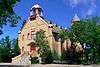 | |||
| Wolseley Court House | SE corner of Ouimet and Richmond Street, Wolseley, SK | 50°25′35″N 103°16′12″W / 50.4264°N 103.27°W | 2778 | | |||
| Wolseley Town Hall/Opera House | 510 Varennes Street, Wolseley, SK | 50°25′27″N 103°16′16″W / 50.4241°N 103.271°W | 2378 | More images | |||
| Wood Mountain School | 200 3rd Avenue, Wood Mountain, SK | 49°22′12″N 106°23′06″W / 49.37°N 106.385°W | 8401 | | |||
| Canadian Pacific Railway Station | A Avenue at Bosworth St., Wynyard, SK | 51°46′19″N 104°11′10″W / 51.7719°N 104.1861°W | 4526 | | |||
| Wynyard Court House | 410 Avenue C E, Wynyard, SK | 51°46′12″N 104°10′44″W / 51.7701°N 104.179°W | 6394 | | |||
| Wynyard Federated Church | 330 Bosworth Street, Wynyard, SK | 51°46′06″N 104°11′06″W / 51.7683°N 104.185°W | 8943 | | |||
| Stone School | 215 Souris Street, Yellow Grass, SK | 49°48′20″N 104°09′40″W / 49.8056°N 104.161°W | 4975 | | |||
| 29 Myrtle Avenue | 29 Myrtle Avenue, Yorkton, SK | 51°13′00″N 102°28′01″W / 51.2167°N 102.467°W | 6077 | 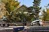 More images | |||
| 81 Second Avenue North | 81 2nd Avenue North, Yorkton, SK | 51°12′59″N 102°27′40″W / 51.2165°N 102.461°W | 6081 | 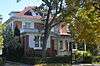 More images | |||
| Army Navy and Air Force Veterans Building | 43-45 Broadway Street East, Yorkton, SK | 51°12′38″N 102°27′36″W / 51.2106°N 102.46°W | 16283 | 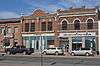 | |||
| Dulmage Homestead | , Yorkton, SK | 51°12′44″N 102°29′49″W / 51.2122°N 102.497°W | 6390 | | |||
| Hudson's Bay Company Store | 19 Broadway Street East, Yorkton, SK | 51°12′38″N 102°27′43″W / 51.2105°N 102.462°W | 2704 |  More images | |||
| Old Land Titles Building | 49 Smith Street East, Yorkton, SK | 51°12′44″N 102°27′33″W / 51.2121°N 102.4593°W | 6155 | | |||
| St. Paul's Lutheran Church | 73 Smith Street E, Yorkton, SK | 51°12′47″N 102°27′32″W / 51.2131°N 102.459°W | 6452 | | |||
| Yorkton Armoury | 56 1st Avenue, Yorkton, SK | 51°12′45″N 102°27′50″W / 51.2126°N 102.464°W | 9585 | 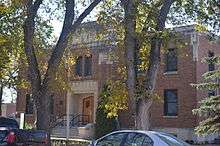 More images | |||
| Yorkton Court House | 29 Darlington Street East, Yorkton, SK | 51°12′47″N 102°27′32″W / 51.2131°N 102.459°W | 2872 | 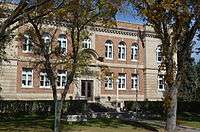 More images | |||
| Yorkton Organic Milling Ltd. | 120 Livingstone Street, Yorkton, SK | 51°12′25″N 102°27′25″W / 51.207°N 102.457°W | 6078 |  More images | |||
| Zelma United Church | 2nd Avenue E, Zelma, SK | 51°50′32″N 105°54′25″W / 51.8422°N 105.907°W | 4869 | | |||
| Paroisse Notre Dame de la Nativitie | Park Road, Zenon Park, SK | 53°04′01″N 103°45′29″W / 53.0669°N 103.758°W | 4871 | |
See also
| Wikimedia Commons has media related to Cultural heritage monuments in Saskatchewan. |
This article is issued from
Wikipedia.
The text is licensed under Creative Commons - Attribution - Sharealike.
Additional terms may apply for the media files.