Rhode Island
Rhode Island (/ˌroʊd -/ (![]()
Rhode Island | |
|---|---|
| State of Rhode Island and Providence Plantations | |
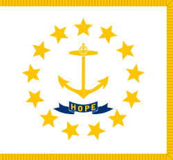 Flag 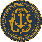 Seal | |
| Nickname(s): The Ocean State Little Rhody[1] | |
| Motto(s): Hope | |
| Anthem: Rhode Island's It for Me | |
.svg.png) Map of the United States with Rhode Island highlighted | |
| Country | United States |
| Before statehood | Colony of Rhode Island and Providence Plantations |
| Admitted to the Union | May 29, 1790 (13th) |
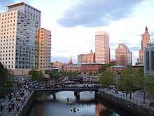
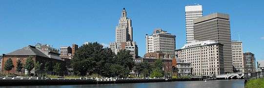
| Capital (and largest city) | Providence |
| Largest metro | Greater Providence |
| Government | |
| • Governor | Gina Raimondo (D) |
| • Lieutenant Governor | Daniel McKee (D) |
| Legislature | Rhode Island General Assembly |
| • Upper house | Senate |
| • Lower house | House of Representatives |
| U.S. senators | Jack Reed (D) Sheldon Whitehouse (D) |
| U.S. House delegation | 1: David Cicilline (D) 2: James Langevin (D) (list) |
| Area | |
| • Total | 1,214[2] sq mi (3,144 km2) |
| • Land | 1,045 sq mi (2,707 km2) |
| • Water | 169 sq mi (438 km2) 13.9% |
| Area rank | 50th |
| Dimensions | |
| • Length | 48 mi (77 km) |
| • Width | 37 mi (60 km) |
| Elevation | 200 ft (60 m) |
| Highest elevation | 812 ft (247 m) |
| Lowest elevation (Atlantic Ocean[3]) | 0 ft (0 m) |
| Population (2019) | |
| • Total | 1,059,361 |
| • Rank | 44th |
| • Density | 1,006/sq mi (388/km2) |
| • Density rank | 2nd |
| • Median household income | $63,870[5] |
| • Income rank | 16th |
| Demonym(s) | Rhode Islander |
| Language | |
| • Official language | De jure: None De facto: English |
| Time zone | UTC-05:00 (Eastern) |
| • Summer (DST) | UTC-04:00 (EDT) |
| USPS abbreviation | RI |
| ISO 3166 code | US-RI |
| Trad. abbreviation | R.I. |
| Latitude | 41° 09′ N to 42° 01′ N |
| Longitude | 71° 07′ W to 71° 53′ W |
| Website | www |
| |
| Rhode Island state symbols | |
|---|---|
The Flag of Rhode Island | |
The Seal of Rhode Island | |
| Living insignia | |
| Bird | Rhode Island Red chicken Gallus gallus domesticus |
| Fish | Striped bass |
| Flower | Violet Viola sororia |
| Insect | American burying beetle Nicroforus americanus |
| Mammal | Morgan horse |
| Reptile | Painted turtle |
| Tree | Red Maple Acer rubrum |
| Inanimate insignia | |
| Beverage | Coffee milk |
| Mineral | Bowenite |
| Rock | Cumberlandite |
| Ship | USS Providence |
| Tartan | Rhode Island State Tartan |
| Other | Fruit: Rhode Island Greening |
| State route marker | |
 | |
| State quarter | |
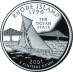 Released in 2001 | |
| Lists of United States state symbols | |
On May 4, 1776, the Colony of Rhode Island was the first of the Thirteen Colonies to renounce its allegiance to the British Crown,[10] and it was the fourth state to ratify the Articles of Confederation, doing so on February 9, 1778.[11] The state boycotted the 1787 convention which drew up the United States Constitution[12] and initially refused to ratify it;[13] it was the last of the original 13 states to do so on May 29, 1790.[14][15]
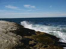
Rhode Island's official nickname is "The Ocean State", a reference to the large bays and inlets that amount to about 14 percent of its total area.[2]
Origin of the name
Despite its name, most of Rhode Island is located on the mainland of the United States. Its official name is State of Rhode Island and Providence Plantations, which is derived from the merger of four Colonial settlements. The settlements of Newport and Portsmouth were situated on what is commonly called Aquidneck Island today but was called Rhode Island in Colonial times.[16][17] Providence Plantation was the name of the colony founded by Roger Williams in the state's capital of Providence.[18] This was adjoined by the settlement of Warwick; hence the plural Providence Plantations.
It is unclear how the island came to be named Rhode Island, but two historical events may have been of influence:

- Explorer Giovanni da Verrazzano noted the presence of an island near the mouth of Narragansett Bay in 1524 which he likened to the island of Rhodes off the coast of Greece.[19] Subsequent European explorers were unable to precisely identify the island that Verrazzano described, but the colonists who settled the area assumed that it was this island.[20]
- Adriaen Block passed by the island during his expeditions in the 1610s, and he described it in a 1625 account of his travels as "an island of reddish appearance," which was "een rodlich Eylande" in 17th-century Dutch, and one popular notion is that this Dutch phrase might have influenced the name Rhode Island.[21][22] (Historians have theorized that this "reddish appearance" resulted from either red autumn foliage or red clay on portions of the shore.)[23]
The earliest documented use of the name "Rhode Island" for Aquidneck was in 1637 by Roger Williams. The name was officially applied to the island in 1644 with these words: "Aquethneck shall be henceforth called the Isle of Rodes or Rhode-Island." The name "Isle of Rodes" is used in a legal document as late as 1646.[24][25] Dutch maps as early as 1659 call the island "Red Island" (Roodt Eylant).
Attempt to change the name
Roger Williams was a theologian who was forced out of the Massachusetts Bay Colony, seeking religious and political tolerance. He and others founded Providence Plantation as a free proprietary colony. "Providence" referred to the concept of divine providence, and "plantation" was an English term for a colony. However, in recent years, the word plantation in the state's name became a contested issue, and the Rhode Island General Assembly voted on June 25, 2009 to hold a general referendum determining whether "and Providence Plantations" would be dropped from the official name.
Advocates for excising plantation claimed that the word symbolized an alleged legacy of disenfranchisement for many Rhode Islanders, as well as the proliferation of slavery in the colonies and in the post-colonial United States. Advocates for retaining the name argued that plantation was simply an archaic synonym for colony and bore no relation to slavery. The referendum election was held on November 2, 2010, and the people voted overwhelmingly (78% to 22%) to retain the entire original name.[26]
History
Colonial era: 1636–1770
In 1636, Roger Williams was banished from the Massachusetts Bay Colony for his religious views, and he settled at the top of Narragansett Bay on land sold or given to him by Narragansett sachem Canonicus. He named the site Providence Plantations, "having a sense of God's merciful providence unto me in my distress",[27] and it became a place of religious freedom where all were welcome.
In 1638 (after conferring with Williams), Anne Hutchinson, William Coddington, John Clarke, Philip Sherman, and other religious dissenters settled on Aquidneck Island (then known as Rhode Island), which was purchased from the local tribes who called it Pocasset. This settlement was called Portsmouth and was governed by the Portsmouth Compact. The southern part of the island became the separate settlement of Newport after disagreements among the founders.
Samuel Gorton purchased lands at Shawomet in 1642 from the Narragansetts, precipitating a dispute with the Massachusetts Bay Colony. In 1644, Providence, Portsmouth, and Newport united for their common independence as the Colony of Rhode Island and Providence Plantations, governed by an elected council and "president". Gorton received a separate charter for his settlement in 1648 which he named Warwick after his patron.[28]
Brown University was founded in 1764 as the College in the English Colony of Rhode Island and Providence Plantations. It was one of nine Colonial colleges granted charters before the American Revolution, but was the first college in America to accept students regardless of religious affiliation.[29]

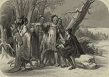
Metacomet was the Wampanoag tribe's war leader, whom the colonists called King Philip. They invaded and burned down several of the towns in the area during King Philip's War (1675–1676), including Providence which was attacked twice.[27] A force of Massachusetts, Connecticut, and Plymouth militia under General Josiah Winslow invaded and destroyed the fortified Narragansett Indian village in the Great Swamp in South Kingstown, Rhode Island on December 19, 1675.[30] In one of the final actions of the war, an Indian associated with Benjamin Church killed King Philip in Bristol, Rhode Island.[31]
The colony was amalgamated into the Dominion of New England in 1686, as King James II attempted to enforce royal authority over the autonomous colonies in British North America, but the colony regained its independence under the Royal Charter after the Glorious Revolution of 1688. Slaves were introduced in Rhode Island at this time, although there is no record of any law legalizing slave-holding. The colony later prospered under the slave trade, distilling rum to sell in Africa as part of a profitable triangular trade in slaves and sugar with the Caribbean.[32]
Revolutionary to Civil War period: 1770–1860
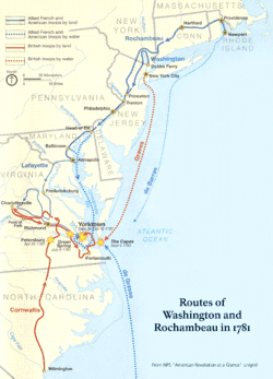
Rhode Island's tradition of independence and dissent gave it a prominent role in the American Revolution. At approximately 2 a.m. on June 10, 1772, a band of Providence residents attacked the grounded revenue schooner Gaspee, burning it to the waterline for enforcing unpopular trade regulations within Narragansett Bay.[33] Rhode Island was the first of the thirteen colonies to renounce its allegiance to the British Crown on May 4, 1776.[34] It was also the last of the thirteen colonies to ratify the United States Constitution on May 29, 1790, and only under threat of heavy trade tariffs from the other former colonies and after assurances were made that a Bill of Rights would become part of the Constitution.[35] During the Revolution, the British occupied Newport in December 1776. A combined Franco-American force fought to drive them off Aquidneck Island. Portsmouth was the site of the first African-American military unit, the 1st Rhode Island Regiment, to fight for the U.S. in the unsuccessful Battle of Rhode Island of August 29, 1778.[36] A month earlier, the appearance of a French fleet off Newport caused the British to scuttle some of their own ships in an attempt to block the harbor. The British abandoned Newport in October 1779, concentrating their forces in New York City. An expedition of 5,500 French troops under Count Rochambeau arrived in Newport by sea on July 10, 1780.[37] The celebrated march to Yorktown, Virginia in 1781 ended with the defeat of the British at the Siege of Yorktown and the Battle of the Chesapeake.
Rhode Island was heavily involved in the slave trade during the post-revolution era.[38] In 1774, the slave population of Rhode Island was 6.3% of the total,[39] nearly twice as high as any other New England colony.
Rhode Island was also heavily involved in the Industrial Revolution, which began in America in 1787 when Thomas Somers reproduced textile machine plans which he imported from England. He helped to produce the Beverly Cotton Manufactory, in which Moses Brown of Providence took an interest. Moses Brown teamed up with Samuel Slater and helped to create the second cotton mill in America, a water-powered textile mill. The Industrial Revolution moved large numbers of workers into the cities, creating a permanently landless class who were therefore, by the law of the time, also voteless. By 1829, 60% of the state's free white males were ineligible to vote. Several attempts were unsuccessfully made to address this problem, and a new state constitution was passed in 1843 allowing landless men to vote if they could pay a $1 poll tax.
For the first several decades of statehood, Rhode Island was governed in accordance with the 1663 colonial charter. Voting rights were restricted to landowners holding at least $134 in property, disenfranchising well over half of the state's male citizens. The charter apportioned legislative seats equally among the state's towns, over-representing rural areas and under-representing the growing industrial centers. Additionally, the charter disallowed landless citizens from filing civil suits without endorsement from a landowner.[40] Bills were periodically introduced in the legislature to expand suffrage, but they were invariably defeated. In 1841, activists led by Thomas W. Dorr organized an extralegal convention to draft a state constitution,[41] arguing that the charter government violated the Guarantee Clause in Article Four, Section Four of the United States Constitution. In 1842, the charter government and Dorr's supporters held separate elections, and two rival governments claimed sovereignty over the state. Dorr's supporters led an armed rebellion against the charter government, and Dorr was arrested and imprisoned for treason against the state.[42] Later that year, the legislature drafted a state constitution, removing property requirements for American-born citizens but keeping them in place for immigrants, and retaining urban under-representation in the legislature.[43]
In the early 19th century, Rhode Island was subject to a tuberculosis outbreak which led to public hysteria about vampirism.
Civil War
During the American Civil War, Rhode Island was the first Union state to send troops in response to President Lincoln's request for help from the states. Rhode Island furnished 25,236 fighting men, of whom 1,685 died. On the home front, Rhode Island and the other northern states used their industrial capacity to supply the Union Army with the materials that it needed to win the war. The United States Naval Academy moved to Rhode Island temporarily during the war.
In 1866, Rhode Island abolished racial segregation in the public schools throughout the state.[44]
Gilded Age
The 50 years following the Civil War were a time of prosperity and affluence that author William G. McLoughlin calls "Rhode Island's halcyon era." Rhode Island was a center of the Gilded Age and provided a home or summer home to many of the country's most prominent industrialists. This was a time of growth in textile mills and manufacturing and brought an influx of immigrants to fill those jobs, bringing population growth and urbanization. In Newport, New York's wealthiest industrialists created a summer haven to socialize and build grand mansions. Thousands of French-Canadian, Italian, Irish, and Portuguese immigrants arrived to fill jobs in the textile and manufacturing mills in Providence, Pawtucket, Central Falls, and Woonsocket.[45]
World War I
During World War I, Rhode Island furnished 28,817 soldiers, of whom 612 died. After the war, the state was hit hard by the Spanish Influenza.[46]
In the 1920s and 1930s, rural Rhode Island saw a surge in Ku Klux Klan membership, largely in reaction to large waves of immigrants moving to the state. The Klan is believed to be responsible for burning the Watchman Industrial School in Scituate, which was a school for African-American children.[47]
Growth in the modern era: 1929–present
Since the Great Depression, the Rhode Island Democratic Party has dominated local politics. Rhode Island has comprehensive health insurance for low-income children and a large social safety net. Many urban areas still have a high rate of children in poverty. Due to an influx of residents from Boston, increasing housing costs have resulted in more homelessness in Rhode Island.[48]
The 350th Anniversary of the founding of Rhode Island was celebrated with a free concert held on the tarmac of the Quonset State Airport on August 31, 1986. Performers included Chuck Berry, Tommy James, and headliner Bob Hope.
In 2003, a nightclub fire in West Warwick claimed 100 lives and resulted in nearly twice as many injured, catching national attention. The fire resulted in criminal sentences.[49]
In March 2010, areas of the state received record flooding due to rising rivers from heavy rain. The first period of rainy weather in mid-March caused localized flooding and, two weeks later, more rain caused more widespread flooding in many towns, especially south of Providence. Rain totals on March 29–30, 2010 exceeded 14 inches (35.5 cm) in many locales, resulting in the inundation of area rivers—especially the Pawtuxet River which runs through central Rhode Island. The overflow of the Pawtuxet River, nearly 11 feet (3 m) above flood stage, submerged a sewage treatment plant and closed a five-mile (8 km) stretch of Interstate 95. In addition, it flooded two shopping malls, numerous businesses, and many homes in the towns of Warwick, West Warwick, Cranston, and Westerly. Amtrak service was also suspended between New York and Boston during this period. Following the flood, Rhode Island was in a state of emergency for two days. The Federal Emergency Management Agency (FEMA) was called in to help flood victims.
Geography and climate
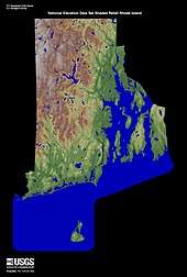
Rhode Island covers an area of 1,214 square miles (3,144 km2) located within the New England region and is bordered on the north and east by Massachusetts, on the west by Connecticut, and on the south by Rhode Island Sound and the Atlantic Ocean.[2] It shares a narrow maritime border with New York State between Block Island and Long Island. The mean elevation of the state is 200 feet (61 m). It is only 37 miles (60 km) wide and 48 miles (77 km) long, yet the state has a tidal shoreline on Narragansett Bay and the Atlantic Ocean of 384 miles (618 km).[50]
Rhode Island is nicknamed the Ocean State and has a number of oceanfront beaches. It is mostly flat with no real mountains, and the state's highest natural point is Jerimoth Hill, 812 feet (247 m) above sea level.[51] The state has two distinct natural regions. Eastern Rhode Island contains the lowlands of the Narragansett Bay, while Western Rhode Island forms part of the New England upland. Rhode Island's forests are part of the Northeastern coastal forests ecoregion.[52]
Narragansett Bay is a major feature of the state's topography. There are more than 30 islands within the bay; the largest is Aquidneck Island which holds the municipalities of Newport, Middletown, and Portsmouth. The second-largest island is Conanicut, and the third is Prudence. Block Island lies about 12 miles (19 km) off the southern coast of the mainland and separates Block Island Sound and the Atlantic Ocean proper.[53][54]
A rare type of rock called Cumberlandite is found only in Rhode Island specifically in the town of Cumberland and is the state rock. There were initially two known deposits of the mineral, but it is an ore of iron and one of the deposits was extensively mined for its ferrous content.[55][56]
- Geography of Rhode Island
 Map of Rhode Island, showing major cities and roads
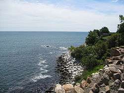 Shoreline in Newport, Rhode Island
 Ninigret Pond National Wildlife Refuge, Rhode Island
Most of Rhode Island has a humid continental climate, with warm summers and cold winters. The southern coastal portions of the state are the broad transition zone into subtropical climates, with hot summers and cool winters with a mix of rain and snow. Block Island has an oceanic climate. The highest temperature recorded in Rhode Island was 104 °F (40 °C), recorded on August 2, 1975 in Providence.[57] The lowest recorded temperature in Rhode Island was −23 °F (−31 °C) on February 5, 1996 in Greene.[58] Monthly average temperatures range from a high of 83 °F (28 °C) to a low of 20 °F (−7 °C).[59]
Rhode Island is vulnerable to tropical storms and hurricanes due to its location in New England, catching the brunt of many storms blowing up the eastern seaboard. Some hurricanes that have done significant damage in the state are the 1938 New England hurricane, Hurricane Carol (1954), Hurricane Donna (1960), and Hurricane Bob (1991).
Government
| Year | Democratic | Republican |
|---|---|---|
| 1950 | 59.3% 176,125 | 40.7% 120,683 |
| 1954 | 57.7% 189,595 | 41.7% 137,131 |
| 1958 | 49.1% 170,275 | 50.9% 176,505 |
| 1962 | 49.9% 163,554 | 50.1% 163,952 |
| 1966 | 36.7% 121,862 | 63.3% 210,202 |
| 1970 | 50.1% 173,420 | 49.5% 171,549 |
| 1974 | 78.5% 252,436 | 21.5% 69,224 |
| 1978 | 62.8% 197,386 | 30.7% 96,596 |
| 1982 | 73.3% 247,208 | 23.6% 79,602 |
| 1986 | 32.4% 104,504 | 64.7% 208,822 |
| 1990 | 74.1% 264,411 | 25.9% 92,177 |
| 1994 | 43.6% 157,361 | 47.4% 171,194 |
| 1998 | 42.1% 129,105 | 51.0% 156,180 |
| 2002 | 45.2% 150,229 | 54.7% 181,827 |
| 2006 | 49.0% 189,503 | 51.0% 197,306 |
| 2010 | 23.1% 78,896 | 33.6% 114,911 |
| 2014 | 40.7% 131,452 | 36.2% 117,106 |
| 2018 | 52.6% 198,122 | 37.2% 139,932 |
| Year | Democratic | Republican |
|---|---|---|
| 1952 | 49.1% 203,293 | 50.9% 210,935 |
| 1956 | 41.7% 161,790 | 58.3% 225,819 |
| 1960 | 63.6% 258,032 | 36.4% 147,502 |
| 1964 | 80.9% 315,463 | 19.1% 74,615 |
| 1968 | 64.0% 246,518 | 31.8% 122,359 |
| 1972 | 46.8% 194,645 | 53.0% 220,383 |
| 1976 | 55.4% 227,636 | 44.1% 181,249 |
| 1980 | 47.7% 198,342 | 37.2% 154,793 |
| 1984 | 48.0% 197,106 | 51.7% 212,080 |
| 1988 | 55.6% 225,123 | 43.9% 177,761 |
| 1992 | 47.0% 213,299 | 29.0% 131,601 |
| 1996 | 59.7% 233,050 | 26.8% 104,683 |
| 2000 | 61.0% 249,508 | 31.9% 130,555 |
| 2004 | 59.4% 259,760 | 38.7% 169,046 |
| 2008 | 62.9% 296,571 | 35.1% 165,391 |
| 2012 | 62.7% 279,677 | 35.2% 157,204 |
| 2016 | 54.4% 252,525 | 38.9% 180,543 |
The capital of Rhode Island is Providence. The state's current governor is Gina Raimondo (D), and the lieutenant governor is Daniel McKee (D). Raimondo became Rhode Island's first female governor with a plurality of the vote in the November 2014 state elections.[61] Its United States senators are Jack Reed (D) and Sheldon Whitehouse (D). Rhode Island's two United States representatives are David Cicilline (D-1) and Jim Langevin (D-2). See congressional districts map. Rhode Island is one of a few states that do not have an official governor's residence. See List of Rhode Island Governors.
The state legislature is the Rhode Island General Assembly, consisting of the 75-member House of Representatives and the 38-member Senate. Both houses of the bicameral body are currently dominated by the Democratic Party; the presence of the Republican Party is minor in the state government, with Republicans holding a handful of seats in both the Senate and House of Representatives.
Elections
Rhode Island's population barely crosses the threshold beyond the minimum of three for additional votes in both the federal House of Representatives and Electoral College; it is well represented relative to its population, with the eighth-highest number of electoral votes and second-highest number of House Representatives per resident. Based on its area, Rhode Island even has the highest density of electoral votes.[62]
Federally, Rhode Island is a reliably Democratic state during presidential elections, usually supporting the Democratic Presidential nominee. The state voted for the Republican Presidential candidate until 1908. Since then, it has voted for the Republican nominee for President seven times, and the Democratic nominee 17 times. The last 16 presidential elections in Rhode Island have resulted in the Democratic Party winning the Ocean State's Electoral College votes 12 times. In the 1980 presidential election, Rhode Island was one of six states to vote against Republican Ronald Reagan. Reagan was the last Republican to win any of the state's counties in a Presidential election until Donald Trump won Kent County in 2016. In 1988, George H. W. Bush won over 40% of the state's popular vote, something that no Republican has done since.
| Party | Active voters | Inactive voters | Total voters | Percentage | |
|---|---|---|---|---|---|
| Democratic | 259,263 | 22,586 | 286,625 | 40.97% | |
| Republican | 65,033 | 6,792 | 72,613 | 10.38% | |
| Unaffiliated | 306,697 | 29,253 | 340,085 | 48.61% | |
| Total | 631,320 | 58,634 | 699,653 | 100% | |
Rhode Island was the Democrats' leading state in 1988 and 2000, and second-best in 1968, 1996, and 2004. Rhode Island's most one-sided Presidential election result was in 1964, with over 80% of Rhode Island's votes going for Lyndon B. Johnson. In 2004, Rhode Island gave John Kerry more than a 20-percentage-point margin of victory (the third-highest of any state), with 59.4% of its vote. All but three of Rhode Island's 39 cities and towns voted for the Democratic candidate. The exceptions were East Greenwich, West Greenwich, and Scituate.[65] In 2008, Rhode Island gave Barack Obama a 28-percentage-point margin of victory (the third-highest of any state), with 63% of its vote. All but one of Rhode Island's 39 cities and towns voted for the Democratic candidate (the exception being Scituate).[66]
Legislation and taxes
Rhode Island is one of 21 states that have abolished capital punishment; it was second do so, just after Michigan, and carried out its last execution in the 1840s. Rhode Island was the second to last state to make prostitution illegal. Until November 2009 Rhode Island law made prostitution legal provided it took place indoors.[67] In a 2009 study Rhode Island was listed as the 9th safest state in the country.[68]
In 2011, Rhode Island became the third state in the United States to pass legislation to allow the use of medical marijuana. Additionally, the Rhode Island General Assembly passed civil unions, and it was signed into law by Governor Lincoln Chafee on July 2, 2011. Rhode Island became the eighth state to fully recognize either same-sex marriage or civil unions.[69] Same-sex marriage became legal on May 2, 2013, and took effect August 1.[70]
Rhode Island has some of the highest taxes in the country, particularly its property taxes, ranking seventh in local and state taxes, and sixth in real estate taxes.[71]
Demographics
| Historical population | |||
|---|---|---|---|
| Census | Pop. | %± | |
| 1790 | 68,825 | — | |
| 1800 | 69,122 | 0.4% | |
| 1810 | 76,931 | 11.3% | |
| 1820 | 83,059 | 8.0% | |
| 1830 | 97,199 | 17.0% | |
| 1840 | 108,830 | 12.0% | |
| 1850 | 147,545 | 35.6% | |
| 1860 | 174,620 | 18.4% | |
| 1870 | 217,353 | 24.5% | |
| 1880 | 276,531 | 27.2% | |
| 1890 | 345,506 | 24.9% | |
| 1900 | 428,556 | 24.0% | |
| 1910 | 542,610 | 26.6% | |
| 1920 | 604,397 | 11.4% | |
| 1930 | 687,497 | 13.7% | |
| 1940 | 713,346 | 3.8% | |
| 1950 | 791,896 | 11.0% | |
| 1960 | 859,488 | 8.5% | |
| 1970 | 946,725 | 10.1% | |
| 1980 | 947,154 | 0.0% | |
| 1990 | 1,003,464 | 5.9% | |
| 2000 | 1,048,319 | 4.5% | |
| 2010 | 1,052,567 | 0.4% | |
| Est. 2019 | 1,059,361 | 0.6% | |
| Source: 1910–2010[72] 2018 estimate[73] | |||
The United States Census Bureau estimates that the population of Rhode Island was 1,059,361 on July 1, 2019, a 0.65% increase since the 2010 United States Census.[73] The center of population of Rhode Island is located in Providence County, in the city of Cranston.[74] A corridor of population can be seen from the Providence area, stretching northwest following the Blackstone River to Woonsocket, where 19th-century mills drove industry and development.
According to the 2010 Census, 81.4% of the population was White (76.4% non-Hispanic white), 5.7% was Black or African American, 0.6% American Indian and Alaska Native, 2.9% Asian, 0.1% Native Hawaiian and other Pacific Islander, 3.3% from two or more races. 12.4% of the total population was of Hispanic or Latino origin (they may be of any race).[75]
| Racial composition | 1970[76] | 1990[76] | 2000[77] | 2010[78] |
|---|---|---|---|---|
| White | 96.6% | 91.4% | 85.0% | 81.4% |
| Black | 2.7% | 3.9% | 4.5% | 5.7% |
| Asian | 0.4% | 1.8% | 2.3% | 2.9% |
| Native | 0.1% | 0.4% | 0.5% | 0.6% |
| Native Hawaiian and other Pacific Islander | – | – | 0.1% | 0.1% |
| Other race | 0.2% | 2.5% | 5.0% | 6.1% |
| Two or more races | – | – | 2.7% | 3.3% |
Of the people residing in Rhode Island, 58.7% were born in Rhode Island, 26.6% were born in a different state, 2.0% were born in Puerto Rico, U.S. Island areas or born abroad to American parent(s), and 12.6% were foreign born.[79]
According to the U.S. Census Bureau, as of 2015, Rhode Island had an estimated population of 1,056,298, which is an increase of 1,125, or 0.10%, from the prior year and an increase of 3,731, or 0.35%, since the year 2010. This includes a natural increase since the last census of 15,220 people (that is 66,973 births minus 51,753 deaths) and an increase due to net migration of 14,001 people into the state. Immigration from outside the United States resulted in a net increase of 18,965 people, and migration within the country produced a net decrease of 4,964 people.
Hispanics in the state make up 12.8% of the population, predominantly Dominican, Puerto Rican, and Guatemalan populations.[80]
According to the 2000 U.S. Census, 84% of the population aged 5 and older spoke only American English, while 8.07% spoke Spanish at home, 3.80% Portuguese, 1.96% French, 1.39% Italian and 0.78% speak other languages at home accordingly.[81]
The state's most populous ethnic group, non-Hispanic white, has declined from 96.1% in 1970 to 76.5% in 2011.[82][83] In 2011, 40.3% of Rhode Island's children under the age of one belonged to racial or ethnic minority groups, meaning that they had at least one parent who was not non-Hispanic white.[84]
6.1% of Rhode Island's population were reported as under 5, 23.6% under 18, and 14.5% were 65 or older. Females made up approximately 52% of the population.
According to the 2010–2015 American Community Survey, the largest ancestry groups were Irish (18.3%), Italian (18.0%), English (10.5%), French (10.4%), and Portuguese (9.3%).[85]
Rhode Island has a higher percentage of Americans of Portuguese ancestry, including Portuguese Americans and Cape Verdean Americans than any other state in the nation. Additionally, the state also has the highest percentage of Liberian immigrants, with more than 15,000 residing in the state.[86] Italian Americans make up a plurality in central and southern Providence County and French-Canadian Americans form a large part of northern Providence County. Irish Americans have a strong presence in Newport and Kent counties. Americans of English ancestry still have a presence in the state as well, especially in Washington County, and are often referred to as "Swamp Yankees." African immigrants, including Cape Verdean Americans, Liberian Americans, Nigerian Americans and Ghanaian Americans, form significant and growing communities in Rhode Island.
Although Rhode Island has the smallest land area of all 50 states, it has the second highest population density of any state in the Union, second to that of New Jersey.
Birth data
| Race | 2013[87] | 2014[88] | 2015[89] | 2016[90] | 2017[91] | 2018[92] |
|---|---|---|---|---|---|---|
| White: | 8,672 (80.2%) | 8,734 (80.7%) | 8,824 (80.3%) | ... | ... | ... |
| Non-Hispanic White | 6,572 (60.8%) | 6,573 (60.7%) | 6,702 (61.0%) | 6,338 (58.7%) | 6,142 (57.7%) | 6,008 (57.2%) |
| Black | 1,411 (13.0%) | 1,365 (12.6%) | 1,392 (12.7%) | 784 (7.3%) | 776 (7.3%) | 783 (7.5%) |
| Asian | 598 (5.5%) | 594 (5.5%) | 639 (5.8%) | 565 (5.2%) | 542 (5.1%) | 519 (4.9%) |
| American Indian | 128 (1.2%) | 130 (1.2%) | 138 (1.2%) | 63 (0.6%) | 51 (0.5%) | 41 (0.4%) |
| Hispanic (of any race) | 2,453 (22.7%) | 2,585 (23.9%) | 2,622 (23.8%) | 2,684 (24.8%) | 2,760 (25.9%) | 2,756 (26.2%) |
| Total Rhode Island | 10,809 (100%) | 10,823 (100%) | 10,993 (100%) | 10,798 (100%) | 10,638 (100%) | 10,506 (100%) |
- Since 2016, data for births of White Hispanic origin are not collected, but included in one Hispanic group; persons of Hispanic origin may be of any race.
Religion
A Pew survey of Rhode Island residents' religious self-identification showed the following distribution of affiliations: Roman Catholic 43%, Protestant 27%, Jewish 1%, Orthodox 1%, Jehovah's Witnesses 1%, Buddhism 1%, Mormonism 0.5%, Hinduism 0.5%, Islam 0.5% and Non-religious 23%.[93] The largest denominations are the Roman Catholic Church with 456,598 adherents, the Episcopal Church with 19,377, the American Baptist Churches USA with 15,220, and the United Methodist Church with 6,901 adherents.[94]
Rhode Island has the highest proportion of Roman Catholic residents of any state,[95] mainly due to large Irish, Italian, and French-Canadian immigration in the past; recently, significant Portuguese and various Hispanic communities have also been established in the state. Though it has the highest overall Catholic percentage of any state, none of Rhode Island's individual counties ranks among the 10 most Catholic in the United States, as Catholics are very evenly spread throughout the state.
The Jewish community of Rhode Island is centered in the Providence area, and emerged during a wave of Jewish immigration predominantly from Eastern Europeans shtetls between 1880 and 1920. The presence of the Touro Synagogue in Newport, the oldest existing synagogue in the United States, emphasizes that these second-wave immigrants did not create Rhode Island's first Jewish community; a comparatively smaller wave of Spanish and Portuguese Jews immigrated to Newport during the colonial era.
Cities and towns
Rhode Island is divided into five counties but it has no county governments. The entire state is divided into municipalities, which handle all local government affairs.
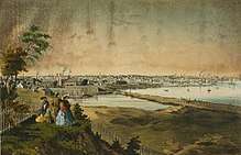
There are 39 cities and towns in Rhode Island. Major population centers today result from historical factors; development took place predominantly along the Blackstone, Seekonk, and Providence Rivers with the advent of the water-powered mill. Providence is the base of a large metropolitan area.
The state's 18 largest municipalities ranked by population are[96] :
- Providence (180,393)
- Warwick (82,672)
- Cranston (80,387)
- Pawtucket (72,001)
- East Providence (47,600)
- Woonsocket (41,759)
- Coventry (34,933)
- Cumberland (34,927)
- North Providence (32,511)
- South Kingstown (30,788)
- Johnston (29,332)
- West Warwick (28,626)
- North Kingstown (26,160)
- Newport (24,942)
- Westerly (22,567)
- Bristol (22,290)
- Lincoln (21,863)
- Smithfield (21,767)
Some of Rhode Island's cities and towns are further partitioned into villages, in common with many other New England states. Notable villages include Kingston in the town of South Kingstown, which houses the University of Rhode Island; Wickford in the town of North Kingstown, the site of an annual international art festival; and Wakefield where the Town Hall is located for the Town of South Kingstown.[97]
- Major Cities of Rhode Island
 1. Providence
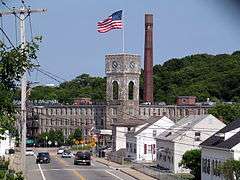 2. Warwick
 3. Cranston
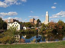 4. Pawtucket
 5. East Providence
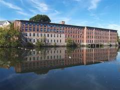 6. Woonsocket
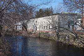 7. Coventry
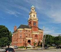 8. Cumberland
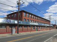 9. North Providence
 10. South Kingstown
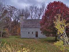 11. Johnston
 12. West Warwick
 13. North Kingstown
 14. Newport
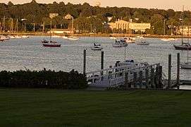 15. Bristol
Economy


The Rhode Island economy had a colonial base in fishing.
The Blackstone River Valley was a major contributor to the American Industrial Revolution. It was in Pawtucket that Samuel Slater set up Slater Mill in 1793,[98] using the waterpower of the Blackstone River to power his cotton mill. For a while, Rhode Island was one of the leaders in textiles. However, with the Great Depression, most textile factories relocated to southern U.S. states. The textile industry still constitutes a part of the Rhode Island economy but does not have the same power that it once had.
Other important industries in Rhode Island's past included toolmaking, costume jewelry, and silverware. An interesting by-product of Rhode Island's industrial history is the number of abandoned factories, many of them now being used for condominiums, museums, offices, and low-income and elderly housing. Today, much of the economy of Rhode Island is based in services, particularly healthcare and education, and still manufacturing to some extent.[99][100] The state's nautical history continues in the 21st century in the form of nuclear submarine construction.
Per the 2013 American Communities Survey, Rhode Island has the highest paid elementary school teachers in the country, with an average salary of $75,028 (adjusted to inflation).[101]
The headquarters of Citizens Financial Group is located in Providence, the 14th largest bank in the United States.[102] The Fortune 500 companies CVS Caremark and Textron are based in Woonsocket and Providence, respectively. FM Global, GTECH Corporation, Hasbro, American Power Conversion, Nortek, and Amica Mutual Insurance are all Fortune 1000 companies that are based in Rhode Island.[103]
Rhode Island's 2000 total gross state production was $46.18 billion (adjusted to inflation), placing it 45th in the nation. Its 2000 per capita personal income was $41,484 (adjusted to inflation), 16th in the nation. Rhode Island has the lowest level of energy consumption per capita of any state.[104][105][106] Additionally, Rhode Island is rated as the 5th most energy efficient state in the country.[107][108] In December 2012, the state's unemployment rate was 10.2%.[109]
Health services are Rhode Island's largest industry. Second is tourism, supporting 39,000 jobs, with tourism-related sales at $4.56 billion (adjusted to inflation) in the year 2000. The third-largest industry is manufacturing.[110] Its industrial outputs are submarine construction, shipbuilding, costume jewelry, fabricated metal products, electrical equipment, machinery, and boatbuilding. Rhode Island's agricultural outputs are nursery stock, vegetables, dairy products, and eggs.
Rhode Island's taxes were appreciably higher than neighboring states,[71] because Rhode Island's income tax was based on 25% of the payer's federal income tax payment.[111] Former Governor Donald Carcieri claimed that the higher tax rate had an inhibitory effect on business growth in the state and called for reductions to increase the competitiveness of the state's business environment. In 2010, the Rhode Island General Assembly passed a new state income tax structure that was then signed into law on June 9, 2010 by Governor Carcieri.[112] The income tax overhaul has now made Rhode Island competitive with other New England states by lowering its maximum tax rate to 5.99% and reducing the number of tax brackets to three.[113] The state's first income tax was enacted in 1971.[114]
Largest employers
As of March 2011, the largest employers in Rhode Island (excluding employees of municipalities) are the following:[115]
| Rank | Employer | Employees | Notes |
|---|---|---|---|
| 1 | State of Rhode Island | 14,904 | Full-time equivalents |
| 2 | Lifespan Hospital Group | 11,869 | Rhode Island Hospital (7,024 employees), The Miriam Hospital (2,410), Newport Hospital (919), Emma Pendleton Bradley Hospital (800), Lifespan Corporate Services (580), Newport Alliance Newport (68), Lifespan MSO (53), and Home Medical (15) |
| 3 | U.S. federal government | 11,581 | Excludes 3,000 active duty military personnel and 7,000 reservists, but includes 250 employees of the Naval War College. |
| 4 | Roman Catholic Diocese of Providence | 6,200 | |
| 5 | Care New England | 5,953 | Employees at: Women & Infants Hospital of Rhode Island (3,134), Kent County Memorial Hospital (1,850), Butler Hospital (800), VNA of Care New England (140), and Care New England (29) |
| 6 | CVS Caremark | 5,800 | The corporate headquarters are at Woonsocket (5,630 employees). The corporation also has 170 employees at Pharmacare |
| 7 | Citizens Financial Group | 4,991 | The corporate headquarters are in Johnston. |
| 8 | Brown University | 4,800 | Excludes student employees. |
| 9 | Stop & Shop Supermarket (subsidiary of Ahold) |
3,632 | |
| 10 | Bank of America | 3,500 | |
| 11 | Fidelity Investments | 2,934 | 2,434 employees in Smithfield and 500 in Providence |
| 12 | Rhode Island ARC | 2,851 | Employees at James L. Maher Center (700), The Homestead Group (650), Cranston Arc (374), The ARC of Blackstone Valley (350), Kent County ARC (500), The Fogarty Center (225), and Westerly Chariho, ARC (52) |
| 13 | MetLife Insurance Co. | 2,604 | |
| 14 | General Dynamics Corp. | 2,243 | 2,200 employees at General Dynamics Electric Boat in North Kingstown, and 43 employees at General Dynamics Information Technology – Newport in Middletown adjacent to the Naval Undersea Warfare Center[116] |
| 15 | University of Rhode Island | 2,155 | |
| 16 | Wal-Mart | 2,078 | |
| 17 | The Jan Companies | 2,050 | Employees at Jan-Co Burger King (1,500) (Burger King franchiser); Newport Creamery, LLC (400), Quidnessett Country Club (100), and The Country Inn (50) |
| 18 | Shaw's Supermarkets (subsidiary of Albertsons LLC) |
1,900 | |
| 19 | St. Joseph Health Services and Hospitals of Rhode Island/CharterCARE Health Partners | 1,865 | Employees at Our Lady of Fatima Hospital (1,343) and St. Joseph Hospital for Specialty Care (522) |
| 20 | The Home Depot, Inc. | 1,780 |
Transportation
Bus
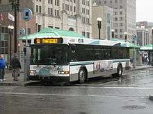
The Rhode Island Public Transit Authority (RIPTA) operates statewide intra- and intercity bus transport from its hubs at Kennedy Plaza in Providence, Pawtucket, and Newport. RIPTA bus routes serve 38 of Rhode Island's 39 cities and towns. (New Shoreham on Block Island is not served). RIPTA currently operates 58 routes, including daytime trolley service (using trolley-style replica buses) in Providence and Newport.
Ferry
From 2000 through 2008, RIPTA offered seasonal ferry service linking Providence and Newport (already connected by highway) funded by grant money from the United States Department of Transportation. Though the service was popular with residents and tourists, RIPTA was unable to continue on after the federal funding ended. Service was discontinued as of 2010.[117] The service was resumed in 2016 and has been successful. The privately run Block Island Ferry[118] links Block Island with Newport and Narragansett with traditional and fast-ferry service, while the Prudence Island Ferry[119] connects Bristol with Prudence Island. Private ferry services also link several Rhode Island communities with ports in Connecticut, Massachusetts, and New York. The Vineyard Fast Ferry[120] offers seasonal service to Martha's Vineyard from Quonset Point with bus and train connections to Providence, Boston, and New York. Viking Fleet[121] offers seasonal service from Block Island to New London, Connecticut, and Montauk, New York.
Rail
The MBTA Commuter Rail's Providence/Stoughton Line links Providence and T. F. Green Airport with Boston. The line was later extended southward to Wickford Junction, with service beginning April 23, 2012. The state hopes to extend the MBTA line to Kingston and Westerly. as well as explore the possibility of extending Connecticut's Shore Line East to T.F. Green Airport.[122] Amtrak's Acela Express stops at Providence Station (the only Acela stop in Rhode Island), linking Providence to other cities in the Northeast Corridor. Amtrak's Northeast Regional service makes stops at Providence Station, Kingston, and Westerly.
Aviation
Rhode Island's primary airport for passenger and cargo transport is T. F. Green Airport in Warwick, though most Rhode Islanders who wish to travel internationally on direct flights and those who seek a greater availability of flights and destinations often fly through Logan International Airport in Boston.
Limited access highways
Interstate 95 (I-95) runs southwest to northeast across the state, linking Rhode Island with other states along the East Coast. I-295 functions as a partial beltway encircling Providence to the west. I-195 provides a limited-access highway connection from Providence (and Connecticut and New York via I-95) to Cape Cod. Initially built as the easternmost link in the (now cancelled) extension of I-84 from Hartford, Connecticut, a portion of U.S. Route 6 (US 6) through northern Rhode Island is limited-access and links I-295 with downtown Providence.
Several Rhode Island highways extend the state's limited-access highway network. Route 4 is a major north–south freeway linking Providence and Warwick (via I-95) with suburban and beach communities along Narragansett Bay. Route 10 is an urban connector linking downtown Providence with Cranston and Johnston. Route 37 is an important east–west freeway through Cranston and Warwick and links I-95 with I-295. Route 99 links Woonsocket with Providence (via Route 146). Route 146 travels through the Blackstone Valley, linking Providence and I-95 with Worcester, Massachusetts and the Massachusetts Turnpike. Route 403 links Route 4 with Quonset Point.
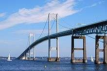
Several bridges cross Narragansett Bay connecting Aquidneck Island and Conanicut Island to the mainland, most notably the Claiborne Pell Newport Bridge and the Jamestown-Verrazano Bridge.
Bicycle paths
The East Bay Bike Path stretches from Providence to Bristol along the eastern shore of Narragansett Bay, while the Blackstone River Bikeway will eventually link Providence and Worcester. In 2011, Rhode Island completed work on a marked on-road bicycle path through Pawtucket and Providence, connecting the East Bay Bike Path with the Blackstone River Bikeway, completing a 33.5 miles (54 km) bicycle route through the eastern side of the state.[123] The William C. O'Neill Bike Path (commonly known as the South County Bike Path) is an 8 mi (13 km) path through South Kingstown and Narragansett. The 19 mi (31 km) Washington Secondary Bike Path stretches from Cranston to Coventry, and the 2 mi (3.2 km) Ten Mile River Greenway path runs through East Providence and Pawtucket.
Environmental legislation
On May 29, 2014, Governor Lincoln D. Chafee announced that Rhode Island was one of eight states to release a collaborative Action Plan to put 3.3 million zero emission vehicles on the roads by 2025. The goal of the plan is to reduce greenhouse gas and smog-causing emissions. The Action Plan covers promoting zero emission vehicles and investing in the infrastructure to support them.[124]
In 2014, Rhode Island received grants from the Environmental Protection Agency in the amount of $2,711,685 to clean up Brownfield sites in eight locations. The intent of the grants was to provide communities with the funding necessary to assess, clean up, and redevelop contaminated properties, boost local economies, and leverage jobs while protecting public health and the environment.[125]
In 2013, the "Lots of Hope" program was established in the City of Providence to focus on increasing the city's green space and local food production, improve urban neighborhoods, promote healthy lifestyles and improve environmental sustainability. "Lots of Hope", supported by a $100,000 grant, will partner with the City of Providence, the Southside Community Land Trust and the Rhode Island Foundation to convert city-owned vacant lots into productive urban farms.[126]
In 2012, Rhode Island passed bill S2277/H7412, "An act relating to Health and Safety – Environmental Cleanup Objectives for Schools", informally known as the "School Siting Bill." The bill, sponsored by Senator Juan Pichardo and Representative Scott Slater and signed into law by the Governor, made Rhode Island the first state in the US to prohibit school construction on Brownfield Sites where there is an ongoing potential for toxic vapors to negatively impact indoor air quality. It also creates a public participation process whenever a city or town considers building a school on any other kind of contaminated site.[127]
Media
Education


Primary and secondary schools
Colleges and universities
Rhode Island has several colleges and universities:
- Brown University
- Bryant University
- Community College of Rhode Island
- Johnson & Wales University
- Naval War College
- New England Institute of Technology
- Providence College
- Rhode Island College
- Rhode Island School of Design
- Roger Williams University
- Salve Regina University of Newport
- University of Rhode Island
Culture
Local accent
Some Rhode Islanders speak with the distinctive, non-rhotic, traditional Rhode Island accent that many compare to a cross between the New York City and Boston accents (e.g., "water" sounds like "watuh"). Many Rhode Islanders distinguish a strong aw sound [ɔə] (i.e., do not exhibit the cot–caught merger) as one might hear in New Jersey or New York City; for example, the word coffee is pronounced [ˈkʰɔəfi] KAW-fee.[128] This type of accent may have been brought to the region by early settlers from eastern England in the Puritan migration to New England in the mid-17th century.[129]
Rhode Islanders refer to a drinking fountain as a "bubbler" (sometimes pronounced "bubahluh") and sometimes call milkshakes "cabinets". A foot-long, overstuffed sandwich (of whatever kind) is called a "grinder."
Food and beverages
Rhode Island, like the rest of New England, has a tradition of clam chowder. Both the white New England and the red Manhattan varieties are popular, but there is also a unique clear-broth chowder known as Rhode Island Clam Chowder available in many restaurants. A culinary tradition in Rhode Island is the clam cake (also known as a clam fritter outside of Rhode Island), a deep fried ball of buttery dough with chopped bits of clam inside. They are sold by the half-dozen or dozen in most seafood restaurants around the state, and the quintessential summer meal in Rhode Island is chowder and clam cakes.
The quahog is a large local clam usually used in a chowder. It is also ground and mixed with stuffing or spicy minced sausage, and then baked in its shell to form a stuffie. Calamari (squid) is sliced into rings and fried as an appetizer in most Italian restaurants, typically served Sicilian-style with sliced banana peppers and marinara sauce on the side. Clams Casino originated in Rhode Island, invented by Julius Keller, the maitre d' in the original Casino next to the seaside Towers in Narragansett.[130] Clams Casino resemble the beloved stuffed quahog but are generally made with the smaller littleneck or cherrystone clam and are unique in their use of bacon as a topping.
The official state drink of Rhode Island is coffee milk,[131] a beverage created by mixing milk with coffee syrup. This unique syrup was invented in the state and is sold in almost all Rhode Island supermarkets, as well as its bordering states. Johnnycakes have been a Rhode Island staple since Colonial times, made with corn meal and water then pan-fried much like pancakes.
Submarine sandwiches are called grinders throughout Rhode Island, and the Italian grinder is especially popular, made with cold cuts such as ham, prosciutto, capicola, salami, and Provolone cheese. Linguiça or chouriço is a spicy Portuguese sausage, frequently served with peppers among the state's large Portuguese community and eaten with hearty bread.
Rhode Island state symbols
| Rhode Island state symbols | |
|---|---|
| Living insignia | |
| Bird | Rhode Island Red Chicken |
| Fish | Striped Bass |
| Flower | Violet |
| Tree | Red maple |
| Inanimate insignia | |
| Beverage | Coffee milk |
| Food | Rhode Island Greening Apple |
| Mineral | Bowenite |
| Rock | Cumberlandite |
| Shell | Northern Quahog |
| Slogan | Unwind, "Hope" |
| Soil | Narragansett |
| Song | Rhode Island, Rhode Island, It's for Me |
| Tartan | Rhode Island Tartan |
| State route marker | |
 | |
| State quarter | |
Released in 2001 | |
| Lists of United States state symbols | |

Popular culture
The Farrelly brothers and Seth MacFarlane depict Rhode Island in popular culture, often making comedic parodies of the state. MacFarlane's television series Family Guy is based in a fictional Rhode Island city named Quahog, and notable local events and celebrities are regularly lampooned. Peter Griffin is seen working at the Pawtucket brewery, and other state locations are mentioned.
The movie High Society (starring Bing Crosby, Grace Kelly, and Frank Sinatra) was set in Newport, Rhode Island.
The 1974 film adaptation of The Great Gatsby was also filmed in Newport.
Jacqueline Bouvier and John F. Kennedy were married at St. Mary's church in Newport. Their reception was held at Hammersmith Farm, the Bouvier summer home in Newport.
Cartoonist Don Bousquet, a state icon, has made a career out of Rhode Island culture, drawing Rhode Island-themed gags in The Providence Journal and Yankee magazine. These cartoons have been reprinted in the Quahog series of paperbacks (I Brake for Quahogs, Beware of the Quahog, and The Quahog Walks Among Us.) Bousquet has also collaborated with humorist and Providence Journal columnist Mark Patinkin on two books: The Rhode Island Dictionary and The Rhode Island Handbook.
The 1998 film Meet Joe Black was filmed at Aldrich Mansion in the Warwick Neck area of Warwick.
Body of Proof's first season was filmed entirely in Rhode Island.[132] The show premiered on March 29, 2011.[133]
The 2007 Steve Carell and Dane Cook film Dan in Real Life was filmed in various coastal towns in the state. The sunset scene with the entire family on the beach takes place at Napatree Point.
Jersey Shore star Pauly D filmed part of his spin-off The Pauly D Project in his hometown of Johnston.
The Comedy Central cable television series Another Period is set in Newport during the Gilded Age.
Notable firsts in Rhode Island
Rhode Island has been the first in a number of initiatives. The Colony of Rhode Island and Providence Plantations enacted the first law prohibiting slavery in America on May 18, 1652.[134]
The first act of armed rebellion in America against the British Crown was the boarding and burning of the Revenue Schooner Gaspee in Narragansett Bay on June 10, 1772. The idea of a Continental Congress was first proposed at a town meeting in Providence on May 17, 1774. Rhode Island elected the first delegates (Stephen Hopkins and Samuel Ward) to the Continental Congress on June 15, 1774. The Rhode Island General Assembly created the first standing army in the colonies (1,500 men) on April 22, 1775. On June 15, 1775, the first naval engagement took place in the American Revolution between an American sloop commanded by Capt. Abraham Whipple and an armed tender of the British Frigate Rose. The tender was chased aground and captured. Later in June, the General Assembly created the American Navy when it commissioned the sloops Katy and Washington, armed with 24 guns and commanded by Abraham Whipple who was promoted to Commodore. Rhode Island was the first Colony to declare independence from Britain on May 4, 1776.[134]
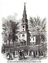
Slater Mill in Pawtucket was the first commercially successful cotton-spinning mill with a fully mechanized power system in America and was the birthplace of the Industrial Revolution in the US.[135] The oldest Fourth of July parade in the country is still held annually in Bristol, Rhode Island. The first Baptist church in America was founded in Providence in 1638.[136] Ann Smith Franklin of the Newport Mercury was the first female newspaper editor in America (August 22, 1762).[134] Touro Synagogue was the first synagogue in America, founded in Newport in 1763.[134]
Pelham Street in Newport was the first in America to be illuminated by gaslight in 1806.[134] The first strike in the United States in which women participated occurred in Pawtucket in 1824.[134] Watch Hill has the nation's oldest flying horses carousel that has been in continuous operation since 1850.[134] The motion picture machine was patented in Providence on April 23, 1867.[134] The first lunch wagon in America was introduced in Providence in 1872.[134] The first nine-hole golf course in America was completed in Newport in 1890.[134] The first state health laboratory was established in Providence on September 1, 1894.[134] The Rhode Island State House was the first building with an all-marble dome to be built in the United States (1895–1901).[134] The first automobile race on a track was held in Cranston on September 7, 1896.[134] The first automobile parade was held in Newport on September 7, 1899 on the grounds of Belcourt Castle.[134]
Miscellaneous local culture
Rhode Island is nicknamed "The Ocean State", and the nautical nature of Rhode Island's geography pervades its culture. Newport Harbor, in particular, holds many pleasure boats. In the lobby of T. F. Green, the state's main airport, is a large life-sized sailboat,[137] and the state's license plates depict an ocean wave or a sailboat.[138]
Additionally, the large number of beaches in Washington County lures many Rhode Islanders south for summer vacation.[139]
The state was notorious for organized crime activity from the 1950s into the 1990s when the Patriarca crime family held sway over most of New England from its Providence headquarters.
Rhode Islanders developed a unique style of architecture in the 17th century called the stone-ender.[140]
Rhode Island is the only state to still celebrate Victory over Japan Day which is officially named "Victory Day" but is sometimes referred to as "VJ Day."[141] It is celebrated on the second Monday in August.[142]
Nibbles Woodaway, more commonly referred to as "The Big Blue Bug", is a 58-foot-long termite mascot for a Providence extermination business. Since its construction in 1980, it has been featured in several movies and television shows, and has come to be recognized as a cultural landmark by many locals.[143]
Sports
Professional
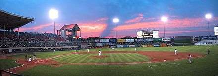
Rhode Island has two professional sports teams, both of which are top-level minor league affiliates for teams in Boston. The Pawtucket Red Sox baseball team of the Triple-A International League are an affiliate of the Boston Red Sox. They play at McCoy Stadium in Pawtucket and have won four league titles, the Governors' Cup, in 1973, 1984, 2012, and 2014. McCoy Stadium also has the distinction of being home to the longest professional baseball game ever played – 33 innings.
The other professional minor league team is the Providence Bruins ice hockey team of the American Hockey League, who are an affiliate of the Boston Bruins. They play in the Dunkin' Donuts Center in Providence and won the AHL's Calder Cup during the 1998–99 AHL season.
The Providence Reds were a hockey team that played in the Canadian-American Hockey League (CAHL) between 1926 and 1936 and the American Hockey League (AHL) from 1936 to 1977, the last season of which they played as the Rhode Island Reds. The team won the Calder Cup in 1938, 1940, 1949, and 1956. The Reds played at the Rhode Island Auditorium, located on North Main Street in Providence, Rhode Island from 1926 through 1972, when the team affiliated with the New York Rangers and moved into the newly built Providence Civic Center. The team name came from the rooster known as the Rhode Island Red. They moved to New York in 1977, then to Connecticut in 1997, and are now called the Hartford Wolf Pack.
The Reds are the oldest continuously operating minor-league hockey franchise in North America, having fielded a team in one form or another since 1926 in the CAHL. It is also the only AHL franchise to have never missed a season. The AHL returned to Providence in 1992 in the form of the Providence Bruins.
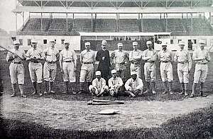
Before the great expansion of athletic teams all over the country, Providence and Rhode Island in general played a great role in supporting teams. The Providence Grays won the first World Championship in baseball history in 1884. The team played their home games at the old Messer Street Field in Providence. The Grays played in the National League from 1878 to 1885. They defeated the New York Metropolitans of the American Association in a best of five game series at the Polo Grounds in New York. Providence won three straight games to become the first champions in major league baseball history. Babe Ruth played for the minor league Providence Grays of 1914 and hit his only official minor league home run for that team before being recalled by the Grays' parent club, the Boston Red Stockings.
The now-defunct professional football team the Providence Steam Roller won the 1928 NFL title. They played in a 10,000 person stadium called the Cycledrome.[144] The Providence Steamrollers played in the Basketball Association of America which became the National Basketball Association.
Rhode Island is also home to a top semi-professional soccer club, the Rhode Island Reds, which compete in the National premier soccer league, in the fourth division of U.S. Soccer.
Rhode Island is home to one top level non-minor league team, the Rhode Island Rebellion rugby league team, a semi-professional rugby league team that competes in the USA Rugby League, the Top Competition in the United States for the Sport of Rugby League.[145][146] The Rebellion play their home games at Classical High School in Providence.[147]
Current professional teams
| Professional Team | League | Sport | Venue | City | Established | Championships |
|---|---|---|---|---|---|---|
| Pawtucket Red Sox | International League (IHL) | Baseball | McCoy Stadium | Pawtucket, Rhode Island | 1970 | 4 |
| Providence Bruins | American Hockey League (AHL) | Ice hockey | Dunkin' Donuts Center | Providence, Rhode Island | 1987 | 1 |
| USLC Rhode Island | USL Championship (USLC) | Soccer | Riptide Stadium | Pawtucket, Rhode Island | 2020 | 0 |
Current semi-professional teams
| Semi-Professional Team | League | Sport | Venue | City | Established | Championships |
|---|---|---|---|---|---|---|
| Rhode Island Rebellion | USA Rugby League (USARL) | Rugby union | Marvel Field | Providence, Rhode Island | 2011 | 0 |
| Rhode Island Reds FC | National Premier Soccer League (NPSL) | Soccer | Brown University | Providence, Rhode Island | 2012 | 0 |
| Rhode Island Reds FC | Women's Premier Soccer League (WPSL) | Soccer | Bayside Field | Bristol, Rhode Island | 2012 | 0 |
Collegiate and amateur sports

There are four NCAA Division I schools in Rhode Island. All four schools compete in different conferences. The Brown University Bears compete in the Ivy League, the Bryant University Bulldogs compete in the Northeast Conference, the Providence College Friars compete in the Big East Conference, and the University of Rhode Island Rams compete in the Atlantic-10 Conference. Three of the schools' football teams compete in the Football Championship Subdivision, the second-highest level of college football in the United States. Brown plays FCS football in the Ivy League, Bryant plays FCS football in the Northeast Conference, and Rhode Island plays FCS football in the Colonial Athletic Association. All four of the Division I schools in the state compete in an intrastate all-sports competition known as the Ocean State Cup, with Bryant winning the most recent cup in 2011–12 academic year.
From 1930 to 1983, America's Cup races were sailed off Newport, and the extreme-sport X Games and Gravity Games were founded and hosted in the state's capital city.
The International Tennis Hall of Fame is in Newport at the Newport Casino, site of the first U.S. National Championships in 1881. The Hall of Fame and Museum were established in 1954 by James Van Alen as "a shrine to the ideals of the game".
Rhode Island is also home to the headquarters of the governing body for youth rugby league in the United States, the American Youth Rugby League Association or AYRLA. The AYRLA has started the first-ever Rugby League youth competition in Providence Middle Schools, a program at the RI Training School, in addition to starting the first High School Competition in the US in Providence Public High School.[148]
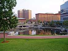
Landmarks
.jpg)

The state capitol building is made of white Georgian marble. On top is the world's fourth largest self-supported marble dome.[149] It houses the Rhode Island Charter granted by King Charles II in 1663, the Brown University charter, and other state treasures.
The First Baptist Church of Providence is the oldest Baptist church in the Americas, founded by Roger Williams in 1638.
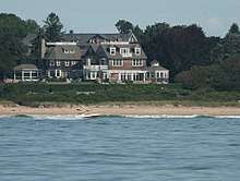
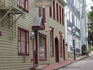
The first fully automated post office in the country is located in Providence. There are many historic mansions in the seaside city of Newport, including The Breakers, Marble House, and Belcourt Castle. Also located there is the Touro Synagogue, dedicated on December 2, 1763, considered by locals to be the first synagogue within the United States (see below for information on New York City's claim), and still serving. The synagogue showcases the religious freedoms that were established by Roger Williams, as well as impressive architecture in a mix of the classic colonial and Sephardic style. The Newport Casino is a National Historic Landmark building complex that presently houses the International Tennis Hall of Fame and features an active grass-court tennis club.
Scenic Route 1A (known locally as Ocean Road) is in Narragansett. "The Towers" is also located in Narragansett featuring a large stone arch. It was once the entrance to a famous Narragansett casino that burned down in 1900. The Towers now serve as an event venue and host the local Chamber of Commerce, which operates a tourist information center.
The Newport Tower has been hypothesized to be of Viking origin, although most experts believe that it was a Colonial-era windmill.[150]
Notable people
- Thomas Angell (1618–1694) – co-founder of the Colony of Rhode Island and Providence Plantations
- Joshua Babcock (1707–1783) – physician, American Revolution general, state Supreme Court justice, and postmaster
- John Clarke (1609–1676) – Baptist minister, co-founder of the Colony of Rhode Island and Providence Plantations, author of its influential charter, and a leading advocate of religious freedom in America
- William Coddington (1601–1678) – magistrate of the Colony of Rhode Island and Providence Plantations, Judge of Portsmouth, Judge of Newport, Governor of Portsmouth and Newport, Deputy Governor of the entire colony, and governor of the colony
- William Ellery (1727–1820) – a signer of the United States Declaration of Independence as a representative of Rhode Island
- Samuel Gorton (1593–1677) – settled Warwick
- Nathanael Greene (1742–1786) – Continental Army officer, considered George Washington's most gifted officer
- Esek Hopkins (1718–1802) – Commander in Chief of the Continental Navy during the American Revolutionary War
- Stephen Hopkins (1707–1785) – Governor of Rhode Island, RI Supreme Court justice, Signatory of the Declaration of Independence
- Anne Hutchinson (1591–1643) – early settler of Newport, the catalyst of the Antinomian Controversy
- James Mitchell Varnum (1748–1789) – general in the Continental Army during the American Revolutionary War
- Samuel Ward, Jr. (1756–1832) – American Revolutionary War soldier and delegate to the secessionist Hartford Convention
- H. P. Lovecraft (1890–1937) – author
- Gilbert Stuart (1755–1828) – painter, one of America's foremost portraitists
- Samuel Slater (1768–1835) - industrialist, "father of the industrial revolution"
- Samuel Ward (1725–1776) – Supreme Court Justice, Governor of the Colony of Rhode Island and Providence Plantations, and a delegate to the Continental Congress
- Roger Williams (1603–1684) – founder of the Colony of Rhode Island and Providence Plantations, influential author, considered the first proponent of separation of church and state
- Abraham Whipple (1733–1819) – Continental Navy commander-in-chief
See also
- Index of Rhode Island-related articles
- Outline of Rhode Island
References
- "Rhode Island Government: Government". RI.gov. Retrieved July 31, 2010.
- Office of the Secretary of State: A. Ralph Mollis: State Library. Sos.ri.gov. Retrieved on July 12, 2013.
- "Elevations and Distances in the United States". United States Geological Survey. 2001. Archived from the original on October 15, 2011. Retrieved October 24, 2011.
- Elevation adjusted to North American Vertical Datum of 1988
- "Median Annual Household Income". The Henry J. Kaiser Family Foundation. Retrieved December 9, 2016.
- Jones, Daniel (2003) [1917], Peter Roach; James Hartmann; Jane Setter (eds.), English Pronouncing Dictionary, Cambridge: Cambridge University Press, ISBN 978-3-12-539683-8
- "Rhode Island". Merriam-Webster Dictionary.
- "Constitution of the State of Rhode Island and Providence Plantations". State of Rhode Island General Assembly. Retrieved September 6, 2016.
- "RG 042.03". Office of the Secretary of State: Nellie M. Gorbea.
- "The May 4, 1776, Act of Renunciation". State of Rhode Island. Retrieved May 3, 2014.
- Jensen, Merrill (1959). The Articles of Confederation: An Interpretation of the Social-Constitutional History of the American Revolution, 1774–1781. University of Wisconsin Press. pp. xi, 184. ISBN 978-0-299-00204-6.
- "Letter from Certain Citizens of Rhode Island to the Federal Convention". Ashland, Ohio: TeachingAmericanHistory.org. Retrieved October 21, 2015.
- Flexner, James Thomas (1984). Washington, The Indispensable Man. New York: Signet. p. 208. ISBN 978-0-451-12890-4.
- Vile, John R. (2005). The Constitutional Convention of 1787: A Comprehensive Encyclopedia of America's Founding (Volume 1: A-M). ABC-CLIO. p. 658. ISBN 978-1-85109-669-5. Retrieved October 21, 2015.
- "US constitution Ratification: RI". Usconstitution.net. January 8, 2010. Retrieved January 26, 2013.
- This island is the largest of several islands in Narragansett Bay.
- "Colony Of Rhode Island A Brief History". celebrateboston.com. Retrieved July 16, 2015.
- "Rhode Island Geography Maps". Dlt.ri.gov. Retrieved January 26, 2013.
- Verrazano, Giovanni. Verrazano's voyage along the Atlantic coast of North America, 1524. State University of New York at Albany. p. 10. Retrieved August 14, 2015.
- Giovanni da Verrazzano named a place on Rhode Island Puntum Iovianum in honor of his friend Paolo Giovio (Jovium in Latin) (1483–1542), humanist and historian. Giovio owned the Cèllere Codex of Verrazzano containing the text of his first trip.
- Samuel Greene Arnold (1859). "1636-1700". Appleton. p. 70 – via Google Books.
- "Joannes de Laet". S4U Languages (in Portuguese). Retrieved December 11, 2015.
- Elisha Potter (1835). The Early History of Narragansett. Collections of the Rhode-Island Historical Society, Volume 3. p. 22 – via Google Books.
- Office of the Secretary of State: A. Ralph Mollis: State Library. Sos.ri.gov. Retrieved on April 12, 2014.
- Hamilton B. Staples (1882). "Origins of the Names of the State of the Union". Proceedings of the American Antiquarian Society, Volume 1. p. 367 – via Google Books.
- Macris, Gina (November 3, 2010). "Strong 'no' to changing R.I. name". The Providence Journal. Archived from the original on November 6, 2010. Retrieved November 3, 2010.
- An Album of Rhode Island History by Patrick T. Conley
- "Charter of Rhode Island (1663)". Lonang.com. Retrieved July 31, 2010.
- Ted Widmer, Brown: The History of An Idea (New York: Thames & Hudson, 2015), 42.
- Michael Tougias (1997). "King Philip's War in New England". The History Place. Archived from the original on June 8, 2010.
- "King Philip's War". Military History Online. July 17, 2004. Retrieved January 26, 2013.
- "The Unrighteous Traffick". The Providence Journal. March 12, 2006. Archived from the original on September 12, 2009. Retrieved July 31, 2010.
- gaspee.org. "Gaspee Affair Archive". Gaspee Virtual Archives. Retrieved August 20, 2012.
- "Know Rhode Island, RI Secretary of State". Sos.ri.gov. Retrieved February 26, 2014.
- "Rhode Island Ratification of the U.S. Constitution". Usconstitution.net. January 8, 2010. Retrieved January 26, 2013.
- Dearden, Paul F (1980). The Rhode Island Campaign of 1778. Providence, RI: Rhode Island Bicentennial Federation. ISBN 978-0-917012-17-4. OCLC 60041024.
- Duchesneau, John T., Troost-Cramer, Kathleen (2014). Fort Adams: A History. The History Press. pp. 16–19. ISBN 9781625850584. Retrieved March 15, 2017.
- Ricardo Howell. "Slavery, the Brown Family of Providence, and Brown University". The Brown University News Service. Archived from the original on June 15, 2009.
- The General Assembly of the Governor and Company of the English Colony of the Rhode Island (June 14, 1774). The Rhode Island Census of 1774 (Report). Hon. General Assembly. Retrieved September 20, 2016.
- Bolles, John Augustus (1842). The Affairs of Rhode Island, Being a Review of President Wayland's Discourse, a Vindication of the Sovereignty of the People, and a Refutation of the Doctrines and Doctors of Despotism. Boston: B.T. Albro. Retrieved June 9, 2015.
- Webster, Daniel (1848). The Rhode Island Question: Mr. Webster's Argument in the Supreme Court of the United States in the Case of Martin Luther vs. Luther M. Borden and Others, January 27th, 1848. Washington, D.C.: J. and G.S. Gideon. Retrieved June 9, 2015.
- Pitman, Joseph S. (1844). Report on the Trial of Thomas Wilson Dorr, for Treason Against the State of Rhode Island, Containing the Arguments of Counsel, and the Charge of Chief Justice Durfee. Boston: Tappan & Dennet. Retrieved June 9, 2015.
- King, Dan (1859). The Life and Times of Thomas Wilson Dorr, with Outlines of the Political History of Rhode Island. Boston: Dan King. Retrieved June 9, 2015.
- "Rhode Island History: CHAPTER V: Change, Controversy, and War, 1846–1865". Archived from the original on February 3, 2006. Retrieved March 28, 2006.
- McLoughlin, William G (1986). Rhode Island: A History. New York: W.W. Norton & Company. pp. 148–168. ISBN 978-0393302714.
- "Rhode Island History: CHAPTER VII: Boom, Bust, and War, 1900–1945". Archived from the original on March 2, 2006. Retrieved March 28, 2006.
- Robert Smith (April 26, 1999). "In the 1920s the Klan Ruled the Countryside". The Providence Journal. Archived from the original on July 22, 2011.
- "Providence Neighborhood Profiles". Archived from the original on April 25, 2006.
- Butler, Brian (February 21, 2003). "Nightclub Fire Kills 39 People". CNN.
- Official Government Web Portal for the State of Rhode Island www.ri.gov/facts/history.php accessed May 24, 2014.
- "Elevations and Distances in the United States". U.S Geological Survey. April 29, 2005. Archived from the original on November 2, 2006. Retrieved November 7, 2006.
- Olson, D.M.; Dinerstein, E.; et al. (2001). "Terrestrial Ecoregions of the World: A New Map of Life on Earth". BioScience. 51 (11): 933–938. doi:10.1641/0006-3568(2001)051[0933:TEOTWA]2.0.CO;2. Archived from the original on October 14, 2011.
- US Geological Survey topographical map Providence 1:250,000 (NK 19-7) 1958
- US Geological Survey topographical map Block Island (1:100,000) 30 x 60 minute series 1984 (41071-A1-TM-100)
- "Cumberlandite". Mineral Resource Data. United States Geological Survey. Retrieved June 19, 2019.
- A somewhat similar ore has been described in Taberg, Sweden. Quinn, Alonzo W (1949). "Bedrock Geology of Rhode Island". Geological Survey Bulletin. Washington, DC: U.S. Department of the Interior (1295): 31. Retrieved June 19, 2019.
- Recorded Highest Temperatures by State Information Please Almanac
- Recorded Lowest Temperatures by State Information Please Almanac
- "Average Temperature Range". Retrieved January 26, 2013.
- Leip, David. "General Election Results – Rhode Island". United States Election Atlas. Retrieved November 18, 2016.
- "Democrat Gina Raimondo becomes Rhode Island's first female governor". Reuters. Retrieved January 23, 2015.
- "New Jersey Presidential Election Voting History". 270towin.com. Retrieved January 26, 2013.
- "Registration and Party Enrollment Statistics" (PDF). RI Secretary of State. Retrieved March 14, 2011.
- "Number of Solidly Democratic States Cut in Half From '08 to '10". Gallup.com. Retrieved January 26, 2013.
- Stewart, Charles. "nationwide2004". Massachusetts Institute of Technology. Retrieved August 28, 2007. taken from web.mit.edu
- "CNN Election Results by town in Rhode Island". Retrieved January 6, 2009.
- Eric Tucker. "Rhode Island police seek stricter anti-prostitution laws". Union-Tribune Publishing Co. Retrieved April 13, 2008.
- "Safest States". Walletpop.com. Retrieved January 26, 2013.
- "RI Gov. Chafee signs bill allowing civil unions". WHDH-TV 7NEWS WHDH.COM. Archived from the original on January 17, 2013. Retrieved January 26, 2013.
- David Klepper (May 2, 2013). "Rhode Island Becomes 10th State With Gay Marriage". Archived from the original on May 21, 2013.
- Downing, Neil. "Rhode Island taxes rising, now seventh in the country". Archived from the original on December 11, 2007. Retrieved April 24, 2008.
- Resident Population Data. "Resident Population Data – 2010 Census". 2010.census.gov. Archived from the original on December 20, 2012. Retrieved December 24, 2012.
- "QuickFacts Rhode Island; UNITED STATES". 2018 Population Estimates. United States Census Bureau, Population Division. March 12, 2019. Retrieved March 12, 2019.
- "Population and Population Centers by State: 2000". US Census Bureau. Archived from the original on September 18, 2008. Retrieved April 24, 2008.
- "Rhode Island QuickFacts from the US Census Bureau". Quickfacts.census.gov. Archived from the original on October 15, 2010. Retrieved August 14, 2012.
- "Historical Census Statistics on Population Totals By Race, 1790 to 1990, and By Hispanic Origin, 1970 to 1990, For The United States, Regions, Divisions, and States". Census.gov. Archived from the original on July 25, 2008. Retrieved February 26, 2014.
- "Cannot GET /city/RI". January 11, 2014. Archived from the original on January 11, 2014. Retrieved November 26, 2018.
- 2010 Census Data. "2010 Census Data". Census.gov. Retrieved February 26, 2014.
- "U.S. Census website". census.gov. Retrieved December 11, 2015.
- "2010 Census quick facts: Rhode Island". U.S. Census Bureau. Archived from the original on October 15, 2010. Retrieved November 8, 2010.
- "Language Map Data Center". Mla.org. July 17, 2007. Retrieved July 31, 2010.
- "Rhode Island QuickFacts". U.S. Census Bureau. Archived from the original on October 15, 2010.
- "Rhode Island – Race and Hispanic Origin: 1790 to 1990". U.S. Census Bureau. Archived from the original on July 25, 2008.
- Exner, Rich (June 3, 2012). "Americans under age 1 now mostly minorities, but not in Ohio: Statistical Snapshot". The Plain Dealer.
- Bureau, U. S. Census. "U.S. Census website". United States Census Bureau. Retrieved March 18, 2019.
- "Obama grants 12-month extension to Liberians on DED". The Providence Journal c/o The African Media Network. Archived from the original on April 18, 2009. Retrieved January 4, 2009.
- https://www.cdc.gov/nchs/data/nvsr/nvsr64/nvsr64_01.pdf
- https://www.cdc.gov/nchs/data/nvsr/nvsr64/nvsr64_12.pdf
- https://www.cdc.gov/nchs/data/nvsr/nvsr66/nvsr66_01.pdf
- https://www.cdc.gov/nchs/data/nvsr/nvsr67/nvsr67_01.pdf
- https://www.cdc.gov/nchs/data/nvsr/nvsr67/nvsr67_08-508.pdf
- "Data" (PDF). www.cdc.gov. Retrieved December 21, 2019.
- "U.S. Religion Map and Religious Populations – U.S. Religious Landscape Study – Pew Forum on Religion & Public Life". Religions.pewforum.org. Retrieved February 26, 2014.
- "The Association of Religion Data Archives | State Membership Report". www.thearda.com. Archived from the original on December 17, 2013. Retrieved December 5, 2013.
- "The Largest Roman Catholic Communities". Adherents.com. 2000. Retrieved February 13, 2009.
- "City and Town Population Totals: 2010-2017". Quickfacts.census.gov. March 12, 2019. Retrieved March 12, 2019.
- "Homepage of the Town of South Kingstown". Retrieved April 5, 2013.
- "Slater Mill". Slater Mill Historic Site. Retrieved April 13, 2008.
- "Providence: Economy – Major Industries and Commercial Activity". Advameg, Inc. Retrieved April 13, 2008.
- "Rhode Island Economy at a Glance". US Dept. of Labor. Retrieved April 13, 2008.
- "Rhode Island Has the Highest Salaries for Elementary School Teachers in US". GoLocalProv. Retrieved January 23, 2015.
- "Nation's Largest Banks". Nyjobsource.com. June 30, 2009. Retrieved July 31, 2010.
- "Fortune 500 2009: Top 1000 American Companies – Exxon Mobil – XOM". CNN. Retrieved July 31, 2010.
- "State-Level Energy Consumption, Expenditures, and Prices, 2004". US Dept. of Energy. Retrieved April 13, 2008.
- "Energy consumption per capita, 2003". US Census Bureau. Archived from the original on April 14, 2008. Retrieved June 26, 2008.
- "Energy Consumption: Red State and Blue State Comparisons". sustainablemiddleclass.com. Archived from the original on June 2, 2008. Retrieved June 26, 2008.
- "Massachusetts ranks No. 1 in energy efficiency". The Boston Globe. Archived from the original on January 5, 2012.
- Kuffner, Alex (October 20, 2011). "RI moves up in state energy efficiency rankings". The Providence Journal. Archived from the original on November 27, 2011.
- "Local Area Unemployment Statistics". Bureau of Labor Statistics. Retrieved January 26, 2013.
- "Facts about Rhode Island". Visitrhodeisland.com. Archived from the original on May 12, 2008. Retrieved April 13, 2008.
- "State Individual Income Taxes" (PDF). Federation of Tax Administrators. Archived from the original (PDF) on April 14, 2008. Retrieved April 13, 2008.
- "Carcieri signs law changing income tax structure". Projo 7 to 7 News Blog | The Providence Journal. June 9, 2010. Archived from the original on June 13, 2010. Retrieved July 31, 2010.
- "R.I. General Assembly approves income tax overhaul". The Providence Journal. June 5, 2010. Archived from the original on June 13, 2010. Retrieved July 31, 2010.
- "CHAPTER VIII, The Era of Transition. 1946–1983". Chapter VIII:Era of Transition. State of Rhode Island General Assembly. December 29, 2009. Archived from the original on September 2, 2012.
- "Top Employers in Rhode Island" (PDF). Rhode Island Economic Development Corporation. March 2011. Archived from the original (PDF) on July 18, 2013.
- "General Dynamics Electric Boat". Gdeb.com. Retrieved January 26, 2013.
- "RIPTA: No Newport ferry service in 2010". Pbn.com. December 7, 2012. Retrieved January 26, 2013.
- "Block Island Ferry". Block Island Ferry. Retrieved January 26, 2013.
- "Prudence Island Ferry". Prudenceferry.com. October 15, 2012. Retrieved January 26, 2013.
- Marthas Vineyard Ferry. "Vineyard Fast Ferry". Vineyard Fast Ferry. Retrieved January 26, 2013.
- "Viking Fleet". Viking Fleet. Retrieved January 26, 2013.
- "State of Rhode Island: Department of Transportation: Intermodal Planning". Dot.state.ri.us. October 27, 2010. Archived from the original on January 17, 2013. Retrieved January 26, 2013.
- "Providence Journal | Rhode Island news, sports, weather & more". Projo.com. Archived from the original on September 14, 2011. Retrieved January 26, 2013.
- http://www.governor.ri.gov/, http://www.dem.ri.gov/zevplanmou.pdf
- "EPA Awards $17.5 Million to Clean Up Brownfield Sites in New England; Funds help protect health, the environment and Revitalize communities". Retrieved December 24, 2014.
- "Providence Environmental Initiative Will Transform Vacant City-Owned Parcels into Urban Farms". Retrieved December 24, 2014.
- "Rhode Island First State in Nation to Prohibit School Construction on Vapor Intrusion Brownfield Sites – Clean Water Action". Archived from the original on December 24, 2014. Retrieved December 24, 2014.
- "Guide to Rhode Island Language Stuff". Quahog.org. Retrieved May 30, 2007.
- David Hackett Fischer, Albion's Seed: Four British Folkways in America (Oxford University Press, 1989), pg. 13-207 (ISBN 0195069056)
- Ruth Reichl, John Willoughby, Zanne Early Stewart The Gourmet Cookbook: More Than 1000 Recipes Houghton Mifflin Harcourt, 2006 ISBN 0-618-80692-X, 9780618806928 1056 pages page 50 The Gourmet Cookbook
- RI.gov (July 20, 2000). "RI Government Facts and History". Ri.gov. Retrieved January 26, 2013.
- "Body of Proof". Film.ri.gov. Archived from the original on January 17, 2013. Retrieved January 26, 2013.
- "Body of Proof". Abc.go.com. Retrieved January 26, 2013.
- "Rhode Island history and facts of interest" (PDF). Rhode Island State Library. Archived from the original (PDF) on October 27, 2004. Retrieved August 28, 2007.
- "Slater Mill Today". Slater Mill Historic Site. Retrieved August 28, 2007.
- "The First Baptist Church". The First Baptist Church in America. Archived from the original on January 13, 2010.
- "Terminal Improvement Project". Rhode Island Airport Corporation. Archived from the original on August 13, 2007. Retrieved May 13, 2008.
- Michael Kusterman. "United States:Rhode Island". PlatesUSA.com. Archived from the original on April 20, 2008. Retrieved April 13, 2008.
- "Quahog.org: Rhode Island Beaches". Quahog.org. Retrieved May 30, 2007.
- Don D'Amato. "Warwick's Villages & Historic Places". City of Warwick. Archived from the original on September 27, 2007. Retrieved April 13, 2008.
- Nesi, Ted. "Here's why Rhode Island is the only state that celebrates Victory Day". WPRI. Retrieved March 27, 2019.
- "Home > State Library > History of Rhode Island > State Facts & Figures". Rhode Island Office of the Secretary of State. Retrieved September 24, 2013.
- writer, Amy Forliti, Associated Press. "For 2-ton, blue termite, near-cult status in R.I." southcoasttoday.com. Retrieved July 18, 2019.
- "NFL History by Decade". Nfl.com. Archived from the original on April 10, 2016. Retrieved January 26, 2013.
- Ian Bridge (February 18, 2011). "Inaugural USARL Line-up Announced". league13.info. Archived from the original on August 9, 2011. Retrieved March 24, 2011.
- "USARL Constitution & Teams announced". usarl.com. USA Rugby League. February 18, 2011. Archived from the original on May 13, 2011. Retrieved March 24, 2011.
- "MAIN". Rebellion-rugby.com. June 6, 2012. Retrieved January 26, 2013.
- "High School Rugby League Kicks Off in USA". USARL.com. November 14, 2013. Archived from the original on November 18, 2013. Retrieved November 14, 2013.
- "State Capitol". VisitRhodeIsland.com. Archived from the original on April 28, 2008.
- "Who built the Newport Tower?". Newport Tower Museum. Retrieved September 28, 2016.
Bibliography
Primary sources
- Dwight, Timothy. Travels Through New England and New York (circa 1800) 4 vol. (1969) Online at: vol 1; vol 2; vol 3; vol 4
- McPhetres, S. A. A political manual for the campaign of 1868, for use in the New England states, containing the population and latest election returns of every town (1868)
- Rhode Island's Geography and Climate
Secondary sources
- Adams, James Truslow. The Founding of New England (1921)
- Adams, James Truslow. Revolutionary New England, 1691–1776 (1923)
- Adams, James Truslow. New England in the Republic, 1776–1850 (1926)
- Andrews, Charles M. The Fathers of New England: A Chronicle of the Puritan Commonwealths (1919). Short survey by leading scholar.
- Axtell, James, ed. The American People in Colonial New England (1973), new social history
- Brewer, Daniel Chauncey. Conquest of New England by the Immigrant (1926).
- Coleman, Peter J. The Transformation of Rhode Island, 1790–1860 (1963)
- Conforti, Joseph A. Imagining New England: Explorations of Regional Identity from the Pilgrims to the Mid-Twentieth Century (2001)
- Dennison, George M. The Dorr War: Republicanism on Trial, 1831–1861 (1976)
- Hall, Donald, ed. Encyclopedia of New England (2005)
- Karlsen, Carol F. The Devil in the Shape of a Woman: Witchcraft in Colonial New England (1998)
- Lovejoy, David S. Rhode Island Politics and the American Revolution, 1760–1776 (1969)
- McLaughlin, William. Rhode Island: A Bicentennial History (1976)
- Moondancer & Strong Woman "Cultural History of the Native Peoples of Southern New England". Bauu Press. (2007).
- Palfrey, John Gorham. History of New England (5 vol 1859–90)
- "Slavery in Rhode Island". Slavery in the North. Retrieved July 31, 2010.
- Sletcher, Michael. New England. (2004).
- Stephenson, Nathaniel Wright. Nelson W. Aldrich, a Leader in American Politics (1930).
- WPA. Guide to Rhode Island (1939).
- Zimmerman, Joseph F. The New England Town Meeting: Democracy in Action. (1999)
External links
- Rhode Island at Curlie
- State of Rhode Island Government website
- Energy & Environmental Data for Rhode Island
- USGS real-time, geographic, and other scientific resources of Rhode Island
- U.S. Census Bureau Quickfacts: Rhode Island
- Rhode Island laws
- Scituate Art Festival
- USDA Rhode Island State Facts
- . Encyclopædia Britannica. 23 (11th ed.). 1911. pp. 248–254. — Detailed Historical Article
- Indian Place Names

- Rhode Island State Databases – Annotated list of searchable databases produced by Rhode Island state agencies and compiled by the Government Documents Roundtable of the American Library Association.
- Rhode Island State Guide from the Library of Congress
- Rhode Island State Archives Catalog for further information
| Preceded by North Carolina |
List of U.S. states by date of admission to the Union Ratified Constitution on May 29, 1790 (13th) |
Succeeded by Vermont |
Providence (capital) | ||
| Topics |
| Seal of Rhode Island |
| Society |
| |
| Regions |
| |
| Cities |
| |
| Towns |
| |
| Topics |
| ||||||
|---|---|---|---|---|---|---|---|
| States | |||||||
| Major cities |
| ||||||
| State capitals | |||||||
| Transportation |
| ||||||
| |||||||
| |
| |
| |
| |
|
| States |
|
|---|---|
| Federal district | |
| Insular areas | |
| Outlying islands | |
| Indian reservations |
|
| Other |
|
| Authority control |
|
|---|