Twin Peaks (Salt Lake County, Utah)
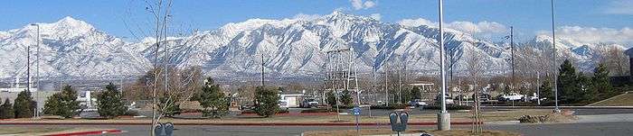
There are actually two sets of well-known Twin Peaks of the Wasatch Front in Utah. "Broad's Fork" Twin Peaks, overlooking the Salt Lake Valley, and "American Fork" Twin Peaks which is located less than five miles to the southeast. "American Fork" Twin Peaks is actually the higher of the two, at 11,489 feet (3,502 m), and is the tallest peak of Salt Lake County. "Broads Fork" Twin Peaks is only 11,330 ft tall (3,450 m) and the second highest of Salt Lake County. While standing atop either one, the other can easily be seen. American Fork Canyon lies on the southern flank of its Twins with Little Cottonwood Canyon to the north. Broad's Fork Twins is also flanked by Little Cottonwood Canyon, but to the south and Broad's Fork, a side-canyon of Big Cottonwood Canyon, to the north. Deaf Smith Canyon and Ferguson Canyon also make their short courses up the western side of Broad's Fork Twin Peaks.
Salt Lake City (capital) | |||||||||||||
| Topics |
|  | |||||||||||
| Society |
| ||||||||||||
| Regions | |||||||||||||
| Largest cities |
| ||||||||||||
| Counties | |||||||||||||
| Attractions |
| ||||||||||||
| Twin Peaks (Broad's Fork) | |
|---|---|
| Highest point | |
| Elevation | 11,330 ft (3,453 m) |
| Coordinates | 40°35′37″N 111°43′24″W |
| Geography | |
| Location | Salt Lake County, Utah, U.S. |
| Parent range | Wasatch Range |
| Twin Peaks (American Fork) | |
|---|---|
| Highest point | |
| Elevation | 11,489 ft (3,502 m) |
| Coordinates | 40°33′07″N 111°39′25″W |
| Geography | |
| Location | Utah, U.S. |
| Parent range | Wasatch Range |