Saint-Théoffrey
Saint-Théoffrey is a commune in the Isère department in southeastern France.
Saint-Théoffrey | |
|---|---|
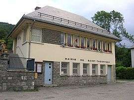 Town hall | |
Location of Saint-Théoffrey 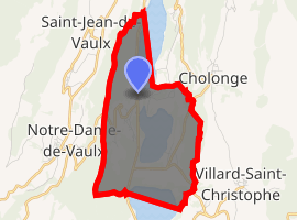
| |
 Saint-Théoffrey  Saint-Théoffrey | |
| Coordinates: 44°59′59″N 5°46′25″E | |
| Country | France |
| Region | Auvergne-Rhône-Alpes |
| Department | Isère |
| Arrondissement | Grenoble |
| Canton | Matheysine-Trièves |
| Intercommunality | Matheysine |
| Government | |
| • Mayor (2014–2020) | Bernard Meckler |
| Area 1 | 6 km2 (2 sq mi) |
| Population (2017-01-01)[1] | 521 |
| • Density | 87/km2 (220/sq mi) |
| Time zone | UTC+01:00 (CET) |
| • Summer (DST) | UTC+02:00 (CEST) |
| INSEE/Postal code | 38462 /38119 |
| Elevation | 905–1,240 m (2,969–4,068 ft) (avg. 940 m or 3,080 ft) |
| 1 French Land Register data, which excludes lakes, ponds, glaciers > 1 km2 (0.386 sq mi or 247 acres) and river estuaries. | |
Population
| Historical population | ||
|---|---|---|
| Year | Pop. | ±% |
| 1793 | 262 | — |
| 1806 | 267 | +1.9% |
| 1821 | 309 | +15.7% |
| 1831 | 401 | +29.8% |
| 1841 | 456 | +13.7% |
| 1851 | 457 | +0.2% |
| 1861 | 447 | −2.2% |
| 1872 | 411 | −8.1% |
| 1881 | 352 | −14.4% |
| 1892 | 334 | −5.1% |
| 1901 | 323 | −3.3% |
| 1911 | 314 | −2.8% |
| 1921 | 258 | −17.8% |
| 1931 | 242 | −6.2% |
| 1946 | 225 | −7.0% |
| 1954 | 218 | −3.1% |
| 1962 | 215 | −1.4% |
| 1968 | 171 | −20.5% |
| 1975 | 115 | −32.7% |
| 1982 | 210 | +82.6% |
| 1990 | 279 | +32.9% |
| 1999 | 342 | +22.6% |
| 2006 | 417 | +21.9% |
| 2011 | 454 | +8.9% |
See also
References
- "Populations légales 2017". INSEE. Retrieved 6 January 2020.
| Wikimedia Commons has media related to Saint-Théoffrey. |
| Authority control |
|
|---|
This article is issued from Wikipedia. The text is licensed under Creative Commons - Attribution - Sharealike. Additional terms may apply for the media files.