Corenc
Corenc is a commune in the département of Isère in southeastern France. It is an upscale suburb of Grenoble.
Corenc | |
|---|---|
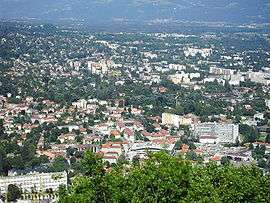 Corenc is in the background; in the foreground is La Tronche | |
 Coat of arms | |
Location of Corenc 
| |
 Corenc  Corenc | |
| Coordinates: 45°12′44″N 5°45′05″E | |
| Country | France |
| Region | Auvergne-Rhône-Alpes |
| Department | Isère |
| Arrondissement | Grenoble |
| Canton | Meylan |
| Intercommunality | Grenoble-Alpes Métropole |
| Government | |
| • Mayor (2014–2020) | Jean-Damien Mermillod-Blondin |
| Area 1 | 6.5 km2 (2.5 sq mi) |
| Population (2017-01-01)[1] | 4,013 |
| • Density | 620/km2 (1,600/sq mi) |
| Time zone | UTC+01:00 (CET) |
| • Summer (DST) | UTC+02:00 (CEST) |
| INSEE/Postal code | 38126 /38700 |
| Elevation | 221–1,328 m (725–4,357 ft) (avg. 467 m or 1,532 ft) |
| 1 French Land Register data, which excludes lakes, ponds, glaciers > 1 km2 (0.386 sq mi or 247 acres) and river estuaries. | |
Population
| Historical population | ||
|---|---|---|
| Year | Pop. | ±% |
| 1793 | 479 | — |
| 1806 | 552 | +15.2% |
| 1821 | 586 | +6.2% |
| 1831 | 568 | −3.1% |
| 1841 | 709 | +24.8% |
| 1851 | 807 | +13.8% |
| 1861 | 739 | −8.4% |
| 1872 | 701 | −5.1% |
| 1881 | 927 | +32.2% |
| 1891 | 901 | −2.8% |
| 1901 | 895 | −0.7% |
| 1911 | 806 | −9.9% |
| 1921 | 767 | −4.8% |
| 1931 | 1,156 | +50.7% |
| 1946 | 1,739 | +50.4% |
| 1954 | 2,508 | +44.2% |
| 1962 | 2,510 | +0.1% |
| 1968 | 2,850 | +13.5% |
| 1975 | 3,029 | +6.3% |
| 1982 | 3,138 | +3.6% |
| 1990 | 3,356 | +6.9% |
| 1999 | 3,856 | +14.9% |
| 2007 | 3,773 | −2.2% |
| 2011 | 3,898 | +3.3% |
Economy
In 2007, Corenc's per capita income of €30,742 was the highest of any commune of France outside of the Paris region, and was nearly double the national average of €15,849.
See also
- Urban unit of Grenoble
- Mélanie Calvat
References
External links
| Wikimedia Commons has media related to Corenc. |
| Authority control |
|
|---|
- "Populations légales 2017". INSEE. Retrieved 6 January 2020.
This article is issued from Wikipedia. The text is licensed under Creative Commons - Attribution - Sharealike. Additional terms may apply for the media files.