Montferrat, Isère
Montferrat is a commune in the Isère department in southeastern France.
Montferrat | |
|---|---|
 The church of Montferrat | |
Location of Montferrat 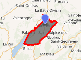
| |
 Montferrat  Montferrat | |
| Coordinates: 45°29′19″N 5°35′29″E | |
| Country | France |
| Region | Auvergne-Rhône-Alpes |
| Department | Isère |
| Arrondissement | La Tour-du-Pin |
| Canton | Le Grand-Lemps |
| Intercommunality | CA Pays Voironnais |
| Government | |
| • Mayor (2014–2020) | René Philip |
| Area 1 | 12.26 km2 (4.73 sq mi) |
| Population (2017-01-01)[1] | 1,786 |
| • Density | 150/km2 (380/sq mi) |
| Time zone | UTC+01:00 (CET) |
| • Summer (DST) | UTC+02:00 (CEST) |
| INSEE/Postal code | 38256 /38620 |
| Elevation | 488–721 m (1,601–2,365 ft) (avg. 557 m or 1,827 ft) |
| 1 French Land Register data, which excludes lakes, ponds, glaciers > 1 km2 (0.386 sq mi or 247 acres) and river estuaries. | |
Population
| Historical population | ||
|---|---|---|
| Year | Pop. | ±% |
| 1793 | 902 | — |
| 1806 | 1,082 | +20.0% |
| 1821 | 1,078 | −0.4% |
| 1831 | 1,326 | +23.0% |
| 1841 | 1,404 | +5.9% |
| 1851 | 1,353 | −3.6% |
| 1861 | 1,188 | −12.2% |
| 1872 | 1,088 | −8.4% |
| 1881 | 1,007 | −7.4% |
| 1891 | 973 | −3.4% |
| 1901 | 899 | −7.6% |
| 1911 | 806 | −10.3% |
| 1921 | 708 | −12.2% |
| 1931 | 735 | +3.8% |
| 1946 | 646 | −12.1% |
| 1954 | 709 | +9.8% |
| 1962 | 680 | −4.1% |
| 1968 | 669 | −1.6% |
| 1975 | 680 | +1.6% |
| 1982 | 981 | +44.3% |
| 1990 | 1,249 | +27.3% |
| 1999 | 1,286 | +3.0% |
| 2006 | 1,430 | +11.2% |
| 2011 | 1,595 | +11.5% |
References
- "Populations légales 2017". INSEE. Retrieved 6 January 2020.
| Wikimedia Commons has media related to Montferrat (Isère). |
| Authority control |
|---|
This article is issued from Wikipedia. The text is licensed under Creative Commons - Attribution - Sharealike. Additional terms may apply for the media files.