Le Champ-près-Froges
Le Champ-près-Froges is a commune in the Isère department in southeastern France.
Le Champ-près-Froges | |
|---|---|
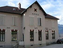 Town hall | |
Location of Le Champ-près-Froges 
| |
 Le Champ-près-Froges  Le Champ-près-Froges | |
| Coordinates: 45°16′54″N 5°56′22″E | |
| Country | France |
| Region | Auvergne-Rhône-Alpes |
| Department | Isère |
| Arrondissement | Grenoble |
| Canton | Le Haut-Grésivaudan |
| Intercommunality | CC Le Grésivaudan |
| Government | |
| • Mayor (2014–2020) | Gilbert Reymond |
| Area 1 | 5 km2 (2 sq mi) |
| Population (2017-01-01)[1] | 1,197 |
| • Density | 240/km2 (620/sq mi) |
| Time zone | UTC+01:00 (CET) |
| • Summer (DST) | UTC+02:00 (CEST) |
| INSEE/Postal code | 38070 /38190 |
| Elevation | 220–826 m (722–2,710 ft) (avg. 320 m or 1,050 ft) |
| 1 French Land Register data, which excludes lakes, ponds, glaciers > 1 km2 (0.386 sq mi or 247 acres) and river estuaries. | |
Population
| Historical population | ||
|---|---|---|
| Year | Pop. | ±% |
| 1793 | 600 | — |
| 1800 | 538 | −10.3% |
| 1821 | 286 | −46.8% |
| 1831 | 555 | +94.1% |
| 1841 | 567 | +2.2% |
| 1851 | 530 | −6.5% |
| 1861 | 510 | −3.8% |
| 1872 | 504 | −1.2% |
| 1881 | 502 | −0.4% |
| 1891 | 423 | −15.7% |
| 1901 | 376 | −11.1% |
| 1911 | 405 | +7.7% |
| 1921 | 403 | −0.5% |
| 1931 | 453 | +12.4% |
| 1946 | 397 | −12.4% |
| 1954 | 470 | +18.4% |
| 1962 | 577 | +22.8% |
| 1968 | 556 | −3.6% |
| 1975 | 701 | +26.1% |
| 1982 | 924 | +31.8% |
| 1990 | 1,008 | +9.1% |
| 1999 | 1,158 | +14.9% |
| 2009 | 1,224 | +5.7% |
See also
- Urban unit of Grenoble
- Communes of the Isère department
References
- "Populations légales 2017". INSEE. Retrieved 6 January 2020.
| Wikimedia Commons has media related to Le Champ-près-Froges. |
| Authority control |
|
|---|
This article is issued from Wikipedia. The text is licensed under Creative Commons - Attribution - Sharealike. Additional terms may apply for the media files.