Saint-Clair-de-la-Tour
Saint-Clair-de-la-Tour is a commune in the Isère department in southeastern France.
Saint-Clair-de-la-Tour | |
|---|---|
 Saint-Clair-de-la-Tour around 1925 | |
Location of Saint-Clair-de-la-Tour 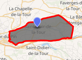
| |
 Saint-Clair-de-la-Tour  Saint-Clair-de-la-Tour | |
| Coordinates: 45°34′29″N 5°28′57″E | |
| Country | France |
| Region | Auvergne-Rhône-Alpes |
| Department | Isère |
| Arrondissement | La Tour-du-Pin |
| Canton | La Tour-du-Pin |
| Intercommunality | Les Vallons de La Tour du Pin |
| Government | |
| • Mayor (2014–2020) | Jean-François Deldicque |
| Area 1 | 9.24 km2 (3.57 sq mi) |
| Population (2017-01-01)[1] | 3,424 |
| • Density | 370/km2 (960/sq mi) |
| Time zone | UTC+01:00 (CET) |
| • Summer (DST) | UTC+02:00 (CEST) |
| INSEE/Postal code | 38377 /38110 |
| Elevation | 314–425 m (1,030–1,394 ft) (avg. 340 m or 1,120 ft) |
| 1 French Land Register data, which excludes lakes, ponds, glaciers > 1 km2 (0.386 sq mi or 247 acres) and river estuaries. | |
Geography
The Bourbre flows west through the middle of the commune and crosses the village.
Population
| Historical population | ||
|---|---|---|
| Year | Pop. | ±% |
| 1793 | 601 | — |
| 1806 | 690 | +14.8% |
| 1821 | 916 | +32.8% |
| 1831 | 991 | +8.2% |
| 1841 | 945 | −4.6% |
| 1851 | 1,038 | +9.8% |
| 1861 | 1,120 | +7.9% |
| 1872 | 1,100 | −1.8% |
| 1881 | 1,157 | +5.2% |
| 1891 | 1,124 | −2.9% |
| 1901 | 1,332 | +18.5% |
| 1911 | 1,473 | +10.6% |
| 1921 | 1,480 | +0.5% |
| 1931 | 1,895 | +28.0% |
| 1946 | 1,759 | −7.2% |
| 1954 | 1,921 | +9.2% |
| 1962 | 1,996 | +3.9% |
| 1968 | 1,808 | −9.4% |
| 1975 | 2,244 | +24.1% |
| 1982 | 2,758 | +22.9% |
| 1990 | 2,565 | −7.0% |
| 1999 | 2,677 | +4.4% |
| 2006 | 3,065 | +14.5% |
| 2011 | 3,393 | +10.7% |
See also
References
| Wikimedia Commons has media related to Saint-Clair-de-la-Tour. |
- "Populations légales 2017". INSEE. Retrieved 6 January 2020.
| Authority control |
|
|---|
This article is issued from Wikipedia. The text is licensed under Creative Commons - Attribution - Sharealike. Additional terms may apply for the media files.