Ruy, Isère
Ruy is a commune in the Isère department in southeastern France.
Ruy | |
|---|---|
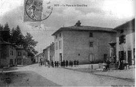 Ruy in 1907 | |
Location of Ruy 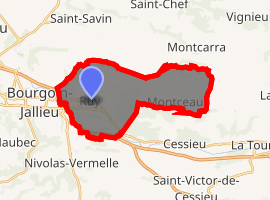
| |
 Ruy  Ruy | |
| Coordinates: 45°35′21″N 5°19′07″E | |
| Country | France |
| Region | Auvergne-Rhône-Alpes |
| Department | Isère |
| Arrondissement | La Tour-du-Pin |
| Canton | Bourgoin-Jallieu |
| Intercommunality | Porte de l'Isère |
| Government | |
| • Mayor (2014–2020) | Guy Rabuel |
| Area 1 | 20.81 km2 (8.03 sq mi) |
| Population (2017-01-01)[1] | 4,529 |
| • Density | 220/km2 (560/sq mi) |
| Time zone | UTC+01:00 (CET) |
| • Summer (DST) | UTC+02:00 (CEST) |
| INSEE/Postal code | 38348 /38300 |
| Elevation | 244–505 m (801–1,657 ft) (avg. 260 m or 850 ft) |
| 1 French Land Register data, which excludes lakes, ponds, glaciers > 1 km2 (0.386 sq mi or 247 acres) and river estuaries. | |
Geography
The Bourbre forms most of the commune's southwestern border.
Population
| Historical population | ||
|---|---|---|
| Year | Pop. | ±% |
| 1793 | 993 | — |
| 1806 | 1,035 | +4.2% |
| 1821 | 1,237 | +19.5% |
| 1831 | 1,278 | +3.3% |
| 1841 | 1,367 | +7.0% |
| 1851 | 1,381 | +1.0% |
| 1861 | 1,396 | +1.1% |
| 1872 | 1,411 | +1.1% |
| 1881 | 1,300 | −7.9% |
| 1891 | 1,329 | +2.2% |
| 1901 | 1,455 | +9.5% |
| 1911 | 1,339 | −8.0% |
| 1921 | 1,279 | −4.5% |
| 1931 | 1,514 | +18.4% |
| 1946 | 1,280 | −15.5% |
| 1954 | 1,340 | +4.7% |
| 1962 | 1,402 | +4.6% |
| 1968 | 1,526 | +8.8% |
| 1975 | 2,184 | +43.1% |
| 1975 | 2,184 | +0.0% |
| 1982 | 2,619 | +19.9% |
| 1990 | 3,143 | +20.0% |
| 1999 | 3,762 | +19.7% |
| 2006 | 3,993 | +6.1% |
| 2011 | 4,253 | +6.5% |
See also
References
| Wikimedia Commons has media related to Ruy-Montceau. |
- "Populations légales 2017". INSEE. Retrieved 6 January 2020.
| Authority control |
|
|---|
This article is issued from Wikipedia. The text is licensed under Creative Commons - Attribution - Sharealike. Additional terms may apply for the media files.