Bizonnes
Bizonnes is a commune in the Isère department in southeastern France. The closest airport to Bizonnes is Grenoble Airport (10 km). Also nearby are Lyon Airport (37 km), Chambéry Airport (45 km), or St Etienne Airport (84 km).[2]
Bizonnes | |
|---|---|
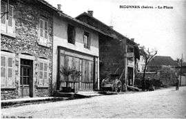 The village square in 1910 | |
Location of Bizonnes 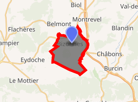
| |
 Bizonnes  Bizonnes | |
| Coordinates: 45°27′21″N 5°22′52″E | |
| Country | France |
| Region | Auvergne-Rhône-Alpes |
| Department | Isère |
| Arrondissement | La Tour-du-Pin |
| Canton | Le Grand-Lemps |
| Intercommunality | Bièvre Est |
| Government | |
| • Mayor (2008–2014) | Joseph Charvet |
| Area 1 | 11.04 km2 (4.26 sq mi) |
| Population (2017-01-01)[1] | 963 |
| • Density | 87/km2 (230/sq mi) |
| Time zone | UTC+01:00 (CET) |
| • Summer (DST) | UTC+02:00 (CEST) |
| INSEE/Postal code | 38046 /38690 |
| Elevation | 529–642 m (1,736–2,106 ft) (avg. 630 m or 2,070 ft) |
| 1 French Land Register data, which excludes lakes, ponds, glaciers > 1 km2 (0.386 sq mi or 247 acres) and river estuaries. | |
Geography
Bizonnes is located 20 miles from Bourgoin-Jallieu and 18 km from Voiron.
Population
| Historical population | ||
|---|---|---|
| Year | Pop. | ±% |
| 1962 | 575 | — |
| 1968 | 564 | −1.9% |
| 1975 | 584 | +3.5% |
| 1982 | 609 | +4.3% |
| 1990 | 623 | +2.3% |
| 1999 | 629 | +1.0% |
| 2009 | 791 | +25.8% |
See also
References
- "Populations légales 2017". INSEE. Retrieved 6 January 2020.
- frenchconnections.co.uk Archived 2011-10-05 at the Wayback Machine
| Wikimedia Commons has media related to Bizonnes. |
| Authority control |
|
|---|
This article is issued from Wikipedia. The text is licensed under Creative Commons - Attribution - Sharealike. Additional terms may apply for the media files.