Le Pont-de-Beauvoisin, Isère
Le Pont-de-Beauvoisin (name correctly Pont-de-Beauvoisin since 1963) is a commune in the Isère department in southeastern France.
Pont-de-Beauvoisin | |
|---|---|
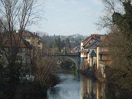 Bridge over the Guiers | |
 Coat of arms | |
Location of Pont-de-Beauvoisin 
| |
 Pont-de-Beauvoisin  Pont-de-Beauvoisin | |
| Coordinates: 45°32′06″N 5°40′16″E | |
| Country | France |
| Region | Auvergne-Rhône-Alpes |
| Department | Isère |
| Arrondissement | La Tour-du-Pin |
| Canton | Chartreuse-Guiers |
| Intercommunality | Les Vallons du Guiers |
| Government | |
| • Mayor (2014–2020) | Michel Serrano |
| Area 1 | 7.36 km2 (2.84 sq mi) |
| Population (2017-01-01)[1] | 3,630 |
| • Density | 490/km2 (1,300/sq mi) |
| Time zone | UTC+01:00 (CET) |
| • Summer (DST) | UTC+02:00 (CEST) |
| INSEE/Postal code | 38315 /38480 |
| Elevation | 239–332 m (784–1,089 ft) |
| 1 French Land Register data, which excludes lakes, ponds, glaciers > 1 km2 (0.386 sq mi or 247 acres) and river estuaries. | |
Population
| Historical population | ||
|---|---|---|
| Year | Pop. | ±% |
| 1793 | 1,505 | — |
| 1806 | 1,543 | +2.5% |
| 1821 | 1,849 | +19.8% |
| 1831 | 2,139 | +15.7% |
| 1841 | 2,268 | +6.0% |
| 1851 | 2,394 | +5.6% |
| 1861 | 1,871 | −21.8% |
| 1872 | 1,784 | −4.6% |
| 1881 | 1,883 | +5.5% |
| 1891 | 2,032 | +7.9% |
| 1901 | 2,010 | −1.1% |
| 1911 | 2,120 | +5.5% |
| 1921 | 1,925 | −9.2% |
| 1931 | 1,907 | −0.9% |
| 1946 | 2,023 | +6.1% |
| 1954 | 2,053 | +1.5% |
| 1962 | 1,935 | −5.7% |
| 1968 | 2,716 | +40.4% |
| 1975 | 2,796 | +2.9% |
| 1982 | 2,564 | −8.3% |
| 1990 | 2,369 | −7.6% |
| 1999 | 2,504 | +5.7% |
| 2006 | 3,053 | +21.9% |
| 2011 | 3,476 | +13.9% |
International relations

See also
- Communes of the Isère department
- Disappearance of Maëlys de Araujo
External links
| Wikimedia Commons has media related to Le Pont-de-Beauvoisin (Isère). |
| Authority control |
|
|---|
This article is issued from Wikipedia. The text is licensed under Creative Commons - Attribution - Sharealike. Additional terms may apply for the media files.