Saint-Baudille-et-Pipet
Saint-Baudille-et-Pipet is a commune in the Isère department in southeastern France.
Saint-Baudille-et-Pipet | |
|---|---|
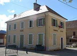 The town hall of Saint-Baudille-et-Pipet | |
Location of Saint-Baudille-et-Pipet 
| |
 Saint-Baudille-et-Pipet  Saint-Baudille-et-Pipet | |
| Coordinates: 44°47′06″N 5°46′10″E | |
| Country | France |
| Region | Auvergne-Rhône-Alpes |
| Department | Isère |
| Arrondissement | Grenoble |
| Canton | Matheysine-Trièves |
| Intercommunality | Mens |
| Government | |
| • Mayor (2014–2020) | Jean-Louis Poite |
| Area 1 | 36 km2 (14 sq mi) |
| Population (2017-01-01)[1] | 257 |
| • Density | 7.1/km2 (18/sq mi) |
| Time zone | UTC+01:00 (CET) |
| • Summer (DST) | UTC+02:00 (CEST) |
| INSEE/Postal code | 38366 /38710 |
| Elevation | 718–2,696 m (2,356–8,845 ft) (avg. 830 m or 2,720 ft) |
| 1 French Land Register data, which excludes lakes, ponds, glaciers > 1 km2 (0.386 sq mi or 247 acres) and river estuaries. | |
Population
| Historical population | ||
|---|---|---|
| Year | Pop. | ±% |
| 1793 | 787 | — |
| 1806 | 835 | +6.1% |
| 1821 | 775 | −7.2% |
| 1831 | 626 | −19.2% |
| 1841 | 790 | +26.2% |
| 1851 | 718 | −9.1% |
| 1861 | 653 | −9.1% |
| 1872 | 603 | −7.7% |
| 1881 | 580 | −3.8% |
| 1891 | 525 | −9.5% |
| 1901 | 466 | −11.2% |
| 1911 | 426 | −8.6% |
| 1921 | 375 | −12.0% |
| 1931 | 343 | −8.5% |
| 1946 | 338 | −1.5% |
| 1954 | 327 | −3.3% |
| 1962 | 286 | −12.5% |
| 1968 | 251 | −12.2% |
| 1975 | 209 | −16.7% |
| 1982 | 209 | +0.0% |
| 1990 | 215 | +2.9% |
| 1999 | 232 | +7.9% |
| 2006 | 246 | +6.0% |
| 2011 | 250 | +1.6% |
See also
References
- "Populations légales 2017". INSEE. Retrieved 6 January 2020.
| Wikimedia Commons has media related to Saint-Baudille-et-Pipet. |
| Authority control |
|
|---|
This article is issued from Wikipedia. The text is licensed under Creative Commons - Attribution - Sharealike. Additional terms may apply for the media files.