Corps, Isère
Corps is a commune in the department of Isère in southeastern France.
Corps | |
|---|---|
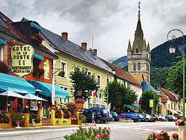 The Rue des Fossés in Corps | |
 Coat of arms | |
Location of Corps 
| |
 Corps  Corps | |
| Coordinates: 44°49′10″N 5°56′51″E | |
| Country | France |
| Region | Auvergne-Rhône-Alpes |
| Department | Isère |
| Arrondissement | Grenoble |
| Canton | Matheysine-Trièves |
| Intercommunality | Pays de Corps |
| Government | |
| • Mayor (2014–2020) | Fabien Mulyk |
| Area 1 | 11 km2 (4 sq mi) |
| Population (2017-01-01)[1] | 486 |
| • Density | 44/km2 (110/sq mi) |
| Time zone | UTC+01:00 (CET) |
| • Summer (DST) | UTC+02:00 (CEST) |
| INSEE/Postal code | 38128 /38970 |
| Elevation | 639–1,840 m (2,096–6,037 ft) (avg. 937 m or 3,074 ft) |
| 1 French Land Register data, which excludes lakes, ponds, glaciers > 1 km2 (0.386 sq mi or 247 acres) and river estuaries. | |
Geography
Corps is situated in the Alps and borders on the frontier between the départments of Isère and Hautes-Alpes.
Population
| Historical population | ||
|---|---|---|
| Year | Pop. | ±% |
| 1793 | 935 | — |
| 1806 | 1,238 | +32.4% |
| 1821 | 1,128 | −8.9% |
| 1831 | 1,441 | +27.7% |
| 1841 | 1,386 | −3.8% |
| 1851 | 1,350 | −2.6% |
| 1861 | 1,335 | −1.1% |
| 1872 | 1,306 | −2.2% |
| 1881 | 1,356 | +3.8% |
| 1891 | 1,226 | −9.6% |
| 1901 | 1,104 | −10.0% |
| 1911 | 942 | −14.7% |
| 1921 | 737 | −21.8% |
| 1931 | 899 | +22.0% |
| 1946 | 1,128 | +25.5% |
| 1954 | 687 | −39.1% |
| 1962 | 608 | −11.5% |
| 1968 | 556 | −8.6% |
| 1975 | 465 | −16.4% |
| 1982 | 505 | +8.6% |
| 1990 | 512 | +1.4% |
| 1999 | 453 | −11.5% |
| 2005 | 456 | +0.7% |
| 2010 | 511 | +12.1% |
| 2015 | 478 | −6.5% |
See also
References
External links
| Wikimedia Commons has media related to Corps (Isère). |
| Authority control |
|
|---|
- "Populations légales 2017". INSEE. Retrieved 6 January 2020.
This article is issued from Wikipedia. The text is licensed under Creative Commons - Attribution - Sharealike. Additional terms may apply for the media files.