Chélieu
Chélieu is a commune in the Isère department in southeastern France.
Chélieu | |
|---|---|
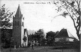 The church at the start of the 20th century | |
Location of Chélieu 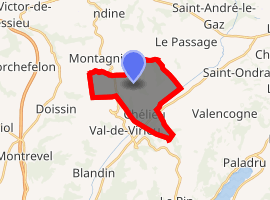
| |
 Chélieu  Chélieu | |
| Coordinates: 45°30′46″N 5°28′36″E | |
| Country | France |
| Region | Auvergne-Rhône-Alpes |
| Department | Isère |
| Arrondissement | La Tour-du-Pin |
| Canton | Le Grand-Lemps |
| Intercommunality | Vallée de la Bourbre |
| Government | |
| • Mayor (2014–2020) | Max Gauthier |
| Area 1 | 10.13 km2 (3.91 sq mi) |
| Population (2017-01-01)[1] | 676 |
| • Density | 67/km2 (170/sq mi) |
| Time zone | UTC+01:00 (CET) |
| • Summer (DST) | UTC+02:00 (CEST) |
| INSEE/Postal code | 38098 /38730 |
| Elevation | 374–607 m (1,227–1,991 ft) |
| 1 French Land Register data, which excludes lakes, ponds, glaciers > 1 km2 (0.386 sq mi or 247 acres) and river estuaries. | |
Geography
The Bourbre flows northeast through the eastern part of the commune and forms part of its northeastern border.
Population
| Historical population | ||
|---|---|---|
| Year | Pop. | ±% |
| 1800 | 680 | — |
| 1821 | 802 | +17.9% |
| 1831 | 901 | +12.3% |
| 1841 | 805 | −10.7% |
| 1851 | 760 | −5.6% |
| 1861 | 696 | −8.4% |
| 1872 | 670 | −3.7% |
| 1881 | 587 | −12.4% |
| 1891 | 598 | +1.9% |
| 1901 | 567 | −5.2% |
| 1911 | 517 | −8.8% |
| 1921 | 482 | −6.8% |
| 1931 | 487 | +1.0% |
| 1946 | 448 | −8.0% |
| 1962 | 407 | −9.2% |
| 1968 | 378 | −7.1% |
| 1982 | 368 | −2.6% |
| 1990 | 415 | +12.8% |
| 1999 | 522 | +25.8% |
| 2011 | 668 | +28.0% |
See also
References
- "Populations légales 2017". INSEE. Retrieved 6 January 2020.
| Wikimedia Commons has media related to Chélieu. |
This article is issued from Wikipedia. The text is licensed under Creative Commons - Attribution - Sharealike. Additional terms may apply for the media files.