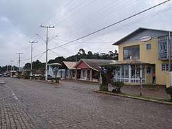
São José dos Ausentes
São José dos Ausentes is a municipality with an average altitude of 1200 meters, in the state of Rio Grande do Sul, Brazil. Its population was approximately 3300 in 2010. It has an area of approximately 1176 km². Pico do Monte Negro is located in São José dos Ausentes, with its peak 1403 meters above sea level. It is the highest point in Rio Grande do Sul State. The town is 220 km far from state's capital Porto Alegre City.
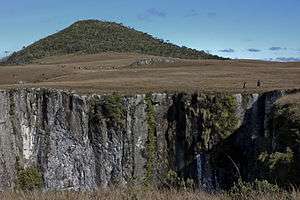

Canyons

Frost in rural zone's town
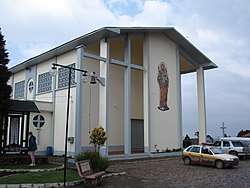
São José dos Ausentes main church
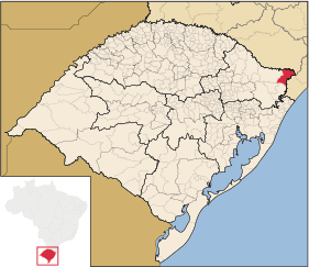
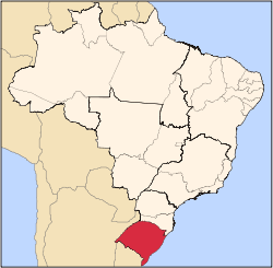
Location in Rio Grande do Sul State
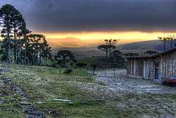
Sunset near Monte Negro Peak
São José dos Ausentes Ausentino | |
|---|---|
 | |
 Flag  Seal | |
| Nickname(s): Ausentes(Absents in english) | |
 São José dos Ausentes Location in Brazil | |
| Coordinates: 28°45′00″S 50°03′50″W | |
| Country | Brazil |
| Region | South |
| State | State of Rio Grande do Sul |
| Founded | Mars 20, 1992 |
| Government | |
| • Mayor | Paulo Guimarães (PMDB) |
| Area | |
| • Total | 1,176.685 km2 (454.321 sq mi) |
| Elevation | 1,200 m (3,900 ft) |
| Population (2010)[1] | |
| • Total | 3,290 |
| • Density | 2.796/km2 (7.24/sq mi) |
| Time zone | UTC-3 (UTC-3) |
| • Summer (DST) | UTC-2 (UTC-2) |
| Website | São José dos Ausentes City Hall |
Climate
São José dos Ausentes features an Oceanic climate (type Cfb), It features an annual uniform precipitation. The Annual average temperature is 13 °C The city is one of the coldest in Brazil and snow precipitation is not uncommon.
| Climate data for São José dos Ausentes | |||||||||||||
|---|---|---|---|---|---|---|---|---|---|---|---|---|---|
| Month | Jan | Feb | Mar | Apr | May | Jun | Jul | Aug | Sep | Oct | Nov | Dec | Year |
| Average high °C (°F) | 23.8 (74.8) |
22.8 (73.0) |
20.5 (68.9) |
17.9 (64.2) |
15.9 (60.6) |
15.4 (59.7) |
16.0 (60.8) |
17.2 (63.0) |
18.6 (65.5) |
20.2 (68.4) |
21.2 (70.2) |
22.6 (72.7) |
19.7 (67.5) |
| Daily mean °C (°F) | 18.9 (66.0) |
18.2 (64.8) |
15.9 (60.6) |
13.4 (56.1) |
11.3 (52.3) |
10.7 (51.3) |
11.2 (52.2) |
12.3 (54.1) |
13.6 (56.5) |
15.1 (59.2) |
16.9 (62.4) |
15.7 (60.3) |
14.4 (57.9) |
| Average low °C (°F) | 14.1 (57.4) |
13.6 (56.5) |
11.4 (52.5) |
8.9 (48.0) |
6.8 (44.2) |
6.1 (43.0) |
6.5 (43.7) |
7.4 (45.3) |
8.6 (47.5) |
10.1 (50.2) |
11.8 (53.2) |
10.8 (51.4) |
9.3 (48.7) |
| Average precipitation mm (inches) | 176 (6.9) |
172 (6.8) |
145 (5.7) |
121 (4.8) |
127 (5.0) |
135 (5.3) |
143 (5.6) |
165 (6.5) |
171 (6.7) |
153 (6.0) |
131 (5.2) |
134 (5.3) |
1,773 (69.8) |
| Source: Climate Data.[2] | |||||||||||||
References
- http://www.ibge.gov.br/home/estatistica/populacao/estimativa2006/POP_2006_DOU.pdf
- "São José dos Ausentes Weather" (in Portuguese). Climate Data. Retrieved 13 October 2014.
This article is issued from Wikipedia. The text is licensed under Creative Commons - Attribution - Sharealike. Additional terms may apply for the media files.