Arroio do Sal
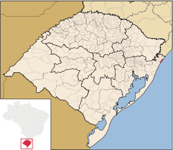
Arroio do Sal is a municipality in the state of Rio Grande do Sul, Brazil. It is about 30 km south of Torres and 30 km north of Capão da Canoa, thus in about the northern half of the state's shoreline. It is 175 km from Porto Alegre, with which it is connected via BR 101 and BR 290.
Arroio do Sal | |
|---|---|
Municipality | |
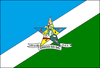 Flag  Coat of arms | |
 | |
| Coordinates: 29°33′03″S 49°53′20″W | |
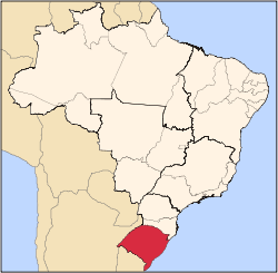
| Country | Brazil |
| State | Rio Grande do Sul |
| Mesoregion | Metropolitana de Porto Alegre[1] |
| Microregion | Osório[1] |
| Founded | April 22, 1988 |
| Government | |
| • Mayor | João Luiz da Rocha |
| Area | |
| • Total | 120.939 km2 (46.695 sq mi) |
| Elevation | 6 m (20 ft) |
| Population | |
| • Total | 7,109 |
| • Density | 59/km2 (150/sq mi) |
| Time zone | UTC-3 (UTC-3) |
| • Summer (DST) | UTC-2 (UTC-2) |
| HDI | 0.813[3] |
| GDP | R$ 54,357,000[4] |
| GDP per capita | R$8,140.00 |
| Website | arroiodosal.rs.gov.br |
Though the population is only about 7,000, during the summer tourism season the number of people increases to about 90,000. It includes 27 km of the Atlantic coast, and has about 60 beaches.
References
- "Divisão Territorial do Brasil". Divisão Territorial do Brasil e Limites Territoriais. Instituto Brasileiro de Geografia e Estatística (IBGE). 1 July 2008. Retrieved 11 October 2008.
- "Estimativas da população para 1º de julho de 2008" (PDF). Instituto Brasileiro de Geografia e Estatística (IBGE). 29 August 2008. Archived (PDF) from the original on 8 September 2008. Retrieved 5 September 2008.
- "Ranking decrescente do IDH-M dos municípios do Brasil". Atlas do Desenvolvimento Humano. Programa das Nações Unidas para o Desenvolvimento (PNUD). 2000. Archived from the original on 3 October 2009. Retrieved 11 October 2008.
- "Produto Interno Bruto dos Municípios 2002-2005" (PDF). Instituto Brasileiro de Geografia e Estatística (IBGE). 19 December 2007. Archived from the original (PDF) on 2 October 2008. Retrieved 11 October 2008.
This article is issued from Wikipedia. The text is licensed under Creative Commons - Attribution - Sharealike. Additional terms may apply for the media files.