Coqueiros do Sul
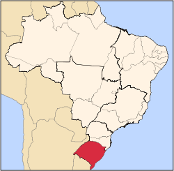
Coqueiros do Sul is a municipality in the North-west of the state of Rio Grande do Sul, Brazil. It's part of the subregion of Carazinho and is situated 306 km to the north-west of Porto Alegre, capital of the state. It is situated on a latitude of -28.118889 and a longitude of -52.782778, and an elevation of 601 meters above the sea level.
Southern Coconut Trees Coqueiros do Sul | |
|---|---|
 Flag  Seal | |
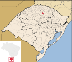 | |
 Southern Coconut Trees Location in Brazil | |
| Coordinates: 28.118889°S 52.782778°W | |
| Country | |
| State | |
| Mesoregion | Noroeste Rio-Grandense |
| Microregion | Carazinho |
| Founded | March 20, 1992 |
| Government | |
| • Mayor | Valoir Chapuis (PP) (2017–2020) |
| Area | |
| • Total | 277.6 km2 (107.2 sq mi) |
| Elevation | 601 m (1,972 ft) |
| Population (2016) | |
| • Total | 2,457 |
| • Density | 8.9/km2 (23/sq mi) |
| Demonym(s) | Coqueirense |
| Time zone | UTC−03:00 (BRT) |
| • Summer (DST) | UTC−02:00 (BRT DST) |
| Postal code | 99528-000 |
| Area code(s) | +54 |
| Website | www.coqueirosul.com.br |
It has an area of 277.637 square kilometres (107.196 sq mi) and had a population of roughly 2,457 inhabitants in 2016 but could have increased to 2327 in 2018.
The municipality has a 98.8% schooling percentage. The child mortality rate is 47.62 deaths per 1,000 live births.
Its population are mostly from German descent (60% in its origin, roughly), but also of Italian and Portuguese descent.
The main economy production of Coqueiros do Sul is agriculture. Soybeans, corn and wheat are the major products.
Photos
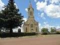 A church in Coqueiros do Sul
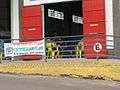 14th Meeting of the Lamb family
References
- "Coqueiros do Sul". IBGE (in Portuguese). Retrieved 2019-07-15.