Arroio do Tigre
Arroio do Tigre is a municipality in the state of Rio Grande do Sul, Brazil.
Arroio do Tigre | |
|---|---|
Municipality | |
 Flag  Seal | |
| Nickname(s): Celeiro do centro-serra | |
 | |
| Coordinates: 29°19′58″S 53°05′34″W | |
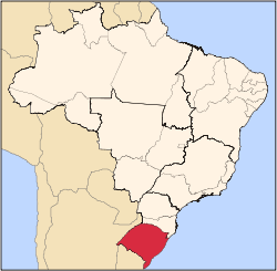
| Country | Brazil |
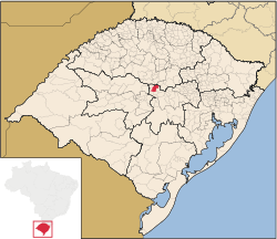
| State | Rio Grande do Sul |
| Mesoregion | Centro Oriental Rio-grandense[1] |
| Microregion | Santa Cruz do Sul[1] |
| Founded | November 6, 1963 |
| Government | |
| • Mayor | Gilberto Rathke |
| Area | |
| • Total | 318.524 km2 (122.983 sq mi) |
| Elevation | 409 m (1,342 ft) |
| Population | |
| • Total | 13,126 |
| • Density | 41/km2 (110/sq mi) |
| Time zone | UTC-3 (UTC-3) |
| • Summer (DST) | UTC-2 (UTC-2) |
| HDI | 0.764[3] |
| GDP | R$ 125,575,000[4] |
| GDP per capita | R$10,093.00 |
The municipality is partly flooded by the reservoir of the Dona Francisca Hydroelectric Plant on the upper Jacuí River.[5]
History
The principal settlement of the region occurred around 1900, when German settlers migrated from the "Colônias Velhas" region (called die Altkolonie, in the regional German dialect Riograndenser Hunsrückisch) of Santa Cruz do Sul and the surrounding areas. Afterwards there was an influx of Italian Brazilians and Portuguese Brazilians. In 1920 it began to be known as Vila Tigre, and found its first commercial buildings, Catholic and Evangelical churches, and later, the Hospital Santa Rosa de Lima and Colégio Sagrado Coração de Jesus. In 1920 an agricultural cooperative, Cooperativa Agrícola Mista Linha Cereja (COMACEL), was founded, which is still active.
Until 1929 the region was part of the municipality of Soledade, then became the third district of Sobradinho. It became its own municipality on November 6, 1963, by the Law No. 605A.
References
- "Divisão Territorial do Brasil". Divisão Territorial do Brasil e Limites Territoriais. Instituto Brasileiro de Geografia e Estatística (IBGE). 1 July 2008. Retrieved 11 October 2008.
- "Estimativas da população para 1º de julho de 2008" (PDF). Instituto Brasileiro de Geografia e Estatística (IBGE). 29 August 2008. Archived (PDF) from the original on 8 September 2008. Retrieved 5 September 2008.
- "Ranking decrescente do IDH-M dos municípios do Brasil". Atlas do Desenvolvimento Humano. Programa das Nações Unidas para o Desenvolvimento (PNUD). 2000. Archived from the original on 3 October 2009. Retrieved 11 October 2008.
- "Produto Interno Bruto dos Municípios 2002-2005" (PDF). Instituto Brasileiro de Geografia e Estatística (IBGE). 19 December 2007. Archived from the original (PDF) on 2 October 2008. Retrieved 11 October 2008.
- Dona Francisca (in Portuguese), OSAB: Observatório Sócio-Ambiental da Baragens, retrieved 2017-01-20