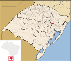
Barão
Barão is a municipality in the state of Rio Grande do Sul, Brazil. It includes the districts Arroio Canoas, Francesa Alta, General Neto and Francesa Baixa. Barão is 80 km from Porto Alegre. The municipality is bordered by Carlos Barbosa (north), São Vendelino (east), Bom Princípio (southeast), Tupandi (southeast), São Pedro da Serra (south), Salvador do Sul (southwest), Poço das Antas (southwest), and Boa Vista do Sul (northwest).
Barão | |
|---|---|
Municipality | |
.png) Flag .png) Coat of arms | |
 | |
| Coordinates: 29°22′37″S 51°29′45″W | |
| Country | Brazil |
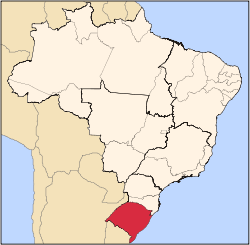
| State | Rio Grande do Sul |
| Mesoregion | Metropolitana de Porto Alegre[1] |
| Microregion | Montenegro IBGE/2008[1] |
| Founded | December 5, 1988 |
| Government | |
| • Mayor | Claudio Ferrari (PT) |
| Area | |
| • Total | 124.497 km2 (48.069 sq mi) |
| Elevation | 642 m (2,106 ft) |
| Population | |
| • Total | 5,444 |
| • Density | 44/km2 (110/sq mi) |
| Time zone | UTC-3 (UTC-3) |
| • Summer (DST) | UTC-2 (UTC-2) |
| HDI | 0.807[3] |
| GDP | R$ 40,682,000[4] |
| GDP per capita | R$7,647.00 |
The residents are primarily of German Brazilian descent.
References
- "Divisão Territorial do Brasil". Divisão Territorial do Brasil e Limites Territoriais. Instituto Brasileiro de Geografia e Estatística (IBGE). 1 July 2008. Retrieved 11 October 2008.
- "Estimativas da população para 1º de julho de 2008" (PDF). Instituto Brasileiro de Geografia e Estatística (IBGE). 29 August 2008. Archived (PDF) from the original on 8 September 2008. Retrieved 5 September 2008.
- "Ranking decrescente do IDH-M dos municípios do Brasil". Atlas do Desenvolvimento Humano. Programa das Nações Unidas para o Desenvolvimento (PNUD). 2000. Archived from the original on 3 October 2009. Retrieved 11 October 2008.
- "Produto Interno Bruto dos Municípios 2002-2005" (PDF). Instituto Brasileiro de Geografia e Estatística (IBGE). 19 December 2007. Archived from the original (PDF) on 2 October 2008. Retrieved 11 October 2008.
External links
- www.cnm.org.br municipal history
This article is issued from Wikipedia. The text is licensed under Creative Commons - Attribution - Sharealike. Additional terms may apply for the media files.