São Francisco de Paula, Rio Grande do Sul
São Francisco de Paula is a city in the Serra Gaúcha of the state of Rio Grande do Sul, Brazil. The municipality covers about 3,289.7 km2 (1,270.2 sq mi) and sits about 112 km (70 mi) from Porto Alegre. City population estimate for 2004 is 19,968. The municipality was originally created on December 23, 1902.
São Francisco de Paula Serrano or Franciscano | |
|---|---|
 | |
 Seal | |
| Nickname(s): São Chico (Saint Francis) | |
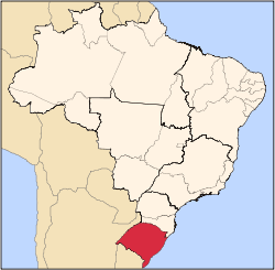
 São Francisco de Paula Location in Brazil | |
| Coordinates: 29°26′40″S 50°34′50″W | |
| Country | Brazil |
| Region | South |
| State | State of Rio Grande do Sul |
| Founded | May 21, 1878 |
| Government | |
| • Mayor | Antonio Juarez Hampel Schlichting (PTB) |
| Area | |
| • Total | 3,273.498 km2 (1,263.905 sq mi) |
| Elevation | 907 m (2,976 ft) |
| Population (2010)[1] | |
| • Total | 20,540 |
| • Density | 6.27/km2 (16.2/sq mi) |
| Time zone | UTC-3 (UTC-3) |
| • Summer (DST) | UTC-2 (UTC-2) |
| Website | São Francisco de Paula City Hall |
The city is a tourist destination and is a link along two official scenic tourist routes: the Região das Hortênsias and the Rota Romântica.
The municipality contains the São Francisco de Paula National Forest, a 1,616 hectares (3,990 acres) sustainable use conservation area created in 1968.[2] It also contains part of the 6,655 hectares (16,440 acres) Tainhas State Park, created in 1975.[3]
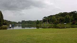
Gallery
.jpg) Main Church
Main Church.jpg) São Francisco de Paula Church seen from inside
São Francisco de Paula Church seen from inside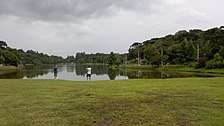 São Francisco de Paula
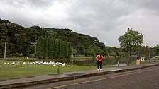 São Francisco de Paula
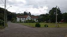 São Francisco de Paula
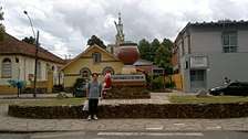 São Francisco de Paula
Climate
São Francisco de Paula Features an Oceanic climate (type Cfb), with humid, cool-to-warm summers and humid cold winters. The experience of Snowfalls on winters can occur every winter in few days between July and August. It is the wettest place in Rio Grande do Sul State with more than 2,100 millimetres (83 in) of rain precipitation per year.
| Month | Jan | Feb | Mar | Apr | May | Jun | Jul | Aug | Sep | Oct | Nov | Dec | Year |
|---|---|---|---|---|---|---|---|---|---|---|---|---|---|
| Average high °C (°F) | 24.9 (76.8) |
24.2 (75.6) |
23.0 (73.4) |
19.9 (67.8) |
17.6 (63.7) |
16.3 (61.3) |
16.3 (61.3) |
17.3 (63.1) |
18.1 (64.6) |
20.0 (68.0) |
22.0 (71.6) |
23.3 (73.9) |
20.2 (68.4) |
| Daily mean °C (°F) | 19.8 (67.6) |
19.4 (66.9) |
18.2 (64.8) |
15.2 (59.4) |
12.9 (55.2) |
11.7 (53.1) |
11.3 (52.3) |
12.3 (54.1) |
13.4 (56.1) |
15.0 (59.0) |
16.8 (62.2) |
18.0 (64.4) |
15.3 (59.5) |
| Average low °C (°F) | 14.8 (58.6) |
14.7 (58.5) |
13.5 (56.3) |
10.5 (50.9) |
8.3 (46.9) |
7.1 (44.8) |
6.4 (43.5) |
7.4 (45.3) |
8.7 (47.7) |
10.1 (50.2) |
11.6 (52.9) |
12.7 (54.9) |
10.5 (50.9) |
| Average precipitation mm (inches) | 187.0 (7.36) |
182.0 (7.17) |
182.0 (7.17) |
169.0 (6.65) |
165.0 (6.50) |
191.0 (7.52) |
170.0 (6.69) |
170.0 (6.69) |
201.0 (7.91) |
188.0 (7.40) |
139.0 (5.47) |
166.0 (6.54) |
2,110 (83.07) |
| Source: Climate Data.[4] | |||||||||||||
References
- http://www.ibge.gov.br/home/estatistica/populacao/estimativa2006/POP_2006_DOU.pdf
- Unidade de Conservação: Floresta Nacional de São Francisco de Paula (in Portuguese), MMA: Ministério do Meio Ambiente, retrieved 2016-05-31
- "Parque Estadual de Tainhas", cambaradosul.tur.br (in Portuguese), archived from the original on 2016-02-14, retrieved 2016-12-09
- "Town Climate: São Francisco de Paula" (in Portuguese). Climate Data. Archived from the original on July 17, 2015. Retrieved October 13, 2014.CS1 maint: BOT: original-url status unknown (link)
External links
- São Francisco de Paula official site (in Portuguese)