Amaral Ferrador
Amaral Ferrador is a municipality in the state of Rio Grande do Sul, Brazil. The population is 6,778 (2015 est.) in an area of 506.46 km².[2] It is situated on the Camaquã River.
Amaral Ferrador | |
|---|---|
 Flag  Coat of arms | |
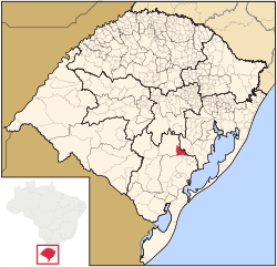 Location in Rio Grande do Sul state | |
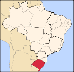
 Amaral Ferrador Location in Brazil | |
| Coordinates: 30°52′30″S 52°15′10″W | |
| Country | Brazil |
| Region | South |
| State | Rio Grande do Sul |
| Mesoregion | Sudeste Rio-Grandense |
| Microregion | Serras de Sudeste |
| Area | |
| • Total | 506.46 km2 (195.55 sq mi) |
| Elevation | 140 m (460 ft) |
| Population (2015)[2] | |
| • Total | 6,778 |
| • Density | 13/km2 (35/sq mi) |
| Time zone | UTC-03:00 (BRT) |
| • Summer (DST) | UTC-02:00 (BRST) |
| Postal code | 96635-xxx |
| Website | www |
Economy
The main economical activities are trade, agriculture (maize, tobacco and beans) and livestock (cattle, sheep and pork).
Demography
Its population consists of 60% Portuguese ancestry, 25% Polish ancestry and 15% Afro-Brazilians.
Bounding municipalities
References
- "Dados Gerais - Amaral Ferrador/RS" (in Portuguese). FAMURS. Archived from the original on 2012-11-29. Retrieved 2008-03-23.
- Instituto Brasileiro de Geografia e Estatística
External links
- Official website of the prefecture
- https://web.archive.org/web/20071116225345/http://www.citybrazil.com.br/rs/amaralferrador/ (in Portuguese)
This article is issued from Wikipedia. The text is licensed under Creative Commons - Attribution - Sharealike. Additional terms may apply for the media files.