Arroio do Meio
Arroio do Meio is a municipality in the state of Rio Grande do Sul, Brazil. It is 98 km from Porto Alegre. It is on the banks of the Taquari River.
Arroio do Meio | |
|---|---|
 Flag  Seal | |
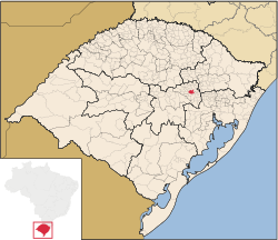 Location within Rio Grande do Sul | |
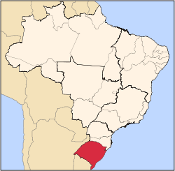
 Arroio do Meio Location in Brazil | |
| Coordinates: 29°24′03″S 51°56′42″W | |
| Country | |
| State | Rio Grande do Sul |
| Mesoregion | Centro Oriental Rio-grandense[1] |
| Microregion | Lajeado-Estrela[1] |
| Settled | 1853 |
| Founded | November 28, 1934 |
| Government | |
| • Mayor | Sidnei Eckerdt (PMDB) |
| Area | |
| • Total | 157.955 km2 (60.987 sq mi) |
| Elevation | 54 m (177 ft) |
| Population | |
| • Total | 20,168 |
| • Density | 130/km2 (330/sq mi) |
| Time zone | UTC-3 (UTC-3) |
| • Summer (DST) | UTC-2 (UTC-2) |
| HDI | 0.837[3] |
| GDP | R$ 405,662,000[4] |
| GDP per capita | R$22,123.00 |
| Website | www |
The territory was little populated before the arrival of Europeans. Settlement in the territory began in 1853, principally by Germans and Portuguese. The territory used to be part of Lajeado and Encantado municipalities.
References
- "Divisão Territorial do Brasil". Divisão Territorial do Brasil e Limites Territoriais. Instituto Brasileiro de Geografia e Estatística (IBGE). 1 July 2008. Retrieved 11 October 2008.
- "Estimativas da população para 1º de julho de 2016" (PDF). Instituto Brasileiro de Geografia e Estatística (IBGE). 13 December 2017. Archived (PDF) from the original on 8 September 2008. Retrieved 22 July 2017.
- "Ranking decrescente do IDH-M dos municípios do Brasil". Atlas do Desenvolvimento Humano. Programa das Nações Unidas para o Desenvolvimento (PNUD). 2000. Archived from the original on 3 October 2009. Retrieved 11 October 2008.
- "Produto Interno Bruto dos Municípios 2002-2005" (PDF). Instituto Brasileiro de Geografia e Estatística (IBGE). 19 December 2007. Archived from the original (PDF) on 2 October 2008. Retrieved 11 October 2008.
External links
This article is issued from Wikipedia. The text is licensed under Creative Commons - Attribution - Sharealike. Additional terms may apply for the media files.