National Register of Historic Places listings in Rock County, Wisconsin
This is a list of the National Register of Historic Places listings in Rock County, Wisconsin. It is intended to provide a comprehensive listing of entries in the National Register of Historic Places that are located in Rock County, Wisconsin. The locations of National Register properties for which the latitude and longitude coordinates are included below may be seen in a map.[1]

Location of Rock County in Wisconsin
There are 139 properties and districts listed on the National Register in the county. Another seven properties were once listed but have been removed.
- This National Park Service list is complete through NPS recent listings posted June 26, 2020.[2]
Current listings
| [3] | Name on the Register[4] | Image | Date listed[5] | Location | City or town | Description |
|---|---|---|---|---|---|---|
| 1 | John Alexander Wheat Warehouse | 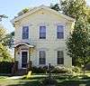 John Alexander Wheat Warehouse |
September 13, 1978 (#78003383) |
304 S. Janesville St. 42°46′29″N 88°56′11″W |
Milton | Italianate-styled warehouse with poured grout walls a foot thick, built about 1850 when wheat was king. Later a blacksmith shop, a filling station, and an apple warehouse.[6][7] |
| 2 | Abram Allen House | 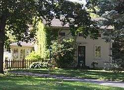 Abram Allen House |
September 13, 1978 (#78003386) |
205 E. Madison Ave. 42°46′45″N 88°56′54″W |
Milton | 1853 house with grout walls and Greek Revival styling, built by Allen, an early settler. |
| 3 | The Armory | 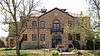 The Armory |
November 21, 1978 (#78000130) |
10 S. High St. 42°40′49″N 89°01′40″W |
Janesville | 1930 armory designed by Lt. Colonel Henry C. Hengles in Spanish Revival style, with walls of colored brick and tile roof. Originally housed the 32nd Tank Company of the Wisconsin National Guard, which helped defend Bataan in 1941-42 and endured the Bataan Death March. Nearly two thirds did not return.[8][9] |
| 4 | Bartlett Memorial Historical Museum | 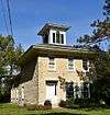 Bartlett Memorial Historical Museum |
April 11, 1977 (#77000048) |
2149 St. Lawrence Ave. 42°30′15″N 89°04′10″W |
Beloit | Greek Revival/Italianate-styled limestone house built around 1857,[10] with barn[11] and smokehouse.[12] Builder James Hanchett built dams, including several on the Rock River. John and Lillie Herrick bought it in 1901, and three of John's sisters became MDs - early for women. Now a museum.[13] |
| 5 | Beloit Power Plant | 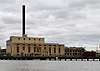 Beloit Power Plant |
July 31, 2017 (#100001404) |
850 Pleasant St. 42°30′23″N 89°01′56″W |
Beloit | Coal-fired, steam turbine power plant, built on the Rock River in 1907 and expanded many times after. Consists of the powerhouse and the crusher house.[14] |
| 6 | Beloit Water Tower | 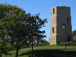 Beloit Water Tower |
January 7, 1983 (#83003410) |
1005 Pleasant St. 42°30′33″N 89°01′49″W |
Beloit | 36-foot octagonal, stepped limestone tower which supported a 20-foot tall cypress water tank, completed in 1889. Built by a private consortium, largely for fire protection. |
| 7 | Benton Avenue Historic District |  Benton Avenue Historic District |
March 7, 1996 (#96000251) |
Roughly bounded by Benton Ave., Milton Ave., Sherman Ave., Richardson St., Blaine Ave. and Prairie Ave. 42°41′48″N 89°00′48″W |
Janesville | Neighborhood of modest homes (mostly bungalows) built on small lots in 1919 and 1920 by developer Matteson and Landstrom of Chicago, probably aiming to sell them to workers from Samson Tractor. Good examples are the 1-story front-gabled bungalow at 821 Blaine St.[15] the 1-story side-gabled Sullivan bungalow at 808 Benton,[16] the 1.5-story bungalow at 875 Sherman,[17] and the American Foursquare Ocheltree house at 938 Benton.[18][19] |
| 8 | Selvy Blodgett House |  Selvy Blodgett House |
May 23, 1980 (#80000183) |
417 Bluff St. 42°29′59″N 89°02′29″W |
Beloit | 1.5-story house built 1847-1850, with thick limestone walls and Greek Revival styling. New Yorker Selvy was a son of Caleb Blodget, first permanent settler of Beloit, and he and his son later owned the Blodgett (flour) Milling Co.[20][21] |
| 9 | Bluff Street Historic District | 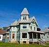 Bluff Street Historic District |
January 7, 1983 (#83003411) |
Roughly both sides of Bluff St. from Shirland Ave. to Merrill St. 42°30′04″N 89°02′30″W |
Beloit | Neighborhood of houses and churches near the industrial area along the Rock River, including the 1848 Lathrop-Munn cobblestone house,[22] the late-1840s Selvy-Blodgett house,[20] the 1858 Italianate-style Parker house,[23] the 1877 Gothic Revival-styled Norwegian Lutheran Church,[24] the 1889 Queen Anne/Stick-style Anderson house (pictured),[25] the 1890 Queen Anne-styled Aldrich house,[26] and the 1909 Queen Anne/Tudor Revival Evans house.[27][28] |
| 10 | Bostwick Avenue Historic District | 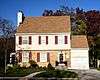 Bostwick Avenue Historic District |
April 24, 2006 (#06000321) |
404-436 Bostwick Ave. and 1118 and 1128 Grace St. 42°40′56″N 89°00′37″W |
Janesville | Small group of period revival houses built after WWI as Janesville industrialized, including the 1922 Dutch Colonial Revival Slawson house,[29] the 1928 Tudor Revival Pember house,[30] the 1929 Colonial Revival Grubb house,[31] the 1933 Colonial Revival Conrad house (pictured),[32] the 1937 Cape Cod-style Bogardus house,[33] and the 1940 Tudor Revival Tait house.[34][35] |
| 11 | Brasstown Cottage |  Brasstown Cottage |
March 4, 1983 (#83003412) |
1701 Colley Rd. 42°30′26″N 89°00′53″W |
Beloit | Worker's cottage, but with Stick style bargeboards, bay, porch and lattice typical of a larger, more expensive home. This is the best-preserved survivor of many such cottages that were built here in the late 1800s near the Union Brass factory.[36][37] |
| 12 | Church of St. Thomas the Apostle |  Church of St. Thomas the Apostle |
January 7, 1983 (#83003413) |
822 E. Grand Ave. 42°29′58″N 89°01′41″W |
Beloit | 1885 brick church with Gothic-style details and Stick style porches. Home of Beloit's oldest Catholic parish, with roots back to 1846. |
| 13 | Citizens Bank | 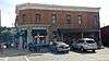 Citizens Bank |
August 1, 1985 (#85001661) |
Front & Allen Sts. 42°33′12″N 88°51′46″W |
Clinton | 1882 red brick Italianate-styled building with chamfered corner, segmental-arched windows, and bracketed cornice. With street-level corner bays clad in Neoclassical-style grey stone.[38][39] |
| 14 | City of Beloit Waterworks and Pump Station |  City of Beloit Waterworks and Pump Station |
September 13, 1990 (#90001460) |
1005 Pleasant St. 42°30′32″N 89°01′51″W |
Beloit | 1885 building constructed by a private company to pump water into the old tower up the hill and into the mains to supply high pressure at the fire hydrants. Also a concrete reservoir and a 1927 metal water tower and pump shed. |
| 15 | Clark-Brown House | 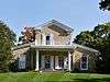 Clark-Brown House |
September 13, 1985 (#85002126) |
3457 Riverside Dr. 42°33′45″N 89°02′06″W |
Beloit | Greek Revival-style house built in 1847, with corner quoins, cornice returns, and most notably, a veneer of fine cobblestone.[40][41] |
| 16 | Clinton Village Hall | 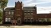 Clinton Village Hall |
August 1, 1985 (#85001660) |
301 Cross St. 42°33′18″N 88°51′42″W |
Clinton | 2-story dark brick Gothic Revival-style municipal building with square central tower, built in 1913 to house Clinton's city offices, fire department, and library.[42][43] |
| 17 | Clinton Water Tower | 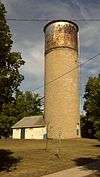 Clinton Water Tower |
March 7, 1985 (#85000493) |
High St. 42°33′39″N 88°51′48″W |
Clinton | 59-foot standpipe on the highest point in Clinton, built of limestone by mason Jacob Miller in 1895. Originally supported a large wooden water tank, which was replaced in 1929 by a metal tank.[44][45] |
| 18 | Columbus Circle Historic District | 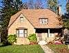 Columbus Circle Historic District |
May 19, 2005 (#05000453) |
Columbus Circle generally bounded by N. Adams and E. Milwaukee Sts. and N. Garfield Ave. 42°41′24″N 89°00′38″W |
Janesville | Modest residential neighborhood developed from the mid-1920s to 1943, including the 1927 Dutch Colonial Revival Taylor house,[46] the 1927 Spanish Colonial Revival-influenced Haugan house,[47] the 1927 Mediterranean Revival Smiley house,[48] the 1928 Colonial Revival-style Curler house,[49] the 1928 Tudor Revival McWilliams House,[50] the 1930 French Provincial style Carpenter house,[51] and the 1942 Contemporary-style Jensen house.[52][53] |
| 19 | Conrad Cottages Historic District | 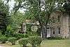 Conrad Cottages Historic District |
March 11, 1993 (#93000157) |
235-330 Milton Ave. 42°41′12″N 89°01′03″W |
Janesville | Small group of intact homes, consisting of the 1845 Greek Revival-style Taylor house,[54] the 1855 Gothic Revival-influenced Meyher house,[55] the 1870 Second Empire-style Jenkins house,[56] and the four Conrad cottages. These cottages are similar, cream brick Italianate-style houses built by local grocer Charles B. Conrad in 1882 as early tract housing.[57][58] |
| 20 | Cooksville Cheese Factory |  Cooksville Cheese Factory |
September 17, 1980 (#80000395) |
SR 1 42°50′06″N 89°14′36″W |
Evansville | Cheese factory built in 1875 by a farmers' co-op. Served as a social center too until closed in 1884. |
| 21 | Cooksville Historic District |  Cooksville Historic District |
October 25, 1973 (#73000254) |
Both sides of streets bordering the Public Sq. and Rock St. 42°50′08″N 89°14′19″W |
Cooksville | Village built around a public square, resembling the New England villages where many of the settlers had roots. Includes the 1842 frame John Cook house,[59] 1846-48 Greek Revival style Lovejoy-Duncan house,[60] the 1840s Cooksville General Store,[61] the ca. 1847 Gothic Revival Backenstoe-Howard house,[62] the 1851 frame Cure-Van Vleck house,[63] the 1852 Gothic Revival Hoxie house,[64] the 1879 Congregational Church,[65] the 1886 Cooksville school,[66] and the 1896 Norwegian Lutheran Church.[67] The village largely stopped changing in 1857 when the railroad bypassed it.[68] |
| 22 | Cooksville Mill and Mill Pond Site |  Cooksville Mill and Mill Pond Site |
September 17, 1980 (#80000394) |
SR 1 42°50′19″N 89°14′32″W |
Evansville | Site on Badfish Creek where John Cook built his sawmill in 1842 and followers built a gristmill in 1847. Derelict by the 1890s. Foundations and an earth embankment remain.[69] |
| 23 | Cooper-Gillies House |  Cooper-Gillies House |
September 17, 1980 (#80000397) |
SR 1 42°50′03″N 89°15′17″W |
Evansville | 4-bay brick Greek Revival-styled house built in the early 1850s by Mathew Cooper on a ridge overlooking Cooksville. Bought by David Gillies in 1862.[70][71] |
| 24 | Courier Building |  Courier Building |
August 24, 2015 (#15000552) |
513 Vernal Ave. 42°46′50″N 88°57′47″W |
Milton | 2-story Italianate-styled paint store built in 1887, then taken over in 1907 by The Weekly Telephone, a predecessor of the Milton Courier, which remains in the building.[72] |
| 25 | Court Street Methodist Church |  Court Street Methodist Church |
November 17, 1977 (#77000045) |
36 S. Main St. 42°40′55″N 89°01′17″W |
Janesville | A Methodist congregation built this dignified, but un-churchy-looking Second Empire-styled building in 1868, with store space at street-level and the sanctuary above. Bought by a Masonic Order in 1905 and converted for use as their temple, which lasted until 1965. |
| 26 | Courthouse Hill Historic District |  Courthouse Hill Historic District |
January 17, 1986 (#86000205) |
Roughly bounded by E. Milwaukee St., Garfield and Oakland Aves., S. Main St., and E. Court St. and Milton Ave. 42°41′00″N 89°00′58″W |
Janesville | |
| 27 | J. W. Crist House | 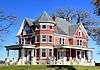 J. W. Crist House |
January 7, 1983 (#83003414) |
2601 Afton Rd. 42°32′26″N 89°03′04″W |
Beloit | |
| 28 | Crosby Block | 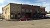 Crosby Block |
August 1, 1985 (#85001658) |
102 Allen St. 42°33′12″N 88°51′46″W |
Clinton | |
| 29 | James B. Crosby House | 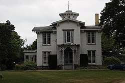 James B. Crosby House |
December 14, 1995 (#95001454) |
1005 Sutherland Ave. 42°41′41″N 89°01′27″W |
Janesville | |
| 30 | Charles L. Culton House | 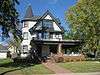 Charles L. Culton House |
August 22, 1977 (#77000046) |
708 Washington St. 42°50′19″N 89°04′34″W |
Edgerton | |
| 31 | De Jean House |  De Jean House |
September 13, 1978 (#78003388) |
27 Third St. 42°46′54″N 88°57′33″W |
Milton | |
| 32 | Erastus Dean Farmstead |  Erastus Dean Farmstead |
December 4, 1978 (#78000131) |
E of Janesville on U.S. 14 42°39′20″N 88°52′50″W |
Janesville | |
| 33 | Homer B. DeLong House |  Homer B. DeLong House |
August 1, 1985 (#85001659) |
500 Milwaukee Rd. 42°33′29″N 88°51′51″W |
Clinton | |
| 34 | John T. Dow House |  John T. Dow House |
September 17, 1980 (#80000396) |
SR 1 42°50′05″N 89°14′49″W |
Evansville | |
| 35 | Eager Free Public Library |  Eager Free Public Library |
August 16, 1977 (#77000047) |
39 W. Main St. 42°46′48″N 89°18′03″W |
Evansville | |
| 36 | Almeron Eager Funerary Monument and Plot |  Almeron Eager Funerary Monument and Plot |
July 20, 2011 (#11000477) |
8012 N. Cemetery Rd. 42°46′59″N 89°17′21″W |
Evansville | |
| 37 | East Milwaukee Street Historic District |  East Milwaukee Street Historic District |
February 8, 1980 (#80000184) |
N. Parker Dr. and E. Milwaukee St. 42°41′01″N 89°01′18″W |
Janesville | |
| 38 | Edgerton Depot |  Edgerton Depot |
April 13, 1998 (#98000283) |
20 S. Main St. 42°50′00″N 89°04′13″W |
Edgerton | |
| 39 | Edgerton Post Office |  Edgerton Post Office |
October 24, 2000 (#00001239) |
104 N. Swift St. 42°50′08″N 89°04′16″W |
Edgerton | |
| 40 | Edgerton Public Grade Schools | 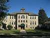 Edgerton Public Grade Schools |
January 14, 1987 (#86003568) |
116 N. Swift St. 42°50′09″N 89°04′11″W |
Edgerton | |
| 41 | Emerson Hall | 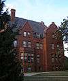 Emerson Hall |
September 20, 1979 (#79000109) |
Beloit College campus 42°30′26″N 89°01′43″W |
Beloit | |
| 42 | Evansville Historic District | 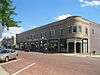 Evansville Historic District |
November 16, 1978 (#78000132) |
roughly bounded by Allens Creek, Liberty, 4th and Garfield Sts. 42°46′46″N 89°18′10″W |
Evansville | |
| 43 | Evansville Standpipe | 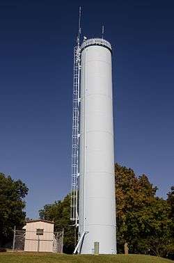 Evansville Standpipe |
February 27, 2008 (#08000120) |
288 N. 4th St. 42°47′05″N 89°18′47″W |
Evansville | |
| 44 | Fairbanks Flats | 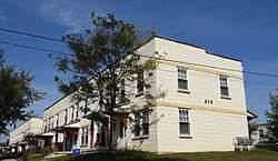 Fairbanks Flats |
January 7, 1983 (#83003416) |
205, 215 Birch Ave. and 206, 216 Carpenter Ave. 42°31′19″N 89°02′24″W |
Beloit | |
| 45 | First Congregational Church | 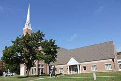 First Congregational Church |
January 23, 1975 (#75000078) |
801 Bushnell St. 42°30′06″N 89°01′40″W |
Beloit | |
| 46 | Footville Condensery |  Footville Condensery |
May 7, 1982 (#82000704) |
Beloit St. 42°40′00″N 89°12′27″W |
Footville | |
| 47 | Footville State Bank | 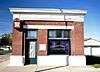 Footville State Bank |
May 7, 1982 (#82000705) |
158 Depot St. 42°40′11″N 89°12′40″W |
Footville | |
| 48 | Fredendall Block | 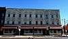 Fredendall Block |
March 25, 1982 (#82000706) |
33-39 S. Main St. 42°40′56″N 89°01′17″W |
Janesville | |
| 49 | Fulton Congregational Church | 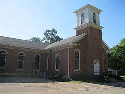 Fulton Congregational Church |
June 7, 1976 (#76000077) |
Fulton St. 42°48′21″N 89°07′44″W |
Fulton | |
| 50 | Fulton Street Historic District | 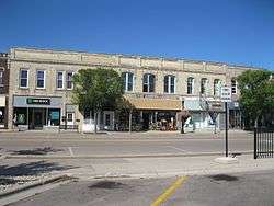 Fulton Street Historic District |
July 1, 1999 (#99000788) |
Along Fulton St., roughly bounded by Main and Albion Sts.; 11-21 Swift St. 42°50′03″N 89°04′13″W |
Edgerton | |
| 51 | Gempeler Round Barn | June 4, 1979 (#79000110) |
SW of Orfordville 42°39′50″N 89°19′50″W |
Orfordville | ||
| 52 | Gifford House | 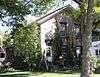 Gifford House |
September 13, 1978 (#78003387) |
308 Vernal 42°46′51″N 88°57′36″W |
Milton | |
| 53 | Gilley-Tofsland Octagonal Barn | 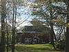 Gilley-Tofsland Octagonal Barn |
June 4, 1979 (#79000111) |
NW of Edgerton 42°50′40″N 89°10′30″W |
Edgerton | |
| 54 | Goodrich Blacksmith Shop | 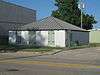 Goodrich Blacksmith Shop |
September 13, 1978 (#78003382) |
28 S. Janesville St. 42°46′34″N 88°56′10″W |
Milton | |
| 55 | Goodrich-Buten House | 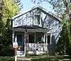 Goodrich-Buten House |
September 13, 1978 (#78003385) |
528 E. Madison St. 42°46′38″N 88°56′22″W |
Milton | |
| 56 | Ezra and Elizabeth Goodrich House | 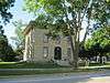 Ezra and Elizabeth Goodrich House |
July 14, 2015 (#15000425) |
742 E. Madison Ave. 42°46′38″N 88°56′17″W |
Milton | |
| 57 | William H. and Edith Gray Farmstead | 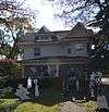 William H. and Edith Gray Farmstead |
June 30, 2015 (#15000377) |
313 E. High St. 42°46′23″N 88°56′46″W |
Milton | |
| 58 | Reynolds and Lois Greenman House | 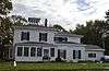 Reynolds and Lois Greenman House |
August 23, 2016 (#16000567) |
12 Merchant Row 42°46′59″N 88°57′44″W |
Milton | |
| 59 | Grove Street Historic District | 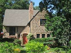 Grove Street Historic District |
August 10, 2011 (#11000531) |
103, 111, 112, 116, 119, 125, 126, 133 & 134 Grove St. 42°47′00″N 89°18′08″W |
Evansville | |
| 60 | Hanchett Block | 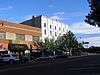 Hanchett Block |
March 20, 1980 (#80000185) |
307 State St. 42°29′56″N 89°02′08″W |
Beloit | |
| 61 | Haven-Crandall House |  Haven-Crandall House |
August 29, 2016 (#16000575) |
220 S. Janesville St. 42°46′29″N 88°56′12″W |
Milton | |
| 62 | Hilton House Hotel |  Hilton House Hotel |
November 7, 2003 (#03001128) |
434 E. Grand Ave. 42°29′58″N 89°02′02″W |
Beloit | No longer standing |
| 63 | How-Beckman Mill |  How-Beckman Mill |
September 7, 1977 (#77000049) |
11600 County Highway H 42°30′38″N 89°10′12″W |
Beloit | |
| 64 | John and Martha Hugunin House |  John and Martha Hugunin House |
June 1, 2005 (#05000534) |
2739 Beloit Ave. 42°38′23″N 89°00′40″W |
Janesville | |
| 65 | Janesville Cotton Mill | 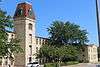 Janesville Cotton Mill |
July 16, 1980 (#80000186) |
220 N. Franklin St. 42°41′02″N 89°01′39″W |
Janesville | |
| 66 | Janesville High School | 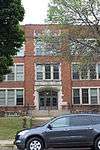 Janesville High School |
June 25, 1999 (#99000760) |
408 S. Main St. 42°40′40″N 89°01′02″W |
Janesville | Also known as Marshall Junior High School |
| 67 | Janesville Public Library | 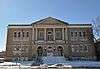 Janesville Public Library |
July 1, 1981 (#81000057) |
64 S. Main St. 42°40′53″N 89°01′15″W |
Janesville | |
| 68 | Janesville Pumping Station | 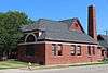 Janesville Pumping Station |
March 7, 1985 (#85000494) |
500 Blk. River St. 42°40′48″N 89°01′22″W |
Janesville | |
| 69 | Jefferson Avenue Historic District | 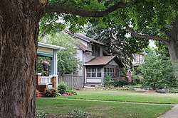 Jefferson Avenue Historic District |
April 19, 2006 (#06000300) |
Bounded by Oakland, Garfield and Ruger Aves. and Forest Park Blvd. 42°41′10″N 89°00′40″W |
Janesville | |
| 70 | John H. Jones House | 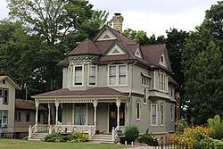 John H. Jones House |
March 14, 2008 (#08000186) |
538 S. Main St. 42°40′36″N 89°00′56″W |
Janesville | |
| 71 | Samuel S. Jones Cobblestone House | 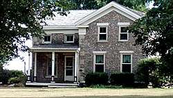 Samuel S. Jones Cobblestone House |
February 23, 1978 (#78000133) |
E of Clinton on Milwaukee Rd. 42°33′57″N 88°49′02″W |
Clinton | |
| 72 | Kinney Farmstead-Tay-e-he-Dah Site |  Kinney Farmstead-Tay-e-he-Dah Site |
February 17, 1978 (#78000134) |
1612 E. Hotel Dr. 42°50′32″N 89°00′17″W |
Edgerton | |
| 73 | Lappin-Hayes Block | 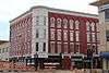 Lappin-Hayes Block |
November 7, 1976 (#76000224) |
20 E. Milwaukee St. 42°40′58″N 89°01′21″W |
Janesville | |
| 74 | LaPrairie Grange Hall No. 79 | 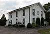 LaPrairie Grange Hall No. 79 |
April 11, 1977 (#77000050) |
SE of Janesville on Town Hall Rd. 42°37′37″N 88°57′12″W |
Janesville | |
| 75 | Lathrop-Munn Cobblestone House |  Lathrop-Munn Cobblestone House |
August 22, 1977 (#77000051) |
524 Bluff St. 42°30′03″N 89°02′31″W |
Beloit | |
| 76 | Leonard—Leota Park |  Leonard—Leota Park |
September 4, 2012 (#12000610) |
20, 30, 40, 50, ca 60, 120, 121 Antes Dr., 321, 340, 359, 360, 363, 365, 395 Burr W. Jones Cir., Leonard Park Dr. 42°47′07″N 89°18′06″W |
Evansville | |
| 77 | Look West Historic District |  Look West Historic District |
March 26, 1987 (#87000506) |
Roughly bounded by Mineral Point Ave., N. Franklin and Race Sts., Laurel Ave., and N. Chatham St. 42°41′03″N 89°02′00″W |
Janesville | Boundary increase (listed December 10, 1993): Roughly bounded by Laurel Ave. and N. Madison, W. Court and N. Palm Sts. |
| 78 | Lovejoy and Merrill-Nowlan Houses | 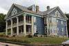 Lovejoy and Merrill-Nowlan Houses |
January 21, 1980 (#80000187) |
220 and 202 St. Lawrence Ave. 42°40′55″N 89°01′07″W |
Janesville | |
| 79 | Masonic Temple | 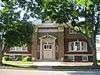 Masonic Temple |
July 21, 2015 (#15000458) |
508 Vernal Ave. 42°46′51″N 88°57′47″W |
Milton | |
| 80 | Peter McEwan Warehouse | 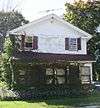 Peter McEwan Warehouse |
September 13, 1978 (#78003384) |
711 E. High St. 42°46′22″N 88°56′19″W |
Milton | |
| 81 | Merchant Row Historic District | 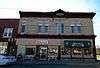 Merchant Row Historic District |
August 3, 2015 (#15000504) |
212, 216, 218-220, 228-230 Merchant Row & 553, 537, 541 Vernal Ave. 42°46′54″N 88°57′48″W |
Milton | |
| 82 | Merrill Avenue Historic District |  Merrill Avenue Historic District |
February 19, 1993 (#93000028) |
103, 107, 111, 115 Merrill Ave. 42°30′34″N 89°02′13″W |
Beloit | |
| 83 | Miller House |  Miller House |
September 17, 1980 (#80000399) |
SR 1 42°49′40″N 89°14′25″W |
Evansville | |
| 84 | Milton College Historic District |  Milton College Historic District |
May 27, 1980 (#80000188) |
College St. 42°46′27″N 88°56′32″W |
Milton | |
| 85 | Milton House |  Milton House |
February 1, 1972 (#72000065) |
18 S. Janesville St. 42°46′37″N 88°56′11″W |
Milton | |
| 86 | Moran's Saloon | 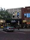 Moran's Saloon |
January 7, 1983 (#83003417) |
312 State St. 42°29′57″N 89°02′09″W |
Beloit | |
| 87 | Mouth of the Yahara Archeological District |  Mouth of the Yahara Archeological District |
April 28, 1975 (#75000079) |
Address Restricted |
Fulton | |
| 88 | Murray-George House |  Murray-George House |
September 13, 1985 (#85002125) |
SR P 42°30′33″N 88°56′18″W |
Beloit | |
| 89 | Peter Myers Pork Packing Plant and Willard Coleman Building | 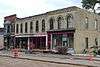 Peter Myers Pork Packing Plant and Willard Coleman Building |
July 7, 1983 (#83003418) |
117-123 N. Main St. 42°41′03″N 89°01′26″W |
Janesville | |
| 90 | Myers-Newhoff House |  Myers-Newhoff House |
May 18, 1979 (#79000277) |
121 N. Parker Dr. 42°41′05″N 89°01′22″W |
Janesville | |
| 91 | Near East Side Historic District |  Near East Side Historic District |
January 7, 1983 (#83003419) |
Roughly bounded by Pleasant, Clary Sts., Wisconsin and E. Grand Aves. 42°30′10″N 89°01′40″W |
Beloit | |
| 92 | Elbert Neese House |  Elbert Neese House |
January 7, 1983 (#83003420) |
1302 Bushnell St 42°30′04″N 89°01′15″W |
Beloit | |
| 93 | North Main Street Historic District |  North Main Street Historic District |
February 8, 1980 (#80000189) |
N. Main St. and N. Parker Dr. 42°41′02″N 89°01′23″W |
Janesville | |
| 94 | Sterling North House | 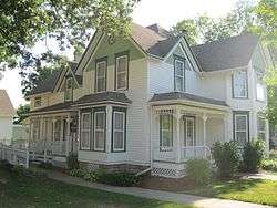 Sterling North House |
January 9, 1997 (#96001579) |
409 W. Rollin St. 42°50′14″N 89°04′04″W |
Edgerton | |
| 95 | Clark Nye House | 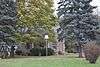 Clark Nye House |
January 7, 1983 (#83003422) |
2501 Spring Creek Rd. 42°31′34″N 89°04′45″W |
Beloit | |
| 96 | Old Fourth Ward Historic District |  Old Fourth Ward Historic District |
May 30, 1990 (#90000789) |
Roughly bounded by Washington St., Center Ave., Court St., Franklin St., and Monterey Park 42°40′24″N 89°01′45″W |
Janesville | |
| 97 | Orfordville Depot | 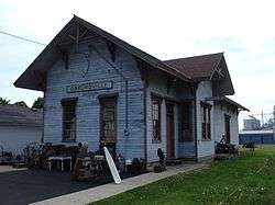 Orfordville Depot |
October 13, 1988 (#88002004) |
Beloit St. 42°37′41″N 89°15′22″W |
Orfordville | |
| 98 | John and Margaret Owen House | 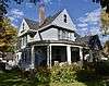 John and Margaret Owen House |
August 23, 2016 (#16000568) |
33 2nd St. 42°46′54″N 88°57′38″W |
Milton | |
| 99 | William J. Owen Store | 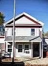 William J. Owen Store |
May 7, 1982 (#82000707) |
220 Depot St. 42°40′11″N 89°12′40″W |
Footville | |
| 100 | J. L. Pangborn House | 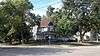 J. L. Pangborn House |
August 1, 1985 (#85001664) |
300 Allen St. 42°33′20″N 88°51′47″W |
Clinton | |
| 101 | Parkview Historic District | 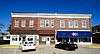 Parkview Historic District |
August 3, 2015 (#15000505) |
644-655 College St. & 247-319 Parkview Dr. 42°46′27″N 88°56′22″W |
Milton | |
| 102 | Payne-Craig House | 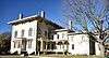 Payne-Craig House |
July 2, 1987 (#87000990) |
2200 W. Memorial Dr. 42°41′44″N 89°02′52″W |
Janesville | |
| 103 | Pearsons Hall of Science |  Pearsons Hall of Science |
June 30, 1980 (#80000190) |
Beloit College campus 42°30′13″N 89°01′53″W |
Beloit | |
| 104 | Pomeroy and Pelton Tobacco Warehouse | 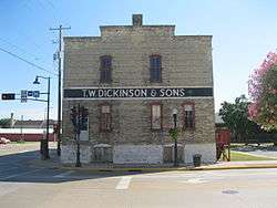 Pomeroy and Pelton Tobacco Warehouse |
July 9, 1998 (#98000848) |
1 W. Fulton St. 42°50′00″N 89°04′10″W |
Edgerton | Also known as Dickinson Tobacco Warehouse |
| 105 | J. K. Porter Farmstead | 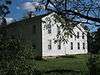 J. K. Porter Farmstead |
September 17, 1980 (#80000400) |
SR 1 42°50′09″N 89°13′35″W |
Evansville | |
| 106 | Prospect Hill Historic District |  Prospect Hill Historic District |
November 5, 1992 (#92001558) |
Roughly bounded by Eisenhower, Prospect and Atwood Aves., Milwaukee St., Parker Dr. and Centerway 42°41′10″N 89°01′16″W |
Janesville | |
| 107 | Brewster Randall House | 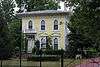 Brewster Randall House |
March 1, 1984 (#84003782) |
1412 Ruger Ave. 42°41′10″N 89°00′19″W |
Janesville | |
| 108 | Rasey House | 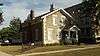 Rasey House |
December 27, 1974 (#74000123) |
517 Prospect St. 42°30′05″N 89°01′50″W |
Beloit | |
| 109 | Charles Rau House | 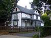 Charles Rau House |
January 7, 1983 (#83003423) |
757 Euclid Ave. 42°30′01″N 89°02′56″W |
Beloit | |
| 110 | Richardson Grout House | 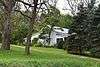 Richardson Grout House |
September 17, 1980 (#80000402) |
SR 1 42°49′06″N 89°12′41″W |
Evansville | |
| 111 | Hamilton Richardson House | 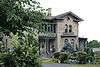 Hamilton Richardson House |
July 17, 1978 (#78000135) |
429 Prospect Ave. 42°41′14″N 89°01′13″W |
Janesville | |
| 112 | Richardson-Brinkman Cobblestone House | 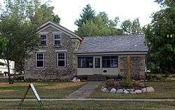 Richardson-Brinkman Cobblestone House |
July 28, 1977 (#77000052) |
607 W. Milwaukee Rd. 42°33′27″N 88°51′58″W |
Clinton | |
| 113 | Rindfleisch Building | 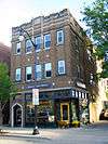 Rindfleisch Building |
January 7, 1983 (#83003424) |
512 E. Grand Ave. 42°29′58″N 89°02′00″W |
Beloit | |
| 114 | Risum Round Barn | .jpg) Risum Round Barn |
June 4, 1979 (#79000112) |
Southwest of Orfordville 42°35′55″N 89°17′35″W |
Orfordville | |
| 115 | John C. and Mary Robinson Farmstead | 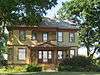 John C. and Mary Robinson Farmstead |
January 7, 2010 (#09001221) |
18002 W. County Trunk Highway C 42°47′14″N 89°21′26″W |
Union | |
| 116 | St. John's Lutheran Church | 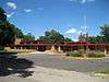 St. John's Lutheran Church |
August 14, 2012 (#12000521) |
312 S. 3rd St. 42°46′34″N 89°18′21″W |
Evansville | |
| 117 | Seventh Day Baptist Church | 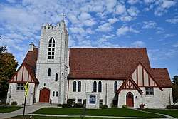 Seventh Day Baptist Church |
August 22, 2016 (#16000569) |
720 E. Madison Ave. 42°46′37″N 88°56′15″W |
Milton | |
| 118 | Shopiere Congregational Church | 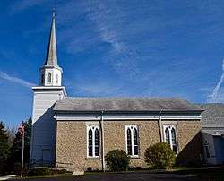 Shopiere Congregational Church |
August 13, 1976 (#76000078) |
Buss Rd., near Shopiere Rd. 42°34′14″N 88°56′17″W |
Shopiere | Congregational church built starting in 1850, with its limestone main block in Greek Revival style and the New England-styled tower and steeple added later. |
| 119 | Stephen Slaymaker House |  Stephen Slaymaker House |
January 7, 1983 (#83003425) |
348 Euclid Ave. 42°29′59″N 89°02′32″W |
Beloit | |
| 120 | Samuel Smiley House |  Samuel Smiley House |
October 21, 1982 (#82001849) |
SE of Orfordville on WI 213 42°35′59″N 89°12′25″W |
Orfordville | |
| 121 | John Smith House | 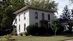 John Smith House |
August 1, 1985 (#85001663) |
312 Pleasant St. 42°33′24″N 88°52′04″W |
Clinton | |
| 122 | South First Street Residential Historic District | 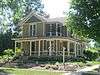 South First Street Residential Historic District |
August 10, 2011 (#11000532) |
341, 348, 349, 402, 408, 409, 412, 419, 433, 439 & 443, S. 1st St. 42°46′29″N 89°18′03″W |
Evansville | NRHP # 11000532 |
| 123 | South Main Street Historic District | 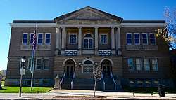 South Main Street Historic District |
June 1, 1990 (#90000820) |
Roughly S. Main St. from Milwaukee St. to Rock Co. Courthouse grounds and E. Court St. from Parker Dr. to Rock R. 42°40′55″N 89°01′17″W |
Janesville | |
| 124 | St. Paul's Episcopal Church | 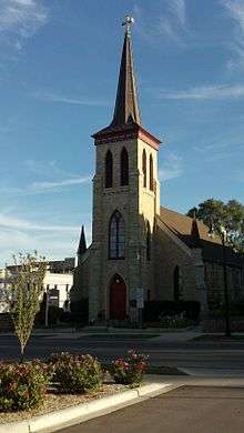 St. Paul's Episcopal Church |
April 4, 1978 (#78000136) |
212 W. Grand Ave. 42°30′05″N 89°02′22″W |
Beloit | |
| 125 | Stark-Clint House | 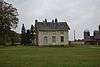 Stark-Clint House |
September 13, 1985 (#85002124) |
Creek Rd. 42°35′04″N 88°55′32″W |
Tiffany | |
| 126 | Harrison Stebbins House | 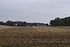 Harrison Stebbins House |
September 17, 1980 (#80000401) |
SR 1 42°49′36″N 89°12′55″W |
Evansville | Demolished in 2013[73] |
| 127 | Soloman J. Strang House | 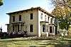 Soloman J. Strang House |
May 7, 1982 (#82000708) |
231 North Gilbert 42°40′25″N 89°12′32″W |
Footville | |
| 128 | Strong Building | 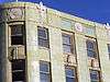 Strong Building |
January 7, 1983 (#83003426) |
400-408 E. Grand Ave. 42°29′58″N 89°02′07″W |
Beloit | |
| 129 | Strong Partridge Mound Group | 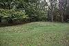 Strong Partridge Mound Group |
March 1, 1994 (#94000057) |
1750 Arrowhead Dr. 42°31′09″N 89°00′37″W |
Beloit | |
| 130 | John and Eleanor Strunk House | 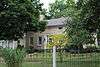 John and Eleanor Strunk House |
March 11, 2008 (#08000184) |
2306 N. Parker Dr. 42°42′38″N 89°01′59″W |
Janesville | |
| 131 | Tallman House | 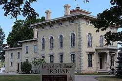 Tallman House |
October 15, 1970 (#70000085) |
440 N. Jackson St. 42°41′10″N 89°01′53″W |
Janesville | |
| 132 | A. E. Taylor House |  A. E. Taylor House |
August 1, 1985 (#85001662) |
318 Durand St. 42°33′25″N 88°51′51″W |
Clinton | |
| 133 | Turtleville Iron Bridge | .jpg) Turtleville Iron Bridge |
September 15, 1977 (#77000053) |
N of Beloit on Lathers Rd. 42°33′56″N 88°57′52″W |
Beloit | |
| 134 | West Luther Valley Lutheran Church | 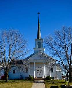 West Luther Valley Lutheran Church |
May 27, 1980 (#80000191) |
SW of Orfordville on W. Church Rd. 42°36′26″N 89°19′35″W |
Orfordville | |
| 135 | West Milwaukee Street Historic District | 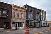 West Milwaukee Street Historic District |
May 17, 1990 (#90000790) |
Roughly bounded by Wall, River, Court, and Academy Sts. 42°40′52″N 89°01′33″W |
Janesville | |
| 136 | Whiton-Parker House | 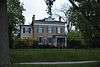 Whiton-Parker House |
February 8, 2016 (#15001056) |
1000 E. Milwaukee St. 42°41′17″N 89°00′45″W |
Janesville | |
| 137 | Frances Willard Schoolhouse |  Frances Willard Schoolhouse |
October 5, 1977 (#77000054) |
Craig Ave. 42°41′29″N 89°00′19″W |
Janesville | |
| 138 | Wyman-Rye Farmstead |  Wyman-Rye Farmstead |
November 7, 1977 (#77000055) |
N of Clinton on Wyman-Rye Dr. 42°35′28″N 88°52′18″W |
Clinton | |
| 139 | Florence Yates House |  Florence Yates House |
January 7, 1983 (#83003427) |
1614 Emerson St. 42°30′16″N 89°00′59″W |
Beloit |
Formerly listed
| [3] | Name on the Register | Image | Date listed | Date removed | Location | City or town | Summary |
|---|---|---|---|---|---|---|---|
| 1 | Belle Cottage | May 8, 1979 (#79000107) | May 18, 1987 | 1837 Center Ave. |
Janesville | Gothic revival-styled house clad in local cobblestones, built by George Josiah Kellog in 1854. A.k.a. Damrow House. Demolished February 27, 1987.[74] | |
| 2 | Carlton Hotel | October 3, 1988 (#88002173) | March 6, 1992 | 14 N. Henry St. |
Edgerton | 3-story German Renaissance Revival hotel designed by Frank H. Kemp and built in 1898. Destroyed by fire in 1991.[75] | |
| 3 | Dean-Armstrong-Englund Octagonal Barn | June 4, 1979 (#79003769) | March 30, 1984 | Milton | Built in 1893.[76]:3 | ||
| 4 | Dougan Round Barn |  Dougan Round Barn |
June 4, 1979 (#79000108) | January 30, 2014 | 444 West Colley Rd. |
Beloit | Demolished in 2012.[77] |
| 5 | J.B. Dow House and Carpenter Douglas Barn | January 7, 1983 (#83003415) | May 12, 2009 | 910 Board St. |
Beloit | The Dow house was a mix of Colonial Revival and Queen Anne styles, built in 1905. Dow was a realtor, lawyer and insurance salesman. Damaged by fire September 1996, demolished.[78] The 1847 barn is clad in cobblestone with limestone quoins.[79] | |
| 6 | Elijah Goodrich Wheat Warehouse | 1978 (#78003389) | June 15, 1984 | 602 E. Madison St. |
Milton | ||
| 7 | Leedle Mill Truss Bridge | 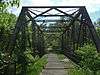 Leedle Mill Truss Bridge |
September 17, 1980 (#80000398) | January 9, 2013 | SR 1 42°50′37″N 89°15′09″W |
Evansville | |
| 8 | Myers Opera House | 1977 (#77001583) | 1978 | 118 E. Milwaukee St. |
Janesville | Demolished in 1978. | |
| 9 | Wisconsin School for the Blind-Music Building | March 13, 1987 (#87000440) | February 17, 1989 | 1700 W. State St. |
Janesville | ||
| 10 | Wright-Amato House | Unknown (#71001095) | 1972 | 923 Mineral Point Ave. |
Janesville |
See also
| Wikimedia Commons has media related to National Register of Historic Places in Rock County, Wisconsin. |
References
- The latitude and longitude information provided is primarily from the National Register Information System, and has been found to be fairly accurate for about 99% of listings. For 1%, the location info may be way off. We seek to correct the coordinate information wherever it is found to be erroneous. Please leave a note in the Discussion page for this article if you believe any specific location is incorrect.
- "National Register of Historic Places: Weekly List Actions". National Park Service, United States Department of the Interior. Retrieved on June 26, 2020.
- Numbers represent an ordering by significant words. Various colorings, defined here, differentiate National Historic Landmarks and historic districts from other NRHP buildings, structures, sites or objects.
- "National Register Information System". National Register of Historic Places. National Park Service. April 24, 2008.
- The eight-digit number below each date is the number assigned to each location in the National Register Information System database, which can be viewed by clicking the number.
- "John Alexander Wheat Warehouse". Architecture and History Inventory. Wisconsin Historical Society. Retrieved 2017-11-18.
- "NRHP Inventory/Nomination: John Alexander Wheat Warehouse". National Park Service. 1978-09-13. Retrieved 2017-11-18. With one photo.
- "The Armory (Janesville)". Architecture and History Inventory. Wisconsin Historical Society. Retrieved 2017-11-18.
- Nancy Belle Douglas (1977-12-01). "NRHP Inventory/Nomination: The Armory". National Park Service. Retrieved 2017-11-18. With two photos.
- "James Hanchett-Bartlett-Farmstead". Wisconsin Historical Society. Retrieved 2019-11-28.
- "Bartlett memorial Historical Museum - Limestone Barn". Wisconsin Historical Society. Retrieved 2019-11-28.
- "Bartlett memorial Historical Museum - Limestone Smokehouse". Wisconsin Historical Society. Retrieved 2019-11-28.
- Nancy Belle Douglas; Donald N. Anderson (1976-09-02). "Intensive Survey Form: Hanchett-Bartlett Farmstead". State Historical Society of Wisconsin. Retrieved 2019-11-28. With three photos.
- "Beloit Power Plant". Wisconsin Historical Society. Retrieved 2019-11-28.
- "Matteson and Lindstrom House". Architecture and History Inventory. Wisconsin Historical Society. Retrieved 2019-12-02.
- "Matteson and Lindstrom House; William J. Sullivan". Architecture and History Inventory. Wisconsin Historical Society. Retrieved 2019-12-02.
- "Matteson and Lindstrom House". Architecture and History Inventory. Wisconsin Historical Society. Retrieved 2019-12-02.
- "Matteson and Lindstrom House; Charles R. Ocheltree". Architecture and History Inventory. Wisconsin Historical Society. Retrieved 2019-12-02.
- Carol Lohry Cartwright (1993-05-15). "NRHP Inventory/Nomination: Benton Avenue Historic District". National Park Service. Retrieved 2019-12-02. With twelve photos.
- "Selvy Blodgett House". Architecture and History Inventory. Wisconsin Historical Society. Retrieved 2019-12-03.
- Nancy Belle Douglas (1979-11-29). "NRHP Inventory/Nomination: Blodgett, Selvy, House". National Park Service. Retrieved 2019-12-02. With one photo.
- "Lathrop-Munn Cobblestone House". Wisconsin Historical Society. Retrieved 2019-12-07.
- "Charles H. Parker House". Wisconsin Historical Society. Retrieved 2019-12-07.
- "Norwegian Lutheran Church". Wisconsin Historical Society. Retrieved 2019-12-07.
- "259-261 St Lawrence Ave". Wisconsin Historical Society. Retrieved 2019-12-07.
- "A.A. Aldrich House". Wisconsin Historical Society. Retrieved 2019-12-07.
- "E.J. Evans House". Wisconsin Historical Society. Retrieved 2019-12-07.
- Richard P. Hartung (July 1981). District Survey Form: Bluff Street Historic District. National Park Service. Retrieved 2019-12-07. With 95 photos.
- "Frank and Erna Slawson House". Wisconsin Historical Society. Retrieved 2020-03-22.
- "Aubrey Pember House". Wisconsin Historical Society. Retrieved 2020-03-22.
- "Paul and Ethel Grubb House". Wisconsin Historical Society. Retrieved 2020-03-22.
- "Bradley Conrad House". Wisconsin Historical Society. Retrieved 2020-03-22.
- "Henry Bogardus House". Wisconsin Historical Society. Retrieved 2020-03-22.
- "Henry Bogardus House". Wisconsin Historical Society. Retrieved 2020-03-22.
- Carol Lohry Cartwright (2005-08-29). NRHP Inventory/Nomination: Bostwick Avenue Historic District. National Park Service. Retrieved 2020-03-24. With five photos.
- "Brasstown Cottage". Wisconsin Historical Society. Retrieved 2020-03-22.
- Richard P. Hartung (July 1981). Intensive Survey Form: Brasstown Cottage. State Historical Society of Wisconsin. Retrieved 2020-03-24. With two photos.
- "Citizens Bank of Clinton". Wisconsin Historical Society. Retrieved 2020-03-27.
- Richard P. Hartung (1981-06-01). Intensive Survey Form: Citizens Bank. State Historical Society of Wisconsin. Retrieved 2020-03-27. With four photos.
- "Clark Brown House". Wisconsin Historical Society. Retrieved 2020-03-27.
- Ruth Ann Willis (1981-02-20). NRHP Inventory/Nomination: Cobblestone Buildings of Rock County. National Park Service. Retrieved 2020-03-27. With three photos.
- "Clinton Village Hall". Wisconsin Historical Society. Retrieved 2020-03-27.
- Richard P. Hartung (1981-06-01). Intensive Survey Form: Clinton Village Hall and Post Office. State Historical Society of Wisconsin. Retrieved 2020-03-27. With six photos.
- "Clinton Water Tower". Wisconsin Historical Society. Retrieved 2020-03-27.
- Ruth Ann Willis (1980-02-19). NRHP Inventory/Nomination: Water Works Structures of Rock County. National Park Service. Retrieved 2020-03-27. With four photos.
- "Paul & Agnes Taylor House". Wisconsin Historical Society. Retrieved 2020-06-08.
- "Addison & Ruth Haugan House". Wisconsin Historical Society. Retrieved 2020-06-08.
- "George and Isabel Smiley House". Wisconsin Historical Society. Retrieved 2020-06-08.
- "Albert T. and Jennie Curler House". Wisconsin Historical Society. Retrieved 2020-06-08.
- "J. Glenn & Nellie McWilliams House". Wisconsin Historical Society. Retrieved 2020-06-08.
- "Lloyd and Winnifred Carpenter House". Wisconsin Historical Society. Retrieved 2020-06-08.
- "Ellis Jensen House". Wisconsin Historical Society. Retrieved 2020-06-08.
- Carol Lohry Cartwright (2003-09-29). NRHP Inventory/Nomination: Columbus Circle Historic District. National Park Service. Retrieved 2020-06-08. With nine photos.
- "Hiram Taylor House". Wisconsin Historical Society. Retrieved 2020-06-10.
- "Old Meyher House". Wisconsin Historical Society. Retrieved 2020-06-10.
- "John C. Jenkins House". Wisconsin Historical Society. Retrieved 2020-06-10.
- "318 Milton Ave". Wisconsin Historical Society. Retrieved 2020-06-10.
- Carol Lohry Cartwright (1991-05-24). NRHP Inventory/Nomination: Conrad Cottages Historic District. National Park Service. Retrieved 2020-06-10. With six photos.
- "John Cook House". Wisconsin Historical Society. Retrieved 2020-06-13.
- "Lovejoy-Duncan House". Wisconsin Historical Society. Retrieved 2020-06-13.
- "Cooksville General Store". Wisconsin Historical Society. Retrieved 2020-06-13.
- "Backenstoe-Howard House". Wisconsin Historical Society. Retrieved 2020-06-13.
- "Van Vleck House". Wisconsin Historical Society. Retrieved 2020-06-13.
- "Benjamin Hoxie House". Wisconsin Historical Society. Retrieved 2020-06-13.
- "Cooksville Congregational Church". Wisconsin Historical Society. Retrieved 2020-06-13.
- "Cooksville School". Wisconsin Historical Society. Retrieved 2020-06-13.
- "Norwegian Lutheran Church". Wisconsin Historical Society. Retrieved 2020-06-13.
- Donald N. Anderson (1972-06-30). NRHP Inventory/Nomination: Coooksville Historic District. National Park Service. Retrieved 2020-06-13. With 17 photos.
- NRHP Inventory/Nomination: Thematic Resources of Coooksville. National Park Service. 1980. Retrieved 2020-06-19. With two photos.
- "Cooper-Gillies House". Wisconsin Historical Society. Retrieved 2020-06-19.
- NRHP Inventory/Nomination: Thematic Resources of the Coooksville Area. National Park Service. 1980. Retrieved 2020-06-19. With one photo.
- "Cooper-Gillies House". Wisconsin Historical Society. Retrieved 2020-06-19.
- Reed, Larry (December 7, 2013). "The Historic Stebbins House: R.I.P." Retrieved October 16, 2016.
- "George Josiah Kellogg House (Belle Cottage)". Architecture and History Inventory. Wisconsin Historical Society. Retrieved 2014-09-02.
- "Carlton Hotel". Architecture and History Inventory. Wisconsin Historical Society. Retrieved 2014-09-02.
- Nancy Belle Douglas (November 10, 1978). "National Register of Historic Places Multiple Property Documentation: Centric Barns in Rock County TR". National Park Service.
- http://www.beloitdailynews.com/news/historic-dougan-round-barn-demolished/article_92a45bf4-8a33-11e1-854c-001a4bcf887a.html
- "J. B. Dow House". Architecture and History Inventory. Wisconsin Historical Society. Retrieved 2014-09-02.
- "Carpenter-Douglas Barn". Architecture and History Inventory. Wisconsin Historical Society. Retrieved 2014-09-02.
External links
- Janesville's Benton Avenue Historic District: A Guide
- Janesville's Columbus Circle Historic District : A Guide
- Janesville's Court House Hill Historic District: A Guide
- Janesville's Look West Historic District: A Guide
- Main & Milwaukee, Janesville's Downtown Historic Districts: A Guide
- Janesville's Old Fourth Ward Historic District: A Guide
- Janesville's Prospect Hill & Conrad Cottages Historic Districts: A Guide
| Topics | |
|---|---|
| Lists by state |
|
| Lists by insular areas | |
| Lists by associated state | |
| Other areas | |
| Related | |
| |
Municipalities and communities of Rock County, Wisconsin, United States | ||
|---|---|---|
| Cities | | |
| Villages | ||
| Towns | ||
| CDP | ||
| Unincorporated communities |
| |
| Ghost towns/neighborhoods | ||
| Footnotes | ‡This populated place also has portions in an adjacent county or counties | |
This article is issued from Wikipedia. The text is licensed under Creative Commons - Attribution - Sharealike. Additional terms may apply for the media files.