Pratapgarh, Uttar Pradesh
Pratapgarh, also called Belha or Bela Pratapgarh, is a city and municipality in the state of Uttar Pradesh in India. It is the administrative headquarters of Pratapgarh district, part of the Allahabad division.
Pratapgarh | |
|---|---|
City | |
 Pratapgarh Location in Uttar Pradesh, India  Pratapgarh Pratapgarh (India)  Pratapgarh Pratapgarh (Asia) | |
| Coordinates: 25.897°N 81.945°E | |
| Country | |
| State | Uttar Pradesh |
| District | Pratapgarh |
| Government | |
| • District magistrate | Rupesh Kumar |
| Elevation | 137 m (449 ft) |
| Language | |
| • Official | Hindi[1] |
| • Additional official | Urdu[1] |
| Time zone | UTC+5:30 (IST) |
| PIN | 230001-02 |
| Telephone code | +91 05342 |
| Vehicle registration | UP-72 |
| Sex Ratio | 957 ♂/♀ |
| Website | pratapgarh |
It is one of the oldest districts of Uttar Pradesh, that came into existence in the year 1858. It is at a height of 491m from sea level.
History and etymology
The district is named after its headquarter town Belha Pratapgarh, commonly known as Pratapgarh. Raja Pratap Bhadur Singh (1628–1682), a local king, located his capital at Rampur near the old town of Aror. There he built a garh (fort) and called it Pratapgarh after himself. Subsequently, the area around the fort started to be known as Pratapgarh. When the district was constituted in 1858, its headquarters was established at Belha, which came to be known as Belha Pratapgarh, the name Belha presumably being derived from the temple of Belha Bhawani on the bank of river Sai. It is popularly known as "Belha
Several human skeletons along some animal bones and a number of a small stones implements, belonging probably to the Neolithic, have been unearthed in Archaeological exploration at Sarai Nahar in Kunda. It is the only site in the entire valley of Ganga which has yielded human skeleton of such an early age as also the Stone Age implements. On the left bank of river Sai there stand a ruined "Kot" representing a Buddhist Stupa.
Geography
Sai and the Ganges are the main rivers flowing through Pratapgarh district. The district lies between the parallels of 25°34′ and 26°11′ north latitude and between the meridians of 81°19′ and 82°27′ east longitude extending for some 110 kilometres (68 mi) from west to east. It is bounded on the north by the district of Sultanpur, on the south by Allahabad, on the east by Jaunpur, on the west by Fatehpur and north-west by Raebareli. In the south-west the Ganges forms the boundary of the district for about 50 kilometres (31 mi). Separating it from Fatehpur and Allahabad and in the extreme north-east the Gomti forms the boundary for about 6 kilometres (3.7 mi). According to the Central Statistics Office, India, the district has an area of 3,730 square kilometres (1,440 sq mi).
Economy
In 2006, the Ministry of Panchayati Raj named Pratapgarh one of the country's 250 most backward districts (out of a total of 640).[2] It is one of the 34 districts in Uttar Pradesh currently receiving funds from the Backward Regions Grant Fund Programme (BRGF).[2]
Primarily, an agrarian district, for a while now, Pratapgarh has risen in ranks as the top producer of Aonla (Amla). The fruit grown here is sold all over India and the world in the form of sweets and medicines.
Transport
Air
Nearest airport is Allahabad Airport located 70km away from city in Prayagraj.
Railways
Railway is the main transport form in this district and some junctions are Pratapgarh, Chilbila and Bhupia Mau. Pratapgarh Junction railway station handles 42 trains daily.
Road
- Allahabad -Faizabad Highway (NH-96)
- Lucknow Varanasi highway (NH-31)
- Patti Raniganj Delhupur road (MDR-164/E)
Expressway
- Ganga Expressway (coming soon)
Attractions
Kisan Devta Mandir
Pratapgarh district has the world's first temple dedicated to farmers, named Kisan Devta Mandir. In this district, farmers are revered as gods. The temple was established by Shailendra Yogi, a homeopathic doctor, in Sarai Mahesh village of Patti tehsil of Pratapgarh in 2015.[3][4] It was [5]
Notable people
- Munishwar Datt Upadhyay (1898-1983), statesman, leader in the Indian independence movement, educationist and the first Member of Parliament from Pratapgarh
- Raja Bajrang Bahadur Singh, founder vice-chancellor of Pant Nagar University and later the first Governor of Himanchal Pradesh
- Dinesh Singh (1925-1995), Deputy Minister in the ministry of external affairs and served as a member of parliament
- Harivansh Rai Bachchan (1907-2003) poet and professor of Allahabad University, best known for his early work Madhushala; father of Bollywood star Amitabh Bachchan
- Raghuraj Pratap Singh (born 1969) also known as Raja Bhaiya, politician, independent member of legislative assembly
- Srishti, Writer, Poet and speaker
- Jagadguru Kripalu Maharaj (1922 - 2013), Hindu spiritual leader and Saint from Mangarh
- Mohammad Imran Pratapgarhi, Indian poet and politician
- Deepak Dhar ( born in October,1951) is a theoretical physicist and distinguished professor at IISER Pune. He is awarded with one of the highest indian science award the Shanti Swarup Bhatnagar Prize for Science and Technology by the apex agency of government of India for scientific research the Council of Scientific and Industrial Research.
- Ajit Pratap Singh (14 January 1917 – 6 January 2000) was an Indian politician of Indian National Congress party from Pratapgarh, who was cabinet minister of Government of Uttar Pradesh (1969–77) and also the member of Lok Sabha twice from Pratapgarh constituency in 1962 and 1980.
Gallery
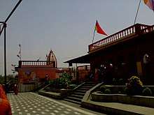
 Shani Dev Temple
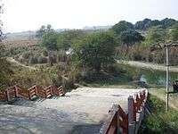 View of river Bakulahi from the Shani Dev Temple
_Devi_Temple.JPG) Maa Chauharjan (Barahi) Devi Temple
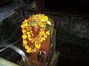
Maa Chauharjan (Barahi) Devi Temple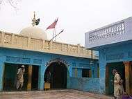 Kamakshi Devi Temple, Kamasin
References
- "52nd REPORT OF THE COMMISSIONER FOR LINGUISTIC MINORITIES IN INDIA" (PDF). nclm.nic.in. Ministry of Minority Affairs. Archived from the original (PDF) on 25 May 2017. Retrieved 20 December 2018.
- Ministry of Panchayati Raj (8 September 2009). "A Note on the Backward Regions Grant Fund Programme" (PDF). National Institute of Rural Development. Archived from the original (PDF) on 5 April 2012. Retrieved 27 September 2011.
- "प्रतापगढ़: यहां होती है किसानों की पूजा, बना है दुनिया का पहला किसान मंदिर". News18 India. 4 June 2018. Retrieved 19 January 2020.
- "यहां करिए किसान देवता के दर्शन; दावा- दुनिया में है एकलौता मंदिर, 4 मार्च तक चलेगा कैंप". Dainik Bhaskar (in Hindi). 11 February 2019. Retrieved 19 January 2020.
- "At this Kisan Temple in Pratapgarh dist, farmers sow devotion and reap blessings | Allahabad News - Times of India". The Times of India. 19 October 2019. Retrieved 19 February 2020.