Northwood, New Hampshire
Northwood is a town in Rockingham County, New Hampshire, United States. The population was 4,241 at the 2010 census.[1]
Northwood, New Hampshire | |
|---|---|
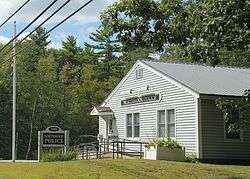 Northwood Police Station | |
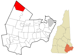 Location in Rockingham County and the state of New Hampshire. | |
| Coordinates: 43°11′39″N 71°09′03″W | |
| Country | United States |
| State | New Hampshire |
| County | Rockingham |
| Incorporated | 1773 |
| Villages | Northwood Northwood Center Northwood Narrows Northwood Ridge |
| Government | |
| • Board of Selectmen | Scott Bryer, Chair Beth Boudreau, Vice-Chair Matthew Frye Hal Kreider David Ruth |
| • Town Administrator | Heather Thibodeau |
| Area | |
| • Total | 30.0 sq mi (77.8 km2) |
| • Land | 28.0 sq mi (72.5 km2) |
| • Water | 2.1 sq mi (5.4 km2) 6.89% |
| Elevation | 558 ft (170 m) |
| Population (2010) | |
| • Total | 4,241 |
| • Density | 140/sq mi (55/km2) |
| Time zone | UTC-5 (Eastern) |
| • Summer (DST) | UTC-4 (Eastern) |
| ZIP code | 03261 |
| Area code(s) | 603 |
| FIPS code | 33-56820 |
| GNIS feature ID | 0873689 |
| Website | www |
History
First settled in 1763, Northwood was incorporated on February 6, 1773 by Colonial Governor John Wentworth, when a large tract of land called "North Woods" was separated from Nottingham. Around 1800, the Portsmouth to Concord Turnpike was built, and the town began to prosper. Numerous taverns accommodated sledge and stage passengers. At one time, there were some twelve sawmills in the town, five of which were replaced by shoe factories during the latter half of the 19th century. By 1920, however, the last shoe factory had closed. More recently, the town has been a popular vacation spot, being home to nine lakes and many antique shops.
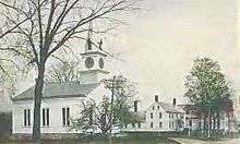
Four Northwood districts along Route 4 are considered historic sections of town. They are, from east to west, East Northwood, Northwood Ridge, Northwood Center and Northwood Narrows. The town is home to Coe-Brown Northwood Academy, founded in 1867.
Geography
According to the United States Census Bureau, the town has a total area of 30.0 square miles (78 km2), of which 28.0 sq mi (73 km2) is land and 2.1 sq mi (5.4 km2) is water, comprising 6.89% of the town. Northwood is well known for its lakes, with both seasonal and year-round residences. The larger lakes and ponds include Bow Lake, which is part of the Piscataqua River drainage basin, and Northwood Lake, Pleasant Lake, Jenness Pond, Harvey Lake, and Long Pond, all of which drain to the Suncook River, a tributary of the Merrimack River. The highest point in Northwood is Saddleback Mountain, at 1,150 feet (350 m) above sea level.
Adjacent municipalities
- Strafford, New Hampshire (north)
- Barrington, New Hampshire (east)
- Nottingham, New Hampshire (southeast)
- Deerfield, New Hampshire (south)
- Epsom, New Hampshire (west)
- Pittsfield, New Hampshire (northwest)
Ecosystem
Northwood has a diverse ecosystem with many various flora and fauna. The climate of Northwood is a temperate, humid continental climate, with warm summers and cold, snowy winters. Some of the flora and fauna that can be seen in Northwood are as follows.
Flora
Fauna
- Fisher
- American black bear
- Raccoon
- Red fox
- White-tailed deer
- Common loon
- Bald eagle
- Coyote
- Barred owl
- Great horned owl
- Moose
- Osprey
- Eastern wild turkey
- Great blue heron
- Eastern gray squirrel
- Eastern chipmunk
- North American porcupine
- Striped skunk
- Opossum
- Groundhog
- Largemouth bass
- Smallmouth bass
- Pickerel
- Yellow perch
- North American beaver
- Common snapping turtle
- Painted turtle
- Common garter snake
- Eastern American toad
- Red-spotted newt
Demographics
| Historical population | |||
|---|---|---|---|
| Census | Pop. | %± | |
| 1790 | 744 | — | |
| 1800 | 950 | 27.7% | |
| 1810 | 1,095 | 15.3% | |
| 1820 | 1,260 | 15.1% | |
| 1830 | 1,342 | 6.5% | |
| 1840 | 1,182 | −11.9% | |
| 1850 | 1,308 | 10.7% | |
| 1860 | 1,502 | 14.8% | |
| 1870 | 1,430 | −4.8% | |
| 1880 | 1,345 | −5.9% | |
| 1890 | 1,478 | 9.9% | |
| 1900 | 1,304 | −11.8% | |
| 1910 | 1,059 | −18.8% | |
| 1920 | 891 | −15.9% | |
| 1930 | 872 | −2.1% | |
| 1940 | 873 | 0.1% | |
| 1950 | 966 | 10.7% | |
| 1960 | 1,034 | 7.0% | |
| 1970 | 1,526 | 47.6% | |
| 1980 | 2,175 | 42.5% | |
| 1990 | 3,124 | 43.6% | |
| 2000 | 3,640 | 16.5% | |
| 2010 | 4,241 | 16.5% | |
| Est. 2017 | 4,289 | [2] | 1.1% |
| U.S. Decennial Census[3] | |||
As of the census[4] of 2000, there were 3,640 people, 1,347 households, and 1,000 families residing in the town. The population density was 130.1 people per square mile (50.2/km²). There were 1,905 housing units at an average density of 68.1 per square mile (26.3/km²). The racial makeup of the town was 97.53% White, 0.30% African American, 0.30% Native American, 0.66% Asian, 0.14% Pacific Islander, 0.19% from other races, and 0.88% from two or more races. Hispanic or Latino of any race were 0.55% of the population.
There were 1,347 households out of which 36.7% had children under the age of 18 living with them, 62.0% were married couples living together, 7.7% had a female householder with no husband present, and 25.7% were non-families. 18.0% of all households were made up of individuals and 5.1% had someone living alone who was 65 years of age or older. The average household size was 2.70 and the average family size was 3.07.

In the town, the population was spread out with 27.1% under the age of 18, 6.6% from 18 to 24, 32.1% from 25 to 44, 25.2% from 45 to 64, and 9.0% who were 65 years of age or older. The median age was 37 years. For every 100 females, there were 100.3 males. For every 100 females age 18 and over, there were 99.3 males.
The median income for a household in the town was $50,675, and the median income for a family was $53,953. Males had a median income of $36,161 versus $27,721 for females. The per capita income for the town was $21,491. About 1.5% of families and 4.2% of the population were below the poverty line, including 3.0% of those under age 18 and 3.0% of those age 65 or over.
Notable people
- Bruce Hodgdon, former state representative
- Ella Knowles, suffragist, lawyer and politician; born in Northwood (1860)
Camps
Northwood is home to Camp Yavneh, a Jewish summer camp founded in 1944 on Lucas Pond, and Wah-Tut-Ca Scout Reservation, a Boy Scout Camp run by the Spirit of Adventure Council.
References
- United States Census Bureau, U.S. Census website, 2010 Census figures. Retrieved March 23, 2011.
- "Annual Estimates of the Resident Population: April 1, 2010 to July 1, 2017 (PEPANNRES): Minor Civil Divisions – New Hampshire". Archived from the original on February 13, 2020. Retrieved November 15, 2018.
- "Census of Population and Housing". Census.gov. Retrieved June 4, 2016.
- "U.S. Census website". United States Census Bureau. Retrieved 2008-01-31.
Further reading
- Bailey, J.W. (1992) A Guide to the History and Old Dwelling Places of Northwood, New Hampshire, Second Edition, Peter E. Randall Publisher, Portsmouth, NH, 305 pp.
External links
| Wikimedia Commons has media related to Northwood, New Hampshire. |
- Town of Northwood official website
- Northwood Historical Society
- New Hampshire Economic and Labor Market Information Bureau Profile
Places adjacent to Northwood, New Hampshire | |
|---|---|
Municipalities and communities of Rockingham County, New Hampshire, United States | ||
|---|---|---|
| City | 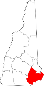 Map of New Hampshire highlighting Rockingham County | |
| Towns |
| |
| CDPs | ||
| Other villages | ||
| Authority control |
|
|---|