Epping (CDP), New Hampshire
Epping is a census-designated place (CDP) and the main village in the town of Epping in Rockingham County, New Hampshire, United States. The population of the CDP was 1,681 at the 2010 census,[1] out of 6,411 people in the entire town of Epping.
Epping, New Hampshire | |
|---|---|
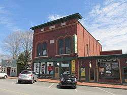 Leddy Building | |
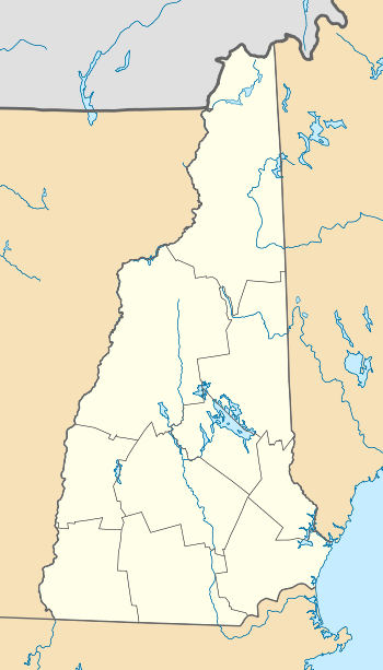 Epping  Epping | |
| Coordinates: 43°2′21″N 71°4′23″W | |
| Country | United States |
| State | New Hampshire |
| County | Rockingham |
| Town | Epping |
| Area | |
| • Total | 2.66 sq mi (6.88 km2) |
| • Land | 2.66 sq mi (6.88 km2) |
| • Water | 0.2 sq mi (0.6 km2) |
| Elevation | 129 ft (39 m) |
| Population (2010) | |
| • Total | 1,681 |
| • Density | 633/sq mi (244.4/km2) |
| Time zone | UTC-5 (Eastern (EST)) |
| • Summer (DST) | UTC-4 (EDT) |
| ZIP code | 03042 |
| Area code(s) | 603 |
| FIPS code | 33-24580 |
| GNIS feature ID | 2378062 |
Geography
The CDP is in the south-central part of the town of Epping, comprising most of the main village of Epping, part of the village of West Epping, and less densely developed land in between. The CDP is bordered to the south by the New Hampshire Route 101 expressway and to the west by Depot Road. Most of the northern border of the CDP follows New Hampshire Route 27 (Pleasant Street), except around the village of Epping in the eastern part of the CDP. From Route 27, the CDP border follows Main Street north, Odiorne Street, Academy Street, Main Street again, Elm Street, North River Road, and Old Hedding Road to New Hampshire Route 125 (Calef Highway). The border turns south on Route 125, turns east on Lagoon Road, then turns south again following a power line and passing just east of two shopping centers before returning to Route 101.[2]
NH Route 101, with one exit in Epping, leads east 12 miles (19 km) to Interstate 95 in Hampton and west 19 miles (31 km) to Interstate 93 in Manchester. Route 125, which intersects Route 101 at Exit 7 in Epping, leads north 21 miles (34 km) to Rochester and south 20 miles (32 km) to Haverhill, Massachusetts. Route 27, the pre-expressway routing of Route 101, leads east 7 miles (11 km) to Exeter and west 6 miles (10 km) to Raymond.
According to the U.S. Census Bureau, the Epping CDP has a total area of 2.7 square miles (6.9 km2), all of it recorded as land.[1] The Lamprey River passes through Epping village, flowing east toward Great Bay.
Demographics
As of the census of 2010, there were 1,681 people, 766 households, and 447 families residing in the CDP. There were 847 housing units, of which 81, or 9.6%, were vacant. The racial makeup of the CDP was 96.7% white, 0.3% African American, 0.1% Native American, 1.0% Asian, 0.0% Pacific Islander, 1.1% some other race, and 1.8% from two or more races. 1.2% of the population were Hispanic or Latino of any race.[3]
Of the 766 households in the CDP, 24.3% had children under the age of 18 living with them, 43.5% were headed by married couples living together, 10.2% had a female householder with no husband present, and 41.6% were non-families. 33.7% of all households were made up of individuals, and 13.2% were someone living alone who was 65 years of age or older. The average household size was 2.19, and the average family size was 2.79.[3]
18.2% of residents in the CDP were under the age of 18, 9.8% were from age 18 to 24, 24.3% were from 25 to 44, 29.7% were from 45 to 64, and 18.1% were 65 years of age or older. The median age was 43.4 years. For every 100 females, there were 87.8 males. For every 100 females age 18 and over, there were 83.1 males.[3]
For the period 2011-15, the estimated median annual income for a household was $50,438, and the median income for a family was $57,083. Male full-time workers had a median income of $50,917 versus $48,447 for females. The per capita income for the CDP was $27,359. 9.5% of the population and 4.5% of families were below the poverty line.[4]
References
- "Geographic Identifiers: 2010 Demographic Profile Data (G001): Epping CDP, New Hampshire". U.S. Census Bureau, American Factfinder. Archived from the original on February 13, 2020. Retrieved October 2, 2017.
- "TIGERweb: Epping CDP, New Hampshire". Geography Division, U.S. Census Bureau. Retrieved October 2, 2017.
- "Profile of General Population and Housing Characteristics: 2010 Census Summary File 1 (DP-1): Epping CDP, New Hampshire". U.S. Census Bureau, American Factfinder. Archived from the original on February 13, 2020. Retrieved October 2, 2017.
- "Selected Economic Characteristics: 2011-2015 American Community Survey 5-Year Estimates (DP03): Epping CDP, New Hampshire". U.S. Census Bureau, American Factfinder. Archived from the original on February 13, 2020. Retrieved October 2, 2017.
Municipalities and communities of Rockingham County, New Hampshire, United States | ||
|---|---|---|
| City | 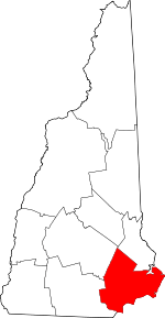 Map of New Hampshire highlighting Rockingham County | |
| Towns |
| |
| CDPs | ||
| Other villages | ||