Barrington, New Hampshire
Barrington is a town in Strafford County, New Hampshire, United States. The population was 8,576 at the 2010 census.[1] The town is a woodland, farm and bedroom community.
Barrington, New Hampshire | |
|---|---|
Town | |
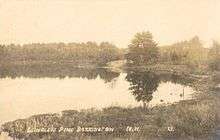
 Tom Ham Brook c. 1910 | |
 Seal | |
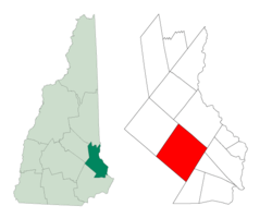 Location within Strafford County, New Hampshire | |
| Coordinates: 43°13′22″N 71°02′49″W | |
| Country | United States |
| State | New Hampshire |
| County | Strafford |
| Settled | 1699 |
| Incorporated | 1722 |
| Villages | Barrington East Barrington West Barrington |
| Government | |
| • Select Board | George Bailey Dawn Hatch Andrew Knapp Tracy Hardekopf Daniel Ayer |
| • Town Administrator | Conner MacIver |
| Area | |
| • Total | 48.5 sq mi (125.7 km2) |
| • Land | 46.6 sq mi (120.7 km2) |
| • Water | 1.9 sq mi (5.0 km2) |
| Elevation | 381 ft (116 m) |
| Population (2010) | |
| • Total | 8,576 |
| • Density | 180/sq mi (68/km2) |
| Time zone | UTC-5 (EST) |
| • Summer (DST) | UTC-4 (EDT) |
| ZIP code | 03825 |
| Area code(s) | 603 |
| FIPS code | 33-03460 |
| GNIS feature ID | 0873538 |
| Website | www |
History
Barrington was incorporated in 1722 and named for Samuel Shute of Barrington Hall, colonial governor of Massachusetts and New Hampshire. His brother was John Shute Barrington, 1st Viscount Barrington.
The town was made up of two grants, the first containing all of Strafford and present-day Barrington except for a parcel two miles wide called New Portsmouth, or the Two Mile Streak. This second grant had been set aside to provide fuel and home sites for imported workers at the Lamprey River Iron Works, chartered in 1719 by the Massachusetts General Court to encourage industrial development in the province.
Slow at first to be settled because of rocky soil, Barrington by 1810 had 3,564 residents, then the state's third largest town, its primary industry the smelting of iron ore. The Isinglass River, together with its tributaries, provided water power for grist, fulling and saw mills. In 1820, Strafford was set off from Barrington, reducing its land area by about half, because of lengthy travel required to attend town meetings.
In 1882, the Reverend Alonzo Hall Quint writes:
- "Of those towns in the state whose scenery is somewhat quiet, one of the most beautiful is Barrington."
Indeed, the town's attractive natural features, including rivers, brooks, waterfalls and not less than 14 ponds, are summarized by the name of a 374-foot (114 meter) summit: Beauty Hill. Barrington is bisected by the Calef Highway (Route 125), named for a state senator from the 1800s whose family also founded the locally famous general store founded in 1869.
Geography
According to the United States Census Bureau, the town has a total area of 48.5 square miles (126 km2), of which 46.6 sq mi (121 km2) is land and 1.9 sq mi (4.9 km2) is water, comprising 3.98% of the town. Barrington is drained by the Isinglass River and Bellamy River. Swains Lake and Mendum's Pond are in the south. The highest point in town is an unnamed summit near its western border, measuring 610 feet (190 m) above sea level. The highest named summit is Bumfagging Hill, at 601 ft (183 m). Barrington lies fully within the Piscataqua River (Coastal) watershed.[2]
The commercial center of town is the village of East Barrington, centered on the junction of state routes 9 and 125.
Adjacent municipalities
- Rochester, New Hampshire (northeast)
- Dover, New Hampshire (east)
- Madbury, New Hampshire (east)
- Lee, New Hampshire (southeast)
- Nottingham, New Hampshire (southwest)
- Northwood, New Hampshire (west)
- Strafford, New Hampshire (northwest)
Demographics
| Historical population | |||
|---|---|---|---|
| Census | Pop. | %± | |
| 1790 | 2,470 | — | |
| 1800 | 2,773 | 12.3% | |
| 1810 | 3,564 | 28.5% | |
| 1820 | 1,610 | −54.8% | |
| 1830 | 1,895 | 17.7% | |
| 1840 | 1,845 | −2.6% | |
| 1850 | 1,752 | −5.0% | |
| 1860 | 1,963 | 12.0% | |
| 1870 | 1,581 | −19.5% | |
| 1880 | 1,497 | −5.3% | |
| 1890 | 1,408 | −5.9% | |
| 1900 | 1,208 | −14.2% | |
| 1910 | 900 | −25.5% | |
| 1920 | 616 | −31.6% | |
| 1930 | 613 | −0.5% | |
| 1940 | 780 | 27.2% | |
| 1950 | 1,052 | 34.9% | |
| 1960 | 1,036 | −1.5% | |
| 1970 | 1,865 | 80.0% | |
| 1980 | 4,404 | 136.1% | |
| 1990 | 6,164 | 40.0% | |
| 2000 | 7,475 | 21.3% | |
| 2010 | 8,576 | 14.7% | |
| Est. 2017 | 9,049 | [3] | 5.5% |
| U.S. Decennial Census[4] | |||

As of the census[5] of 2000, there were 7,475 people, 2,756 households, and 2,075 families residing in the town. The population density was 160.5 people per square mile (61.9/km2). There were 3,147 housing units at an average density of 67.6 per square mile (26.1/km2). The racial makeup of the town was 98.11% White, 0.25% African American, 0.13% Native American, 0.41% Asian, 0.05% Pacific Islander, 0.23% from other races, and 0.80% from two or more races. Hispanic or Latino of any race were 0.92% of the population.
There were 2,756 households, out of which 38.8% had children under the age of 18 living with them, 64.6% were married couples living together, 6.5% had a female householder with no husband present, and 24.7% were non-families. 16.9% of all households were made up of individuals, and 4.3% had someone living alone who was 65 years of age or older. The average household size was 2.71 and the average family size was 3.07.
In the town, the population was spread out, with 27.5% under the age of 18, 5.7% from 18 to 24, 35.1% from 25 to 44, 24.7% from 45 to 64, and 7.0% who were 65 years of age or older. The median age was 37 years. For every 100 females, there were 104.1 males. For every 100 females age 18 and over, there were 101.7 males.
The median income for a household in the town was $50,630, and the median income for a family was $56,136. Males had a median income of $39,098 versus $27,956 for females. The per capita income for the town was $21,012. About 3.6% of families and 5.5% of the population were below the poverty line, including 7.0% of those under age 18 and none of those age 65 or over.
Education
The Barrington School District serves town children from pre-K through grade 8, at the Early Childhood Learning Center (ECLC), Barrington Elementary School and the Barrington Middle School. Students of high school age attend schools in neighboring communities, including Dover High School, Coe-Brown Northwood Academy, Oyster River High School or St. Thomas Aquinas High School.
Notable people
- John Buzzell, Free Will Baptist preacher and writer
- Paul Frase, American pro-football player (New York Jets, Jacksonville Jaguars, Green Bay Packers, Baltimore Ravens), co-founder Joshua Frase Foundation
- Frank Jones, brewer, hotelier, and U.S. congressman
- Jillian Wheeler, singer, songwriter and actress
References
- United States Census Bureau, U.S. Census website, 2010 Census figures. Retrieved March 23, 2011.
- Foster, Debra H.; Batorfalvy, Tatianna N.; Medalie, Laura (1995). Water Use in New Hampshire: An Activities Guide for Teachers. U.S. Department of the Interior and U.S. Geological Survey.
- "Annual Estimates of the Resident Population: April 1, 2010 to July 1, 2017 (PEPANNRES): Minor Civil Divisions – New Hampshire". Archived from the original on February 13, 2020. Retrieved November 15, 2018.
- "Census of Population and Housing". Census.gov. Retrieved June 4, 2016.
- "U.S. Census website". United States Census Bureau. Retrieved 2008-01-31.
Further reading
- Rev. Alonzo Hall Quint, "Daniel Hall," Sketches of Successful New Hampshire Men (1882), pub. John Badger Clarke, Manchester, New Hampshire
External links
- Town of Barrington official website
- Barrington Public Library
- New Hampshire Economic and Labor Market Information Bureau Profile
- Greater Barrington Chamber of Commerce
Places adjacent to Barrington, New Hampshire | |
|---|---|
Municipalities and communities of Strafford County, New Hampshire, United States | ||
|---|---|---|
| Cities |  Map of New Hampshire highlighting Strafford County | |
| Towns | ||
| CDPs | ||
| Other villages | ||