National Register of Historic Places listings in Fort Bend County, Texas
This is a list of the National Register of Historic Places listings in Fort Bend County, Texas.

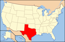
Location of Fort Bend County in Texas
This is intended to be a complete list of properties and districts listed on the National Register of Historic Places in Fort Bend County, Texas. There are one district and six individual properties listed on the National Register in the county. Three of the individually listed properties are Recorded Texas Historic Landmarks including one that is also a State Antiquities Landmark.
- This National Park Service list is complete through NPS recent listings posted June 19, 2020.[1]
Current listings
The locations of National Register properties and districts may be seen in a mapping service provided.[2]
| [3] | Name on the Register | Image | Date listed[4] | Location | City or town | Description |
|---|---|---|---|---|---|---|
| 1 | Fort Bend County Courthouse | 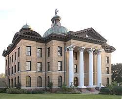 Fort Bend County Courthouse |
March 13, 1980 (#80004119) |
400 Jackson St. 29°34′54″N 95°45′42″W |
Richmond | State Antiquities Landmark, Recorded Texas Historic Landmark |
| 2 | Henry G. and Annie B. Green House | 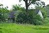 Henry G. and Annie B. Green House |
September 18, 1996 (#96001016) |
.5 mi SE of old US 59 and TX 118 29°26′59″N 95°59′38″W |
Kendleton | Demolished in 2018. |
| 3 | Imperial Sugar Company Refinery Historic District | 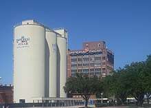 Imperial Sugar Company Refinery Historic District |
June 26, 2017 (#100001253) |
198 Kempner St. 29°37′15″N 95°38′11″W |
Sugar Land | |
| 4 | Lamar-Calder House | 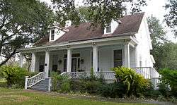 Lamar-Calder House |
March 30, 2005 (#05000244) |
915 Front St. 29°34′40″N 95°45′23″W |
Richmond | |
| 5 | Methodist Church of Richmond | .jpg) Methodist Church of Richmond |
June 13, 2014 (#14000339) |
400 Jackson Street 29°34′56″N 95°45′42″W |
Richmond | Recorded Texas Historic Landmark |
| 6 | John M. and Lottie D. Moore House | 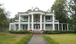 John M. and Lottie D. Moore House |
December 9, 2001 (#01000104) |
406 S. Fifth St. 29°34′51″N 95°45′44″W |
Richmond | Recorded Texas Historic Landmark |
| 7 | B. Ray and Charlotte Woods House |  B. Ray and Charlotte Woods House |
January 6, 2004 (#03001377) |
610 Woods Ln. 29°47′00″N 95°49′39″W |
Katy |
See also
References
- "National Register of Historic Places: Weekly List Actions". National Park Service, United States Department of the Interior. Retrieved on June 19, 2020.
- The latitude and longitude information provided in this table was derived originally from the National Register Information System, which has been found to be fairly accurate for about 99% of listings. Some locations in this table may have been corrected to current GPS standards.
- Numbers represent an ordering by significant words. Various colorings, defined here, differentiate National Historic Landmarks and historic districts from other NRHP buildings, structures, sites or objects.
- The eight-digit number below each date is the number assigned to each location in the National Register Information System database, which can be viewed by clicking the number.
External links
![]()
Municipalities and communities of Fort Bend County, Texas, United States | ||
|---|---|---|
| Cities | Fort Bend County map | |
| Town | ||
| Villages | ||
| CDPs |
| |
| Other unincorporated communities | ||
| Ghost towns | ||
| Footnotes | ‡This populated place also has portions in an adjacent county or counties;
±Former community annexed by Missouri City | |
This article is issued from Wikipedia. The text is licensed under Creative Commons - Attribution - Sharealike. Additional terms may apply for the media files.