National Register of Historic Places listings in Burnet County, Texas
This is a list of the National Register of Historic Places listings in Burnet County, Texas.
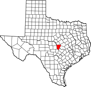
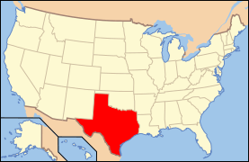
Location of Burnet County in Texas
This is intended to be a complete list of properties and districts listed on the National Register of Historic Places in Burnet County, Texas. There are two districts and six individual properties listed on the National Register in the county. Two properties and one site within one district are designated as Recorded Texas Historic Landmarks.
- This National Park Service list is complete through NPS recent listings posted June 19, 2020.[1]
Current listings
The publicly disclosed locations of National Register properties and districts may be seen in a mapping service provided.[2]
| [3] | Name on the Register | Image | Date listed[4] | Location | City or town | Description |
|---|---|---|---|---|---|---|
| 1 | Austin and Northwestern Railroad Historic District-Fairland to Llano | 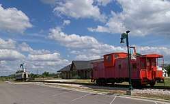 Austin and Northwestern Railroad Historic District-Fairland to Llano |
October 6, 1997 (#97001161) |
Roughly along RR tracks from Fairland to Llano 30°38′52″N 98°17′44″W |
Kingsland | Extends into Llano County |
| 2 | Briggs State Bank | 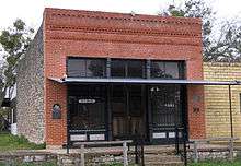 Briggs State Bank |
August 11, 2000 (#00000885) |
176 S. Loop 308 (approx. 0.5 mi. N of jct. with US 183) 30°53′17″N 97°55′28″W |
Briggs | Recorded Texas Historic Landmark |
| 3 | Burnet County Courthouse | %2C_Burnet%2C_TX.jpg) Burnet County Courthouse |
November 15, 2000 (#00001384) |
220 S. Pierce St. 30°45′25″N 98°13′37″W |
Burnet | |
| 4 | Krause Spring Site | 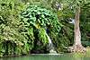 Krause Spring Site |
November 15, 1978 (#78002901) |
Address restricted[5] |
Spicewood | |
| 5 | Louis Page Archeological Site |  Louis Page Archeological Site |
March 30, 1978 (#78002900) |
Address restricted[5] |
Marble Falls | |
| 6 | Park Road 4 Historic District | 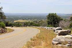 Park Road 4 Historic District |
February 7, 2011 (#10001221) |
Park Road 4 from US 281 to TX 29 & Longhorn Cavern State Park 30°42′18″N 98°20′09″W |
Burnet vicinity | Includes Recorded Texas Historic Landmark |
| 7 | Roper Hotel |  Roper Hotel |
January 8, 1980 (#80004083) |
707 3rd St. 30°34′16″N 98°16′31″W |
Marble Falls | Recorded Texas Historic Landmark |
| 8 | State Highway 29 Bridge at the Colorado River | 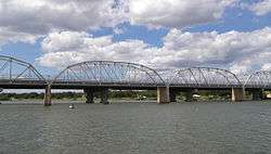 State Highway 29 Bridge at the Colorado River |
October 10, 1996 (#96001116) |
TX 29 at the Llano County line 30°44′53″N 98°23′54″W |
Buchanan Dam | Extends into Llano County |
See also
- National Register of Historic Places listings in Texas
- Recorded Texas Historic Landmarks in Burnet County
References
- "National Register of Historic Places: Weekly List Actions". National Park Service, United States Department of the Interior. Retrieved on June 19, 2020.
- The latitude and longitude information provided in this table was derived originally from the National Register Information System, which has been found to be fairly accurate for about 99% of listings. Some locations in this table may have been corrected to current GPS standards.
- Numbers represent an ordering by significant words. Various colorings, defined here, differentiate National Historic Landmarks and historic districts from other NRHP buildings, structures, sites or objects.
- The eight-digit number below each date is the number assigned to each location in the National Register Information System database, which can be viewed by clicking the number.
- Federal and state laws and practices restrict general public access to information regarding the specific location of this resource. In some cases, this is to protect archeological sites from vandalism, while in other cases it is restricted at the request of the owner. See: Knoerl, John; Miller, Diane; Shrimpton, Rebecca H. (1990), Guidelines for Restricting Information about Historic and Prehistoric Resources, National Register Bulletin, National Park Service, U.S. Department of the Interior, OCLC 20706997.
External links
![]()
Places adjacent to National Register of Historic Places listings in Burnet County, Texas | ||||||||||
|---|---|---|---|---|---|---|---|---|---|---|
| ||||||||||
Municipalities and communities of Burnet County, Texas, United States | ||
|---|---|---|
| Cities | Burnet County map | |
| Unincorporated communities | ||
| Footnotes | ‡This populated place also has portions in an adjacent county or counties | |
This article is issued from Wikipedia. The text is licensed under Creative Commons - Attribution - Sharealike. Additional terms may apply for the media files.