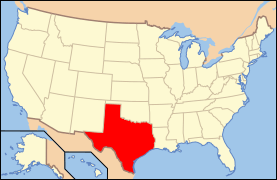
National Register of Historic Places listings in Bexar County, Texas
This is a list of the National Register of Historic Places listings in Bexar County, Texas.
This is intended to be a complete list of properties and districts listed on the National Register of Historic Places in Bexar County, Texas. There are 27 districts, 126 individual properties, and one former property listed on the National Register in the county. Two districts and seven individually listed properties are National Historic Landmarks. One district is a National Historical Park, and one property is a National Historic Site. One property is a State Historic Site. Two districts and 15 individually listed properties are State Antiquities Landmarks while six districts contain several more. Two districts are Recorded Texas Historic Landmarks (RTHLs) while 33 individual properties are also designated RTHLs or contain one or more. Ten districts contain many more RTHLs.
- This National Park Service list is complete through NPS recent listings posted June 19, 2020.[1]
Current listings
The publicly disclosed locations of National Register properties and districts may be seen in a mapping service provided.[2]
| [3] | Name on the Register[4] | Image | Date listed[5] | Location | City or town | Description |
|---|---|---|---|---|---|---|
| 1 | Alamo Methodist Church |  Alamo Methodist Church |
June 11, 1979 (#79003446) |
1150 S. Alamo St. 29°24′41″N 98°29′35″W |
San Antonio | Part of South Alamo Street-South Mary's Street Historic District |
| 2 | Alamo National Bank Building | 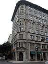 Alamo National Bank Building |
January 5, 1984 (#84001574) |
316 E. Commerce St. 29°25′26″N 98°29′21″W |
San Antonio | Part of San Antonio Downtown and River Walk Historic District |
| 3 | Alamo National Bank Building | .jpg) Alamo National Bank Building |
May 10, 2006 (#06000364) |
105 S. St. Mary's St. 29°25′27″N 98°29′30″W |
San Antonio | Part of San Antonio Downtown and River Walk Historic District |
| 4 | Alamo Plaza Historic District | .jpg) Alamo Plaza Historic District |
July 13, 1977 (#77001425) |
Roughly bounded by S. Broadway, Commerce, Bonham and Travis Sts. 29°25′31″N 98°29′08″W |
San Antonio | Includes National Historic Landmarks, State Antiquities Landmarks, Recorded Texas Historic Landmarks |
| 5 | Alamo Portland and Roman Cement Works | 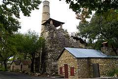 Alamo Portland and Roman Cement Works |
December 12, 1976 (#76002005) |
Brackenridge Park 29°27′38″N 98°28′36″W |
San Antonio | State Antiquities Landmark; part of Brackenridge Park |
| 6 | The Alamo | .jpg) The Alamo |
October 15, 1966 (#66000808) |
Alamo Plaza 29°25′32″N 98°29′10″W |
San Antonio | State Antiquities Landmark, Recorded Texas Historic Landmark; part of Alamo Plaza Historic District |
| 7 | Alamo Stadium and Gymnasium | .jpg) Alamo Stadium and Gymnasium |
September 8, 2011 (#11000651) |
110 Tuleta Drive 29°27′46″N 98°28′42″W |
San Antonio | State Antiquities Landmark |
| 8 | Aue Stagecoach Inn |  Aue Stagecoach Inn |
August 1, 1979 (#79002912) |
Boerne Stage Rd. and I-10 29°39′55″N 98°37′43″W |
Leon Springs | |
| 9 | Aztec Theater | .jpg) Aztec Theater |
October 22, 1992 (#92001403) |
104 N. St. Mary's St. 29°25′28″N 98°29′27″W |
San Antonio | Part of San Antonio Downtown and River Walk Historic District |
| 10 | Joseph, Jr. and Salome Ball Homestead |  Joseph, Jr. and Salome Ball Homestead |
July 23, 2018 (#100002696) |
Address restricted[6] |
Lytle | Historic Farms and Ranches of Bexar County MPS |
| 11 | Barnes-Laird House | .jpg) Barnes-Laird House |
July 28, 1988 (#88001146) |
103 W. Ashby Pl. 29°26′58″N 98°29′40″W |
San Antonio | Part of Monte Vista Residential Historic District |
| 12 | Barr Building | 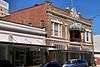 Barr Building |
April 11, 1985 (#85000766) |
213-219 Broadway 29°25′41″N 98°29′15″W |
San Antonio | Part of San Antonio Downtown and River Walk Historic District |
| 13 | Base Administration Building | 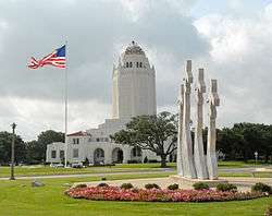 Base Administration Building |
August 27, 1987 (#87001434) |
Randolph AFB 29°32′09″N 98°16′57″W |
Universal City | Part of Randolph Field Historic District |
| 14 | Bexar County Courthouse |  Bexar County Courthouse |
August 29, 1977 (#77001426) |
Main Plaza 29°25′23″N 98°29′36″W |
San Antonio | State Antiquities Landmark, Recorded Texas Historic Landmark; part of Main and Military Plazas Historic District |
| 15 | Blue Star Street Industrial Historic District | _-_001.jpg) Blue Star Street Industrial Historic District |
June 24, 1994 (#94000627) |
1432 S. Alamo St. 29°24′35″N 98°29′44″W |
San Antonio | |
| 16 | James Butler Bonham Elementary School |  James Butler Bonham Elementary School |
November 17, 1978 (#78002890) |
925 S. St. Mary's St. 29°24′50″N 98°29′20″W |
San Antonio | Part of South Alamo Street-South Mary's Street Historic District |
| 17 | Brackenridge Park |  Brackenridge Park |
August 4, 2011 (#11000513) |
Roughly bounded by Hildebrand Ave., Broadway & Ave. B, Josephine St., US 281, River Rd., Alpine Dr., N. St. Mary's St. 29°27′21″N 98°28′23″W |
San Antonio | State Antiquities Landmark; includes additional State Antiquities Landmarks, Recorded Texas Historic Landmarks |
| 18 | Brady Building-Empire Theater | .jpg) Brady Building-Empire Theater |
March 17, 1999 (#99000283) |
204 E. Houston St.-226 N. St. Mary's St. 29°25′34″N 98°29′28″W |
San Antonio | Part of San Antonio Downtown and River Walk Historic District |
| 19 | Brooke Army Medical Center | 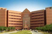 Brooke Army Medical Center |
November 30, 2001 (#01001281) |
Building 1000, Stanley Rd., Fort Sam Houston 29°27′58″N 98°26′57″W |
San Antonio | |
| 20 | Buckeye Park Gate | 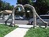 Buckeye Park Gate |
October 22, 2004 (#04001169) |
1600 W. Wildwood 29°28′45″N 98°31′17″W |
San Antonio | Sculpture by Dionicio Rodriguez in Texas MPS |
| 21 | Builders Exchange Building |  Builders Exchange Building |
November 16, 1994 (#94001335) |
152 Pecan St. 29°25′42″N 98°29′30″W |
San Antonio | Part of San Antonio Downtown and River Walk Historic District |
| 22 | Bungalow Colony Historic District | July 8, 2003 (#03000627) |
Roughly bounded by Duncan Dr., Crockett Dr., Walker Rd. and Robins Dr. 29°22′48″N 98°33′39″W |
San Antonio | ||
| 23 | Burns Building |  Burns Building |
March 18, 1999 (#99000284) |
401 E. Houston St. 29°25′35″N 98°29′18″W |
San Antonio | Part of San Antonio Downtown and River Walk Historic District |
| 24 | Bushnell |  Bushnell |
August 26, 1982 (#82004491) |
240 Bushnell 29°27′44″N 98°29′16″W |
San Antonio | Part of Monte Vista Residential Historic District |
| 25 | Calcasieu Building | 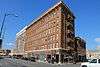 Calcasieu Building |
May 24, 1996 (#96000588) |
202-214 Broadway 29°25′40″N 98°29′14″W |
San Antonio | Part of San Antonio Downtown and River Walk Historic District |
| 26 | George Washington Carver Library and Auditorium | .jpg) George Washington Carver Library and Auditorium |
November 15, 2003 (#03001162) |
226 N. Hackberry St. 29°25′19″N 98°28′21″W |
San Antonio | |
| 27 | Central Trust Company Building |  Central Trust Company Building |
August 11, 1982 (#82004492) |
603 Navarro St. 29°25′36″N 98°29′24″W |
San Antonio | Part of San Antonio Downtown and River Walk Historic District |
| 28 | Chinese Sunken Garden Gate | 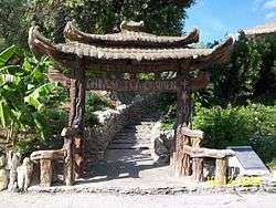 Chinese Sunken Garden Gate |
October 22, 2004 (#04001167) |
Brackenridge Park, 4000 N. St. Mary's St. 29°27′45″N 98°28′38″W |
San Antonio | Part of Brackenridge Park; Sculpture by Dionicio Rodriguez in Texas MPS |
| 29 | Church of Nuestra Senora de la Candelaria y Guadalupe | .jpg) Church of Nuestra Senora de la Candelaria y Guadalupe |
February 25, 1975 (#75001949) |
115 Main Ave. 29°25′28″N 98°29′39″W |
San Antonio | Recorded Texas Historic Landmark; part of Main and Military Plazas Historic District |
| 30 | City of San Antonio Municipal Auditorium | 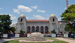 City of San Antonio Municipal Auditorium |
September 14, 1981 (#81000624) |
100 Auditorium Circle 29°25′50″N 98°29′20″W |
San Antonio | Part of San Antonio Downtown and River Walk Historic District |
| 31 | City Public Service Company Building | .jpg) City Public Service Company Building |
December 7, 1995 (#95001422) |
201 N. St. Mary's St. 29°25′31″N 98°29′30″W |
San Antonio | Part of San Antonio Downtown and River Walk Historic District |
| 32 | L. B. Clegg House | 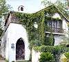 L. B. Clegg House |
December 7, 1979 (#79002913) |
123 W. Park Ave. 29°26′39″N 98°29′43″W |
San Antonio | Recorded Texas Historic Landmark |
| 33 | Dionicio Rodriguez Bridge in Brackenridge Park | 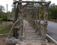 Dionicio Rodriguez Bridge in Brackenridge Park |
October 22, 2004 (#04001166) |
4000 N. St. Mary's St. 29°27′53″N 98°28′06″W |
San Antonio | Part of Brackenridge Park; Sculpture by Dionicio Rodriguez in Texas MPS |
| 34 | Emil Elmendorf House |  Emil Elmendorf House |
May 19, 1980 (#80004077) |
509 Burleson St. 29°25′58″N 98°28′22″W |
San Antonio | Recorded Texas Historic Landmark |
| 35 | Espada Aqueduct | .jpg) Espada Aqueduct |
October 15, 1966 (#66000809) |
Espada Rd., E of U.S. 281S 29°19′56″N 98°27′40″W |
San Antonio | Recorded Texas Historic Landmarks; part of San Antonio Missions National Historical Park |
| 36 | The Fairmount Hotel | The Fairmount Hotel |
June 30, 1988 (#88000753) |
401 S. Alamo 29°25′14″N 98°29′18″W |
San Antonio | |
| 37 | Fence at Alamo Cement Company |  Fence at Alamo Cement Company |
August 9, 2005 (#05000861) |
7300 Jones Maltsberger Rd. 29°29′51″N 98°28′44″W |
San Antonio | Sculpture by Dionicio Rodriguez in Texas MPS |
| 38 | First National Bank of San Antonio |  First National Bank of San Antonio |
March 16, 1972 (#72001348) |
239 E. Commerce St. 29°25′28″N 98°29′25″W |
San Antonio | Recorded Texas Historic Landmark; part of San Antonio Downtown and River Walk Historic District |
| 39 | Floore Country Store |  Floore Country Store |
December 6, 2005 (#05001402) |
14492 Old Bandera Rd. 29°34′40″N 98°41′26″W |
Helotes | |
| 40 | Fort Sam Houston |  Fort Sam Houston |
May 15, 1975 (#75001950) |
N edge of San Antonio 29°26′52″N 98°27′52″W |
San Antonio | Includes Recorded Texas Historic Landmark |
| 41 | Fort Sam Houston National Cemetery | 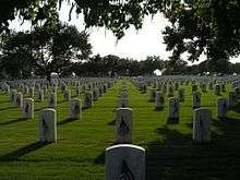 Fort Sam Houston National Cemetery |
March 8, 2016 (#16000065) |
1520 Harry Wurzbach Road 29°28′36″N 98°25′58″W |
San Antonio | |
| 42 | Fountain at Alamo Cement Company | 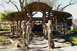 Fountain at Alamo Cement Company |
August 9, 2005 (#05000862) |
7300 Jones Maltsberger Rd. 29°29′51″N 98°28′45″W |
San Antonio | Sculpture by Dionicio Rodriguez in Texas MPS |
| 43 | Fourth Ward School |  Fourth Ward School |
November 17, 1978 (#78002891) |
141 Lavaca St. 29°25′02″N 98°29′12″W |
San Antonio | Part of Lavaca Historic District |
| 44 | Thomas H. Franklin House | 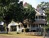 Thomas H. Franklin House |
May 22, 1986 (#86001135) |
105 E. French Pl. 29°27′02″N 98°29′37″W |
San Antonio | Part of Monte Vista Residential Historic District |
| 45 | Friedrich Complex |  Friedrich Complex |
September 26, 2002 (#02001059) |
1617 E. Commerce St. 29°25′14″N 98°28′14″W |
San Antonio | |
| 46 | Garcia-Garza House |  Garcia-Garza House |
July 7, 1983 (#83003091) |
214 W. Salinas St. 29°25′41″N 98°29′42″W |
San Antonio | Part of San Antonio Downtown and River Walk Historic District |
| 47 | Goad Motor Company Building | 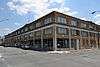 Goad Motor Company Building |
December 8, 1997 (#97001530) |
317 Lexington Ave. 29°26′00″N 98°29′25″W |
San Antonio | |
| 48 | Robert B. Green Memorial Hospital | _Goldbeck_Papers_and_Photography_Collection._Banquet_Negatives_and_Prints.jpg) Robert B. Green Memorial Hospital |
February 13, 2018 (#100002127) |
903 W Martin St. 29°25′48″N 98°30′06″W |
San Antonio | |
| 49 | Carl Hilmar Guenther House | 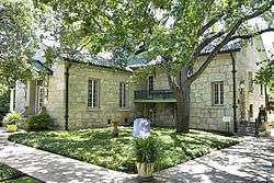 Carl Hilmar Guenther House |
October 11, 1990 (#90001539) |
205 E. Guenther St. 29°24′41″N 98°29′45″W |
San Antonio | |
| 50 | Gunter Hotel |  Gunter Hotel |
January 9, 2007 (#06001233) |
205 E. Houston St. 29°25′36″N 98°29′28″W |
San Antonio | Part of San Antonio Downtown and River Walk Historic District |
| 51 | A. H. Halff House |  A. H. Halff House |
September 4, 1986 (#86002180) |
601 Howard St. 29°26′31″N 98°29′45″W |
San Antonio | Recorded Texas Historic Landmark |
| 52 | Hangar 9 | 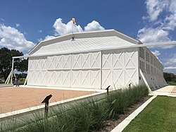 Hangar 9 |
May 21, 1970 (#70000895) |
Brooks Air Force Base Inner Circle Rd. 29°20′38″N 98°26′39″W |
San Antonio | Recorded Texas Historic Landmark |
| 53 | Ethel Wilson Harris House |  Ethel Wilson Harris House |
April 3, 2001 (#01000325) |
6519 San Jose Dr.-San Antonio Missions NHP 29°21′48″N 98°28′50″W |
San Antonio | Part of San Jose Mission National Historic Site, San Antonio Missions National Historical Park |
| 54 | John S. Harrison House | .jpg) John S. Harrison House |
June 29, 2006 (#06000551) |
14997 Evans Rd. 29°34′32″N 98°18′19″W |
Selma | State Antiquities Landmark |
| 55 | The Havana | 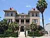 The Havana |
April 10, 1986 (#86000725) |
1015 Navarro St. 29°25′51″N 98°29′23″W |
San Antonio | Part of San Antonio Downtown and River Walk Historic District |
| 56 | Hays Street Bridge | .jpg) Hays Street Bridge |
September 10, 2012 (#12000787) |
Hays St. over UPRR, N. Cherry, & Chestnut Sts. 29°25′49″N 98°28′40″W |
San Antonio | Historic Bridges of Texas, 1866-1945 MPS |
| 57 | Heidemann Ranch | July 6, 2011 (#11000423) |
26090 Toutant Beauregard Rd. 29°41′18″N 98°42′13″W |
San Antonio | Historic Farms and Ranches of Bexar County MPS | |
| 58 | Johann and Anna Heidgen House | 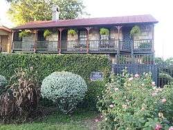 Johann and Anna Heidgen House |
June 9, 2004 (#04000591) |
121 Starr St. 29°25′34″N 98°28′56″W |
San Antonio | Recorded Texas Historic Landmark |
| 59 | Heimann Building | 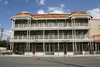 Heimann Building |
January 27, 2005 (#04001396) |
118 N. Medina St. 29°25′37″N 98°30′17″W |
San Antonio | |
| 60 | Herrera Ranch | September 9, 2010 (#10000737) |
Old Somerset Rd. at Medina River 29°16′59″N 98°36′51″W |
Von Ormy | Historic Farms and Ranches of Bexar County MPS | |
| 61 | Huebner-Onion Homestead and Stagecoach Stop | 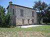 Huebner-Onion Homestead and Stagecoach Stop |
August 10, 2005 (#05000860) |
6613 Bandera Rd. 29°29′39″N 98°37′00″W |
Leon Valley | |
| 62 | International & Great Northern Railroad Passenger Station | .jpg) International & Great Northern Railroad Passenger Station |
September 9, 1975 (#75001951) |
Medina and Houston Sts. 29°25′37″N 98°30′19″W |
San Antonio | |
| 63 | Jacala Restaurant |  Jacala Restaurant |
October 22, 2004 (#04001168) |
2702 N. St. Mary's St. 29°27′01″N 98°29′13″W |
San Antonio | Sculpture by Dionicio Rodriguez in Texas MPS |
| 64 | Kelly Field Historic District |  Kelly Field Historic District |
July 10, 2003 (#03000626) |
Roughly encompassing the 1600 and 1700 Areas of Kelly AFB 29°22′57″N 98°34′15″W |
San Antonio | |
| 65 | King William Historic District | 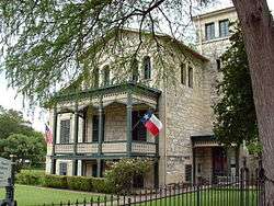 King William Historic District |
January 20, 1972 (#72001349) |
Roughly bounded by Durango, Alamo, Guenther Sts. and the San Antonio River 29°24′51″N 98°29′34″W |
San Antonio | Includes Recorded Texas Historic Landmarks |
| 66 | Krause House | 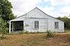 Krause House |
July 19, 2010 (#10000469) |
8551 Old Pearsall Road 29°18′20″N 98°39′56″W |
San Antonio | Recorded Texas Historic Landmark; Historic Farms and Ranches of Bexar County MPS |
| 67 | La Villita Historic District |  La Villita Historic District |
January 20, 1972 (#72001350) |
Bounded by Durango, Navarro, Alamo Sts. and San Antonio River 29°25′17″N 98°29′20″W |
San Antonio | Includes State Antiquities Landmarks, Recorded Texas Historic Landmarks |
| 68 | Lavaca Historic District | Lavaca Historic District |
July 5, 2000 (#00000773) |
Roughly bounded by S. Alamo St., S. Presa St., alley bet. Camargo St., Callahan Ave., Labor St., and Garfield Alley 29°24′47″N 98°29′14″W |
San Antonio | |
| 69 | Robert E. Lee Hotel | .jpg) Robert E. Lee Hotel |
February 16, 1996 (#96000063) |
111 Travis St. 29°25′39″N 98°29′39″W |
San Antonio | Part of San Antonio Downtown and River Walk Historic District |
| 70 | Lerma's Nite Club | .jpg) Lerma's Nite Club |
March 21, 2011 (#11000135) |
1602-1612 N Zarzamora 29°26′40″N 98°31′29″W |
San Antonio | |
| 71 | Light House | 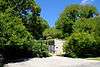 Light House |
March 21, 2011 (#11000131) |
300 Argyle Ave 29°28′32″N 98°28′10″W |
Alamo Heights | |
| 72 | Live Oak Park Site | Live Oak Park Site |
December 15, 1978 (#78002889) |
Address restricted[6] |
Live Oak | Smithsonian trinomial: 41BX435 |
| 73 | Livingston-Hess House |  Livingston-Hess House |
February 16, 1996 (#96000036) |
228 W. Huisache Ave. 29°27′21″N 98°29′46″W |
San Antonio | Part of Monte Vista Residential Historic District |
| 74 | Main and Military Plazas Historic District | 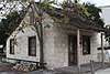 Main and Military Plazas Historic District |
June 11, 1979 (#79002914) |
Roughly bounded by San Antonio River, E. Nueva, Laredo, and Houston Sts. 29°25′27″N 98°29′37″W |
San Antonio | Includes National Historic Landmark, State Antiquities Landmarks, Recorded Texas Historic Landmarks; boundary increased October 7, 2019. |
| 75 | Majestic Theatre | .jpg) Majestic Theatre |
October 1, 1975 (#75001952) |
230 E. Houston St. 29°25′35″N 98°29′26″W |
San Antonio | Recorded Texas Historic Landmark; part of San Antonio Downtown and River Walk Historic District |
| 76 | Maverick Building | 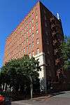 Maverick Building |
January 24, 1995 (#94001593) |
606 N. Presa 29°25′35″N 98°29′18″W |
San Antonio | Part of San Antonio Downtown and River Walk Historic District |
| 77 | Maverick-Altgelt Ranch and Fenstermaker-Fromme Farm | Maverick-Altgelt Ranch and Fenstermaker-Fromme Farm |
April 12, 1979 (#79002915) |
Address restricted[6] |
San Antonio | Smithsonian trinomials: 41BX493, 41BX494, 41BX495, 41BX496, 41BX497, 41BX498 |
| 78 | Maverick-Carter House | 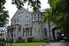 Maverick-Carter House |
July 21, 1998 (#98000844) |
119 Taylor St. 29°25′48″N 98°29′16″W |
San Antonio | Recorded Texas Historic Landmark; part of San Antonio Downtown and River Walk Historic District |
| 79 | Otto Meerscheidt House | .jpg) Otto Meerscheidt House |
July 4, 1980 (#80004488) |
332 Adams St. 29°24′30″N 98°29′25″W |
San Antonio | Part of South Alamo Street-South Mary's Street Historic District |
| 80 | Menger Soap Works |  Menger Soap Works |
December 12, 1973 (#73001958) |
400 block of N. Laredo St. 29°25′45″N 98°29′48″W |
San Antonio | Recorded Texas Historic Landmark |
| 81 | Merchants Ice and Cold Storage Company |  Merchants Ice and Cold Storage Company |
September 26, 2002 (#02001060) |
1305 E. Houston St. 29°25′31″N 98°28′38″W |
San Antonio | |
| 82 | Meyer Pottery Archeological Complex | Meyer Pottery Archeological Complex |
March 9, 1990 (#90000299) |
Address restricted[6] |
Atascosa | Smithsonian trinomial; 41BX128, also known as Black Hill Pottery |
| 83 | Milam Building | 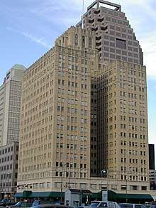 Milam Building |
May 18, 2014 (#15000246) |
115 East Travis Street 29°25′40″N 98°29′35″W |
San Antonio | Part of San Antonio Downtown and River Walk Historic District |
| 84 | Miraflores Park |  Miraflores Park |
June 14, 2006 (#04001176) |
800 Hildebrand 29°27′55″N 98°28′03″W |
San Antonio | State Antiquities Landmark; part of Brackenridge Park; Sculpture by Dionicio Rodriguez in Texas MPS |
| 85 | Mission Concepcion |  Mission Concepcion |
April 15, 1970 (#70000740) |
807 Mission Rd. 29°23′27″N 98°29′28″W |
San Antonio | State Antiquities Landmark, Recorded Texas Historic Landmark; part of San Antonio Missions National Historical Park |
| 86 | Mission Parkway |  Mission Parkway |
October 6, 1975 (#75001953) |
Along San Antonio River 29°21′06″N 98°28′11″W |
San Antonio | Part of San Antonio Missions National Historical Park; includes State Antiquities Landmark |
| 87 | Mission San Francisco de la Espada |  Mission San Francisco de la Espada |
February 23, 1972 (#72001351) January 28, 1974 boundary increase (#74002324) |
Espada Rd. 29°19′03″N 98°27′00″W |
San Antonio | State Antiquities Landmark; part of San Antonio Missions National Historical Park |
| 88 | Mission San Juan Capistrano |  Mission San Juan Capistrano |
February 23, 1972 (#72001352) |
Mission Rd. 29°19′55″N 98°27′16″W |
San Antonio | State Antiquities Landmark, Recorded Texas Historic Landmark; part of San Antonio Missions National Historical Park |
| 89 | Monastery of Our Lady of Charity |  Monastery of Our Lady of Charity |
June 25, 1999 (#99000719) |
1900 Montana 29°25′05″N 98°26′56″W |
San Antonio | |
| 90 | Monte Vista Residential Historic District | (jay-adams-house).jpg) Monte Vista Residential Historic District |
December 10, 1998 (#98001421) |
Roughly bounded by Hildebrand, Stadium, N. St. Mary's, Asby, and San Pedro Sts. 29°27′27″N 98°29′26″W |
San Antonio | Includes Recorded Texas Historic Landmarks |
| 91 | William J. Morrison, Jr. House |  William J. Morrison, Jr. House |
July 12, 1990 (#90001078) |
710 N. Olive St. 29°25′41″N 98°28′16″W |
San Antonio | |
| 92 | Jose Antonio Navarro Elementary School |  Jose Antonio Navarro Elementary School |
November 29, 1978 (#78002892) |
623 S. Pecos St. 29°25′11″N 98°30′08″W |
San Antonio | State Antiquities Landmark |
| 93 | Jose Antonio Navarro House Complex | Jose Antonio Navarro House Complex |
March 24, 1972 (#72001353) December 23, 2016 NHL designation (#100000830) |
228-232 S. Laredo St. 29°25′23″N 98°29′50″W |
San Antonio | State Historic Site, State Antiquities Landmark, Recorded Texas Historic Landmark |
| 94 | Old Lone Star Brewery | .jpg) Old Lone Star Brewery |
October 26, 1972 (#72001354) September 25, 1979 boundary increase (#79003544) |
200 West Jones Ave. 29°26′13″N 98°28′53″W |
San Antonio | |
| 95 | Our Lady of Mount Carmel and St. Therese Church |  Our Lady of Mount Carmel and St. Therese Church |
July 9, 1998 (#98000843) |
906 Kentucky 29°26′45″N 98°31′30″W |
San Antonio | |
| 96 | Hiram Partee House |  Hiram Partee House |
September 20, 1984 (#84001576) |
605 Belknap Pl. 29°27′08″N 98°29′52″W |
San Antonio | Part of Monte Vista Residential Historic District |
| 97 | Perez Rancho Site and Delores Crossing | Perez Rancho Site and Delores Crossing |
November 26, 2014 (#14000099) |
Address restricted[6] |
San Antonio | Historic Resources of El Camino Real de los Tejas National Historic Trail MPS; Lt. Col. Ygnacio Perez Stone Rancho Site, Smithsonian trinomial: 41BX274 |
| 98 | Pershing House |  Pershing House |
July 30, 1974 (#74002058) |
Staff Post Rd., Fort Sam Houston 29°26′42″N 98°28′10″W |
San Antonio | Part of Fort Sam Houston |
| 99 | Plehwe Complex |  Plehwe Complex |
December 15, 1983 (#83003755) |
W of Leon Springs on Boerne Stage Rd. 29°39′53″N 98°38′20″W |
Leon Springs | |
| 100 | Poe Motor Company | November 5, 2018 (#100003073) |
900 Broadway St. 29°26′00″N 98°28′53″W |
San Antonio | ||
| 101 | Post Chapel, Fort Sam Houston |  Post Chapel, Fort Sam Houston |
May 17, 1974 (#74002057) |
Bldg. 2200, Wilson St. 29°26′54″N 98°27′31″W |
San Antonio | Part of Fort Sam Houston |
| 102 | Presnall-Watson Homestead | Presnall-Watson Homestead |
April 10, 2012 (#12000192) |
Address restricted[6] |
San Antonio | Historic Farms and Ranches of Bexar County MPS |
| 103 | Prospect Hill Missionary Baptist Church | 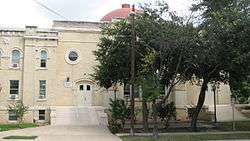 Prospect Hill Missionary Baptist Church |
September 18, 1986 (#86002185) |
1601 Buena Vista 29°25′35″N 98°30′57″W |
San Antonio | |
| 104 | The Quadrangle |  The Quadrangle |
July 30, 1974 (#74002059) |
Grayson St., Fort Sam Houston 29°26′40″N 98°27′44″W |
San Antonio | Recorded Texas Historic Landmark; part of Fort Sam Houston |
| 105 | Randolph Field Historic District | 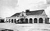 Randolph Field Historic District |
July 8, 1996 (#96000753) |
Randolph Air Force Base, off Pat Booker Rd., 18 NE of San Antonio 29°31′56″N 98°16′48″W |
Universal City | Randolph Air Force Base MPS |
| 106 | Reinbolt Hall at St. Mary's University | February 21, 2017 (#100000668) |
1 Camino Santa Maria 29°27′10″N 98°33′42″W |
San Antonio | ||
| 107 | Saint Anthony Hotel | 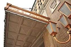 Saint Anthony Hotel |
September 19, 1986 (#86002186) |
300 Travis St. 29°25′38″N 98°29′19″W |
San Antonio | Part of San Antonio Downtown and River Walk Historic District |
| 108 | St. John's Seminary | May 23, 2018 (#100002470) |
222 E Mitchell St. 29°23′29″N 98°29′27″W |
San Antonio | ||
| 109 | St. Louis Hall at St. Mary's University | 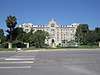 St. Louis Hall at St. Mary's University |
March 24, 2008 (#08000239) |
1 Camino Santa Maria 29°27′10″N 98°33′40″W |
San Antonio | |
| 110 | St. Mark's Episcopal Church |  St. Mark's Episcopal Church |
February 12, 1998 (#98000103) |
315 E. Pecan St. 29°25′43″N 98°29′19″W |
San Antonio | Recorded Texas Historic Landmark; part of San Antonio Downtown and River Walk Historic District |
| 111 | Salado Battlefield and Archeological Site | Salado Battlefield and Archeological Site |
November 21, 1978 (#78002893) |
Address restricted[6] |
San Antonio | |
| 112 | San Antonio Casino Club Building | 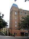 San Antonio Casino Club Building |
January 8, 1980 (#80004078) |
102 W. Crockett St. 29°25′30″N 98°29′19″W |
San Antonio | Recorded Texas Historic Landmark; part of San Antonio Downtown and River Walk Historic District |
| 113 | Old San Antonio City Cemeteries Historic District | 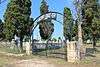 Old San Antonio City Cemeteries Historic District |
October 11, 2000 (#00000772) |
Roughly bounded by Nevada, New Braunfels, Paso Hondo, Palmetto, Potomac, St. James, Pine, E. Commerce, Dakota, Monumenta 29°25′08″N 98°27′52″W |
San Antonio | |
| 114 | San Antonio Downtown and River Walk Historic District | .jpg) San Antonio Downtown and River Walk Historic District |
February 23, 2018 (#100002128) |
Roughly bounded by Camaron, Augusta, 6th, Bonham, Losoya, & Tolie Place 29°25′29″N 98°29′33″W |
San Antonio | Includes Recorded Texas Historic Landmarks |
| 115 | San Antonio Drug Company | .jpg) San Antonio Drug Company |
May 19, 1994 (#94000453) |
432 W. Market St. 29°25′25″N 98°29′29″W |
San Antonio | Part of San Antonio Downtown and River Walk Historic District |
| 116 | San Antonio Loan and Trust Building | July 12, 1976 (#76002006) |
235 E. Commerce St. 29°25′25″N 98°29′26″W |
San Antonio | Part of San Antonio Downtown and River Walk Historic District | |
| 117 | San Antonio Missions National Historical Park |  San Antonio Missions National Historical Park |
November 10, 1978 (#78003147) |
Mission and Espada Rds. and San Jose Dr. 29°21′42″N 98°28′49″W |
San Antonio | Includes National Historic Site, State Antiquities Landmarks, Recorded Texas Historic Landmarks |
| 118 | San Antonio National Cemetery | 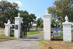 San Antonio National Cemetery |
November 22, 1999 (#99001395) |
517 Paso Hondo St. 29°25′20″N 98°28′05″W |
San Antonio | Part of Old San Antonio City Cemeteries Historic District; Civil War Era National Cemeteries MPS |
| 119 | San Antonio US Post Office and Courthouse | .jpg) San Antonio US Post Office and Courthouse |
September 29, 2000 (#00001174) |
615 E. Houston St. 29°25′37″N 98°29′11″W |
San Antonio | Part of Alamo Plaza Historic District |
| 120 | San Antonio Water Works Pump Station No. 2 | 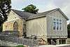 San Antonio Water Works Pump Station No. 2 |
August 21, 1981 (#81000625) |
Brackenridge Park 29°26′55″N 98°28′37″W |
San Antonio | Part of Brackenridge Park |
| 121 | San Jose Mission National Historic Site | 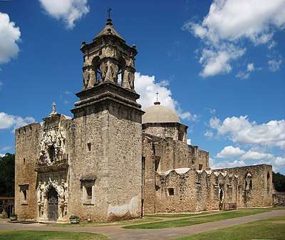 San Jose Mission National Historic Site |
October 15, 1966 (#66000810) |
6519 San Jose Dr. 29°21′44″N 98°28′47″W |
San Antonio | State Antiquities Landmark, Recorded Texas Historic Landmark; part of San Antonio Missions National Historical Park |
| 122 | San Pedro Springs Park | 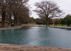 San Pedro Springs Park |
November 1, 1979 (#79002916) |
San Pedro Ave. 29°26′48″N 98°30′05″W |
San Antonio | State Antiquities Landmark |
| 123 | Schroeder-Yturri House | 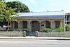 Schroeder-Yturri House |
April 14, 1975 (#75001954) |
1040 E. Commerce St. 29°25′20″N 98°28′54″W |
San Antonio | State Antiquities Landmark |
| 124 | Scottish Rite Cathedral |  Scottish Rite Cathedral |
February 16, 1996 (#96000068) |
308 Ave. E 29°25′39″N 98°29′03″W |
San Antonio | Recorded Texas Historic Landmark; part of San Antonio Downtown and River Walk Historic District |
| 125 | Selma Stagecoach Stop and Post Office | 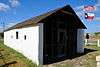 Selma Stagecoach Stop and Post Office |
June 26, 2017 (#100001252) |
9374 Valhalla 29°34′57″N 98°18′20″W |
Selma | |
| 126 | Smith-Young Tower |  Smith-Young Tower |
November 13, 1991 (#91001682) |
310 S. St. Mary's St. 29°25′22″N 98°29′29″W |
San Antonio | Part of San Antonio Downtown and River Walk Historic District |
| 127 | Source of the River District | Source of the River District |
July 31, 1978 (#78002894) |
Address restricted[6] |
San Antonio | |
| 128 | South Alamo Street-South Mary's Street Historic District |  South Alamo Street-South Mary's Street Historic District |
October 4, 1984 (#84000026) |
Bounded by the San Antonio River, S. Alamo, S. St. Mary's, and Temple Sts. 29°24′29″N 98°29′25″W |
San Antonio | Includes Recorded Texas Historic Landmarks |
| 129 | Southern Pacific Depot Historic District |  Southern Pacific Depot Historic District |
February 1, 1979 (#79002917) |
Roughly bounded by Crockett, Chestnut, Galveston, and Cherry Sts. 29°25′16″N 98°28′40″W |
San Antonio | Includes State Antiquities Landmark |
| 130 | Southern Pacific Railroad Passenger Station | 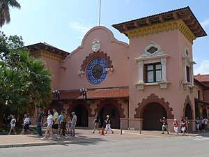 Southern Pacific Railroad Passenger Station |
May 29, 1975 (#75001955) |
1174 E. Commerce St. 29°25′12″N 98°28′40″W |
San Antonio | State Antiquities Landmark; part of Southern Pacific Depot Historic District |
| 131 | Spanish Governor's Palace | 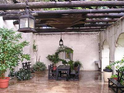 Spanish Governor's Palace |
April 15, 1970 (#70000741) |
105 Military Plaza 29°25′30″N 98°29′45″W |
San Antonio | State Antiquities Landmark, Recorded Texas Historic Landmark; part of Main and Military Plazas Historic District |
| 132 | Staacke Brothers Building | 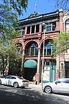 Staacke Brothers Building |
September 2, 1980 (#80004079) |
309 E. Commerce St. 29°25′28″N 98°29′22″W |
San Antonio | Recorded Texas Historic Landmark; part of San Antonio Downtown and River Walk Historic District |
| 133 | State Highway 3-A Bridge at Cibolo Creek |  State Highway 3-A Bridge at Cibolo Creek |
October 10, 1996 (#96001112) |
I-10 at the Bexar and Guadalupe Cnty. line 29°30′05″N 98°11′11″W |
Schertz | Historic Bridges of Texas, 1866-1945 MPS; extends into Guadalupe County |
| 134 | Stations of the Cross and Grotto at the Shrine of St. Anthony de Padua |  Stations of the Cross and Grotto at the Shrine of St. Anthony de Padua |
December 23, 2004 (#04001170) |
100 Peter Baque Rd. 29°30′04″N 98°28′14″W |
San Antonio | Sculpture by Dionicio Rodriguez in Texas MPS |
| 135 | Stevens Building | 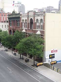 Stevens Building |
May 10, 1984 (#84001614) |
315 E. Commerce St. 29°25′27″N 98°29′21″W |
San Antonio | Recorded Texas Historic Landmark; part of San Antonio Downtown and River Walk Historic District |
| 136 | Thiele House and Thiele Cottage |  Thiele House and Thiele Cottage |
March 3, 1983 (#83003092) |
411 and 415 Sixth St. 29°25′47″N 98°28′59″W |
San Antonio | Recorded Texas Historic Landmarks; part of San Antonio Downtown and River Walk Historic District |
| 137 | Thomas Jefferson High School | 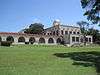 Thomas Jefferson High School |
September 22, 1983 (#83003093) |
723 Donaldson Ave. 29°27′54″N 98°32′15″W |
San Antonio | Recorded Texas Historic Landmark |
| 138 | The Toltec |  The Toltec |
July 26, 2010 (#10000498) |
131 Taylor Ave. 29°25′49″N 98°29′16″W |
San Antonio | Recorded Texas Historic Landmarks; part of San Antonio Downtown and River Walk Historic District |
| 139 | Travelers Hotel |  Travelers Hotel |
September 18, 2015 (#15000617) |
220 Broadway 29°25′42″N 98°29′14″W |
San Antonio | Part of San Antonio Downtown and River Walk Historic District |
| 140 | Trinity University Historic District | .jpg) Trinity University Historic District |
May 29, 2018 (#100002471) |
Roughly bounded by E. Hildebrand, E Mulberry, & Bushnell Aves., Stadium Dr., Kings Ct., Ledge, Shook, & Campus Lns. 29°27′48″N 98°28′58″W |
San Antonio | |
| 141 | Trolley Stop in Alamo Heights | 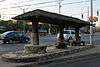 Trolley Stop in Alamo Heights |
October 22, 2004 (#04001165) |
4900 blk of Broadway 29°28′17″N 98°27′48″W |
Alamo Heights | Sculpture by Dionicio Rodriguez in Texas MPS |
| 142 | U.S. San Antonio Arsenal | 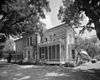 U.S. San Antonio Arsenal |
December 30, 1969 (#69000200) |
Roughly bounded by S. Flores and E. Arsenal Sts., and the San Antonio River 29°24′28″N 98°29′44″W |
San Antonio | Recorded Texas Historic Landmark |
| 143 | Gustav Uhl House and Store | 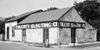 Gustav Uhl House and Store |
September 26, 2002 (#02001061) |
721 Avenue E 29°25′52″N 98°28′52″W |
San Antonio | |
| 144 | University of the Incarnate Word Administration Building |  University of the Incarnate Word Administration Building |
May 17, 2010 (#10000267) |
4301 Broadway 29°28′01″N 98°27′54″W |
San Antonio | |
| 145 | Ursuline Academy | 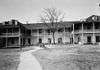 Ursuline Academy |
November 25, 1969 (#69000201) |
300 Augusta St. 29°25′52″N 98°29′32″W |
San Antonio | Recorded Texas Historic Landmark; part of San Antonio Downtown and River Walk Historic District |
| 146 | Voelcker Farmstead Historic District | July 11, 2014 (#14000402) |
13203 Blanco Rd. 29°33′49″N 98°31′37″W |
San Antonio | Historic Farms and Ranches of Bexar County MPS; the site of the Phil Hardberger Park as of 2018. | |
| 147 | Vogel Belt Complex |  Vogel Belt Complex |
April 10, 1975 (#75001956) |
111-121 Military Plaza 29°25′28″N 98°29′45″W |
San Antonio | Recorded Texas Historic Landmark; part of Main and Military Plazas Historic District |
| 148 | Walker Ranch | Walker Ranch |
February 24, 1975 (#75001957) |
Address restricted[6] |
San Antonio | |
| 149 | The Wedgwood | February 21, 2017 (#100000669) |
6701 Blanco Rd. 29°31′04″N 98°30′29″W |
San Antonio | ||
| 150 | R.L. White Ranch | February 24, 1975 (#08000474) |
18744 Bandera Rd. E. 29°37′04″N 98°45′02″W |
Helotes | Recorded Texas Historic Landmark | |
| 151 | David J. and May Bock Woodward House |  David J. and May Bock Woodward House |
February 16, 1996 (#96000069) |
1717 San Pedro Ave. 29°27′01″N 98°29′59″W |
San Antonio | Recorded Texas Historic Landmark |
| 152 | L. T. Wright House |  L. T. Wright House |
April 1, 1983 (#83003094) |
342 Wilkens Ave. 29°23′42″N 98°29′08″W |
San Antonio | |
| 153 | Ximenes Chapel |  Ximenes Chapel |
September 8, 1980 (#80004080) |
113 Ruiz St. 29°26′03″N 98°30′13″W |
San Antonio | |
| 154 | Yturri-Edmunds House |  Yturri-Edmunds House |
August 8, 1996 (#96000870) |
257 Yellowstone St. 29°23′53″N 98°29′15″W |
San Antonio | Recorded Texas Historic Landmark |
Former listings
| [3] | Name on the Register | Image | Date listed | Date removed | Location | City or town | Summary |
|---|---|---|---|---|---|---|---|
| 1 | Daniel J. Sullivan Stable and Carriage House | February 23, 1978 (#78002895) | March 18, 1988 | 314 Fourth St. 29°25′47″N 98°29′08″W |
San Antonio | Delisted after relocation to the San Antonio Botanical Garden 29°27′32″N 98°27′31″W |
See also
- National Register of Historic Places listings in Texas
- Recorded Texas Historic Landmarks in Bexar County
References
- "National Register of Historic Places: Weekly List Actions". National Park Service, United States Department of the Interior. Retrieved on June 19, 2020.
- The latitude and longitude information provided in this table was derived originally from the National Register Information System, which has been found to be fairly accurate for about 99% of listings. Some locations in this table may have been corrected to current GPS standards.
- Numbers represent an ordering by significant words. Various colorings, defined here, differentiate National Historic Landmarks and historic districts from other NRHP buildings, structures, sites or objects.
- "National Register Information System". National Register of Historic Places. National Park Service. November 2, 2013.
- The eight-digit number below each date is the number assigned to each location in the National Register Information System database, which can be viewed by clicking the number.
- Federal and state laws and practices restrict general public access to information regarding the specific location of this resource. In some cases, this is to protect archeological sites from vandalism, while in other cases it is restricted at the request of the owner. See: Knoerl, John; Miller, Diane; Shrimpton, Rebecca H. (1990), Guidelines for Restricting Information about Historic and Prehistoric Resources, National Register Bulletin, National Park Service, U.S. Department of the Interior, OCLC 20706997.
External links
![]()
Places adjacent to National Register of Historic Places listings in Bexar County, Texas | ||||||||||
|---|---|---|---|---|---|---|---|---|---|---|
| ||||||||||
Municipalities and communities of Bexar County, Texas, United States | ||
|---|---|---|
| Cities | 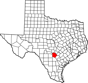 Bexar County map | |
| Towns | ||
| CDPs | ||
| Other unincorporated communities | ||
| Footnotes | ‡This populated place also has portions in an adjacent county or counties | |