Rosenberg, Texas
Rosenberg is a city in the U.S. state of Texas, within the Houston–The Woodlands–Sugar Land metropolitan area and Fort Bend County. The population was 30,618 at the 2010 census,[3] up from 24,043 at the 2000 census. As of 2019, the population had risen to an estimated 38,307.[4]
Rosenberg, Texas | |
|---|---|
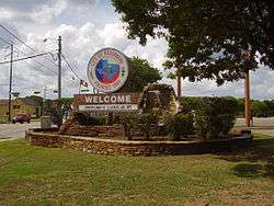 Welcome sign | |
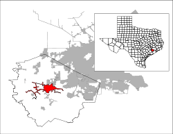 Location of Rosenberg, Texas | |
| Coordinates: 29°33′9″N 95°48′18″W | |
| Country | |
| State | |
| County | Fort Bend |
| Government | |
| • Type | Council-Manager |
| • City Council | Mayor William (Bill) Benton Council At-Large 1 Jacob Balderas Council At-Large 2 Kevin Raines
District 4 Richard A. Olson |
| • City Manager | John Maresh |
| Area | |
| • Total | 22.5 sq mi (58.4 km2) |
| • Land | 22.5 sq mi (58.2 km2) |
| • Water | 0.04 sq mi (0.1 km2) |
| Elevation | 105 ft (32 m) |
| Population (2010) | |
| • Total | 30,618 |
| • Density | 1,362/sq mi (525.8/km2) |
| Demonym(s) | Rosenberger |
| Time zone | UTC-6 (Central (CST)) |
| • Summer (DST) | UTC-5 (CDT) |
| ZIP code | 77471 |
| Area code(s) | 281/346/713/832 |
| FIPS code | 48-63284[1] |
| GNIS feature ID | 1345587[2] |
| Website | www |
The community holds the Fort Bend County fair in October. Rosenberg sits adjacent to the city of Richmond, the Fort Bend County seat.[5]
History
Rosenberg is named after Henry Rosenberg, who migrated from Switzerland to Galveston, Texas in 1843.[6] Rosenberg was the first president of the Gulf, Colorado and Santa Fe Railway.[7]
Geography
Rosenberg is located in central Fort Bend County at 29°33′9″N 95°48′18″W (29.552388, -95.804899),[8] on the south side of the Brazos River. It is bordered to the northeast by Richmond, to the south by Pleak, and to the southwest by Beasley.
The Southwest Freeway (I-69 and US-59) runs through the south side of Rosenberg, bypassing the city center. The freeway leads northeast 32 miles (51 km) to downtown Houston, and US-59 continues southwest 92 miles (148 km) to Victoria and beyond.
According to the United States Census Bureau, Rosenberg has a total area of 22.5 square miles (58.4 km2), of which 22.5 square miles (58.2 km2) are land and 0.04 square miles (0.1 km2), or 0.25%, is water.[3]
Climate
The climate in this area is characterized by hot, humid summers and generally mild to cool winters. According to the Köppen climate classification system, Rosenberg has a humid subtropical climate, Cfa on climate maps.[9]
Demographics
| Historical population | |||
|---|---|---|---|
| Census | Pop. | %± | |
| 1910 | 1,198 | — | |
| 1920 | 1,279 | 6.8% | |
| 1930 | 1,941 | 51.8% | |
| 1940 | 3,457 | 78.1% | |
| 1950 | 6,210 | 79.6% | |
| 1960 | 9,698 | 56.2% | |
| 1970 | 12,098 | 24.7% | |
| 1980 | 17,840 | 47.5% | |
| 1990 | 20,183 | 13.1% | |
| 2000 | 24,043 | 19.1% | |
| 2010 | 30,618 | 27.3% | |
| Est. 2019 | 38,307 | [4] | 25.1% |
| U.S. Decennial Census[10] | |||
At the 2000 census,[1] there were 24,043 people, 7,933 households and 5,976 families residing in the city. The population density was 1,131.7 per square mile (436.8/km²). There were 8,438 housing units at an average density of 397.2 per square mile (153.3/km²). The racial makeup of the city was 65.69% White, 8.53% African American, 0.37% Native American, 0.38% Asian, 0.04% Pacific Islander, 22.17% from other races, and 2.81% from two or more races. Hispanic or Latino of any race were 54.96% of the population.
There were 7,933 households of which 41.3% had children under the age of 18 living with them, 53.4% were married couples living together, 15.7% had a female householder with no husband present, and 24.7% were non-families. 20.8% of all households were made up of individuals and 8.1% had someone living alone who was 65 years of age or older. The average household size was 3.00 and the average family size was 3.48.
30.9% of the population were under the age of 18, 10.8% from 18 to 24, 30.0% from 25 to 44, 18.5% from 45 to 64, and 9.8% who were 65 years of age or older. The median age was 30 years. For every 100 females, there were 98.6 males. For every 100 females age 18 and over, there were 95.2 males.
The median household income was $35,510 and the median family income was $39,965. Males had a median income of $28,723 versus $21,945 for females. The per capita income for the city was $14,814. About 13.6% of families and 16.1% of the population were below the poverty line, including 20.7% of those under age 18 and 12.9% of those age 65 or over.
Government and infrastructure
The Texas Department of Criminal Justice (TDCJ) operates the Rosenberg District Parole Office in a nearby unincorporated area.[11]
The United States Postal Service Rosenberg Post Office is located at 2103 Avenue G.[12]
 Fort Bend County Rosenberg Annex
 Rosenberg City Hall
 Rosenberg Police Department
 Rosenberg Fire Department
 Fire Station No. 3 on FM 2977
 US Post Office at Ave. G and 4th St.
Education
Primary and secondary schools
Public schools
Rosenberg is served by the Lamar Consolidated Independent School District.[13]
Several elementary schools are in Rosenberg and serve Rosenberg: Arredondo, Bowie, Jackson, Taylor Ray and Travis.
 John M. Arredondo Elementary School
 Bowie Elementary School
 A. W. Jackson Elementary School
 Meyer Elementary School
 Taylor Ray Elementary School
 Travis Elementary School
In addition, Hutchison, Long, Seguin, and Smith Elementary Schools, which are all in Richmond, serve small portions of Rosenberg. In addition, Williams Elementary School in unincorporated Fort Bend County serves a small section of Rosenberg.
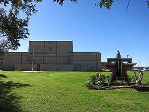
Some of Rosenberg is served by Wessendorf Middle School, Lamar Junior High School, and Lamar Consolidated High School. Other parts are served by Navarro Middle School, George Junior High School, and B.F. Terry High School. All of those schools are in Rosenberg. Some parts are served by Antoinette Reading Junior High and George Ranch High School, in an unincorporated area. Small portions are served by Briscoe Junior High School and Foster High School.
 Brazos Crossing, the Lamar CISD headquarters
 George Junior High School
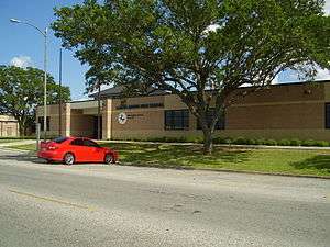 Lamar Junior High School
 Navarro Middle School
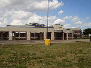 Wessendorff Middle School
Private schools
- Holy Rosary Catholic School: A K-8 school, operated by the Roman Catholic Archdiocese of Galveston-Houston, which is located at 1408 James Street.[14]
- Living Water Christian School, an early childhood-grade 11 Christian school in Rosenberg
Saint John XXIII High School (formerly Pope John XXIII High School) in western Harris County, within Greater Katy, is in proximity to Rosenberg.[15]
Public libraries
Fort Bend County Libraries operates the George Memorial Library, the main library, in Richmond. The main library was originally located in Rosenberg, near the Polly Ryon hospital. The library moved to Richmond in 1986. The library underwent extensive renovations in 2013 and reopened with new technology, media rooms, and room design.[16]
Parks and recreation
The City of Rosenberg operates nine municipal parks within the city limits.
Fort Bend County operates the Bud O'Shieles Community Center in Rosenberg. The two acre center includes an auditorium, meeting centers, and centers for elderly people.[17]
Location from Rosenberg
Destinations from Rosenberg | ||||||||||
|---|---|---|---|---|---|---|---|---|---|---|
| ||||||||||
Transportation
Fort Bend County Public Transportation provides local bus service and commuter service to Houston.[18]
Greyhound Bus Lines serves the Rosenberg Station at Raceway gas station.[19]
Notable people
- Randal Grichuk, Major League Baseball player currently with the Toronto Blue Jays; played on the 2008 Lamar Consolidated Baseball Regional Finalist Team as well as the 2004 Little League World Series team
- John Holiday, operatic countertenor
- Mirabeau Lamar, Republic of Texas statesman
- Dexter Pittman, professional basketball player currently with the Houston Rockets of the NBA; attended B. F. Terry High School
- Clymer Wright, former editor of Fort Bend Reporter; conservative political activist in Greater Houston[20]
References
- "U.S. Census website". United States Census Bureau. Retrieved 2008-01-31.
- "US Board on Geographic Names". United States Geological Survey. 2007-10-25. Retrieved 2008-01-31.
- "Geographic Identifiers: 2010 Demographic Profile Data (G001): Rosenberg city, Texas". U.S. Census Bureau, American Factfinder. Retrieved August 31, 2016.
- "Population and Housing Unit Estimates". Retrieved May 21, 2020.
- https://tshaonline.org/handbook/online/articles/her02
- http://www.jpost.com/Magazine/The-Galveston-movement-411990. Retrieved 2017-08-27
- "Archived copy". Archived from the original on 2008-02-02. Retrieved 2008-07-01.CS1 maint: archived copy as title (link) Retrieved 2008-07-01
- "US Gazetteer files: 2010, 2000, and 1990". United States Census Bureau. 2011-02-12. Retrieved 2011-04-23.
- Climate Summary for Rosenberg, Texas
- "Census of Population and Housing". Census.gov. Retrieved June 4, 2015.
- "Parole Division Region III Archived 2010-07-25 at the Wayback Machine." Texas Department of Criminal Justice. Retrieved on May 15, 2010.
- "Post Office Location - ROSENBERG." United States Postal Service. Retrieved on December 6, 2008.
- "LCISD District Map Archived 2011-08-12 at the Wayback Machine." Lamar Consolidated Independent School District. Retrieved on July 23, 2011.
- "[ Home]." Holy Rosary Catholic School. Retrieved on February 15, 2009.
- "Pope John XXIII High golfers take second place". The Katy Rancher at the Houston Chronicle. 2013-11-04. Retrieved 2017-03-25.
- "George Memorial Library." Fort Bend County Libraries. Retrieved on May 14, 2010.
- "Community Centers." Fort Bend County. Retrieved on October 11, 2009.
- Public Transportation
- "Rosenberg, Texas." Greyhound Bus Lines. Retrieved on May 14, 2010.
- "Doug Miller, "Clymer Wright, conservative term-limit advocate, found dead in his home," January 25, 2011". KHOU-TV. Archived from the original on March 31, 2012. Retrieved January 27, 2011.
External links
| Wikimedia Commons has media related to Rosenberg, Texas. |
| Counties |  | |
|---|---|---|
| "Principal" cities | ||
| Other cities |
For a complete listing, see list of cities and towns in Houston–The Woodlands–Sugar Land MSA | |
| Unincorporated areas | ||
| Bodies of water | ||
Municipalities and communities of Fort Bend County, Texas, United States | ||
|---|---|---|
| Cities |  Fort Bend County map | |
| Town | ||
| Villages | ||
| CDPs |
| |
| Other unincorporated communities | ||
| Ghost towns | ||
| Footnotes | ‡This populated place also has portions in an adjacent county or counties;
±Former community annexed by Missouri City | |

| Authority control |
|
|---|