National Register of Historic Places listings in Travis County, Texas
This is a list of the National Register of Historic Places listings in Travis County, Texas.
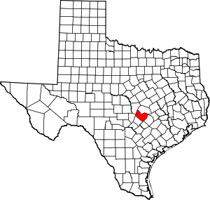
Location of Travis County in Texas
This is intended to be a complete list of the properties and districts on the National Register of Historic Places in Travis County, Texas, United States. The locations of National Register properties and districts for which the latitude and longitude coordinates are included below, may be seen in a map.[1]
There are 199 properties and districts listed on the National Register in the county, including 2 National Historic Landmarks.
- This National Park Service list is complete through NPS recent listings posted June 19, 2020.[2]
Current listings
| [3] | Name on the Register[4] | Image | Date listed[5] | Location | City or town | Description |
|---|---|---|---|---|---|---|
| 1 | 1918 State Office Building and 1933 State Highway Building | 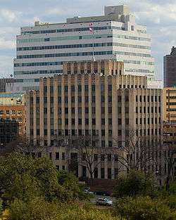 1918 State Office Building and 1933 State Highway Building |
January 7, 1998 (#97001625) |
1019 Brazos and 125 E. 11th Sts. 30°16′20″N 97°44′25″W |
Austin | |
| 2 | All Saints Chapel | .jpg) All Saints Chapel |
August 24, 2015 (#15000543) |
209 W 27th St. 30°17′30″N 97°44′23″W |
Austin | |
| 3 | Administration Building | 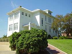 Administration Building |
October 21, 1993 (#86003845) |
1820 E. Eighth St. 30°16′10″N 97°43′46″W |
Austin | |
| 4 | Arnold Bakery | 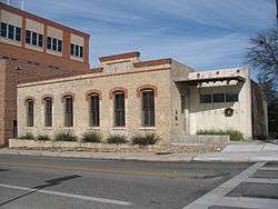 Arnold Bakery |
January 14, 2004 (#03001416) |
1010 E. Eleventh St. 30°16′09″N 97°43′46″W |
Austin | |
| 5 | Austin Central Fire Station #1 | 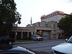 Austin Central Fire Station #1 |
May 5, 2000 (#00000454) |
401 E. Fifth St. 30°15′57″N 97°44′22″W |
Austin | |
| 6 | Austin Daily Tribune Building | 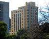 Austin Daily Tribune Building |
November 8, 2000 (#00001358) |
920 Colorado 30°16′19″N 97°44′35″W |
Austin | |
| 7 | Austin Fire Drill Tower | 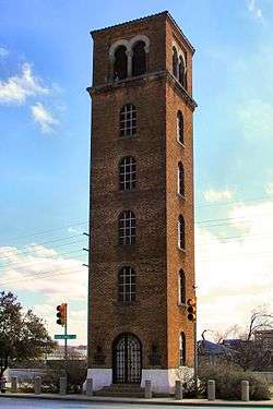 Austin Fire Drill Tower |
October 11, 2016 (#16000720) |
201 W. Cesar Chavez St. 30°15′49″N 97°44′45″W |
Austin | |
| 8 | Austin Public Library |  Austin Public Library |
May 6, 1993 (#93000389) |
810 Guadalupe St 30°16′18″N 97°44′45″W |
Austin | |
| 9 | Austin US Courthouse | 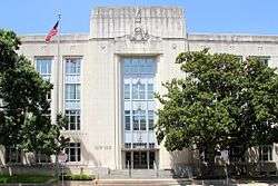 Austin US Courthouse |
April 25, 2001 (#01000432) |
200 West Eighth St. 30°16′14″N 97°44′38″W |
Austin | |
| 10 | Aynesworth-Wright House | 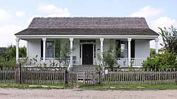 Aynesworth-Wright House |
September 27, 1980 (#80004156) |
10621 Pioneer Farms Dr in Jourdan-Bachman Pioneer Farms 30°22′06″N 97°39′32″W |
Austin | Greek Revival house built about 1852. Moved from original location. |
| 11 | Bailetti House | 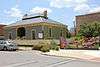 Bailetti House |
September 17, 1985 (#85002268) |
1006 Waller St. 30°16′09″N 97°43′46″W |
Austin | |
| 12 | Charles W. Barnes House |  Charles W. Barnes House |
September 17, 1985 (#85002266) |
1105 E. 12th St. 30°16′20″N 97°43′42″W |
Austin | |
| 13 | William Braxton Barr House | 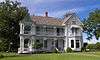 William Braxton Barr House |
January 10, 1983 (#83003164) |
NE of Austin at 10463 Sprinkle Rd. 30°21′06″N 97°38′50″W |
Austin | |
| 14 | Barton Springs Archeological and Historical District | 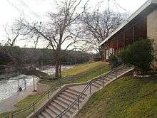 Barton Springs Archeological and Historical District |
November 27, 1985 (#85003213) |
Address Restricted 30°18′27″N 97°43′49″W |
Austin | |
| 15 | Battle Hall | 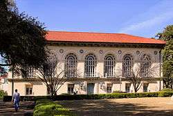 Battle Hall |
August 25, 1970 (#70000763) |
South Mall, University of Texas campus 30°17′07″N 97°44′25″W |
Austin | |
| 16 | Judge Robert Lynn Batts House | 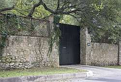 Judge Robert Lynn Batts House |
August 22, 1984 (#84002002) |
1505 Windsor Rd. 30°16′49″N 97°45′11″W |
Austin | |
| 17 | Bertram Building | 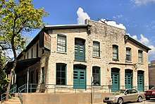 Bertram Building |
August 28, 2012 (#12000590) |
1601 Guadalupe Street 30°16′44″N 97°44′33″W |
Austin | |
| 18 | Bluebonnet Tourist Camp | .jpg) Bluebonnet Tourist Camp |
August 16, 1990 (#90001188) |
4407 Guadalupe St. 30°18′37″N 97°43′59″W |
Austin | |
| 19 | Boardman-Webb-Bugg House | 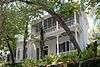 Boardman-Webb-Bugg House |
January 8, 1980 (#80004152) |
602 W. 9th St. 30°16′22″N 97°44′52″W |
Austin | |
| 20 | Bremond Block Historic District |  Bremond Block Historic District |
April 3, 1970 (#70000764) |
Roughly bounded by Guadalupe, San Antonio, 7th and 8th Sts. 30°16′14″N 97°44′47″W |
Austin | |
| 21 | Genaro P. and Carolina Briones House |  Genaro P. and Carolina Briones House |
August 7, 1998 (#98000280) |
1204 E. 7th St. 30°15′56″N 97°43′47″W |
Austin | |
| 22 | Brizendine House |  Brizendine House |
July 22, 1974 (#74002090) |
507 W. 11th St. 30°16′27″N 97°44′47″W |
Austin | |
| 23 | Brown Building |  Brown Building |
April 24, 1997 (#97000364) |
708 Colorado St. 30°16′12″N 97°44′46″W |
Austin | |
| 24 | Cambridge Tower | 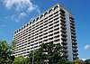 Cambridge Tower |
June 20, 2018 (#100002603) |
1801 Lavaca Street 30°16′51″N 97°44′26″W |
Austin | |
| 25 | Camp Mabry Historic District | 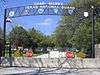 Camp Mabry Historic District |
August 30, 1996 (#96000967) |
2210 W. 35th St. 30°18′56″N 97°45′38″W |
Austin | |
| 26 | Carrington-Covert House | .jpg) Carrington-Covert House |
August 25, 1970 (#70000765) |
1511 Colorado St. 30°16′40″N 97°44′24″W |
Austin | |
| 27 | George Washington Carver Library |  George Washington Carver Library |
March 30, 2005 (#05000241) |
1165 Angelina St. 30°16′18″N 97°43′28″W |
Austin | |
| 28 | Daniel H. and William T. Caswell Houses | 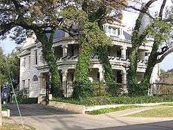 Daniel H. and William T. Caswell Houses |
April 21, 1975 (#75002004) |
1404 and 1502 West Ave. 30°16′45″N 97°44′51″W |
Austin | |
| 29 | Central Christian Church | 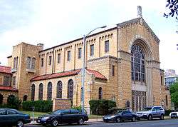 Central Christian Church |
July 16, 1992 (#92000889) |
1110 Guadalupe St. 30°16′29″N 97°44′40″W |
Austin | |
| 30 | Chapman House |  Chapman House |
September 9, 2010 (#10000739) |
901 E 12th St. 30°16′19″N 97°43′50″W |
Austin | |
| 31 | City Cemetery |  City Cemetery |
September 17, 1985 (#85002297) |
16th and Navasota 30°16′36″N 97°43′34″W |
Austin | |
| 32 | Clarksville Historic District |  Clarksville Historic District |
December 1, 1976 (#76002070) |
Bounded by W. Lynn, Waterson, W. 10th and MO-PAC Expwy. 30°16′51″N 97°45′44″W |
Austin | |
| 33 | Commercial Building at 4113 Guadalupe Street |  Commercial Building at 4113 Guadalupe Street |
August 16, 1990 (#90001187) |
4113 Guadalupe St. 30°18′24″N 97°44′07″W |
Austin | |
| 34 | Community Center |  Community Center |
September 17, 1985 (#85002267) |
1192 Angelina St. 30°16′19″N 97°43′31″W |
Austin | |
| 35 | Congress Avenue Historic District |  Congress Avenue Historic District |
August 11, 1978 (#78002989) |
Congress Ave. from Cesar Chavez to 11th St. 30°16′04″N 97°44′33″W |
Austin | |
| 36 | Connelly-Yerwood House |  Connelly-Yerwood House |
April 18, 2003 (#03000279) |
1115 E 12th St. 30°16′19″N 97°43′41″W |
Austin | |
| 37 | Frank M. and Annie G. Covert House |  Frank M. and Annie G. Covert House |
August 16, 1990 (#90001185) |
3912 Ave. G 30°18′07″N 97°43′48″W |
Austin | |
| 38 | Covert Park at Mount Bonnell | 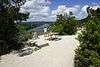 Covert Park at Mount Bonnell |
September 17, 2015 (#15000619) |
3800 Mount Bonnell Rd. 30°19′16″N 97°46′25″W |
Austin | |
| 39 | Andrew M. Cox Ranch Site | December 6, 1975 (#75002009) |
Barton Creek near Loop 360 and MoPac 30°14′35″N 97°48′21″W |
Austin | ||
| 40 | Cox-Craddock House | 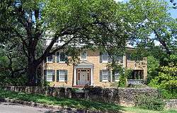 Cox-Craddock House |
May 30, 2001 (#01000612) |
720 E. 32nd St. 30°17′32″N 97°43′46″W |
Austin | |
| 41 | Thomas Cranfill House | 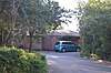 Thomas Cranfill House |
December 29, 2004 (#04001416) |
1901 Cliff St. 30°17′05″N 97°45′05″W |
Austin | |
| 42 | Cranfill Apartments | August 20, 2013 (#13000613) |
1909 Cliff St., Building B 30°17′07″N 97°45′05″W |
Austin | ||
| 43 | Deep Eddy Bathing Beach | 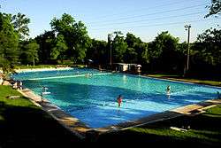 Deep Eddy Bathing Beach |
June 23, 2003 (#03000560) |
301 Quarry St. 30°16′36″N 97°46′22″W |
Austin | |
| 44 | Delta Kappa Gamma Society International Headquarters Building |  Delta Kappa Gamma Society International Headquarters Building |
April 10, 2012 (#12000198) |
416 West 12th Street 30°16′31″N 97°44′41″W |
Austin | |
| 45 | Delwood Duplex Historic District |  Delwood Duplex Historic District |
March 21, 2011 (#11000132) |
Roughly bounded between Maplewood Ave. and Kirkwood, Ashwood, and Wrightwood Rds. 30°17′40″N 97°42′52″W |
Austin | Historic Residential Suburbs in the United States, 1830-1960 MPS |
| 46 | J. Frank Dobie House |  J. Frank Dobie House |
May 20, 1991 (#91000575) |
702 E. 26th St. 30°17′21″N 97°43′56″W |
Austin | |
| 47 | Driskill Hotel |  Driskill Hotel |
November 25, 1969 (#69000212) |
117 E. 7th St. 30°16′05″N 97°44′29″W |
Austin | |
| 48 | East Main Street Historic District |  East Main Street Historic District |
September 10, 2012 (#12000788) |
111, 113, 115, and 117 E. Main St. 30°26′25″N 97°37′11″W |
Pflugerville | |
| 49 | Evans Industrial Building |  Evans Industrial Building |
June 17, 1982 (#82004525) |
Huston-Tillotson College Campus, 1820 E 8th 30°15′48″N 97°42′41″W |
Austin | |
| 50 | Federal Office Building |  Federal Office Building |
April 27, 2011 (#11000211) |
300 E. 8th Ave. 30°16′10″N 97°44′20″W |
Austin | |
| 51 | Fiesta Gardens | April 5, 2019 (#100003600) |
2101 Jesse E. Segovia St. 30°14′56″N 97°43′33″W |
Austin | ||
| 52 | Fischer House |  Fischer House |
December 16, 1982 (#82001741) |
1008 West Ave. 30°16′28″N 97°44′56″W |
Austin | |
| 53 | Seymour and Barbara Fogel House | 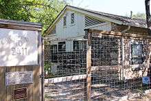 Seymour and Barbara Fogel House |
April 2, 2003 (#03000186) |
2411 Kinney Rd. 30°14′39″N 97°46′27″W |
Austin | |
| 54 | French Legation |  French Legation |
November 25, 1969 (#69000213) |
802 San Marcos St. 30°16′01″N 97°43′56″W |
Austin | |
| 55 | German American Ladies College |  German American Ladies College |
August 13, 2013 (#13000601) |
1604 E. 11th St. 30°16′03″N 97°43′26″W |
Austin | |
| 56 | Gethsemane Lutheran Church | 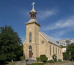 Gethsemane Lutheran Church |
August 25, 1970 (#70000766) |
1510 Congress Ave. 30°16′40″N 97°44′22″W |
Austin | |
| 57 | Gethsemane Lutheran Church | 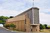 Gethsemane Lutheran Church |
December 30, 2011 (#11000983) |
200 W. Anderson Ln. 30°20′44″N 97°42′20″W |
Austin | |
| 58 | Gilfillan House | 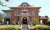 Gilfillan House |
September 27, 1980 (#80004153) |
603 W. 8th St. 30°16′17″N 97°44′53″W |
Austin | |
| 59 | Goodman Building |  Goodman Building |
April 13, 1973 (#73001976) |
202 W. 13th St. 30°16′28″N 97°44′33″W |
Austin | |
| 60 | Governor's Mansion |  Governor's Mansion |
August 25, 1970 (#70000896) |
1010 Colorado St. 30°16′22″N 97°44′34″W |
Austin | |
| 61 | Granger House and The Perch |  Granger House and The Perch |
November 29, 2006 (#06001083) |
805 W. 16th St. 30°16′48″N 97°44′52″W |
Austin | |
| 62 | Green Pastures |  Green Pastures |
September 27, 1980 (#80004154) |
811 W. Live Oak St. 30°14′42″N 97°45′45″W |
Austin | |
| 63 | Haehnel Building |  Haehnel Building |
September 17, 1985 (#85002295) |
1101 E. 11th St. 30°16′08″N 97°43′45″W |
Austin | |
| 64 | Hancock Golf Course | 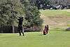 Hancock Golf Course |
September 30, 2014 (#14000821) |
811 E. 41st Street 30°17′56″N 97°43′29″W |
Austin | |
| 65 | John Hancock House | 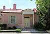 John Hancock House |
April 13, 1973 (#73001977) |
1306 Colorado St. 30°16′33″N 97°44′31″W |
Austin | |
| 66 | Haynes-DeLashwah House | 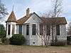 Haynes-DeLashwah House |
March 3, 1983 (#83004033) |
1209 Rosewood Ave. 30°16′06″N 97°43′35″W |
Austin | |
| 67 | Hildreth-Flanagan-Heierman House |  Hildreth-Flanagan-Heierman House |
August 16, 1990 (#90001184) |
3909 Ave. G 30°18′04″N 97°43′47″W |
Austin | |
| 68 | Henry Hirshfeld House and Cottage | 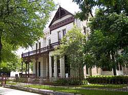 Henry Hirshfeld House and Cottage |
April 13, 1973 (#73001978) |
303 and 305 W. 9th St. 30°16′17″N 97°44′40″W |
Austin | |
| 69 | Hofheintz-Reissig Store | .jpg) Hofheintz-Reissig Store |
June 23, 1983 (#83003165) |
600 E. 3rd St. 30°15′49″N 97°44′15″W |
Austin | |
| 70 | Goldie Horton-Porter House | October 4, 1990 (#90001535) |
2402 Windsor Rd. 30°17′22″N 97°45′22″W |
Austin | ||
| 71 | House at 1170 San Bernard Street |  House at 1170 San Bernard Street |
September 17, 1985 (#85002269) |
1170 San Bernard St. 30°16′12″N 97°43′33″W |
Austin | |
| 72 | House at 1400 Canterbury Street |  House at 1400 Canterbury Street |
September 17, 1985 (#85002274) |
1400 Canterbury St. 30°15′27″N 97°43′50″W |
Austin | |
| 73 | Hyde Park Historic District |  Hyde Park Historic District |
August 16, 1990 (#90001191) |
Roughly bounded by Ave. A, 45th St., Duval St., and 40th St. 30°18′27″N 97°43′49″W |
Austin | |
| 74 | Hyde Park Presbyterian Church |  Hyde Park Presbyterian Church |
August 16, 1990 (#90001175) |
3915 Ave. B 30°18′14″N 97°44′04″W |
Austin | |
| 75 | Robert Irvin House |  Robert Irvin House |
September 17, 1985 (#85002270) |
1008 E. 9th St. 30°16′04″N 97°43′50″W |
Austin | |
| 76 | A. J. Jernigan House |  A. J. Jernigan House |
September 22, 1983 (#83003166) |
602 Harthan 30°16′25″N 97°45′28″W |
Austin | |
| 77 | Phillip W. Jobe House |  Phillip W. Jobe House |
September 17, 1985 (#85002278) |
1113 E. 9th St. 30°16′00″N 97°43′43″W |
Austin | |
| 78 | C.E. Johnson House |  C.E. Johnson House |
September 17, 1985 (#85002282) |
1022 E. 7th St. 30°15′57″N 97°43′50″W |
Austin | |
| 79 | Kappa Kappa Gamma House |  Kappa Kappa Gamma House |
August 13, 2013 (#13000602) |
2001 University Ave. 30°16′58″N 97°44′22″W |
Austin | |
| 80 | Keith House | May 8, 1998 (#98000448) |
2400 Harris Blvd. 30°17′27″N 97°45′24″W |
Austin | ||
| 81 | Laguna Gloria |  Laguna Gloria |
December 6, 1975 (#75002005) |
3809 W. 35th St. 30°18′40″N 97°46′25″W |
Austin | |
| 82 | Lamar Boulevard Bridge | 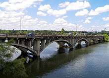 Lamar Boulevard Bridge |
July 7, 1994 (#94000678) |
Lamar Blvd. over the Colorado R. 30°15′55″N 97°45′22″W |
Austin | |
| 83 | Charles P. Ledbetter House |  Charles P. Ledbetter House |
August 16, 1990 (#90001178) |
3904 Ave. C 30°18′11″N 97°44′03″W |
Austin | |
| 84 | Levi Rock Shelter | June 21, 1971 (#71000965) |
Near Hwy 71 and the Pedernales River on Lick Creek 30°22′53″N 98°05′17″W |
Austin | ||
| 85 | Limerick-Frazier House |  Limerick-Frazier House |
March 30, 2005 (#05000238) |
810 E. 13th St. 30°16′24″N 97°43′50″W |
Austin | |
| 86 | Lions Municipal Golf Course |  Lions Municipal Golf Course |
July 7, 2016 (#16000354) |
2901 Enfield Rd. 30°17′23″N 97°46′43″W |
Austin | |
| 87 | Little Campus |  Little Campus |
August 13, 1974 (#74002091) |
Bounded by 18th, Oldham, 19th, and Red River Sts. 30°16′42″N 97°43′53″W |
Austin | |
| 88 | Littlefield House | 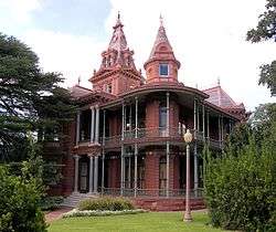 Littlefield House |
August 25, 1970 (#70000767) |
24th St. and Whitis Ave. 30°17′17″N 97°44′27″W |
Austin | |
| 89 | Long Hog Hollow Archeological District | May 25, 1984 (#84002003) |
Address Restricted |
Austin | ||
| 90 | Lung House | 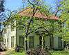 Lung House |
February 5, 2014 (#13001159) |
1605 Canterbury St. 30°15′23″N 97°43′45″W |
Austin | |
| 91 | John W. Maddox House |  John W. Maddox House |
September 17, 1985 (#85002293) |
1115 E. 3rd St. 30°15′40″N 97°43′54″W |
Austin | |
| 92 | Peter and Clotilde Shipe Mansbendel House | 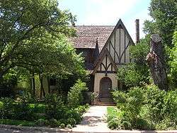 Peter and Clotilde Shipe Mansbendel House |
August 16, 1990 (#90001183) |
3824 Ave. F 30°18′04″N 97°43′55″W |
Austin | |
| 93 | Mather-Kirkland House | 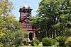 Mather-Kirkland House |
December 8, 1978 (#78002990) |
402 Academy 30°15′07″N 97°44′38″W |
Austin | |
| 94 | Mayfield-Gutsch Estate |  Mayfield-Gutsch Estate |
September 29, 1994 (#94001159) |
3505 W. 35th St. 30°18′46″N 97°46′14″W |
Austin | |
| 95 | Arthur N. and Jane Y. McCallum House |  Arthur N. and Jane Y. McCallum House |
August 22, 1996 (#96000936) |
613 W. 32nd St. 30°17′56″N 97°44′28″W |
Austin | |
| 96 | Robert H. and Edith Ethel McCauley House |  Robert H. and Edith Ethel McCauley House |
August 16, 1990 (#90001236) |
4415 Ave. A 30°18′37″N 97°43′55″W |
Austin | |
| 97 | Floyd McGown House |  Floyd McGown House |
September 17, 1985 (#85002290) |
1202 Garden St. 30°15′27″N 97°43′58″W |
Austin | |
| 98 | McKinney Homestead | 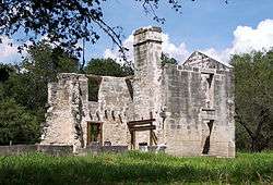 McKinney Homestead |
October 16, 1974 (#74002093) |
SW of Austin between TX 71 and U.S. 183 30°11′23″N 97°43′15″W |
Austin | |
| 99 | Fannie Moss Miller House |  Fannie Moss Miller House |
April 16, 2008 (#08000318) |
900 Rio Grande St., 30°16′23″N 97°44′55″W |
Austin | |
| 100 | Millett Opera House |  Millett Opera House |
March 21, 1978 (#78002991) |
110 E. 9th St. 30°16′15″N 97°44′27″W |
Austin | |
| 101 | Missouri, Kansas and Texas Land Co. House |  Missouri, Kansas and Texas Land Co. House |
August 16, 1990 (#90001179) |
3908 Ave. C 30°18′12″N 97°44′02″W |
Austin | |
| 102 | Montopolis Bridge | 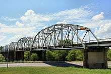 Montopolis Bridge |
October 10, 1996 (#96001118) |
US 183, 8.1 mi (13.0 km). S of jct. with I-35 30°14′43″N 97°41′29″W |
Austin | |
| 103 | Moonlight Towers | 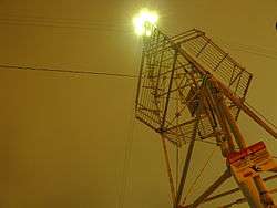 Moonlight Towers |
July 12, 1976 (#76002071) |
Austin and vicinity 30°16′17″N 97°44′41″W |
Austin | |
| 104 | Moore's Crossing Historic District | 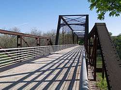 Moore's Crossing Historic District |
October 16, 1996 (#96001091) |
Roughly bounded by FM 973, old Burleson Rd. and Onion Cr. 30°10′03″N 97°39′43″W |
Austin | |
| 105 | Moore-Hancock Farmstead |  Moore-Hancock Farmstead |
September 2, 1994 (#94001079) |
4811 Sinclair Ave. 30°19′15″N 97°44′30″W |
Austin | |
| 106 | Charles B. Moreland House |  Charles B. Moreland House |
September 17, 1985 (#85002276) |
1301 E. Cesar Chavez 30°15′34″N 97°43′54″W |
Austin | |
| 107 | Chester and Lorine Nagel House |  Chester and Lorine Nagel House |
April 17, 1997 (#97000361) |
3215 Churchill Dr. 30°18′15″N 97°45′03″W |
Austin | |
| 108 | Neill-Cochran House |  Neill-Cochran House |
August 25, 1970 (#70000768) |
2310 San Gabriel St. 30°17′15″N 97°44′53″W |
Austin | |
| 109 | Newton House | .jpg) Newton House |
April 2, 1987 (#87000578) |
1013 E. Ninth St. 30°16′02″N 97°43′48″W |
Austin | |
| 110 | Elisabet Ney Studio and Museum |  Elisabet Ney Studio and Museum |
November 29, 1972 (#72001374) |
304 E. 44th St. 30°18′23″N 97°43′34″W |
Austin | |
| 111 | Norwood Building | 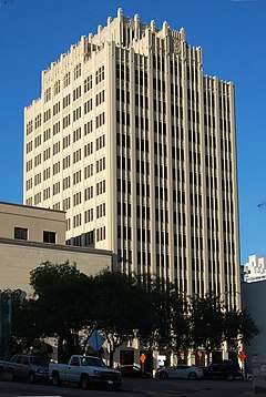 Norwood Building |
February 7, 2011 (#10001224) |
114 W 7th St. 30°16′10″N 97°44′35″W |
Austin | |
| 112 | Oakwood Cemetery Annex | Oakwood Cemetery Annex |
October 30, 2003 (#03001103) |
1601 Comal St. 30°16′36″N 97°43′25″W |
Austin | |
| 113 | Old Bakery | 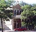 Old Bakery |
December 17, 1969 (#69000214) |
1006 Congress Ave. 30°16′20″N 97°44′30″W |
Austin | |
| 114 | Old Land Office Building |  Old Land Office Building |
August 25, 1970 (#70000769) |
108 E. 11th St. 30°16′21″N 97°44′22″W |
Austin | |
| 115 | Old West Austin Historic District |  Old West Austin Historic District |
September 12, 2003 (#03000937) |
Roughly bounded by W. 13th, Lamar Boulevard, W. 35th, and the Mo-Pac Expressway 30°17′32″N 97°45′18″W |
Austin | |
| 116 | Oliphant-Walker House | 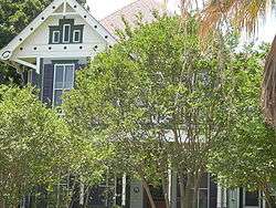 Oliphant-Walker House |
August 16, 1990 (#90001177) |
3900 Ave. C 30°18′10″N 97°44′04″W |
Austin | |
| 117 | Onion Creek Crossing at McKinney Falls | 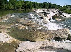 Onion Creek Crossing at McKinney Falls |
May 30, 2019 (#100003972) |
McKinney Falls State Park, 5808 McKinney Falls Pkwy 30°10′51″N 97°43′19″W |
Austin | |
| 118 | Page-Gilbert House |  Page-Gilbert House |
August 16, 1990 (#90001186) |
3913 Ave. G 30°18′06″N 97°43′47″W |
Austin | |
| 119 | Michael Paggi House |  Michael Paggi House |
April 16, 1975 (#75002006) |
200 Lee Barton Dr. 30°15′49″N 97°45′24″W |
Austin | |
| 120 | Paramount Theatre |  Paramount Theatre |
June 23, 1976 (#76002072) |
713 Congress Ave. 30°16′10″N 97°44′31″W |
Austin | |
| 121 | James F. and Susie R. Parker House |  James F. and Susie R. Parker House |
August 16, 1990 (#90001181) |
3906 Ave. D 30°18′10″N 97°43′59″W |
Austin | |
| 122 | Perry Estate-St. Mary's Academy |  Perry Estate-St. Mary's Academy |
August 8, 2001 (#01000874) |
701 E. 41st St. 30°18′04″N 97°43′25″W |
Austin | |
| 123 | Edgar H. Perry, Jr. House |  Edgar H. Perry, Jr. House |
July 11, 2014 (#14000404) |
801 Park Boulevard 30°18′07″N 97°43′23″W |
Austin | |
| 124 | George A. Peterson House |  George A. Peterson House |
September 17, 1985 (#85002273) |
1012 E. 8th St. 30°16′00″N 97°43′50″W |
Austin | |
| 125 | Joseph O. Polhemus House |  Joseph O. Polhemus House |
September 17, 1985 (#85002299) |
912 E. 2nd St. 30°15′41″N 97°44′03″W |
Austin | |
| 126 | William Sidney Porter House |  William Sidney Porter House |
June 18, 1973 (#73001979) |
409 E. 5th S. 30°15′56″N 97°44′20″W |
Austin | |
| 127 | Rainey Street Historic District |  Rainey Street Historic District |
September 17, 1985 (#85002302) |
70-97 Rainey St. 30°15′33″N 97°44′18″W |
Austin | |
| 128 | F. T. and Belle Ramsey House |  F. T. and Belle Ramsey House |
August 16, 1990 (#90001176) |
4412 Ave. B 30°18′34″N 97°43′53″W |
Austin | |
| 129 | Rather House |  Rather House |
October 24, 1979 (#79003013) |
3105 Duval St. 30°17′34″N 97°43′56″W |
Austin | |
| 130 | Raymond-Morley House |  Raymond-Morley House |
November 20, 1974 (#74002092) |
510 Baylor St. 30°16′18″N 97°45′19″W |
Austin | |
| 131 | Louis and Mathilde Reuter House |  Louis and Mathilde Reuter House |
December 7, 1987 (#87002100) |
806 Rosedale Terrace 30°14′28″N 97°44′41″W |
Austin | |
| 132 | Alice H. Robbins House | .jpg) Alice H. Robbins House |
August 16, 1990 (#90001235) |
4311 Ave. A 30°18′32″N 97°43′58″W |
Austin | |
| 133 | Roberts Clinic |  Roberts Clinic |
September 12, 2019 (#100004375) |
1174 San Bernard St. 30°16′15″N 97°43′35″W |
Austin | |
| 134 | Robinson-Macken House |  Robinson-Macken House |
September 12, 1985 (#85002300) |
702 Rio Grande St. 30°16′17″N 97°44′57″W |
Austin | |
| 135 | Edward H. Rogers Homestead |  Edward H. Rogers Homestead |
December 27, 1974 (#74002094) |
N of Austin off TX 1325 30°23′53″N 97°43′44″W |
Austin | |
| 136 | Rogers-Bell House |  Rogers-Bell House |
June 24, 1988 (#88000703) |
1001 E. Eighth St. 30°16′00″N 97°43′53″W |
Austin | |
| 137 | Roy-Hardin House | August 17, 2005 (#05000893) |
1803 Evergreen Ave. 30°14′58″N 97°45′53″W |
Austin | ||
| 138 | Royal Arch Masonic Lodge |  Royal Arch Masonic Lodge |
April 28, 2005 (#05000362) |
311 W. 7th St. 30°16′11″N 97°44′43″W |
Austin | |
| 139 | George W. Sampson House |  George W. Sampson House |
July 8, 1982 (#82004526) |
1003 Rio Grande 30°16′25″N 97°44′52″W |
Austin | |
| 140 | Santa Rita Courts |  Santa Rita Courts |
April 17, 2008 (#08000319) |
Roughly bounded by E. 2nd, Pedernales, Santa Rita, and Corta Sts. 30°15′22″N 97°43′01″W |
Austin | |
| 141 | Kurt and Meta Schemedes House |  Kurt and Meta Schemedes House |
June 15, 2000 (#00000696) |
804 Baylor St. 30°16′26″N 97°45′15″W |
Austin | |
| 142 | J. P. Schneider Store |  J. P. Schneider Store |
January 29, 1979 (#79003014) |
401 W. 2nd St. 30°15′55″N 97°44′52″W |
Austin | |
| 143 | Scholz Garten | 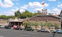 Scholz Garten |
July 27, 1979 (#79003015) |
1607 San Jacinto 30°16′40″N 97°44′11″W |
Austin | |
| 144 | Walter Schulze House and Industrial Structure | April 25, 1986 (#86000864) |
102 Chicon St. 30°15′59″N 97°43′27″W |
Austin | ||
| 145 | Zachary T., Sr., and Sallie Lee Scott House | September 7, 1998 (#98001087) |
2408 Sweetbrush Dr. 30°18′02″N 97°46′38″W |
Austin | ||
| 146 | Scottish Rite Dormitory | 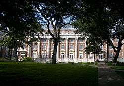 Scottish Rite Dormitory |
April 23, 1998 (#98000404) |
210 W. 27th St. 30°17′32″N 97°44′21″W |
Austin | |
| 147 | Seaholm Power Plant | 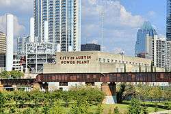 Seaholm Power Plant |
August 20, 2013 (#13000614) |
800 W. Cesar Chavez St. 30°15′59″N 97°45′10″W |
Austin | |
| 148 | Rev. Henry M. and Jennie Sears House | 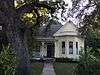 Rev. Henry M. and Jennie Sears House |
August 16, 1990 (#90001174) |
209 W. 39th St. 30°18′09″N 97°44′04″W |
Austin | |
| 149 | Shadow Lawn Historic District |  Shadow Lawn Historic District |
August 16, 1990 (#90001192) |
Roughly bounded by Ave. G, 38th St., Duval St., and 39th St. 30°17′59″N 97°43′48″W |
Austin | |
| 150 | Sheeks-Robertson House |  Sheeks-Robertson House |
June 24, 1976 (#76002073) |
610 W. Lynn St. 30°16′34″N 97°45′43″W |
Austin | |
| 151 | Shield Ranch | February 24, 2020 (#100004984) |
Address Restricted |
Bee Cave vicinity | ||
| 152 | Col. Monroe M. Shipe House |  Col. Monroe M. Shipe House |
March 29, 1983 (#83003167) |
3816 Ave. G 30°18′03″N 97°43′52″W |
Austin | |
| 153 | Shotgun at 1206 Canterbury Street | September 17, 1985 (#85002285) |
1206 Canterbury St. 30°15′29″N 97°43′18″W |
Austin | ||
| 154 | Shotguns at 1203-1205 Bob Harrison |  Shotguns at 1203-1205 Bob Harrison |
September 17, 1985 (#85002284) |
1203-1205 Bob Harrison 30°16′25″N 97°43′37″W |
Austin | |
| 155 | Simms House |  Simms House |
March 30, 2005 (#05000242) |
906 Mariposa Dr. 30°14′28″N 97°44′37″W |
Austin | |
| 156 | Simpson Memorial Methodist Church |  Simpson Memorial Methodist Church |
August 24, 2015 (#15000544) |
1701 E. 12th St. 30°16′23″N 97°43′18″W |
Austin | |
| 157 | Sixth Street Historic District |  Sixth Street Historic District |
December 30, 1975 (#75002132) |
Roughly bounded by 5th, 7th, Lavaca Sts. and I-35 30°16′02″N 97°44′23″W |
Austin | |
| 158 | Smith Rock Shelter |  Smith Rock Shelter |
October 1, 1974 (#74002095) |
In McKinney Falls State Park 30°11′03″N 97°43′26″W |
Austin | |
| 159 | Smith-Marcuse-Lowry House |  Smith-Marcuse-Lowry House |
August 16, 1990 (#90001180) |
3913 Ave. C 30°18′12″N 97°44′00″W |
Austin | |
| 160 | Smith-Clark and Smith-Bickler Houses |  Smith-Clark and Smith-Bickler Houses |
April 20, 1979 (#79003016) |
502 and 504 W. 14th St. 30°16′39″N 97°44′41″W |
Austin | |
| 161 | Richmond Kelley Smoot House |  Richmond Kelley Smoot House |
August 12, 1982 (#82004527) |
1316 W. 6th St. 30°16′28″N 97°45′35″W |
Austin | |
| 162 | Southgate-Lewis House |  Southgate-Lewis House |
September 17, 1985 (#85002265) |
1501 E. 12th St. 30°16′23″N 97°43′25″W |
Austin | |
| 163 | Southwestern Telegraph and Telephone Building |  Southwestern Telegraph and Telephone Building |
February 14, 1978 (#78002993) |
410 Congress Ave. 30°16′00″N 97°44′37″W |
Austin | |
| 164 | St. David's Episcopal Church | 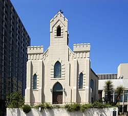 St. David's Episcopal Church |
August 2, 1978 (#78002994) |
304 E. 7th St. 30°16′06″N 97°44′21″W |
Austin | |
| 165 | St. Edward's University Main Building and Holy Cross Dormitory | 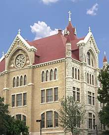 St. Edward's University Main Building and Holy Cross Dormitory |
March 7, 1973 (#73001980) |
3001 S. Congress St. 30°13′46″N 97°45′17″W |
Austin | |
| 166 | St. Mary's Cathedral | 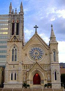 St. Mary's Cathedral |
April 2, 1973 (#73001981) |
201-207 10th St. 30°16′15″N 97°44′23″W |
Austin | |
| 167 | State Cemetery of Texas | 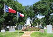 State Cemetery of Texas |
May 12, 1986 (#86001085) |
901 Navasota St. 30°15′54″N 97°43′34″W |
Austin | |
| 168 | State Lunatic Asylum | 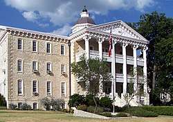 State Lunatic Asylum |
December 4, 1987 (#87002115) |
4110 Guadalupe 30°18′27″N 97°44′12″W |
Austin | |
| 169 | Stavely-Kunz-Johnson House |  Stavely-Kunz-Johnson House |
August 19, 1980 (#80004155) |
1402 E. Cesar Chavez 30°15′30″N 97°43′47″W |
Austin | |
| 170 | Swedish Hill Historic District |  Swedish Hill Historic District |
May 12, 1986 (#86001088) |
900-1000 blocks of E. Fourteenth St. and 900 block of E. Fifteenth St. 30°16′28″N 97°43′45″W |
Austin | |
| 171 | Teachers State Association of Texas Building |  Teachers State Association of Texas Building |
April 28, 2005 (#05000361) |
1191 Navasota 30°16′18″N 97°43′39″W |
Austin | |
| 172 | Texas Federation of Women's Clubs Headquarters |  Texas Federation of Women's Clubs Headquarters |
October 24, 1985 (#85003377) |
2312 San Gabriel St. 30°17′16″N 97°44′53″W |
Austin | |
| 173 | Texas State Capitol | 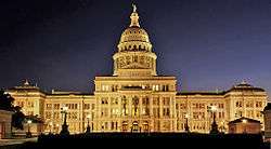 Texas State Capitol |
June 22, 1970 (#70000770) |
Congress and 11th Sts. 30°16′28″N 97°44′22″W |
Austin | |
| 174 | Town Lake Gazebo | .jpg) Town Lake Gazebo |
February 7, 2020 (#100004970) |
9307 Ann & Roy Butler Hike & Bike Trail 30°15′45″N 97°44′55″W |
Austin | |
| 175 | Tucker Apartment House |  Tucker Apartment House |
July 24, 2017 (#100001379) |
1105 Nueces St. 30°16′29″N 97°44′47″W |
Austin | |
| 176 | U.S. Post Office and Federal Building |  U.S. Post Office and Federal Building |
August 25, 1970 (#70000771) |
126 W. 6th St. 30°16′07″N 97°44′36″W |
Austin | |
| 177 | University Baptist Church |  University Baptist Church |
July 31, 1998 (#98000955) |
2130 Guadalupe St. 30°17′05″N 97°44′31″W |
Austin | |
| 178 | University Junior High School |  University Junior High School |
April 19, 2001 (#01000396) |
1925 San Jacinto Blvd. 30°16′51″N 97°43′58″W |
Austin | |
| 179 | Victory Grill | 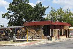 Victory Grill |
October 16, 1998 (#98001226) |
1104 E. 11th St. 30°16′09″N 97°43′43″W |
Austin | |
| 180 | Wahrenberger House | 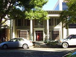 Wahrenberger House |
February 23, 1978 (#78002995) |
208 W. 14th St. 30°16′36″N 97°44′30″W |
Austin | |
| 181 | Walnut Creek Archeological District | September 24, 1981 (#81000633) |
Address Restricted |
Austin | ||
| 182 | James M. and Leana B. Walsh House |  James M. and Leana B. Walsh House |
February 5, 2014 (#13001160) |
3701 Bonnie Rd. 30°17′46″N 97°46′56″W |
Austin | |
| 183 | Wesley United Methodist Church | 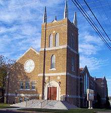 Wesley United Methodist Church |
September 17, 1985 (#85002281) |
1164 San Bernard St. 30°16′11″N 97°43′34″W |
Austin | |
| 184 | West Fifth Street Bridge at Shoal Creek | 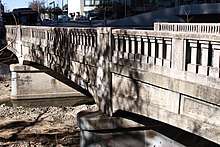 West Fifth Street Bridge at Shoal Creek |
December 3, 2019 (#100004750) |
West Fifth Street at Shoal Creek 30°16′11″N 97°45′08″W |
Austin | |
| 185 | West Line Historic District |  West Line Historic District |
October 12, 2005 (#05001166) |
Roughly bounded by Baylor St., W. Fifth and Sixth Sts., MoPac Expressway 30°16′43″N 97°45′35″W |
Austin | |
| 186 | West Sixth Street Bridge at Shoal Creek | 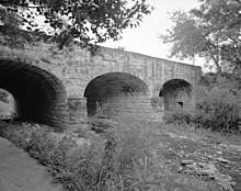 West Sixth Street Bridge at Shoal Creek |
August 18, 2014 (#14000499) |
West Sixth Street at Shoal Creek 30°16′14″N 97°45′04″W |
Austin | |
| 187 | Westgate Tower |  Westgate Tower |
October 12, 2010 (#10000820) |
1122 Colorado St. 30°16′27″N 97°44′34″W |
Austin | |
| 188 | Westhill |  Westhill |
July 26, 1979 (#79003017) |
1703 West Ave. 30°16′52″N 97°44′45″W |
Austin | |
| 189 | W.T. and Clotilde V. Williams House | 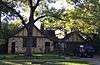 W.T. and Clotilde V. Williams House |
August 16, 1990 (#90001182) |
3820 Ave. F 30°18′03″N 97°43′56″W |
Austin | |
| 190 | Willow-Spence Streets Historic District | 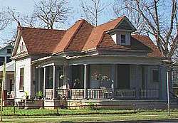 Willow-Spence Streets Historic District |
September 17, 1985 (#85002264) |
Portions of Willow, Spence, Canterbury, San Marcos, and Waller Sts. 30°15′32″N 97°44′03″W |
Austin | |
| 191 | Wilshire Historic District | June 8, 2011 (#11000347) |
Bounded by the Southern Pacific Railroad, Ardenwood Rd., Wilshire Boulevard, and the Delwood III subdivision 30°17′51″N 97°42′50″W |
Austin | ||
| 192 | Woodlawn | Woodlawn |
August 25, 1970 (#70000772) |
6 Niles Rd. 30°17′13″N 97°45′29″W |
Austin | |
| 193 | Wooldridge Park | 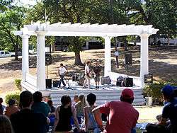 Wooldridge Park |
August 1, 1979 (#79003018) |
Guadalupe St. 30°16′20″N 97°44′43″W |
Austin | |
| 194 | Goodall Wooten House | 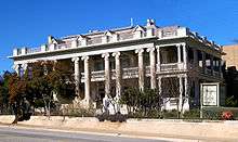 Goodall Wooten House |
April 3, 1975 (#75002008) |
700 W. 19th St. 30°16′58″N 97°44′44″W |
Austin | |
| 195 | Worrell-Ettlinger House |  Worrell-Ettlinger House |
October 12, 2004 (#04001152) |
3110 Harris Park Ave. 30°17′38″N 97°43′52″W |
Austin | |
| 196 | Wroe-Bustin House |  Wroe-Bustin House |
January 25, 1997 (#96001626) |
506 Baylor St. 30°16′28″N 97°45′21″W |
Austin | |
| 197 | Youth Council Site (41TV382) | April 24, 1979 (#79003450) |
Address Restricted |
Austin | ||
| 198 | Zilker Park Historic District |  Zilker Park Historic District |
May 23, 1997 (#97000479) |
2100 Barton Springs Rd. 30°15′49″N 97°46′36″W |
Austin | |
| 199 | Ziller House |  Ziller House |
May 8, 1998 (#98000449) |
1110 Blanco 30°16′40″N 97°45′16″W |
Austin |
Former listings
| [3] | Name on the Register | Image | Date listed | Date removed | Location | City or town | Summary |
|---|---|---|---|---|---|---|---|
| 1 | John Henry and Minnie Tate Brewer House | August 21, 1995 (#95001027) | September 18, 2013 | 1108 S. Chicon St. 30°16′01″N 97°43′13″W |
Austin | ||
| 2 | Dr. Beadie E. and Willie R. Conner House and Park | September 19, 1997 (#97001110) | September 12, 2019 | 3111 E. 13th St. 30°16′37″N 97°42′03″W |
Austin | ||
| 3 | Doyle House | April 13, 1973 (#73001975) | Unknown | 310 E. 14th St. |
Austin | ||
| 4 | Hardeman House | February 23, 1972 (#72001375) | Unknown | 401 E. 16th St. |
Austin | ||
| 5 | John C. Houghton House | _ELEVATION_-_John_H._Houghton_House%2C_307_West_Twelfth_Street%2C_Austin%2C_Travis_County%2C_TX_HABS_TEX%2C227-AUST%2C16-1.tif.jpg) John C. Houghton House |
1973 (#73002248) | 1973 | 307 W. 12th St. |
Austin | Demolished in September 1973 for a parking garage.[6] |
| 6 | B. J. Smith House | April 19, 1978 (#78002992) | May 27, 1999 | 700 W. 6th St. |
Austin |
See also
| Wikimedia Commons has media related to National Register of Historic Places in Travis County, Texas. |
References
- The latitude and longitude information provided in this table was derived originally from the National Register Information System, which has been found to be fairly accurate for about 99% of listings. Some locations in this table may have been corrected to current GPS standards.
- "National Register of Historic Places: Weekly List Actions". National Park Service, United States Department of the Interior. Retrieved on June 19, 2020.
- Numbers represent an ordering by significant words. Various colorings, defined here, differentiate National Historic Landmarks and historic districts from other NRHP buildings, structures, sites or objects.
- "National Register Information System". National Register of Historic Places. National Park Service. April 24, 2008.
- The eight-digit number below each date is the number assigned to each location in the National Register Information System database, which can be viewed by clicking the number.
Places adjacent to National Register of Historic Places listings in Travis County, Texas | ||||||||||
|---|---|---|---|---|---|---|---|---|---|---|
| ||||||||||
| Topics | |
|---|---|
| Lists by state |
|
| Lists by insular areas | |
| Lists by associated state | |
| Other areas | |
| Related | |
| |
Municipalities and communities of Travis County, Texas, United States | ||
|---|---|---|
| Cities | Travis County map | |
| Villages | ||
| CDPs | ||
| Other unincorporated communities | ||
| Footnotes | ‡This populated place also has portions in an adjacent county or counties | |
This article is issued from Wikipedia. The text is licensed under Creative Commons - Attribution - Sharealike. Additional terms may apply for the media files.