Katy, Texas
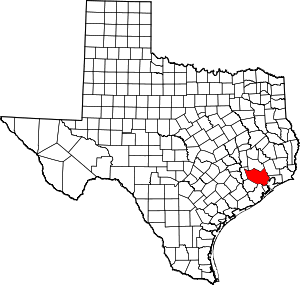
Katy is a city in the U.S. state of Texas, within the Houston–The Woodlands–Sugar Land metropolitan area. The city is approximately centered at the tripoint of Harris, Fort Bend, and Waller counties. Katy had a population of 14,102 at the 2010 census,[1] up from 11,775 in 2000. Its population was estimated at 21,729 in 2019.[5]
Katy, Texas | |
|---|---|
| Motto(s): "Small Town Charm with Big City Convenience" COUNTRY LIVING | |
 Location in Harris County and the state of Texas | |
 Katy Location in Harris County and the state of Texas  Katy Katy (the United States) | |
| Coordinates: 29°47′33″N 95°49′21″W | |
| Country | United States |
| State | Texas |
| Counties | Harris, Fort Bend, Waller |
| Incorporated | 1945 |
| Government | |
| • Mayor | Bill Hastings. |
| Area | |
| • Total | 11.34 sq mi (29.36 km2) |
| • Land | 11.25 sq mi (29.15 km2) |
| • Water | 0.0 sq mi (0.11 km2) |
| Elevation | 141 ft (43 m) |
| Population (2010)[1] | |
| • Total | 14,102 |
| • Estimate (2019) | 21,729 |
| • Density | 1,436/sq mi (554.3/km2) |
| Demonym(s) | Katyite[2] |
| Time zone | UTC−6 (CST) |
| • Summer (DST) | UTC−5 (CDT) |
| ZIP Codes | 77400–77499 |
| Area code(s) | 281 |
| FIPS code | 48-38476[3] |
| GNIS feature ID | 1338960[4] |
| Website | cityofkaty |
First formally settled in the mid-1891s, Katy was a railroad town along the Missouri–Kansas–Texas (MKT) Railroad which ran parallel to U.S. Route 90 (today Interstate 10) into Downtown Houston. The fertile floodplain of Buffalo Bayou, which has its source near Katy, and its tributaries made Katy and other communities in the surrounding prairie an attractive location for rice farming. Beginning in the 1960s, the rapid growth of Houston moved westward along the new Interstate 10 corridor, bringing Katy into its environs. Today, the municipality of Katy lies at the center of a broader area known as Greater Katy, which has become heavily urbanized.
While largely subsumed into Greater Houston, the town of Katy is still notable for Katy Mills Mall, the Katy Independent School District, and its historic town square along the former right-of-way of the MKT railroad.
History
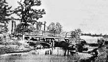
In the early 1800s Katy was known as "Cane Island", named for the creek that runs through the area, a branch of Buffalo Bayou. The creek was filled with tall cane, not native to the area. It was presumed to have been planted by either the Karankawa Indians or Spanish explorers to aid in fur trapping until the 1820s.
In 1845 James J. Crawford received a land grant that included this area. The hot summers and thick clay soil made it difficult to attract settlers to the area. Crawford, Peter Black, John Sills and the families of former slaves Thomas (Mary) Robinson and Milto McGinnis were the only recorded residents of Cane Island in 1875.
In 1895, James Oliver Thomas laid out a town, and in January 1896 the town of Katy was named through Thomas's post office application. The name "Katy" was derived from the MKT Railroad Company, which was commonly referred to as "the K-T" (also its stock exchange symbol). This common designation soon evolved into "the Katy."
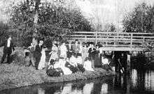
The anticipations of prosperity would bring growth to the new town which was developed around the original train stop and railroad tracks. By the early 1900s many families had come by train and wagon to establish Katy. Cotton and peanuts and corn were the first successful crops, but rice soon became the primary commodity crop. Katy later became known for rice farming; the first concrete rice driers in the state of Texas were built here in 1944 and still stand as landmarks. The farming community well supported local businesses as several hotels, stores, livery stables and saloons were prospering.
On September 8, 1900, the town's early efforts were swept clean by the Great Galveston Hurricane of 1900, the deadliest hurricane in US history. All but two of the original Katy homes were lost in the storm. Despite this, Cane Island rebuilt and continued to grow.
In 1945 the city of Katy was incorporated as a municipality. C. L. Baird was the first mayor. Boundaries were determined by finding the area that contained the most residents and was reasonably sized so that it could be managed by city services.
The construction and opening of Interstate 10 in 1966 allowed for rapid development of the area, as Houston expanded westward. This section was widened in 2008 to an average of 26 lanes, and in some areas 30 lanes total including 6 feeder and 4 HOV lanes for roughly 22 miles, making it the widest Freeway in the world. The population was 9,866 in 1988, 8,005 in 1990, 11,775 in 2000, and 15,591 in 2014. Currently Katy has grown to a population of well over 16,000 residents and almost 270,000 in the Greater Katy area. Katy has won national accolades for growth and sustainability.[6] including the Gadberry Group naming Katy as one of "9 from 2009" most notable high-growth areas in the United States.[7]
Recently, Katy, Texas has grown a strong presence in the hip hop community. On May 1, 2020, Aubrey "Drake" Graham, rapper and Toronto native released his unexpected mixtape, "Dark Lane Demo Tapes". Filled with leaked songs and internet snippets, the project is littered with references to American and Canadian areas. One of the most streamed songs, "Desires" featuring long-time friend and artist Nayvadius "Future" Wilburn, actually makes a direct reference to the city,
"I should have put you somewhere where no one could find you Mansion out in the sticks with nothin' around you Katy, Texas, Dallas, Texas You know, a different environment"
Speaking directly to the removed nature of Katy, the song pays respect to the beautiful mansions and expansive acres that are synonymous with the community.
Geography

The city of Katy is located at the three-border intersection of Harris, Fort Bend, and Waller counties, along Interstate 10, 29 miles (47 km) west of downtown Houston and 22 miles (35 km) east of Sealy. According to the United States Census Bureau, the city of Katy has a total area of 11.3 square miles (29.3 km2), of which 11.2 square miles (29.1 km2) is land and 0.04 square miles (0.1 km2), or 0.38%, is water.[1]
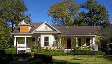
Katy is often further defined as either "Old Towne Katy" or "Greater Katy". "Old Towne Katy" refers to the proper of Katy, which was incorporated in 1945. Its boundaries, as defined by the Katy Independent School Divisions zoning, runs just south of Kingsland Blvd, stretching across Interstate 10 to Morton Road. Katy Fort Bend Road and Cane Island Creek act as the east and west boundaries, The "Greater Katy" area includes the city of Katy plus large sections of unincorporated land surrounding the city corresponding to the boundaries of the 181 sq mi (470 km2) Katy Independent School District. The "All Aboard Katy!" public art project and the Katy Area Economic Development Council's "Energy Grows Here" branding initiative are large-scale projects launched to help promote, identify and unite the Katy area.
Greater Katy includes communities such as Cinco Ranch, Green Trails, Grayson Lakes, Seven Meadows, Pine Mill Ranch, Silver Ranch, Firethorne, Grand Lakes and Cane Island. It also encompasses suburban developments from the 1970s and 1980s, such as Memorial Parkway, Kelliwood and Nottingham Country.
Old Towne Katy's new upscale communities include Pin Oak Village, The Falls at Green Meadows and The Enclave. Large developments underway include a new residential community boarding the east border of Mary Joe Peckham Park and the anticipated Katy Boardwalk. The City of Katy has recently placed a large focus on the downtown redevelopment plan which includes the new City Hall Building and an upcoming Downtown green space. Further projects include the Katy Museum of Modern Art's new building, Typhoon Texas Water Park, Katy Independent School District's Legacy Football Stadium, Katy Independent School District's Rhodes Stadium, Momentum Indoor Climbing Center, REI Climb Store and the YMCA at Katy Main Street. Large road improvements are underway in Downtown, on Morton Road and Franz Road.
The city of Houston's extraterritorial jurisdiction (ETJ) stretches well west of Katy. This means that most of the unincorporated lands in the Katy area may be annexed by the city of Houston at some time in the future. The city of Katy's ETJ, meanwhile, is limited to parcels of land west and north of the city itself.[6]
Climate
The climate in this area is characterized by hot, humid summers and generally mild to cool winters. According to the Köppen Climate Classification system, Katy has a humid subtropical climate, abbreviated "Cfa" on climate maps.[8]
Demographics
| Historical population | |||
|---|---|---|---|
| Census | Pop. | %± | |
| 1950 | 849 | — | |
| 1960 | 1,569 | 84.8% | |
| 1970 | 2,923 | 86.3% | |
| 1980 | 5,660 | 93.6% | |
| 1990 | 8,005 | 41.4% | |
| 2000 | 11,775 | 47.1% | |
| 2010 | 14,102 | 19.8% | |
| Est. 2019 | 21,729 | [5] | 54.1% |
| U.S. Decennial Census | |||
As of the census of 2000, there were 11,775 people in "Old Katy", 3,888 households, and 3,083 families residing in the city. The population density was 1,103.7 people per square mile (426.1/km²). There were 4,072 housing units at an average density of 381.7 per square mile (147.3/km²). The racial makeup of the city was 83.98% White, 4.24% African American, 0.56% Native American, 0.50% Asian, 0.04% Pacific Islander, 8.65% from other races, and 2.03% from two or more races. Hispanic or Latino people of any race were 23.75% of the population.
There were 3,888 households out of which 45.7% had children under the age of 18 living with them, 63.9% were married couples living together, 10.9% had a female householder with no husband present, and 20.7% were non-families. 17.4% of all households were made up of individuals and 6.7% had someone living alone who was 65 years of age or older. The average household size was 3.00 and the average family size was 3.37.
In the city, the population was spread out with 31.5% under the age of 18, 8.7% from 18 to 24, 30.9% from 25 to 44, 20.7% from 45 to 64, and 8.1% who were 65 years of age or older. The median age was 33 years. For every 100 females, there were 98.6 males. For every 100 females age 18 and over, there were 97.5 males.
The median income for a household in the city was $51,111, and the median income for a family was $57,741. Males had a median income of $38,412 versus $33,004 for females. The per capita income for the city was $21,192. 8.4% of the population and 7.0% of families were below the poverty line. Out of the total people living in poverty, 9.1% were under the age of 18 and 6.5% were 65 or older.
Economy
Several corporations are headquartered in areas surrounding Katy.
Igloo Corporation is headquartered west of Katy in unincorporated Waller County.[9] Academy Sports and Outdoors has its corporate offices and product distribution center in unincorporated western Harris County.[10]
BP America is headquartered in the Houston Energy Corridor and is the area's largest employer, with 5,500 employees on its Westlake campus as of 2009. BP's Katy operations include engineering and business support for much of BP's onshore operations in the contiguous United States, as well as its operations in the Gulf of Mexico.
As of 2017 Amazon is building a 1 million-square-foot distribution center near the intersection of Highway 90 and Woods Road. "We are honored Amazon chose Katy to be the location for their next fulfillment center, and we know the City of Katy will benefit from this relationship through increased job opportunities for our residents and their support of local Katy businesses,” said then Katy Mayor Fabol Hughes during the local announcement.
With the economy improving after 2009, retail centers were developed throughout Katy to accommodate the rapid residential growth. The major retail growth is taking place along Katy Fort Bend Road near the east entrance to the Katy Mills shopping mall. In August 2010, H-E-B Food & Drug opened a new UP format store at I-10 and Pin Oak. In July 2013, Costco announced that it would open a store at the southwest corner of Grand Parkway and I-10 in 2014. Construction began in August 2013. The new store was planned for completion by early spring 2014 and would be Costco's fourth Houston-area location.[11][12]
The Katy Area Economic Development Council serves as the economic development organization for the area. Founded in 2003, the Katy Area Economic Development Council's (Katy Area EDC) mission is to establish the Katy area as the premier location for families and businesses through planned economic growth and economic development. Since its inception, the Katy Area EDC has grown to over 210 members, has a budget of $900,000 and has assisted in the creation of over 16,200 jobs and more than $2.5 billion in capital investment. Katy Area EDC is a full-service private, non-profit, 501 (c) 6 economic development corporation.
Government and infrastructure
Katy is a home-rule city, chartered in 1945. Residents within the city limits are governed by a nonpartisan city council made up of five Councilmembers and the Mayor. The city is split into two wards; two council members are elected from each ward, and one council member and the mayor are elected at-large. The Mayor appoints a councilmember to serve as Mayor Pro Tem with a council vote of approval.
| Office | Office Holder |
|---|---|
| Mayor | Bill Hastings |
| Mayor Pro Tem | Chris Harris |
| Ward A | Janet Corte |
| Ward A | Frank O. Carrol |
| Ward B | Durran Dowdle |
| Ward B | Jen Stockdick |
Residents within the city limits pay city taxes and receive municipal police, fire, EMS, and public works service. The city has territory in three counties, each of which has its own representative governments. The counties have a greater influence on areaoutside the incorporated city limits.
The Katy area lies in three counties. Residents in unincorporated Harris, Fort Bend and Waller counties are governed by those counties. The county residents elect representative county commissioners who represent them on the county courts of each county, presided over by the county judge of each county.
Harris County Precinct Three, headed by Steve Radack as of 2008, serves the Harris County portion of Katy.[13] The Fort Bend County portion of Katy is under Fort Bend County Precinct Three headed by Andy Meyers.[14]
Education
Primary and secondary schools
People who live in Katy are zoned to schools in the Katy Independent School District.[15][16] While multiple Katy ISD schools have "Katy, Texas" postal addresses, only a portion are located in and/or serve the Katy city limits.
The elementary schools in the City of Katy are:
- Zelma Hutsell Elementary School[17]
- Katy Elementary School[18]
- WoodCreek Elementary School[19]
- Bryant Elementary School[20]
Middle schools in the City of Katy:
High schools in the City of Katy:
- Katy High School, the oldest high school, is located nearest to the center city. It was established in 1898, and relocated to its present location in 1947. Katy ISD's three alternative education schools (Martha Raines High School, Miller Career and Technology Center, and the Opportunity Awareness Center) are all located within the city.
Aristoi Classical Academy is a charter school in Katy.
The following private schools are located in Katy and serve residents of the City of Katy and Greater Houston:
- Mirus Academy is a flexibly-scheduled and gifted-and-talented-friendly private school which allows for students to be placed in classes according to ability. It was previously called "The Curious Mind" when it was a homeschooling academy; it transitioned into a private school and took its present name in 2010.
Colleges
Katy is served by the Houston Community College System. HCC Northwest College operates the Katy Campus in an unincorporated section of Harris County.[23]
The Bible Seminary offers non-denominational college-level Bible study and ministry training, including a variety of graduate-level Master's programs. These programs include an MA in Biblical Archeology, with dynamic leaders in the field. It also offers a Bible Certificate program for local church members and leaders.
The University of Houston recently purchased the Verde Park Development site, with plans to break ground on a Katy Campus at I10 and 99.
Public libraries
Katy is served by the Katy Branch of Harris County Public Library (HCPL) at 5414 Franz Road. The branch is a partnership between HCPL and the City of Katy. The city joined the county library system in 1921. The Katy Garden Club started the first library, which was housed in several private houses. At a later point it shared space with the Katy Fire Department. The first Katy branch opened in 1940. The Friends of the Katy Library began in 1972. The construction of the current 15,000-square-foot (1,400 m2) branch began in 2002. The current branch building opened for regular business in Monday April 28, 2003, with its grand opening ceremony on the previous day.[24]
Parks and recreation
Transportation
Mass transit
Metropolitan Transit Authority of Harris County (METRO) operates the Kingsland Park and Ride (Route 221) east of Katy at 21669 Kingsland Boulevard. In February 2008 METRO opened a new park and ride location at the Cinemark parking lots near the intersection of Grand Parkway and I-10. The new Route is #222. Currently, only these express routes operate to and from downtown Houston during morning and evening commute hours.
METRO opened a six-story garage Park And Ride Bus Depot at the intersection of I-10 west and the Grand Parkway to service commuters.
Intercity buses
Greyhound Bus Lines operates the Katy Station at Millers Exxon.[28] Megabus.com stops at Katy Mills en route between Austin, San Antonio and Houston. This serves as a park-and-ride location for riders from the Katy and Greater Houston area.
Airports
Privately owned airports for fixed-wing aircraft for public use located near Katy include:
- Sack-O-Grande Acroport (also known as Harbican Airport) in unincorporated Harris County
- Houston Executive Airport in unincorporated Waller County
- West Houston Airport in unincorporated Harris County
Privately owned airports for private use include:
- Hoffpauir Airport in unincorporated Harris County
- Cardiff Brothers Airport in unincorporated Fort Bend County
Area airports with commercial airline service include George Bush Intercontinental Airport and William P. Hobby Airport, both of which are in Houston.
Religion
The original City of Katy became known as the "City of Churches" due to the role of religion in daily life. Not only were churches highly concentrated in the city, but according to area historian Carol Adams, the residents had a fervent religious belief. Circa the 1960s the city erected a "City of Churches" sign. As of 2016 only Christian churches are in the Katy city limits; religious buildings of other faiths are in nearby unincorporated areas.[29]
As of 2016 the city had about 15 churches. Donald G. Burgs Jr., pastor of Alief Baptist Church, estimated that the downtown area of Katy had six to seven church buildings.[29] The first church established in the city was First Baptist Church; in 1898 reverend T.L. Scruggs held the church's first meeting. In 2007 it moved to a facility on Pin Oak Road due to growth, and in 2016 it had about 4,000 worshippers. Alief Baptist Church bought the former First Baptist building.[29] The city's Catholic population began with a group from the modern Czech Republic and has been served by the St. Bartholomew the Apostle Catholic Church; the church has regular worship services in English, Spanish, and Vietnamese.[30] Other churches in the city include Katy First United Methodist Church, and Parkway Fellowship Church.[29]
Notable people
- Rodney Anderson, Cincinnati Bengals running back in the NFL
- Clint Black, country singer and musician
- Kimberly Caldwell, American Idol contestant, singer, actress, television hostess
- Bill Callegari, businessman, engineer, and a Republican member of the Texas House of Representatives from Katy from 2001 to 2015[31]
- The Catt family, 21st-century bank robbing family[32]
- Roger Creager, Texas country singer and songwriter
- Dan Crenshaw, Texas Representative
- Andy Dalton, Cincinnati Bengals quarterback in the NFL
- Bernice Edwards, classic female blues singer, pianist and songwriter[33]
- Paddy Fisher, college football player
- Courtney Ford, actress
- De'Aaron Fox, professional basketball player for the Sacramento Kings in the NBA and McDonald's All American
- Janeane Garofalo, actress, stand-up comedian, and writer
- Cullen Gillaspia, Houston Texans fullback in the NFL
- Sammy Guevara, Professional Wrestler from AEW
- Julie Henderson, model
- Bo Levi Mitchell, professional quarterback currently playing for the Calgary Stampeders in the Canadian Football League, 2014 Grey Cup MVP
- Tyler Myers, pro hockey player for the Winnipeg Jets in the National Hockey League
- Megan Nicole, singer
- Sage Northcutt, UFC fighter
- Renee O'Connor, actress and director, best known for her role as Gabrielle in Xena: Warrior Princess
- Anthony Rendon, professional baseball player for the Washington Nationals in the National League.
- Mike Schofield, Republican state representative from District 132 in Katy, effective 2015
- Jesse Sorensen, professional wrestler
- Ty Tabor, guitarist and vocalist of melodic progressive metal band King's X
- Brett Velicovich, soldier[34]
- Renée Zellweger, actress and producer
See also
References
- "Geographic Identifiers: 2010 Demographic Profile Data (G001): Katy city, Texas". U.S. Census Bureau, American Factfinder. Retrieved August 29, 2016.
- "The Big Apple: Katyite (inhabitant of Katy)". Barrypopik.com. Retrieved January 6, 2012.
- "U.S. Census website". United States Census Bureau. Retrieved January 31, 2008.
- "US Board on Geographic Names". United States Geological Survey. October 25, 2007. Retrieved January 31, 2008.
- "Population and Housing Unit Estimates". Retrieved May 23, 2020.
- Adams, Carol. Historic Katy, (2012), HPN, ISBN 978-1935377924.
- Morrow, Stacy. "Katy, Atascocita named among nation’s highest growth areas" Archived January 9, 2010, at the Wayback Machine, KHOU-TV. 5 January 2010. Retrieved January 8, 2010.
- "Katy, Texas Köppen Climate Classification". Weatherbase.com. Retrieved July 1, 2017.
- "Igloo Worldwide Headquarters Archived April 21, 2010, at the Wayback Machine," Igloo Corporation. Accessed September 5, 2008.
- "Contact Academy Sports & Outdoors Archived January 5, 2010, at the Wayback Machine." Academy Sports and Outdoors. Accessed September 5, 2008.
- "Costco to open store at Grand Parkway and I-10 in Katy Archived August 19, 2013, at the Wayback Machine." Community Impact Newspaper. July 10, 2013. Retrieved September 3, 2013.
- "Costco plans spring opening in Katy area. Houston Chronicle. August 14, 2013. Retrieved September 3, 2013.
- "Precinct Maps : Precinct 3." Harris County. Accessed October 13, 2008.
- https://precinctthree.com/commissioner-andy-meyers
- "School Assignment By Residential Address" (SARA). Katy Independent School District. Retrieved on July 8, 2017.
- "City of Katy Map 2020". City of Katy. Retrieved May 30, 2020. - This map shows which public schools are in the Katy city limits.
- "Lookup Hutsell Elementary School Attendance Zone." Katy Independent School District. Accessed April 11, 2016.
- "Lookup Katy Elementary School Attendance Zone." Katy Independent School District. Accessed April 11, 2016.
- "Lookup WoodCreek Elementary School Attendance Zone." Katy Independent School District. Accessed April 11, 2016.
- "Lookup Bryant Elementary School Attendance Zone." Katy Independent School District. Accessed January 29, 2020
- "Katy Junior High School Attendance Zone." Katy Independent School District. Accessed September 5, 2008.
- "WoodCreek Junior High School Attendance Zone." Katy Independent School District. Accessed September 5, 2008.
- "Northwest College Archived December 25, 2011, at the Wayback Machine." Houston Community College District. Accessed September 5, 2008.
- "Katy Branch Library Archived May 17, 2008, at the Wayback Machine." Harris County Public Library. Retrieved November 29, 2008.
- "Community Centers : Mary Jo Peckham." Harris County. Accessed April 11, 2016.
- "City of Katy Parks and Recreation" Accessed April 11, 2016.
- "Katy Rice Harvest Festival - live entertainment, craft and food booths, carnival and more!". Riceharvestfestival.org. Archived from the original on February 3, 2009. Retrieved July 1, 2017.
- "
- Herrera, Sebastian (March 4, 2016). "Is Katy still the 'City of Churches'?". Houston Chronicle. The Katy Rancher. Retrieved July 12, 2018.
- Glenn, Mike (July 9, 2018). "Czech language service planned at Katy church". Houston Chronicle. Retrieved July 12, 2018.
- "Bill Callegari's Biography". Project Vote Smart. Retrieved March 27, 2014.
- I Would Only Rob Banks for My Family; article; Skip Hollandsworth; June 2014 issue; Texas Monthly; accessed May 2014
- Eagle, Bob; LeBlanc, Eric S. (2013). Blues - A Regional Experience. Santa Barbara: Praeger Publishers. p. 393. ISBN 978-0313344237.
- "Drone soldier missed killing notorious ISIS chief by mere minutes". New York Post. June 29, 2017. Retrieved September 20, 2018.
External links
| Wikimedia Commons has media related to Katy, Texas. |
- City of Katy official website
- Greater Katy Area Chamber of Commerce
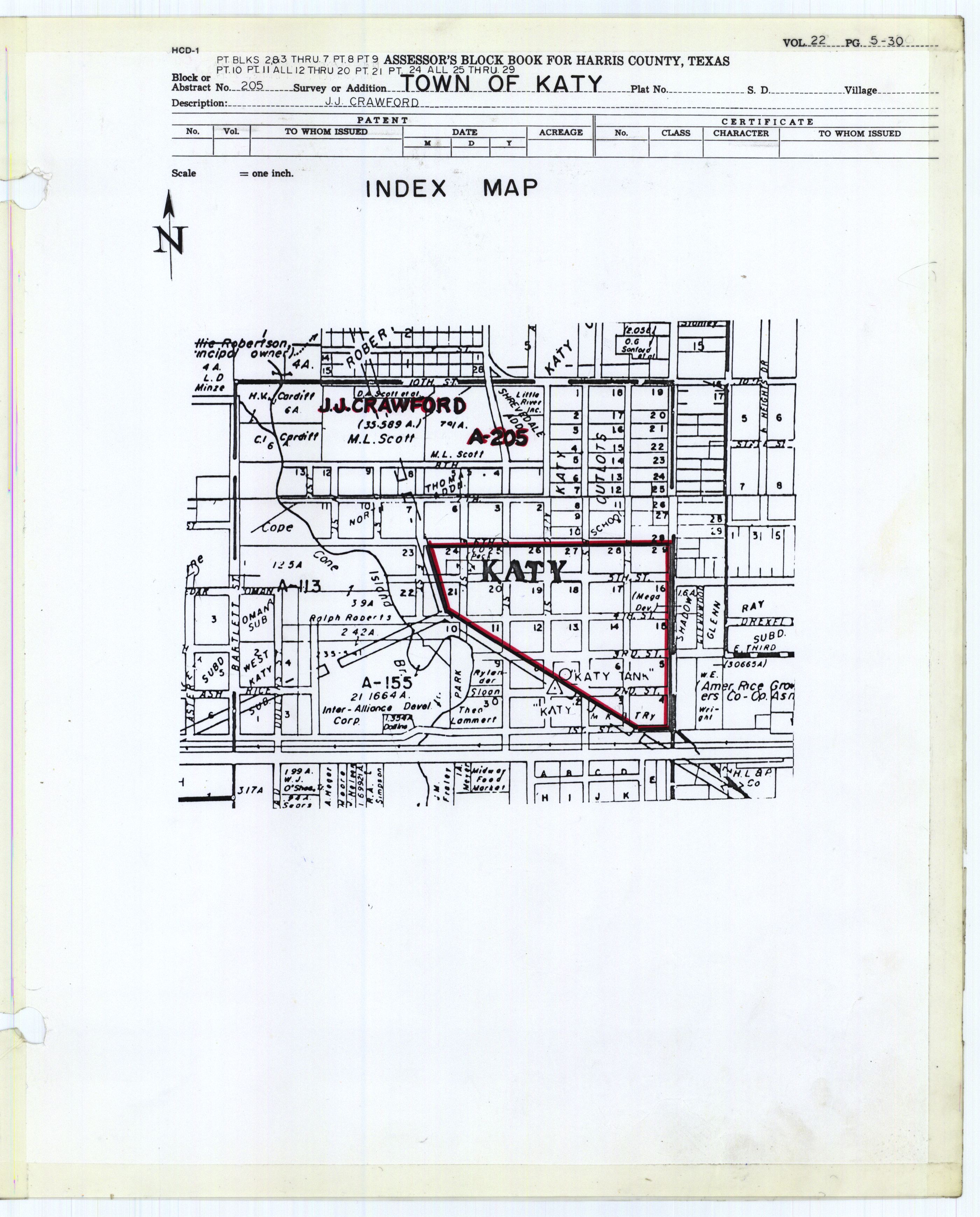
- Harris County block book map (historical map showing portion in Harris County): PDF format, JPG format
| Counties |  | |
|---|---|---|
| "Principal" cities | ||
| Other cities |
For a complete listing, see list of cities and towns in Houston–The Woodlands–Sugar Land MSA | |
| Unincorporated areas | ||
| Bodies of water | ||
Municipalities and communities of Fort Bend County, Texas, United States | ||
|---|---|---|
| Cities |  Fort Bend County map | |
| Town | ||
| Villages | ||
| CDPs |
| |
| Other unincorporated communities | ||
| Ghost towns | ||
| Footnotes | ‡This populated place also has portions in an adjacent county or counties;
±Former community annexed by Missouri City | |
Municipalities and communities of Waller County, Texas, United States | ||
|---|---|---|
| Cities | 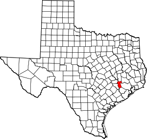 Waller County map | |
| Town | ||
| Unincorporated communities | ||
| Footnotes | ‡This populated place also has portions in an adjacent county or counties | |

| Authority control |
|
|---|