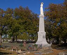
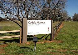
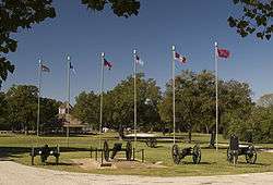
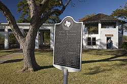
List of Texas State Historic Sites

Official historic sites of the state of Texas may be under the supervision of the Texas Parks and Wildlife Department (TPWD) or the Texas Historical Commission (THC).

Key

Sites with multiple historic designations are colored according to their highest designation within the following hierarchy.

#National Historic Landmark (NHL)
National Register of Historic Places (NRHP)
NRHP Historic District (HD)
NRHP HD contributing property
⁕State Antiquities Landmark
Recorded Texas Historic Landmark
Historic site Image Location Nearest city County Coordinates Supervising agency Notes
Acton State Historic Site FM 167 Acton Hood 32°26′25″N 97°41′5″W THC
Battleship Texas State Historic Site#
More images
3523 Independence Pkwy S. LaPorte Harris 29°45′21″N 95°5′23″W TPWD
Caddo Mounds State Historic Site
More images
1649 W. SH 21 Alto Cherokee 31°35′47″N 95°8′55″W THC
Casa Navarro State Historic Site#⁕⁑ 228 S. Laredo St. San Antonio Bexar 29°25′23″N 98°29′51″W THC
Confederate Reunion Grounds State Historic Site
More images
1738 FM 2705 Mexia Limestone 31°38′1″N 96°33′26″W THC
Eisenhower Birthplace State Historic Site
More images
609 S. Lamar Ave. Denison Grayson 33°44′59″N 96°32′3″W THC
Fannin Battleground State Historic Site 734 FM 2506 Fannin Goliad 28°41′11″N 97°14′2″W THC
Fanthorp Inn State Historic Site
More images
579 S. Main St. Anderson Grimes 30°28′59″N 95°59′2″W THC Part of Anderson Historic District
Fort Griffin State Historic Site
More images
1701 N. US 283 Albany Jones 32°55′11″N 99°13′45″W THC
Fort Lancaster State Historic Site
More images
629 Ft. Lancaster Rd. Sheffield Pecos 30°39′34″N 101°41′36″W THC
Fort Leaton State Historic Site
More images
FM 170 E. Presidio Presidio 29°32′33″N 104°19′37″W TPWD
Fort McKavett State Historic Site
More images
7066 FM 864 Fort McKavett Menard 30°49′28″N 100°6′38″W THC
Fort Richardson State Park and Historic Site#⁕⁑
More images
228 Park Road 61 Jacksboro Jack 33°12′22″N 98°9′25″W TPWD
French Legation State Historic Site⁕⁑ 802 San Marcos St. Austin Travis 30°16′01″N 97°43′56″W THC
Fulton Mansion State Historic Site⁕⁑
More images
317 S. Fulton Beach Rd. Rockport Aransas 28°3′25″N 97°2′7″W THC
Goliad State Park and Historic Site⁕⁑
More images
108 Park Road 6 Goliad Goliad 28°39′23″N 97°23′7″W TPWD
Goodnight Ranch State Historic Site 4989 CR 25 Goodnight Armstrong 35°1′50″N 101°10′59″W THC
Hueco Tanks State Park and Historic Site
More images
6900 Hueco Tanks Road No. 1 El Paso El Paso 31°55′2″N 106°2′38″W TPWD
Landmark Inn State Historic Site⁕⁑
More images
402 E. Florence St. Castroville Medina 29°21′18″N 98°52′29″W THC
Levi Jordan Plantation State Historic Site Brazoria Brazoria 28°59′57″N 95°38′54″W THC
Lipantitlan State Historic Site Upload image Lipantitlan Park Rd. Orange Grove Nueces 27°57′53″N 97°49′4″W THC
Lyndon B. Johnson State Park and Historic Site
More images
Park Road 52 Stonewall Gillespie 30°14′16″N 98°37′35″W TPWD
Magoffin Home State Historic Site⁕⁑
More images
1120 Magoffin Ave. El Paso El Paso 31°45′46″N 106°28′39″W THC Part of Magoffin Historic District
Mission Dolores State Historic Site 701 S. Broadway St. San Augustine San Augustine 31°31′27″N 94°6′49″W THC
Mission Rosario State Historic Site US 59 Goliad Goliad 28°38′44″N 97°26′23″W TPWD
Monument Hill and Kreische Brewery State Historic Sites
More images
414 Loop 92 La Grange Fayette 29°53′20″N 96°52′31″W THC
National Museum of the Pacific War
More images
340 E. Main St. Fredericksburg Gillespie 30°16′19″N 98°52′2″W THC
Port Isabel Lighthouse State Historic Site
More images
421 E. Queen Isabella Blvd. Port Isabel Cameron 26°4′41″N 97°12′26″W THC
Sabine Pass Battleground State Historic Site 6100 Dowling Rd. Port Arthur Jefferson 29°43′43″N 93°52′30″W THC
Sam Bell Maxey House State Historic Site⁕⁑
More images
812 S. Church St. Paris Lamar 33°39′14″N 95°33′17″W THC
Sam Rayburn House State Historic Site# 890 W. SH 56 Bonham Fannin 33°34′10″N 96°12′27″W THC
San Felipe de Austin State Historic Site
More images
15945 FM 1458 San Felipe Austin 29°48′25″N 96°5′51″W THC
San Jacinto Battleground State Historic Site#
More images
3523 Independence Pkwy S. LaPorte Harris 29°44′18″N 95°4′41″W THC
Seminole Canyon State Park and Historic Site
More images
US 90 Comstock Val Verde 29°42′0″N 101°18′47″W TPWD
Starr Family Home State Historic Site
More images
407 W. Travis St. Marshall Harrison 32°32′30″N 94°22′15″W THC
Varner–Hogg Plantation State Historic Site⁕⁑
More images
1702 N. 13th St. West Columbia Brazoria 29°9′45″N 95°38′28″W THC
Washington-on-the-Brazos State Historic Site
More images
23400 Park Road 12 Washington Washington 30°19′25″N 96°9′17″W THC
Zaragoza Birthplace State Historic Site Calle Cinco de Mayo at Lopez Rd. Goliad Goliad 28°38′50″N 97°22′59″W TPWD
This article is issued from Wikipedia. The text is licensed under Creative Commons - Attribution - Sharealike. Additional terms may apply for the media files.