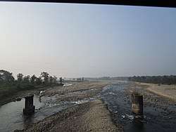
Jaldhaka River
The Jaldhaka River (Pron:/ˌdʒælˈdɑːkə/) (Bengali: জলঢাকা নদী), also known as Dichu River in earlier times,[1] is a trans-boundary river with a length of 192 kilometres that originates from the Kupup or Bitang Lake in southeastern Sikkim in the eastern Himalayas and flows through Bhutan and the Kalimpong, Jalpaiguri and Cooch Behar districts of West Bengal, India. At that point the river enters Bangladesh through the Lalmonirhat District and then joins with the Dharla River until the Dharla debouches into the Brahmaputra River near the Kurigram District. Due to the river's wandering over several international borders, only a small length of the river lies within Bangladesh.[2]
| Jaldhaka River | |
|---|---|
 | |
| Location | |
| Country | India, Bangladesh |
| Physical characteristics | |
| Source | Kupup or Bitang Lake |
| ⁃ location | Kupup or Bitang Lake, India |
| Mouth | Dharla River |
⁃ location | Lalmonirhat District, Bangladesh |
Geography
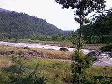
The Jaldhaka River is formed by the conjunction of three streams at Bindu, the end point of the Jaldhaka Police Station at Kalimpong district in West Bengal. The three streams are known as Bindu Khola, Dudh Pokhri and Jaldhaka that originates from the Kupup Lake, a small glacial lake in Sikkim. The combined streams meet at Bindu to form the Jaldhaka River, thus forming a riverine boundary with India and Bhutan in the left bank. The main tributaries that join the river in its right bank are the Murti, the Jholung khola, the Naksal Khola, the Sutunga and the Jarda in the lower reach. The Diana, Rehti-Duduya and Mujnai are the main left bank tributaries.
The river flows through the three North Bengal districts of Kalimpong, Jalpaiguri and Cooch Bihar. The entire watershed is the most fertile agricultural zone along with the Teesta Basin. The upper course is famous for crops like ginger, medicinal herbs and fruits like oranges and pomegranate. The middle course comprising Jalpaiguri district is entirely tea and corn dominated and the lower course is dominated by rice, jute and tobacco. The inter-river formed lands are cultivated with crops like bamboo and mat sticks. In the lower basin, the inter-river lands are cultivated with banana.
The river enters Bangladesh at Ghoksadanga district to meet the Brahmaputra or the Jamuna as it is known there.
References
- Sharma, Suresh Kant; Sharma, Usha (2005), Discovery of North-East India: Geography, History, Culture, Religion, Politics, Sociology, Science, Education and Economy. Assam. Volume three, Mittal Publications, p. 141, ISBN 978-81-8324-037-6
- Murshed, Md Mahbub (2012). "Jaldhaka River". In Islam, Sirajul; Jamal, Ahmed A. (eds.). Banglapedia: National Encyclopedia of Bangladesh (Second ed.). Asiatic Society of Bangladesh.